Fannin County, Georgia

Last updated

Fannin County
Fannin County, Georgia Courthouse.JPG
Fannin County Courthouse in Blue Ridge
Logo of Fannin County, Georgia.svg
Map of Georgia highlighting Fannin County.svg
Location within the U.S. state of Georgia
Georgia in United States.svg
Georgia's location within the U.S.
Coordinates: 34°52′N84°19′W / 34.86°N 84.32°W / 34.86; -84.32
CountryFlag of the United States.svg United States
StateFlag of Georgia (U.S. state).svg  Georgia
Founded1854;170 years ago (1854)
Named for James Fannin
Seat Blue Ridge
Largest cityBlue Ridge
Area
  Total392 sq mi (1,020 km2)
  Land387 sq mi (1,000 km2)
  Water5.2 sq mi (13 km2)  1.3%
Population
 (2020)
  Total25,319
  Density65/sq mi (25/km2)
Time zone UTC−5 (Eastern)
  Summer (DST) UTC−4 (EDT)
Congressional district 9th
Website fannincountyga.org

Fannin County is a county located in the north central portion of the U.S. state of Georgia. As of the 2020 census, the population was 25,319. [1] It is one of the most rural counties in Georgia due its location in the Appalachian Mountain Range, with about 90% of the population of Fannin County living in unincorporated lands. The county seat and largest city is Blue Ridge. [2] The county was created on January 21, 1854, and is named after James Fannin, a veteran who fought in the Texas Revolution.

Contents

History

Prior to European colonization, the area that is now Fannin County was inhabited by the Cherokee people and other Indigenous peoples for thousands of years.

Fannin County was founded on January 12, 1854, taken from 396 square miles that were previously part of Gilmer and Union counties. [3] The county is named for Georgia native James W. Fannin, [4] who fought and died during the Texas Revolution.

Although the county was majority pro-secession at the beginning of the Civil War, wartime conditions inspired a notable number of anti-Confederate "Tories" as early as 1862, many of whom re-located to pro-Union areas of Tennessee for the duration. This contributed to the postwar establishment of a countywide Republican Party earlier and more sustained than almost any other county in Georgia. [5]

Geography

According to the U.S. Census Bureau, the county has a total area of 392 square miles (1,020 km2), of which 387 square miles (1,000 km2) is land and 5.2 square miles (13 km2) (1.3%) is water. [6] The county is located in the Blue Ridge Mountains. [7]

The Toccoa River, which rises in adjacent Union County, flows northward across Fannin County into Tennessee, where it becomes the Ocoee River. Blue Ridge Lake, created in the 1930s by the completion of Blue Ridge Dam (now operated by the Tennessee Valley Authority), spans a substantial stretch of the river in the northern part of the county.

The vast majority of Fannin County is located in the Ocoee River sub-basin of the Middle Tennessee-Hiwassee basin. A very small northeastern portion of Fannin County is located in the Hiwassee River sub-basin of the same Middle Tennessee-Hiwassee basin. Illustrating that watershed boundaries and county boundaries have little in common, Fannin County's southernmost corner is located in the Etowah River sub-basin in the ACT River Basin (Coosa-Tallapoosa River Basin), while two slivers of the county's southwestern area are located in the Coosawattee River sub-basin of the same larger ACT River Basin. Finally, a western portion of the county is located in the Conasauga River sub-basin of the ACT River Basin. [8]

Adjacent counties

National protected area

Transportation

Major highways

Secondary highways

Demographics

Historical population
CensusPop.Note
1860 5,139
1870 5,4295.6%
1880 7,24533.4%
1890 8,72420.4%
1900 11,21428.5%
1910 12,57412.1%
1920 12,103−3.7%
1930 12,9697.2%
1940 14,75213.7%
1950 15,1923.0%
1960 13,620−10.3%
1970 13,357−1.9%
1980 14,74810.4%
1990 15,9928.4%
2000 19,79823.8%
2010 23,68219.6%
2020 25,3196.9%
2023 (est.)25,955 [9] 2.5%
U.S. Decennial Census [10]
1790-1880 [11] 1890-1910 [12]
1920-1930 [13] 1930-1940 [14]
1940-1950 [15] 1960-1980 [16]
1980-2000 [17] 2010 [18] 2020 [19]

2020 census

Fannin County, Georgia – Racial and ethnic composition
(NH = Non-Hispanic)
Note: the US Census treats Hispanic/Latino as an ethnic category. This table excludes Latinos from the racial categories and assigns them to a separate category. Hispanics/Latinos may be of any race.
Race / EthnicityPop 2000 [20] Pop 2010 [18] Pop 2020 [19] % 2000% 2010% 2020
White alone (NH)19,31222,76123,35197.55%96.11%92.23%
Black or African American alone (NH)2275850.11%0.32%0.34%
Native American or Alaska Native alone (NH)8868850.44%0.29%0.34%
Asian alone (NH)47721130.24%0.30%0.45%
Pacific Islander alone (NH)1630.01%0.03%0.01%
Other race alone (NH)117550.01%0.07%0.22%
Mixed race or Multiracial (NH)1972528741.00%1.06%3.45%
Hispanic or Latino (any race)1304317530.66%1.82%2.97%
Total19,79823,68225,319100.00%100.00%100.00%

As of the 2020 United States census, there were 25,319 people, 10,408 households, and 7,083 families residing in the county.

2010 census

As of the 2010 United States Census, there were 23,682 people, 10,187 households, and 7,016 families living in the county. [21] The population density was 61.2 inhabitants per square mile (23.6/km2). There were 16,207 housing units at an average density of 41.9 units per square mile (16.2 units/km2). [22] The racial makeup of the county was 97.1% white, 0.4% black or African American, 0.3% Asian, 0.3% American Indian, 0.7% from other races, and 1.2% from two or more races. Those of Hispanic or Latino origin made up 1.8% of the population. [21] In terms of ancestry, 18.6% were Irish, 13.3% were American, 11.5% were English, and 9.5% were German. [23]

Of the 10,187 households, 25.1% had children under the age of 18 living with them, 55.2% were married couples living together, 9.5% had a female householder with no husband present, 31.1% were non-families, and 27.1% of all households were made up of individuals. The average household size was 2.31 and the average family size was 2.77. The median age was 48.3 years. [21]

The median income for a household in the county was $34,145 and the median income for a family was $41,422. Males had a median income of $34,875 versus $27,097 for females. The per capita income for the county was $21,103. About 12.2% of families and 16.2% of the population were below the poverty line, including 23.0% of those under age 18 and 13.8% of those age 65 or over. [24]

2000 census

As of the census [25] of 2000, there were 19,798 people, 8,369 households, and 6,008 families living in the county. The population density was 51 people per square mile (20 people/km2). There were 11,134 housing units at an average density of 29 units per square mile (11 units/km2). The racial makeup of the county was 99.9% White, 0.2% Black or African American, 0.1% Native American, 0.2% Asian, 0.05% Pacific Islander, 0.0% from other races, and 0.0% from two or more races. 0.0% of the population were Hispanic or Latino of any race.

There were 8,369 households, out of which 25.90% had children under the age of 18 living with them, 59.80% were married couples living together, 8.90% had a female householder with no husband present, and 28.20% were non-families. 25.60% of all households were made up of individuals, and 12.80% had someone living alone who was 65 years of age or older. The average household size was 2.35 and the average family size was 2.80.

In the county, the population was spread out, with 20.90% under the age of 18, 7.00% from 18 to 24, 24.90% from 25 to 44, 28.20% from 45 to 64, and 19.00% who were 65 years of age or older. The median age was 43 years. For every 100 females there were 93.50 males. For every 100 females age 18 and over, there were 90.80 males.

The median income for a household in the county was $30,612, and the median income for a family was $35,258. Males had a median income of $28,728 versus $21,246 for females. The per capita income for the county was $16,269. About 10.20% of families and 12.40% of the population were below the poverty line, including 14.10% of those under age 18 and 14.20% of those age 65 or over.

Communities

Cities

Census-designated places

Unincorporated communities

Politics

Politically, Fannin County is a massive outlier in Georgia. As an entirely white highland county historically devoid of slaves, it is one of the few ancestrally Republican counties in a state that was heavily Democratic nationally until the 1960s and at other levels well into the 1990s. Since the 1870s it has been solidly Republican, displaying voting patterns similar to those of East Tennessee. Fannin was the only county in the Deep South that never voted for Franklin D. Roosevelt; in 1936 it was the only county in Georgia that voted for Alf Landon. Only three Democrats have won an absolute majority in the county since the Civil War: Samuel J. Tilden in 1876, William Jennings Bryan in 1900 and Georgia native Jimmy Carter in 1976 when he carried every county in his home state. Besides Carter, Woodrow Wilson was the only Democrat to win even a plurality of the county's vote in the 20th century. Bill Clinton is the last Democrat to win even 40 percent of the county's vote; he, Carter, Lyndon Johnson and Harry Truman are the only Democrats since FDR to cross that barrier.

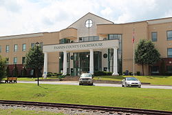
The current county government consists of a three-member county commission consisting of a chairman and commissioners representing two posts.

United States presidential election results for Fannin County, Georgia [26]
Year Republican Democratic Third party
No.%No.%No.%
2020 12,16981.95%2,57017.31%1100.74%
2016 9,63281.10%1,92316.19%3212.70%
2012 7,85778.10%2,02820.16%1751.74%
2008 7,80773.35%2,61124.53%2252.11%
2004 6,86271.01%2,72728.22%750.78%
2000 5,46365.11%2,73632.61%1912.28%
1996 3,37348.67%2,74139.55%81611.77%
1992 3,25545.24%2,90240.33%1,03814.43%
1988 4,27166.45%2,12333.03%330.51%
1984 4,15967.91%1,96532.09%00.00%
1980 3,19654.83%2,52643.34%1071.84%
1976 2,64643.75%3,40256.25%00.00%
1972 3,78379.95%94920.05%00.00%
1968 3,47558.98%1,22920.86%1,18820.16%
1964 3,43354.77%2,83445.21%10.02%
1960 3,02265.68%1,57934.32%00.00%
1956 3,52164.42%1,94535.58%00.00%
1952 2,90460.29%1,91339.71%00.00%
1948 2,79057.29%1,99841.03%821.68%
1944 1,98060.40%1,29839.60%00.00%
1940 2,25656.02%1,77143.98%00.00%
1936 1,89055.10%1,54044.90%00.00%
1932 1,96758.86%1,37541.14%00.00%
1928 1,73068.08%81131.92%00.00%
1924 1,65060.40%1,07939.49%30.11%
1920 1,08366.36%54933.64%00.00%
1916 1669.13%72039.58%93351.29%
1912 16417.75%45148.81%30933.44%

See also

Related Research Articles

<span class="mw-page-title-main">Clay County, Georgia</span> County in Georgia, United States

Clay County is a county located in the southwestern part of the U.S. state of Georgia. As of the 2020 census, the population was 2,848, making it the fourth-least populous county in Georgia. The county seat is Fort Gaines.

<span class="mw-page-title-main">Randolph County, Alabama</span> County in Alabama, United States

Randolph County is a county on the central eastern border of the U.S. state of Alabama. As of the 2020 census, the population was 21,967. Its county seat is Wedowee. Its name is in honor of John Randolph, a member of the United States Senate from Virginia. Randolph County was a prohibition or dry county until 2012, when the citizens of Randolph County voted to repeal prohibition.

<span class="mw-page-title-main">Fannin County, Texas</span> County in Texas, United States

Fannin County is a county in the far northeast of the U.S. state of Texas, on the border with Oklahoma. As of the 2020 census, its population was 35,662. The county seat is Bonham.

<span class="mw-page-title-main">Polk County, Tennessee</span> County in Tennessee, United States

Polk County is a county located in the southeastern corner of the U.S. state of Tennessee. As of the 2020 United States census, its population was 17,544. Its county seat is Benton. The county was created on November 28, 1839, from parts of Bradley and McMinn counties, after final removal of most Cherokee from the region that year. The county was named after then-governor James K. Polk. Polk County is included in the Cleveland, Tennessee Metropolitan Area Statistical Area, which is also included in the Chattanooga–Cleveland–Dalton, TN–GA–AL Combined Statistical Area.

<span class="mw-page-title-main">Whitfield County, Georgia</span> County in Georgia, United States

Whitfield County is a county located in the northwestern part of the U.S. state of Georgia. As of the 2020 census shows a population of 102,864. The county seat is Dalton. The county was created on December 30, 1851, and named after George Whitefield, Methodist evangelist. The "e" was omitted to reflect the pronunciation of his name.

<span class="mw-page-title-main">Walker County, Georgia</span> County in Georgia, United States

Walker County is a county located in the northwestern part of the U.S. state of Georgia. As of the 2020 census, the population was 67,654, down from 68,756 in 2010. The county seat is LaFayette. The county was created on December 18, 1833, from land formerly belonging to the Cherokee Indian Nation.

<span class="mw-page-title-main">Union County, Georgia</span> County in Georgia, United States

Union County is a county located in the north central portion of the U.S. state of Georgia. As of the 2020 census, the population was 24,632. The county seat is Blairsville.

<span class="mw-page-title-main">Towns County, Georgia</span> County in Georgia, United States

Towns County is a county located in the northeastern part of the U.S. state of Georgia. As of the 2020 census, the population was 12,493. Its county seat is Hiawassee. The county was created on March 6, 1856, and named for lawyer, legislator, and politician George W. Towns.

<span class="mw-page-title-main">Polk County, Georgia</span> County in Georgia, United States

Polk County is a county located in the northwestern part of the U.S. state of Georgia. As of the 2020 census, the population was 42,853. The county seat is Cedartown. The county was created on December 20, 1851, by an act of the Georgia General Assembly and named after James K. Polk, the eleventh President of the United States.

<span class="mw-page-title-main">Paulding County, Georgia</span> County in Georgia, United States

Paulding County is a county located in the northwestern part of the U.S. state of Georgia. Part of the Atlanta metropolitan area, it had an estimated population of 168,661 in 2020. The county seat is Dallas.

<span class="mw-page-title-main">Murray County, Georgia</span> County in Georgia, United States

Murray County is a county located in the northwestern part of the U.S. state of Georgia. As of the 2020 census, the population was 39,973. The county seat is Chatsworth.

<span class="mw-page-title-main">Lumpkin County, Georgia</span> County in Georgia, United States

Lumpkin County is a county located in the north central portion of the U.S. state of Georgia. As of the 2020 census, the population was 33,488. Its county seat is Dahlonega. Lumpkin County is included in the Atlanta-Sandy Springs-Roswell, Georgia Metropolitan Statistical Area.

<span class="mw-page-title-main">Gilmer County, Georgia</span> County in Georgia, United States

Gilmer County is a county located in the north central portion of the U.S. state of Georgia. As of the 2020 census, the population was 31,353. The county seat is Ellijay. It was based on a historic Cherokee town also spelled as Elejoy in the eighteenth century. The county was created on December 3, 1832, and was named for George Rockingham Gilmer, a politician who served two non-consecutive terms as governor of the state. Gilmer County is home of the annual Apple Festival, which is held in mid-October. Ninety percent of the land is in cropland and forest. Poultry raising and processing makes up the largest portion of the agricultural economy, which generates 33.2% of the total revenues. Manufacturing is about 20%.

<span class="mw-page-title-main">Dade County, Georgia</span> County in Georgia, United States

Dade County is a county in the U.S. state of Georgia. It occupies the northwest corner of Georgia, and the county's own northwest corner is the westernmost point in the state. As of the 2020 census, the population is 16,251. The county seat and only incorporated municipality is Trenton. Dade County is part of the Chattanooga, TN–GA Metropolitan Statistical Area. In 1860, residents of Dade County voted to secede from the state of Georgia and from the United States, but no government outside the county ever recognized this gesture as legal. In 1945, the county symbolically "rejoined" Georgia and the United States.

<span class="mw-page-title-main">Catoosa County, Georgia</span> County in Georgia, United States

Catoosa County is a county located in the northwestern part of the U.S. state of Georgia. As of the 2020 census, the population was 67,872. The county seat is Ringgold. The county was created on December 5, 1853. The meaning of the Cherokee language name "Catoosa" is obscure: "Catoosa" may come from the Cherokee words gatusi or gatu'gitse.

<span class="mw-page-title-main">Blue Ridge, Georgia</span> City in Georgia, United States

Blue Ridge is a city in Fannin County, Georgia, United States. As of the 2020 census, the city had a population of 1,253. The city is the county seat of Fannin County and the largest city in the county as well.

<span class="mw-page-title-main">McCaysville, Georgia</span> City in Georgia, United States

McCaysville is a city in Fannin County, Georgia, United States. The population was 1,149 at the 2020 census. It is the second largest city in Fannin County after Blue Ridge.

<span class="mw-page-title-main">Hiawassee, Georgia</span> City in Georgia, United States

Hiawassee is the county seat of Towns County, Georgia, United States. The community's population was 880 at the 2010 census. Its name is derived from the Cherokee—or perhaps Creek—word Ayuhwasi, which means meadow, Hiawassee is also known in the novel "Restart" by Gordon Korman.

<span class="mw-page-title-main">Copperhill, Tennessee</span> City in Tennessee, United States

Copperhill is a city in Polk County, Tennessee, United States. The population was 443 at the 2020 census. It is included in the Cleveland Metropolitan Statistical Area.

<span class="mw-page-title-main">Ducktown, Tennessee</span> City in Tennessee, United States

Ducktown is a city in Polk County, Tennessee, United States. The population was 461 at the 2020 census and 475 at the 2010 census. It is included in the Cleveland Metropolitan Statistical Area.

References

  1. "Census - Geography Profile: Fannin County, Georgia". United States Census Bureau . Retrieved December 27, 2022.
  2. "Find a County". National Association of Counties. Archived from the original on May 31, 2011. Retrieved June 7, 2011.
  3. Krakow, Kenneth K. (1975). Georgia Place-Names: Their History and Origins (PDF). Macon, GA: Winship Press. p. 76. ISBN   0-915430-00-2. Archived (PDF) from the original on September 17, 2003.
  4. Gannett, Henry (1905). The Origin of Certain Place Names in the United States. Govt. Print. Off. pp.  123.
  5. A Separate Civil War: Communities in Conflict in the Mountain South, Jonathan Dean Sarris
  6. "US Gazetteer files: 2010, 2000, and 1990". United States Census Bureau. February 12, 2011. Retrieved April 23, 2011.
  7. Ripley, George; Dana, Charles A., eds. (1879). "Fannin. I. A N. W. county of Georgia"  . The American Cyclopædia .
  8. "Georgia Soil and Water Conservation Commission Interactive Mapping Experience". Georgia Soil and Water Conservation Commission. Archived from the original on October 3, 2018. Retrieved November 19, 2015.
  9. "Annual Estimates of the Resident Population for Counties: April 1, 2020 to July 1, 2023". United States Census Bureau. Retrieved March 31, 2024.
  10. "Decennial Census of Population and Housing by Decades". United States Census Bureau.
  11. "1880 Census Population by Counties 1790-1800" (PDF). United States Census Bureau. 1880.
  12. "1910 Census of Population - Georgia" (PDF). United States Census Bureau. 1910.
  13. "1930 Census of Population - Georgia" (PDF). United States Census Bureau. 1930.
  14. "1940 Census of Population - Georgia" (PDF). United States Census Bureau. 1940.
  15. "1950 Census of Population - Georgia -" (PDF). United States Census Bureau. 1950.
  16. "1980 Census of Population - Number of Inhabitants - Georgia" (PDF). United States Census Bureau. 1980.
  17. "2000 Census of Population - Population and Housing Unit Counts - Georgia" (PDF). United States Census Bureau. 2000.
  18. 1 2 "P2: Hispanic or Latino, and Not Hispanic or Latino by Race – 2010: DEC Redistricting Data (PL 94-171) – Fannin County, Georgia". United States Census Bureau. Retrieved January 26, 2024.
  19. 1 2 "P2: Hispanic or Latino, and Not Hispanic or Latino by Race – 2020: DEC Redistricting Data (PL 94-171) - Fannin County, Georgia". United States Census Bureau. Retrieved January 26, 2024.
  20. "P004: Hispanic or Latino, and Not Hispanic or Latino by Race – 2000: DEC Summary File 1 – Fannin County, Georgia". United States Census Bureau. Retrieved January 26, 2024.
  21. 1 2 3 "DP-1 Profile of General Population and Housing Characteristics: 2010 Demographic Profile Data". United States Census Bureau. Archived from the original on February 13, 2020. Retrieved December 29, 2015.
  22. "Population, Housing Units, Area, and Density: 2010 - County". United States Census Bureau. Archived from the original on February 13, 2020. Retrieved December 29, 2015.
  23. "DP02 SELECTED SOCIAL CHARACTERISTICS IN THE UNITED STATES – 2006-2010 American Community Survey 5-Year Estimates". United States Census Bureau. Archived from the original on February 13, 2020. Retrieved December 29, 2015.
  24. "DP03 SELECTED ECONOMIC CHARACTERISTICS – 2006-2010 American Community Survey 5-Year Estimates". United States Census Bureau. Archived from the original on February 13, 2020. Retrieved December 29, 2015.
  25. "U.S. Census website". United States Census Bureau . Retrieved May 14, 2011.
  26. Leip, David. "Dave Leip's Atlas of U.S. Presidential Elections". uselectionatlas.org. Retrieved March 19, 2018.

34°52′N84°19′W / 34.86°N 84.32°W / 34.86; -84.32