Oglethorpe County | |
---|---|
Coordinates: 33°53′N83°05′W / 33.88°N 83.08°W | |
Country | United States |
State | Georgia |
Founded | December 19, 1795 |
Named for | James Oglethorpe |
Seat | Lexington |
Largest city | Crawford |
Area | |
• Total | 442 sq mi (1,140 km2) |
• Land | 439 sq mi (1,140 km2) |
• Water | 3.0 sq mi (8 km2) 0.7% |
Population (2020) | |
• Total | 14,825 |
• Density | 34/sq mi (13/km2) |
Time zone | UTC−5 (Eastern) |
• Summer (DST) | UTC−4 (EDT) |
Congressional district | 10th |
Oglethorpe County is a county located in the northeastern part of the U.S. state of Georgia. As of the 2020 census, the population was 14,825. [1] The county seat is Lexington. [2]
Oglethorpe County is included in the Athens-Clarke County, GA Metropolitan Statistical Area, which is also included in the Atlanta-Athens-Clarke County-Sandy Springs, GA Combined Statistical Area. It is the largest county in Northeast Georgia.
Oglethorpe County was originally part of a large tract of land surrendered by Creek and Cherokee Native Americans to the Colony of Georgia in the treaty of 1773. The county itself was founded on December 19, 1793, and is named for Georgia's founder, General James Oglethorpe.
On September 10, 1919, Obe Cox was accused of murdering a White farmer's wife. He was seized by a White mob taken to the scene of the crime, his body riddled with bullets and burned at the stake. Several thousand persons witnessed the scene. The lynching was controversial as the local black community "thanked" the mob for just killing Cox and not attacking their community. [3] After an investigation the black media of the time reported that the blacks who wrote the letter thanking the lynching "do not stand for much in the town and are excused for their utter ignorance in condoning [lynching]." [3]
See reference "The Lynching Project:Oglethorpe County" [4]
According to the U.S. Census Bureau, the county has a total area of 442 square miles (1,140 km2), of which 439 square miles (1,140 km2) is land and 3.0 square miles (7.8 km2) (0.7%) is water. [5] The county is located in the Piedmont region of the state.
The majority of Oglethorpe County is located in the Broad River sub-basin of the Savannah River basin. A narrow western portion of the county, in a line from just north of Woodville, through Crawford, to just south of Winterville, is located in the Upper Oconee River sub-basin of the Altamaha River basin. A small part of the southern portion of the county, from Maxeys east, is located in the Little River sub-basin of the Savannah River basin. [6]
Census | Pop. | Note | %± |
---|---|---|---|
1800 | 9,780 | — | |
1810 | 12,297 | 25.7% | |
1820 | 14,046 | 14.2% | |
1830 | 13,618 | −3.0% | |
1840 | 10,868 | −20.2% | |
1850 | 12,259 | 12.8% | |
1860 | 11,549 | −5.8% | |
1870 | 11,782 | 2.0% | |
1880 | 15,400 | 30.7% | |
1890 | 16,951 | 10.1% | |
1900 | 17,881 | 5.5% | |
1910 | 18,680 | 4.5% | |
1920 | 20,287 | 8.6% | |
1930 | 12,927 | −36.3% | |
1940 | 12,430 | −3.8% | |
1950 | 9,958 | −19.9% | |
1960 | 7,926 | −20.4% | |
1970 | 7,598 | −4.1% | |
1980 | 8,929 | 17.5% | |
1990 | 9,763 | 9.3% | |
2000 | 12,635 | 29.4% | |
2010 | 14,899 | 17.9% | |
2020 | 14,825 | −0.5% | |
2023 (est.) | 15,754 | [7] | 6.3% |
U.S. Decennial Census [8] 1790-1880 [9] 1890-1910 [10] 1920-1930 [11] 1930-1940 [12] 1940-1950 [13] 1960-1980 [14] 1980-2000 [15] 2010 [16] |
Race | Num. | Perc. |
---|---|---|
White | 10,903 | 73.54% |
Black or African American | 2,248 | 15.16% |
Native American | 40 | 0.27% |
Asian | 134 | 0.9% |
Pacific Islander | 5 | 0.03% |
Other/Mixed | 626 | 4.22% |
Hispanic or Latino | 869 | 5.86% |
As of the 2020 United States census, there were 14,825 people, 5,651 households, and 3,711 families residing in the county.
Historic Districts and Heritage Research, Antique Stores in Historic Lexington, Agriculture and Agritourism as well as Oglethorpe Fresh Produce
In 2016, the Oglethorpe County Recreation Department was named both the District 7 and State Agency of the Year for populations under 20,000 through the Georgia Recreation and Park Association.
The county has limited walkability options available.
Year | Republican | Democratic | Third party | |||
---|---|---|---|---|---|---|
No. | % | No. | % | No. | % | |
2020 | 5,592 | 68.71% | 2,439 | 29.97% | 107 | 1.31% |
2016 | 4,625 | 69.30% | 1,831 | 27.43% | 218 | 3.27% |
2012 | 4,251 | 67.64% | 1,914 | 30.45% | 120 | 1.91% |
2008 | 4,144 | 64.12% | 2,232 | 34.54% | 87 | 1.35% |
2004 | 3,688 | 65.41% | 1,899 | 33.68% | 51 | 0.90% |
2000 | 2,706 | 61.71% | 1,519 | 34.64% | 160 | 3.65% |
1996 | 1,826 | 48.03% | 1,570 | 41.29% | 406 | 10.68% |
1992 | 1,590 | 42.94% | 1,491 | 40.26% | 622 | 16.80% |
1988 | 1,951 | 62.61% | 1,154 | 37.03% | 11 | 0.35% |
1984 | 2,122 | 63.15% | 1,238 | 36.85% | 0 | 0.00% |
1980 | 1,187 | 41.56% | 1,611 | 56.41% | 58 | 2.03% |
1976 | 811 | 30.43% | 1,854 | 69.57% | 0 | 0.00% |
1972 | 1,712 | 84.00% | 326 | 16.00% | 0 | 0.00% |
1968 | 383 | 14.71% | 483 | 18.56% | 1,737 | 66.73% |
1964 | 1,126 | 56.58% | 864 | 43.42% | 0 | 0.00% |
1960 | 142 | 9.17% | 1,406 | 90.83% | 0 | 0.00% |
1956 | 167 | 10.63% | 1,404 | 89.37% | 0 | 0.00% |
1952 | 208 | 12.46% | 1,461 | 87.54% | 0 | 0.00% |
1948 | 62 | 5.55% | 819 | 73.26% | 237 | 21.20% |
1944 | 173 | 15.80% | 922 | 84.20% | 0 | 0.00% |
1940 | 131 | 13.79% | 818 | 86.11% | 1 | 0.11% |
1936 | 115 | 11.93% | 845 | 87.66% | 4 | 0.41% |
1932 | 34 | 2.66% | 1,240 | 97.03% | 4 | 0.31% |
1928 | 205 | 20.14% | 813 | 79.86% | 0 | 0.00% |
1924 | 129 | 6.56% | 1,748 | 88.96% | 88 | 4.48% |
1920 | 42 | 4.74% | 844 | 95.26% | 0 | 0.00% |
1916 | 18 | 2.51% | 657 | 91.63% | 42 | 5.86% |
1912 | 50 | 9.09% | 400 | 72.73% | 100 | 18.18% |
Montgomery County is a county located in the central portion of the U.S. state of Georgia. As of the 2020 census, the population was 8,610. The county seat is Mount Vernon. Montgomery County is part of the Vidalia, GA micropolitan statistical area.
Wilkes County is a county located in the east central portion of the U.S. state of Georgia. As of the 2020 census, the population was 9,565. The county seat is the city of Washington.
Wheeler County is a county located in the central portion of the U.S. state of Georgia. As of the 2020 census, the population was 7,471. The county seat is Alamo. The county is one of the most impoverished counties in the nation. The American Community Survey's 2009–2013 average reports that the county's per-capita income of $8,948 makes it the poorest county in the United States by this metric. The measurement however is misleading as Wheeler County is the site of Wheeler Correctional Facility, a large prison with a capacity of 2,874 prisoners, about 40 percent of the county's total population. Most prisoners have little income. The prison was opened in 1998 and the prison population may also account for the increased population of the county in the early 2000s.
Washington County is a county located in the U.S. state of Georgia. As of the 2020 census, the population was 19,988. The county seat is Sandersville. The county was established on February 25, 1784. It was named for Revolutionary War general George Washington.
Walton County is a county located in the Middle Georgia portion of the U.S. - State of Georgia. As of the 2020 census, the population was 96,673. It is located about 30 miles east of the state capital, the city of Atlanta. Monroe is the county seat; Loganville is another major city.
Upson County is a county located in the west central Piedmont portion of the U.S. state of Georgia. As of the 2020 census, the population was 27,700. The county seat is Thomaston. The county was created on December 15, 1824.
Twiggs County is a county located in the central portion of the U.S. state of Georgia. As of the 2020 census, the population was 8,022. The county seat is Jeffersonville. The county was created on December 14, 1809, and named for American Revolutionary War general John Twiggs.
Oconee County is a county located in the northeastern part of the U.S. state of Georgia. As of the 2020 census, the population was 41,799. The county seat is Watkinsville.
Madison County is a county located in the northeastern part of the U.S. state of Georgia. As of the 2020 census, the population was 30,120. The county seat is Danielsville. The county was created on December 5, 1811. The county's largest city is Comer with a population of 1,200.
Macon County is a county located in the west central portion of the U.S. state of Georgia. As of the 2020 census, the population was 12,082. The county seat is Oglethorpe.
Lumpkin County is a county located in the north central portion of the U.S. state of Georgia. As of the 2020 census, the population was 33,488. Its county seat is Dahlonega. Lumpkin County is included in the Atlanta-Sandy Springs-Roswell, Georgia Metropolitan Statistical Area.
Laurens County is a county located in the central part of the U.S. state of Georgia. As of the 2020 census, the population was 49,570, up from 48,434 in 2010. The county seat is Dublin. The county was founded on December 10, 1807, and named after Lieutenant Colonel John Laurens, an American soldier and statesman from South Carolina during the American Revolutionary War.
Jones County is a county in the central portion of the U.S. state of Georgia. As of the 2020 census, the population was 28,347. The county seat is Gray. The county was created on December 10, 1807, and named after U.S. Representative James Jones.
Jackson County is a county located in the northeastern part of the U.S. state of Georgia. As of the 2020 census, the population was 75,907. The county seat is Jefferson.
Greene County is a county located in the east central portion & the Lake country region of the U.S. state of Georgia. As of the 2020 census, the population was 18,915. The county seat is Greensboro. The county was created on February 3, 1786, and is named for Nathanael Greene, an American Revolutionary War major general.
Elbert County is a county located in the northeastern part of the U.S. state of Georgia. As of the 2020 census, the population was 19,637. The county seat is Elberton. The county was established on December 10, 1790, and was named for Samuel Elbert.
Early County is a county located on the southwest border of the U.S. state of Georgia. As of the 2020 census, the population was 10,854. The county seat is Blakely, where the Early County Courthouse is located. Created on December 15, 1818, it was named for Peter Early, 28th Governor of Georgia. The county is bordered on the west by the Chattahoochee River, forming the border with Alabama.
Clarke County is located in the northeastern part of the U.S. state of Georgia. As of the 2020 census, the population was 128,671. Its county seat is Athens, with which it is a consolidated city-county.
The city of Lexington is the county seat of Oglethorpe County, Georgia
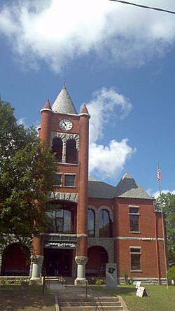
, United States. The population was 239 at the 2000 census.
The Athens–Clarke County Metropolitan Statistical Area, as defined by the United States Census Bureau, is an area consisting of four counties - Clarke, Madison, Oconee, and Oglethorpe - in northeastern Georgia, anchored by the city of Athens. As of the 2020 census, the MSA had a population of 215,479.