Oglethorpe, Georgia

Last updated

Oglethorpe, Georgia
Oglethorpe municipal building.JPG
Oglethorpe municipal building in Oglethorpe
Macon County Georgia Incorporated and Unincorporated areas Oglethorpe Highlighted.svg
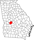
Location in Macon County and the state of Georgia
Coordinates: 32°17′36″N84°3′45″W / 32.29333°N 84.06250°W / 32.29333; -84.06250
Country United States
State Georgia
County Macon
Area
[1]
  Total2.05 sq mi (5.32 km2)
  Land2.01 sq mi (5.20 km2)
  Water0.05 sq mi (0.12 km2)
Elevation
341 ft (104 m)
Population
 (2020) [2]
  Total995
  Density496.01/sq mi (191.49/km2)
Time zone UTC-5 (EST)
  Summer (DST) UTC-4 (EDT)
ZIP code
31068
Area code 478
FIPS code 13-57736 [3]
GNIS feature ID0332561 [4]
Website www.cityofoglethorpe.com

Oglethorpe is a city in Macon County, Georgia, United States. The population was 995 at the 2020 census, [2] down from 1,328 in 2010. The city is the county seat of Macon County. [5] It was named for Georgia's founder, James Oglethorpe.

Contents

History

Oglethorpe was founded in 1838. It was located in the Black Belt of Georgia, where slaves outnumbered whites and did the work to support cultivation of cotton as a commodity crop. Oglethorpe was incorporated as a town in 1849 and as a city in 1852. In 1857, the seat of Macon County was transferred to Oglethorpe from Lanier. [6]

Oglethorpe was once one of the largest cities in southwestern Georgia. Epidemics of malaria and smallpox caused high fatalities in the early 1860s; the remaining residents in Oglethorpe fled south to Americus to escape more disease. [7]

Geography

Oglethorpe is located in south-central Macon County at 32°17′36″N84°3′45″W / 32.29333°N 84.06250°W / 32.29333; -84.06250 (32.293328, -84.062616). [8] It sits on high ground west of the Flint River, which forms the boundary between Oglethorpe and the larger city of Montezuma.

Georgia State Route 49 passes through the center of town as Chatham Street. It leads east into Montezuma and northeast 15 miles (24 km) to Marshallville, while to the southwest it leads 20 miles (32 km) to Americus. State Route 90 enters from the north on North Randolph Street and Sumter Street and leaves to the east on Chatham Street. It connects Oglethorpe with Rupert 18 miles (29 km) to the northwest and with Vienna 23 miles (37 km) to the southeast. State Route 128 leaves Oglethorpe to the north with SR 90 but leads 19 miles (31 km) to Reynolds. State Route 26 (Riverview Drive) passes through the south side of Oglethorpe, leading east through Montezuma 36 miles (58 km) to Hawkinsville and west 17 miles (27 km) to Ellaville.

According to the U.S. Census Bureau, Oglethorpe has a total area of 2.1 square miles (5.4 km2), of which 0.05 square miles (0.13 km2), or 2.34%, are water. [1]

Demographics

Historical population
CensusPop.Note
1850 113
1860 454301.8%
1870 400−11.9%
1880 44210.5%
1890 48610.0%
1900 54512.1%
1910 92469.5%
1920 871−5.7%
1930 9539.4%
1940 1,04810.0%
1950 1,20414.9%
1960 1,169−2.9%
1970 1,28610.0%
1980 1,3051.5%
1990 1,302−0.2%
2000 1,200−7.8%
2010 1,32810.7%
2020 995−25.1%
U.S. Decennial Census [9]
1850-1870 [10] 1880 [11]
1890-1910 [12] 1920-1930 [13]
1930-1940 [14] 1940-1950 [15]
1960-1980 [16] 1990 [17]

Oglethorpe first appeared in the 1850 U.S. census. [10]

Oglethorpe, Georgia – Racial and Ethnic Composition
(NH = Non-Hispanic)
Note: the US Census treats Hispanic/Latino as an ethnic category. This table excludes Latinos from the racial categories and assigns them to a separate category. Hispanics/Latinos may be of any race.
Race / EthnicityPop 2000 [18] Pop 2010 [19] Pop 2020 [20] % 2000% 2010% 2020
White alone (NH)32837622227.33%28.31%22.31%
Black or African American alone (NH)84289368570.17%67.24%68.84%
Native American or Alaska Native alone (NH)3120.25%0.08%0.20%
Asian alone (NH)91190.75%0.83%0.90%
Pacific Islander alone (NH)0110.00%0.08%0.10%
Some Other Race alone (NH)4020.33%0.00%0.20%
Mixed Race/Multi-Racial (NH)44210.33%0.30%2.11%
Hispanic or Latino (any race)1042530.83%3.16%5.33%
Total1,2001,328995100.00%100.00%100.00%

As of the 2020 United States census, there were 995 people, 561 households, and 351 families residing in the city.

Education

Macon County School District

The Macon County School District holds pre-school to grade twelve, and consists of one elementary school, a middle school, and a high school. [21] The district has 129 full-time teachers and over 2,200 students. [22]

Related Research Articles

<span class="mw-page-title-main">Talbot County, Georgia</span> County in Georgia, United States

Talbot County is a county located in the west central portion of the U.S. state of Georgia. The 2020 census showed a population of 5,733. The county seat and largest city is Talbotton.

<span class="mw-page-title-main">Sumter County, Georgia</span> County in Georgia, United States

Sumter County is a county located in the west-central portion of the U.S. state of Georgia. As of the 2020 census, its population was 29,616. The county seat is Americus. The county was created on December 26, 1831.

<span class="mw-page-title-main">Peach County, Georgia</span> County in Georgia, United States

Peach County is a county located in the central portion of the U.S. state of Georgia. As of the 2020 census, the population was 27,981. Its county seat is Fort Valley. Founded in 1924, it is the state's newest county, taken from Houston and Macon counties on July 18 of that year. Its namesake is the peach on account of it being located in a peach-growing district.

<span class="mw-page-title-main">Macon County, Georgia</span> County in Georgia, United States

Macon County is a county located in the west central portion of the U.S. state of Georgia. As of the 2020 census, the population was 12,082. The county seat is Oglethorpe.

<span class="mw-page-title-main">Midville, Georgia</span> City in Georgia, United States

Midville is a city in Burke County, Georgia, United States. The population was 269 at the 2010 census, and 385 in 2020. It is part of the Augusta, Georgia metropolitan area.

<span class="mw-page-title-main">Arlington, Georgia</span> City in Georgia, United States

Arlington is a city in Calhoun and Early counties, Georgia, United States. Per the 2020 census, the population was 1,209.

<span class="mw-page-title-main">Edison, Georgia</span> City in Georgia, United States

Edison is a city in Calhoun County, Georgia, United States. Per the 2020 census, the population was 1,230. The Edison Commercial Historic District is listed on the National Register of Historic Places.

<span class="mw-page-title-main">Byromville, Georgia</span> Town in Georgia, United States

Byromville is a town in Dooly County, Georgia, United States. The population was 546 at the 2010 census, up from 415 in 2000. In 2020, its population was 422.

<span class="mw-page-title-main">Dooling, Georgia</span> Town in Georgia, United States

Dooling is a town in Dooly County, Georgia, United States. The population was 68 at the 2020 census.

<span class="mw-page-title-main">Damascus, Georgia</span> City in Georgia, United States

Damascus is a city in Early County, Georgia, United States. The population was 212 in the 2020 census, down from 254 in the 2010 census.

<span class="mw-page-title-main">Wrightsville, Georgia</span> City in Georgia, United States

Wrightsville is a city in and the county seat of Johnson County, Georgia, United States. The population was 2,195 at the 2010 census, down from 2,223 at the 2000 census. By 2020, its population grew to 3,449. The city limits include Johnson State Prison on the northeast side of town. Wrightsville is part of the Dublin Micropolitan Statistical Area.

<span class="mw-page-title-main">Montezuma, Georgia</span> City in Georgia, United States

Montezuma is a city in Macon County, Georgia. The population was 3,047 at the 2020 census, down from 3,460 in 2010. It is home to the armory of Bravo Company, 648th Engineers of the Georgia Army National Guard.

<span class="mw-page-title-main">Culloden, Georgia</span> City in Georgia, United States

Culloden is a city in Monroe County, Georgia, United States. The population was 200 in the 2020 census. It is part of the Macon metropolitan statistical area.

<span class="mw-page-title-main">Richland, Georgia</span> City in Georgia, United States

Richland is a city in Stewart County, Georgia, United States. Per the 2020 census, the population was 1,370.

<span class="mw-page-title-main">De Soto, Georgia</span> City in Georgia, United States

De Soto is a city in Sumter County, Georgia, United States. The population was 214 at the 2000 census. It is part of the Americus micropolitan statistical area.

<span class="mw-page-title-main">Geneva, Georgia</span> Town in Georgia, United States

Geneva is a town in Talbot County, Georgia, United States. The population was 75 at the 2020 census.

<span class="mw-page-title-main">Junction City, Georgia</span> Town in Georgia, United States

Junction City is a town in Talbot County, Georgia, United States. The population was 138 at the 2020 census.

<span class="mw-page-title-main">Bronwood, Georgia</span> Town in Georgia, United States

Bronwood is a town in Terrell County, Georgia, United States. As of the 2020 census, the city had a population of 334. It is part of the Albany, Georgia metropolitan statistical area.

Cataula is an unincorporated community and census-designated place (CDP) in Harris County, Georgia, United States.

<span class="mw-page-title-main">Tazewell, Georgia</span> Place in Georgia, United States

Tazewell is an unincorporated community and census-designated place (CDP) in Marion County, in the U.S. state of Georgia.

References

  1. 1 2 "2022 U.S. Gazetteer Files: Georgia". United States Census Bureau. Retrieved January 19, 2023.
  2. 1 2 "P1. Race – Oglethorpe city, Georgia: 2020 DEC Redistricting Data (PL 94-171)". U.S. Census Bureau. Retrieved January 19, 2023.
  3. "U.S. Census website". United States Census Bureau . Retrieved January 31, 2008.
  4. "US Board on Geographic Names". United States Geological Survey. October 25, 2007. Retrieved January 31, 2008.
  5. "Find a County". National Association of Counties. Archived from the original on May 31, 2011. Retrieved June 7, 2011.
  6. Hellmann, Paul T. (May 13, 2013). Historical Gazetteer of the United States. Routledge. p. 241. ISBN   978-1135948597 . Retrieved November 30, 2013.
  7. "Oglethorpe, Georgia - Macon County Georgia - Municipalities". Archived from the original on December 10, 2013. Retrieved December 6, 2013.
  8. "US Gazetteer files: 2010, 2000, and 1990". United States Census Bureau. February 12, 2011. Retrieved April 23, 2011.
  9. "Decennial Census of Population and Housing by Decades". US Census Bureau.
  10. 1 2 "1870 Census of Population - Georgia" (PDF). US Census Bureau . 1870.
  11. "1880 Census of Population - Georgia" (PDF). US Census Bureau . 1880.
  12. "1910 Census of Population - Georgia" (PDF). US Census Bureau . 1930.
  13. "1930 Census of Population - Georgia" (PDF). US Census Bureau . 1930. p. 253.
  14. "1940 Census of Population - Georgia" (PDF). US Census Bureau . 1940.
  15. "1950 Census of Population - Georgia" (PDF). US Census Bureau . 1980.
  16. "1980 Census of Population - Number of Inhabitants - Georgia" (PDF). US Census Bureau . 1980.
  17. "1990 Census of Population - General Population Characteristics - Georgia" (PDF). US Census Bureau . 1990.
  18. "P004 Hispanic or Latino, and Not Hispanic or Latino by Race – 2000: DEC Summary File 1 – Oglethorpe, Georgia". United States Census Bureau .
  19. "P2 Hispanic or Latino, and Not Hispanic or Latino by Race – 2010: DEC Redistricting Data (PL 94-171) - Oglethorpe, Georgia". United States Census Bureau .
  20. "P2 Hispanic or Latino, and Not Hispanic or Latino by Race – 2020: DEC Redistricting Data (PL 94-171) - Oglethorpe, Georgia". United States Census Bureau .
  21. Georgia Board of Education [ permanent dead link ], Retrieved June 23, 2010.
  22. School Stats, Retrieved June 23, 2010.