Talbotton, Georgia

Last updated

Talbotton, Georgia
Talbotton, GA.JPG
Confederate Monument in Talbotton, 2012
Talbot County Georgia Incorporated and Unincorporated areas Talbotton Highlighted.svg
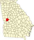
Location in Talbot County and the state of Georgia
Coordinates: 32°40′41″N84°32′23″W / 32.67806°N 84.53972°W / 32.67806; -84.53972
CountryUnited States
State Georgia
County Talbot
Area
[1]
  Total3.13 sq mi (8.09 km2)
  Land3.10 sq mi (8.04 km2)
  Water0.02 sq mi (0.05 km2)
Elevation
732 ft (223 m)
Population
 (2020)
  Total742
  Density238.97/sq mi (92.27/km2)
Time zone UTC−5 (Eastern (EST))
  Summer (DST) UTC−4 (EDT)
ZIP code
31827
Area code 706
FIPS code 13-75244 [2]
GNIS feature ID0333180 [3]
Website talbottonga.org

Talbotton is a city in Talbot County, Georgia, United States. The population was 970 at the 2010 census. [4] The city is the county seat of Talbot County. [5]

Contents

History

Talbotton was founded in 1828 as the seat of the newly formed Talbot County. [6] Both the county and the town were named for Governor Matthew Talbot. [7]

Talbotton may be best known in history as the place where the immigrant Straus family got their start in retail sales in the 19th century. In 1896, the family acquired R. H. Macy & Co. in New York. [8]

Geography

Talbotton is located at 32°40′41″N84°32′23″W / 32.67806°N 84.53972°W / 32.67806; -84.53972 (32.678170, -84.539787). [9] According to the United States Census Bureau, the city has a total area of 3.1 square miles (8.0 km2), of which 3.1 square miles (8.0 km2) is land and 0.32% is water.

The city is located in the central portion of the county along U.S. Route 80, which runs north to south through the main part of town, and turns east leaving town. U.S. Route 80 leads east 34 mi (55 km) to Roberta and southwest 37 mi (60 km) to Columbus. Georgia State Routes 90 and 208 also run through the city as well, with GA 90 leading southeast 8 mi (13 km) to Junction City and GA 208 leading west 13 mi (21 km) to Waverly Hall.

Climate

Talbotton has a humid subtropical climate (Köppen Cfa), with hot, humid summers and mild winters. The record high of 110 °F (43 °C) and record low of −6 °F (−21 °C) were recorded on July 19, 1913 and February 13, 1899, respectively.

On March 3, 2019, an EF4 tornado struck the town at low-end EF3 strength, causing major damage to structures and trees in the town. [10] [11]

Climate data for Talbotton, 1981-2010 normals, extremes 1893-present
MonthJanFebMarAprMayJunJulAugSepOctNovDecYear
Record high °F (°C)82
(28)
83
(28)
93
(34)
96
(36)
100
(38)
105
(41)
110
(43)
107
(42)
108
(42)
100
(38)
89
(32)
83
(28)
110
(43)
Mean daily maximum °F (°C)55.3
(12.9)
59.8
(15.4)
67.2
(19.6)
73.9
(23.3)
80.7
(27.1)
86.6
(30.3)
89.2
(31.8)
88.0
(31.1)
83.2
(28.4)
74.3
(23.5)
66.3
(19.1)
56.7
(13.7)
73.4
(23.0)
Mean daily minimum °F (°C)32.1
(0.1)
35.2
(1.8)
41.2
(5.1)
48.4
(9.1)
56.9
(13.8)
65.5
(18.6)
69.0
(20.6)
68.4
(20.2)
62.2
(16.8)
49.9
(9.9)
40.9
(4.9)
33.8
(1.0)
50.3
(10.2)
Record low °F (°C)−5
(−21)
−6
(−21)
12
(−11)
25
(−4)
33
(1)
42
(6)
50
(10)
50
(10)
34
(1)
23
(−5)
8
(−13)
1
(−17)
−6
(−21)
Average precipitation inches (mm)4.38
(111)
4.89
(124)
5.38
(137)
3.65
(93)
3.19
(81)
4.28
(109)
5.00
(127)
3.83
(97)
3.51
(89)
3.03
(77)
3.95
(100)
4.61
(117)
49.7
(1,262)
Average precipitation days (≥ 0.01 in)7.67.57.46.36.88.38.67.55.75.56.17.484.7
Source: NOAA [12]

Demographics

Historical population
CensusPop.Note
1870 796
1880 1,00826.6%
1890 1,14013.1%
1900 1,131−0.8%
1910 1,081−4.4%
1920 1,0931.1%
1930 1,064−2.7%
1940 1,060−0.4%
1950 1,17510.8%
1960 1,163−1.0%
1970 1,045−10.1%
1980 1,1409.1%
1990 1,046−8.2%
2000 1,019−2.6%
2010 970−4.8%
2020 742−23.5%
U.S. Decennial Census [13]
1850-1870 [14] 1880 [15]
1890-1910 [16] 1920-1930 [17]
1930-1940 [18] 1940-1950 [19]
1960-1980 [20] 1980-2000 [21]
Talbotton racial composition as of 2020 [22]
RaceNum.Perc.
White (non-Hispanic)12216.44%
Black or African American (non-Hispanic)60080.86%
Native American 10.13%
Asian 20.27%
Other/Mixed 70.94%
Hispanic or Latino 101.35%

As of the 2020 United States census, there were 742 people, 372 households, and 222 families residing in the city.

Education

The Talbot County School District headquarters is located in the city as well as the only school building in the entire county. [23] The district and school has 48 full-time teachers and over 792 students. [24]

Notable people

Related Research Articles

<span class="mw-page-title-main">Upson County, Georgia</span> County in Georgia, United States

Upson County is a county located in the west central Piedmont portion of the U.S. state of Georgia. As of the 2020 census, the population was 27,700. The county seat is Thomaston. The county was created on December 15, 1824.

<span class="mw-page-title-main">Talbot County, Georgia</span> County in Georgia, United States

Talbot County is a county located in the west central portion of the U.S. state of Georgia. The 2020 census showed a population of 5,733. The county seat and largest city is Talbotton.

<span class="mw-page-title-main">Chattahoochee County, Georgia</span> County in Georgia, United States

Chattahoochee County, also known as Cusseta-Chattahoochee County, is a county located on the western border in central Georgia. As of the 2020 census, the population was 9,565. The county seat is Cusseta, with which the county shares a consolidated city-county government. The city of Cusseta remains a geographically distinct municipality within Chattahoochee County. The county was created on February 13, 1854.

<span class="mw-page-title-main">LaFayette, Alabama</span> City in Alabama, United States

LaFayette is the county seat of Chambers County, Alabama, United States, 47 miles (76 km) northwest of Columbus, Georgia. As of the 2010 census, the population of the city was 3,003.

<span class="mw-page-title-main">Hurtsboro, Alabama</span> Town in Alabama, United States

Hurtsboro is a town in Russell County, Alabama, United States. At the 2010 census the population was 553, down from 592 in 2000. It was founded in 1857 as Hurtsville and named for Joel Hurt, Sr.. A railroad spur from Columbus, Georgia was completed the next year. It was incorporated in 1872 and in 1883 the town name was changed to Hurtsboro.

<span class="mw-page-title-main">Summerville, Georgia</span> City in Georgia, United States

Summerville is a city and the county seat of Chattooga County, Georgia, United States. The population was 4,534 at the 2010 census.

<span class="mw-page-title-main">Trenton, Georgia</span> City in Georgia, United States

Trenton is a city and the only incorporated municipality in Dade County, Georgia, United States—and as such, it serves as the county seat. The population was 2,195 at the 2020 census. Trenton is part of the Chattanooga, Tennessee–GA Metropolitan Statistical Area.

<span class="mw-page-title-main">Douglasville, Georgia</span> City in Georgia, United States

The city of Douglasville is the county seat of and largest city in Douglas County, Georgia, United States. As of the 2020 census, the city had a population of 34,650, up from 30,961 in 2010 and 20,065 in 2000.

<span class="mw-page-title-main">Greenville, Georgia</span> City in Georgia, United States

Greenville is a city and the county seat of Meriwether County, Georgia, United States. The population was 794 at the 2020 census, down from 876 in 2010. The city is located 60 miles (97 km) southwest of Atlanta and is part of the Atlanta metropolitan area.

<span class="mw-page-title-main">Manchester, Georgia</span> City in Georgia, United States

Manchester is a town in Meriwether and Talbot counties in the U.S. state of Georgia, although primarily in Meriwether. The population was 3,584 at the 2020 census, down from 4,230 in 2010. It is the most populous community in Meriwether County. CSX Transportation runs a railroad yard in Manchester.

<span class="mw-page-title-main">Warm Springs, Georgia</span> City in the United States

Warm Springs is a city in Meriwether County, Georgia, United States. The population was 465 at the 2020 census.

<span class="mw-page-title-main">Oxford, Georgia</span> City in Georgia, United States

Oxford is a city in Newton County, Georgia, United States. The population was 2,308 as of the 2020 census. It is part of the Atlanta metropolitan area.

<span class="mw-page-title-main">Geneva, Georgia</span> Town in Georgia, United States

Geneva is a town in Talbot County, Georgia, United States. The population was 75 at the 2020 census.

<span class="mw-page-title-main">Junction City, Georgia</span> Town in Georgia, United States

Junction City is a town in Talbot County, Georgia, United States. The population was 138 at the 2020 census.

<span class="mw-page-title-main">Woodland, Georgia</span> City in Georgia, United States

Woodland is a city in Talbot County, Georgia, United States. The population was 305 in 2020.

<span class="mw-page-title-main">Butler, Georgia</span> City in Georgia, United States

Butler is the county seat of Taylor County, Georgia, United States. Its population was 1,972 at the 2010 census, and 1,881 in 2020.

<span class="mw-page-title-main">Thomaston, Georgia</span> City in Georgia, United States

Thomaston is a city in and the county seat of Upson County, Georgia, United States. The population was 9,170 at the 2010 census. It is the principal city of and is included in the Thomaston, Georgia Micropolitan Statistical Area, which is included in the Atlanta - Sandy Springs (GA) - Gainesville (GA) - Alabama (partial) Combined Statistical Area.

<span class="mw-page-title-main">Preston, Georgia</span> Unincorporated community in Georgia, United States

Preston is an unincorporated community in Webster County, Georgia, United States, located seventeen miles west of Americus. The population was 453 at the 2000 census. From 1857 to 2009, Preston was an incorporated municipality. The community is the county seat of Webster County.

<span class="mw-page-title-main">Cleveland, Georgia</span> City in Georgia, United States

Cleveland is a city in White County, Georgia, located 90 miles (140 km) northeast of Atlanta and 128 miles (206 km) southeast of Chattanooga, Tennessee. Its population was 3,514 at the 2020 census. It is the county seat of White County.

<span class="mw-page-title-main">Bibb City, Georgia</span> Place in Georgia, United States

Bibb City was a city in west-central Georgia, United States. It had been the company town of the Bibb Manufacturing Company in Muscogee County, and had a population of 510 in its last official U.S. census (2000). The entire city area, consisting of historic Columbus Mill and the associated mill village owned by the company, is now part of the consolidated city-county of Columbus. It is listed in the National Register of Historic Places as Bibb City Historic District.

References

  1. "2020 U.S. Gazetteer Files". United States Census Bureau. Retrieved December 18, 2021.
  2. "U.S. Census website". United States Census Bureau . Retrieved January 31, 2008.
  3. "US Board on Geographic Names". United States Geological Survey. October 25, 2007. Retrieved January 31, 2008.
  4. "Talbotton, GA Profile: Facts & Data".
  5. "Find a County". National Association of Counties. Retrieved June 7, 2011.
  6. Hellmann, Paul T. (May 13, 2013). Historical Gazetteer of the United States. Routledge. p. 248. ISBN   978-1135948597 . Retrieved November 30, 2013.
  7. Krakow, Kenneth K. (1975). Georgia Place-Names: Their History and Origins (PDF). Macon, GA: Winship Press. p. 219. ISBN   0-915430-00-2.
  8. "Historical Markers by County - GeorgiaInfo". March 4, 2019. Archived from the original on March 4, 2019. Retrieved March 4, 2019.
  9. "US Gazetteer files: 2010, 2000, and 1990". United States Census Bureau. February 12, 2011. Retrieved April 23, 2011.
  10. "Beauregard-Smiths Station EF-4 Tornado (Macon/Lee Counties) March 3, 2019". Birmingham, Alabama: National Weather Service. National Weather Service Weather Forecast Office in Birmingham, Alabama. March 5, 2019. Retrieved March 5, 2019.
  11. Update #3 From NWS Damage Surveys Including the Long-Track Tornado which Traversed from Macon and Lee Counties in Alabama Through Muscogee, Harris and Talbotton Counties in Georgia (Report). Iowa Environmental Mesonet. National Weather Service Weather Forecast Office in Atlanta, Georgia. March 5, 2019. Retrieved March 5, 2019.
  12. "NOWData - NOAA Online Weather Data". National Oceanic and Atmospheric Administration. Retrieved January 26, 2021.
  13. "Decennial Census of Population and Housing by Decades". US Census Bureau.
  14. "1870 Census of Population - Georgia - Civil Divisions less than Counties" (PDF). US Census Bureau . 1870.
  15. "1880 Census of Population - Georgia - Civil Divisions less than Counties" (PDF). US Census Bureau . 1880.
  16. "1910 Census of Population - Georgia" (PDF). US Census Bureau . 1930.
  17. "1930 Census of Population - Georgia" (PDF). US Census Bureau . 1930. p. 253.
  18. "1940 Census of Population - Georgia" (PDF). US Census Bureau . 1940.
  19. "1950 Census of Population - Georgia -" (PDF). US Census Bureau . 1980.
  20. "1980 Census of Population - Number of Inhabitants - Georgia" (PDF). US Census Bureau . 1980.
  21. "2000 Census of Population - General Population Characteristics - Georgia" (PDF). US Census Bureau . 2000.
  22. "Explore Census Data". data.census.gov. Retrieved December 18, 2021.
  23. Georgia Board of Education, Retrieved June 26, 2010.
  24. School Stats, Retrieved June 26, 2010.
  25. "Towns, George Washington Bonaparte, (1801 - 1854)". Biographical Directory of the United States Congress. Retrieved September 4, 2012.