Woodland, Georgia | |
|---|---|
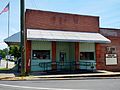
 Woodland in 2012. | |
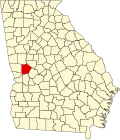
 Location in Talbot County and the state of Georgia | |
| Coordinates: 32°47′15″N84°33′40″W / 32.78750°N 84.56111°W | |
| Country | United States |
| State | Georgia |
| County | Talbot |
| Area | |
• Total | 0.79 sq mi (2.05 km2) |
| • Land | 0.78 sq mi (2.03 km2) |
| • Water | 0.0039 sq mi (0.01 km2) |
| Elevation | 791 ft (241 m) |
| Population (2020) | |
• Total | 305 |
| • Density | 388.4/sq mi (149.98/km2) |
| Time zone | UTC-5 (Eastern (EST)) |
| • Summer (DST) | UTC-4 (EDT) |
| ZIP code | 31836 |
| Area code | 706 |
| FIPS code | 13-83952 [2] |
| GNIS feature ID | 0356649 [3] |
Woodland is a city in Talbot County, Georgia, United States. The population was 305 in 2020.