Talbot County, Georgia

Last updated

Talbot County
Talbot County, GA Courthouse.JPG
Talbot County Courthouse and Confederate Monument in Talbotton
Map of Georgia highlighting Talbot County.svg
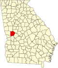
Location within the U.S. state of Georgia
Georgia in United States.svg
Georgia's location within the U.S.
Coordinates: 32°43′N84°32′W / 32.71°N 84.53°W / 32.71; -84.53
CountryFlag of the United States.svg United States
StateFlag of Georgia (U.S. state).svg Georgia
FoundedDecember 14, 1827;198 years ago (1827)
Named after Matthew Talbot
Seat Talbotton
Largest cityTalbotton
Area
  Total
395 sq mi (1,020 km2)
  Land391 sq mi (1,010 km2)
  Water3.4 sq mi (9 km2)  0.9%
Population
 (2020)
  Total
5,733
  Density15/sq mi (6/km2)
Time zone UTC−5 (Eastern)
  Summer (DST) UTC−4 (EDT)
Congressional district 2nd
Website talbotcountyga.org

Talbot County is a county located in the west central portion of the U.S. state of Georgia. The 2020 census showed a population of 5,733. [1] The county seat and largest city is Talbotton. [2]

Contents

History

Talbot County was created from a portion of Muscogee County by a December 14, 1827, act of the Georgia General Assembly. It was named after the late Georgia governor Matthew Talbot. [3] Taylor County was created from a portion of Talbot County in 1852.

Geography

According to the U.S. Census Bureau, the county has a total area of 395 square miles (1,020 km2), of which 391 square miles (1,010 km2) is land and 3.4 square miles (8.8 km2) (0.9%) is water. [4]

The county straddles the fall line of the Eastern U.S., and thus northern areas of the county are hillier compared to southern areas of the county. The Fall Line Freeway runs across the southern portion of the county, following Georgia State Route 96 from Geneva to Junction City. The far northern portion of the county is part of the Pine Mountain Range, with elevations in this areas exceeding 1,000 ft on the highest peaks of the mountains.

The northeastern three-quarters of Talbot County is located in the Upper Flint River sub-basin of the Apalachicola-Chattahoochee-Flint River Basin. The southwestern quarter, west of Junction City, is located in the Middle Chattahoochee River-Walter F. George Lake sub-basin, while a narrow sliver of the western border, east of Waverly Hall, is located in the Middle Chattahoochee River-Lake Harding sub-basin. [5]

Major highways

Adjacent counties

Railroads

Communities

Cities

Towns

Census-designated place

Unincorporated communities

Demographics

Historical population
CensusPop.Note
1830 5,940
1840 15,627163.1%
1850 16,5345.8%
1860 13,616−17.6%
1870 11,913−12.5%
1880 14,11518.5%
1890 13,258−6.1%
1900 12,197−8.0%
1910 11,696−4.1%
1920 11,158−4.6%
1930 8,458−24.2%
1940 8,141−3.7%
1950 7,687−5.6%
1960 7,127−7.3%
1970 6,625−7.0%
1980 6,536−1.3%
1990 6,524−0.2%
2000 6,498−0.4%
2010 6,8655.6%
2020 5,733−16.5%
2024 (est.)5,755 [6] 0.4%
U.S. Decennial Census [7]
1790-1880 [8] 1890-1910 [9]
1920-1930 [10] 1930-1940 [11]
1940-1950 [12] 1960-1980 [13]
1980-2000 [14]
2010 [15] 2020 [16]
Talbot County, Georgia – Racial and ethnic composition
Note: the US Census treats Hispanic/Latino as an ethnic category. This table excludes Latinos from the racial categories and assigns them to a separate category. Hispanics/Latinos may be of any race.
Race / Ethnicity (NH = Non-Hispanic)Pop 2000 [17] Pop 2010 [15] Pop 2020 [16] % 2000% 2010% 2020
White alone (NH)2,3542,6392,42736.23%38.44%42.33%
Black or African American alone (NH)3,9744,0393,05661.16%58.83%53.31%
Native American or Alaska Native alone (NH)141850.22%0.26%0.09%
Asian alone (NH)189170.28%0.13%0.30%
Native Hawaiian or Pacific Islander alone (NH)1010.02%0.00%0.02%
Other race alone (NH)3360.05%0.04%0.10%
Mixed race or Multiracial (NH)52661090.80%0.96%1.90%
Hispanic or Latino (any race)82911121.26%1.33%1.95%
Total6,4986,8655,733100.00%100.00%100.00%

As of the 2020 United States census, there were 5,733 people, 2,809 households, and 1,849 families residing in the county.

Education

The Talbot County School District holds pre-school to grade twelve, and consists of one building with 48 full-time teachers and 792 students. [18] The district headquarters is in Talbotton. [19]

Politics

Like most majority-African-American counties in Georgia, Talbot is a reliably Democratic county. Between 1880 and 2020, Talbot County has only voted Republican three times, although it also voted for American Independent segregationist George Wallace in 1968. Donald Trump's 39.50% in 2020 was the best performance for a Republican since Nixon in the 1972 presidential election. In 2024, Trump furthered increased his vote share to almost 44% of the vote.

United States presidential election results for Talbot County, Georgia [20]
Year Republican Democratic Third party(ies)
No.%No.%No.%
1912 81.48%44682.44%8716.08%
1916 173.14%51194.28%142.58%
1920 4310.19%37989.81%00.00%
1924 336.27%49193.35%20.38%
1928 7412.13%53687.87%00.00%
1932 454.69%91295.00%30.31%
1936 414.86%79694.42%60.71%
1940 496.94%65692.92%10.14%
1944 455.13%83294.87%00.00%
1948 9211.33%58271.67%13817.00%
1952 17520.52%67879.48%00.00%
1956 13616.08%71083.92%00.00%
1960 20721.17%77178.83%00.00%
1964 67951.99%62748.01%00.00%
1968 31720.92%51033.66%68845.41%
1972 99066.09%50833.91%00.00%
1976 45921.93%1,63478.07%00.00%
1980 57225.50%1,63572.89%361.60%
1984 77834.24%1,49465.76%00.00%
1988 80238.93%1,24860.58%100.49%
1992 67125.02%1,76865.92%2439.06%
1996 65227.79%1,57967.31%1154.90%
2000 84433.35%1,66265.67%250.99%
2004 1,10337.43%1,83062.10%140.48%
2008 1,30135.15%2,36964.01%310.84%
2012 1,20234.41%2,26564.84%260.74%
2016 1,19636.68%2,00261.39%631.93%
2020 1,39239.50%2,11459.99%180.51%
2024 1,48343.89%1,88855.87%80.24%

See also

References

  1. "Census - Geography Profile: Talbot County, Georgia". United States Census Bureau . Retrieved December 29, 2022.
  2. "Find a County". National Association of Counties. Retrieved June 7, 2011.
  3. Krakow, Kenneth K. (1975). Georgia Place-Names: Their History and Origins (PDF). Macon, GA: Winship Press. p. 219. ISBN   0-915430-00-2. Archived (PDF) from the original on September 17, 2003.
  4. "US Gazetteer files: 2010, 2000, and 1990". United States Census Bureau. February 12, 2011. Retrieved April 23, 2011.
  5. "Georgia Soil and Water Conservation Commission Interactive Mapping Experience". Georgia Soil and Water Conservation Commission. Archived from the original on October 3, 2018. Retrieved November 20, 2015.
  6. "County Population Totals and Components of Change: 2020-2024". United States Census Bureau. Retrieved August 22, 2025.
  7. "Decennial Census of Population and Housing by Decades". United States Census Bureau.
  8. "1880 Census Population by Counties 1790-1800" (PDF). United States Census Bureau. 1880.
  9. "1910 Census of Population - Georgia" (PDF). United States Census Bureau. 1910. Archived from the original (PDF) on January 16, 2024.
  10. "1930 Census of Population - Georgia" (PDF). United States Census Bureau. 1930. p. 253.
  11. "1940 Census of Population - Georgia" (PDF). United States Census Bureau. 1940.
  12. "1950 Census of Population - Georgia -" (PDF). United States Census Bureau. 1950.
  13. "1980 Census of Population - Number of Inhabitants - Georgia" (PDF). United States Census Bureau. 1980.
  14. "2000 Census of Population - General Population Characteristics - Georgia" (PDF). United States Census Bureau. 2000.
  15. 1 2 "P2: Hispanic or Latino, and Not Hispanic or Latino by Race – 2010: DEC Redistricting Data (PL 94-171) – Talbot County, Georgia". United States Census Bureau. Retrieved January 26, 2024.
  16. 1 2 "P2: Hispanic or Latino, and Not Hispanic or Latino by Race – 2020: DEC Redistricting Data (PL 94-171) – Talbot County, Georgia". United States Census Bureau. Retrieved January 26, 2024.
  17. "P004: Hispanic or Latino, and Not Hispanic or Latino by Race – 2000: DEC Summary File 1 – Talbot County, Georgia". United States Census Bureau. Retrieved January 26, 2024.
  18. Georgia Board of Education [ permanent dead link ], Retrieved June 26, 2010.
  19. School Stats, Retrieved June 26, 2010.
  20. Leip, David. "Dave Leip's Atlas of U.S. Presidential Elections". uselectionatlas.org. Retrieved March 22, 2018.

32°43′N84°32′W / 32.71°N 84.53°W / 32.71; -84.53