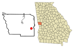
Waverly Hall, Georgia

Last updated

Waverly Hall, Georgia
Waverly Hall Georgia Government and Arts Building.JPG
The Waverly Hall Government & Arts Building
Harris County Georgia Incorporated and Unincorporated areas Waverly Hall Highlighted.svg
Location in Harris County and the state of Georgia
Coordinates: 32°41′5″N84°44′18″W / 32.68472°N 84.73833°W / 32.68472; -84.73833
Country United States
State Georgia
County Harris
Area
[1]
  Total3.36 sq mi (8.70 km2)
  Land3.34 sq mi (8.64 km2)
  Water0.02 sq mi (0.05 km2)
Elevation
741 ft (226 m)
Population
 (2020)
  Total638
  Density191.19/sq mi (73.81/km2)
Time zone UTC-5 (Eastern (EST))
  Summer (DST) UTC-4 (EDT)
ZIP code
31831
Area code 706
FIPS code 13-80844 [2]
GNIS feature ID0333376 [3]
Website waverlyhallga.gov

Waverly Hall is a town in Harris County, Georgia, United States. It is part of the Columbus, Georgia-Alabama metropolitan statistical area. The population was 638 in 2020.

Contents

History

A post office called Waverly was established in 1829. [4] The community derives its name from Sir Walter Scott's Waverley novels. [5]

The Georgia General Assembly incorporated Waverly Hall as a town in 1914. [6]

Geography

Waverly Hall is located in west-central Georgia within the Piedmont geographical region at 32°41′5″N84°44′18″W / 32.68472°N 84.73833°W / 32.68472; -84.73833 (32.684607, -84.738405), [7] in eastern Harris County. Alternate U.S. Route 27 and Georgia State Route 85 run northeast to southeast through the city, leading southwest 24 miles (39 km) to Columbus and north 10 miles (16 km) to Shiloh. The two highways meet Georgia State Route 208 in the northern city limits. Atlanta is 83 miles (134 km) by road to the northeast.

According to the United States Census Bureau, the town has a total area of 3.4 square miles (8.7 km2), of which 0.02 square miles (0.05 km2), or 0.60%, are water. [8]

Demographics

Historical population
CensusPop.Note
1930 515
1940 56910.5%
1950 69021.3%
1960 7123.2%
1970 671−5.8%
1980 91336.1%
1990 769−15.8%
2000 709−7.8%
2010 7353.7%
2020 638−13.2%
U.S. Decennial Census [9]

As of the census [2] of 2000, there were 709 people, 249 households, and 176 families residing in the town. By 2020, its population declined to 638.

Arts and culture

The Village Green rail trail offers residents a walking track and playground. [10]

Related Research Articles

<span class="mw-page-title-main">Talbot County, Georgia</span> County in Georgia, United States

Talbot County is a county located in the west central portion of the U.S. state of Georgia. The 2020 census showed a population of 5,733. The county seat and largest city is Talbotton.

<span class="mw-page-title-main">Harris County, Georgia</span> County in Georgia, United States

Harris County is a county located in the west-central portion of the U.S. state of Georgia; its western border with the state of Alabama is formed by the Chattahoochee River. As of the 2020 census, the population was 34,668. The county seat is Hamilton. The largest city in the county is Pine Mountain, a resort town that is home to the Franklin D. Roosevelt State Park. Harris County was created on December 14, 1827, and named for Charles Harris, a Georgia judge and attorney.

<span class="mw-page-title-main">Cusseta, Georgia</span> Consolidated city-county in Georgia, United States

Cusseta is a city in Chattahoochee County, Georgia, United States. It is part of the Columbus, Georgia-Alabama metropolitan statistical area. The population was 9,565 in 2020. The city is the county seat of Chattahoochee County, with which it shares a consolidated city-county government. Despite this, Cusseta is not coterminous with the county; it remains a geographically distinct municipality within the county.

<span class="mw-page-title-main">Blakely, Georgia</span> City in Georgia, United States

Blakely is a city and the county seat of Early County, Georgia, United States. As of 2020, its population was 5,371. It is located approximately halfway between Columbus and Tallahassee, Florida on U.S. Route 27.

<span class="mw-page-title-main">Nunez, Georgia</span> City in Georgia, United States

Nunez is a city in Emanuel County, Georgia, United States. The population was 134 in 2020.

<span class="mw-page-title-main">Hamilton, Georgia</span> City in Georgia, United States

Hamilton is a city in, and the county seat of Harris County, Georgia, United States. It is part of the Columbus, Georgia-Alabama metropolitan statistical area. The population was 1,680 at the 2020 census, up from 307 at the 2000 census.

<span class="mw-page-title-main">Pine Mountain, Harris County, Georgia</span> Town in Georgia, United States

Pine Mountain is a town in Harris and Meriwether counties in the U.S. state of Georgia. As of the 2020 census it had a population of 1,216.

<span class="mw-page-title-main">Shiloh, Georgia</span> City in Georgia, United States

Shiloh is a city on the northeastern edge of Harris County, Georgia, United States. It is part of the Columbus, Georgia–Alabama metropolitan statistical area. As of the 2020 census, the population was 402.

<span class="mw-page-title-main">Lake Park, Georgia</span> City in Georgia, United States

Lake Park is a city in Lowndes County, Georgia, United States. The population was 932 in 2020, up from 733 in 2010.

<span class="mw-page-title-main">Ideal, Georgia</span> City in Georgia, United States

Ideal is a city in Macon County, Georgia, United States. The population was 407 at the 2020 census, down from 499 in 2010.

<span class="mw-page-title-main">Oglethorpe, Georgia</span> City in Georgia, United States

Oglethorpe is a city in Macon County, Georgia, United States. The population was 995 at the 2020 census, down from 1,328 in 2010. The city is the county seat of Macon County. It was named for Georgia's founder, James Oglethorpe.

<span class="mw-page-title-main">Greenville, Georgia</span> City in Georgia, United States

Greenville is a city and the county seat of Meriwether County, Georgia, United States. The population was 794 at the 2020 census, down from 876 in 2010. The city is located 60 miles (97 km) southwest of Atlanta and is part of the Atlanta metropolitan area.

<span class="mw-page-title-main">Meigs, Georgia</span> City in Georgia, United States

Meigs is a city in Thomas County, Georgia, United States, with a small portion extending north into Mitchell County. The population was 928 at the 2020 census, down from 1,035 in 2010.

<span class="mw-page-title-main">Higgston, Georgia</span> Town in Georgia, United States

Higgston is a town in Montgomery County, Georgia, United States. The population was 314 at the 2020 census.

<span class="mw-page-title-main">Geneva, Georgia</span> Town in Georgia, United States

Geneva is a town in Talbot County, Georgia, United States. The population was 75 at the 2020 census.

<span class="mw-page-title-main">Junction City, Georgia</span> Town in Georgia, United States

Junction City is a town in Talbot County, Georgia, United States. The population was 179 at the 2000 census.

<span class="mw-page-title-main">Talbotton, Georgia</span> City in Georgia, United States

Talbotton is a city in Talbot County, Georgia, United States. The population was 970 at the 2010 census. The city is the county seat of Talbot County.

<span class="mw-page-title-main">Butler, Georgia</span> City in Georgia, United States

Butler is the county seat of Taylor County, Georgia, United States. Its population was 1,972 at the 2010 census.

Cataula is an unincorporated community and census-designated place (CDP) in Harris County, Georgia, United States.

<span class="mw-page-title-main">Ellerslie, Georgia</span> Place in Georgia, United States

Ellerslie is an unincorporated community and census-designated place (CDP) in Harris County, Georgia, United States. Ellerslie is a part of the Columbus, Georgia metropolitan area.

References

  1. "2020 U.S. Gazetteer Files". United States Census Bureau. Retrieved December 18, 2021.
  2. 1 2 "U.S. Census website". United States Census Bureau . Retrieved January 31, 2008.
  3. "US Board on Geographic Names". United States Geological Survey. October 25, 2007. Retrieved January 31, 2008.
  4. "Post Offices". Jim Forte Postal History. Retrieved June 29, 2019.
  5. Krakow, Kenneth K. (1975). Georgia Place-Names: Their History and Origins (PDF). Macon, GA: Winship Press. p. 248. ISBN   0-915430-00-2.
  6. Acts and Resolutions of the General Assembly of the State of Georgia. Clark & Hines, State Printers. 1914. p. 1211.
  7. "US Gazetteer files: 2010, 2000, and 1990". United States Census Bureau. February 12, 2011. Retrieved April 23, 2011.
  8. "Geographic Identifiers: 2010 Demographic Profile Data (G001): Waverly Hall town, Georgia". American Factfinder. U.S. Census Bureau. Retrieved May 18, 2017.[ dead link ]
  9. "Census of Population and Housing". Census.gov. Retrieved June 4, 2015.
  10. "Waverly Hall". GeorgiaGov. Retrieved June 29, 2019.