Smiths Station, Alabama

Last updated

Smiths Station
2021-03-08 Smiths Station, AL - Historic Jones Store Complex.jpg
The Historic Jones Store Museum in Smiths Station
Lee County Alabama Incorporated and Unincorporated areas Smiths Station Highlighted 0171190.svg
Location of Smiths Station in Lee County, Alabama.
Coordinates: 32°32′21″N85°05′55″W / 32.53917°N 85.09861°W / 32.53917; -85.09861
Country United States
State Alabama
Counties Lee
Government
  MayorRichard Cooley
Area
[1]
   City 8.27 sq mi (21.41 km2)
  Land8.24 sq mi (21.34 km2)
  Water0.03 sq mi (0.07 km2)
Elevation
370 ft (113 m)
Population
 (2020)
   City 5,384
  Density653.40/sq mi (252.27/km2)
   Metro
150,933
Time zone Eastern (EST)
ZIP codes
36877
Area code 334
FIPS code 01-71190
Website smithsstational.gov

Smiths Station is a city in Lee County, Alabama, United States. It is part of the Columbus, Georgia metropolitan area. At the time of the 2000 census, it was still a census-designated place (CDP), and its population was 6,756. The area that incorporated as Smiths Station in 2001 was much smaller than the CDP, and contained a population of 4,926 by the 2010 census. Smiths Station, known to locals as "Smiths", is a bedroom community of Columbus, Georgia, and Phenix City, Alabama. Smiths Station High School has an enrollment of over 1,800 students and is the 11th-largest high school in the state.

Contents

History

Smiths Station was first settled in 1738. The Central of Georgia Railway was extended through the community from Columbus, Georgia to Opelika, Alabama in 1845. The depot was named for Broadus Smith, a prominent early settler who lived near the city's current location. [2]

Local legend contends that around 1960, local Jon Ergan grew tired of writing Smiths Station, so he took it upon himself to drop "Station" from the name of the community.[ citation needed ]

Smiths Station was officially incorporated on June 22, 2001, and is as of 2004 Alabama's second newest city next to Center Point. [3]

On November 3, 2023, the city's mayor, Bubba Copeland, died by suicide after being publicly outed by reporter Craig Monger of conservative news website 1819 News for cross-dressing and adopting a transgender persona online. [4] [5] [6]

Geography

According to the U.S. Census Bureau, the CDP had a total area of 6.740 square miles (17.46 km2), of which 6.713 square miles (17.39 km2) is land and 0.027 square miles (0.070 km2) is water. [7]

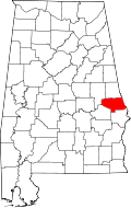
The city is located in the southeastern part of Lee County, adjacent to Phenix City, which it borders to the southeast. U.S. Routes 280 and 431 run through the eastern part of the city, leading northwest 19 mi (31 km) to Opelika and southeast 8 mi (13 km) to Phenix City. Numerous county and local roads also run through the city as well, leading to more rural areas in Lee County.

Climate

The climate in this area is characterized by relatively high temperatures and evenly distributed precipitation throughout the year. According to the Köppen Climate Classification system, Smiths Station has a humid subtropical climate, abbreviated "Cfa" on climate maps. [8]

On March 3, 2019, an EF4 tornado ripped through Smiths Station at high-end EF2 strength. Major damage occurred to homes, businesses and trees in the area. [9] [10]

Demographics

Historical population
CensusPop.Note
1990 3,456
2000 21,756529.5%
2010 4,926−77.4%
2020 5,3849.3%
U.S. Decennial Census [11]

From 1990–2001, the community was listed as Smiths CDP in the U.S. Census; the precipitous drop in population from 2000–2010 was due to just a segment of the CDP's incorporation as the city of Smiths Station. The remainder of the former CDP was disbanded as a separate entity for the 2010 census. [12]

2000 census

At the 2000 census, there were 21,756 people, 7,806 households, and 6,252 families in the CDP. The population density was 305.7 inhabitants per square mile (118.0/km2). There were 8,437 housing units at an average density of 118.6 per square mile (45.8/km2). The racial makeup of the CDP was 84.79% White, 12.67% Black or African American, 0.38% Native American, 0.39% Asian, 0.01% Pacific Islander, 0.74% from other races, and 1.03% from two or more races. 2.08% of the population were Hispanic or Latino of any race.

Of the 7,806 households 44.6% had children under the age of 18 living with them, 64.4% were married couples living together, 11.4% had a female householder with no husband present, and 19.9% were non-families. 16.5% of households were one person and 4.8% were one person aged 65 or older. The average household size was 2.79 and the average family size was 3.12.

The age distribution was 30.4% under the age of 18, 7.9% from 18 to 24, 34.9% from 25 to 44, 19.6% from 45 to 64, and 7.2% 65 or older. The median age was 32 years. For every 100 females, there were 98.4 males. For every 100 females age 18 and over, there were 95.7 males.

The median household income was $43,977 and the median family income was $47,765. Males had a median income of $32,246 versus $23,707 for females. The per capita income for the CDP was $17,608. About 7.2% of families and 8.9% of the population were below the poverty line, including 11.6% of those under age 18 and 11.2% of those age 65 or over.

2010 census

At the 2010 census, there were 4,926 people in 1,913 households, including 1,407 families, in the city. There were 8,437 housing units. The racial makeup of the city was 80.3% White, 15.9% Black or African American, 0.7% Native American, 0.5% Asian, 0.0% Pacific Islander, 0.6% from other races, and 2.0% from two or more races. 2.8% of the population were Hispanic or Latino of any race.

Of the 1,913 households 31.1% had children under the age of 18 living with them, 53.9% were married couples living together, 15.1% had a female householder with no husband present, and 26.5% were non-families. 22.9% of households were one person and 7.5% were one person aged 65 or older. The average household size was 2.58 and the average family size was 2.99.

The age distribution was 24.1% under the age of 18, 9.0% from 18 to 24, 24.1% from 25 to 44, 29.7% from 45 to 64, and 13.1% 65 or older. The median age was 39.3 years. For every 100 females, there were 93.1 males. For every 100 females age 18 and over, there were 93.9 males.

The median household income was $47,969 and the median family income was $54,698. Males had a median income of $38,294 versus $25,394 for females. The per capita income for the city was $20,678. About 7.5% of families and 9.8% of the population were below the poverty line, including 13.7% of those under age 18 and 12.1% of those age 65 or over.

2020 census

Smiths Station racial composition [13]
RaceNum.Perc.
White (non-Hispanic)3,88672.18%
Black or African American (non-Hispanic)99718.52%
Native American 110.2%
Asian 400.74%
Pacific Islander 20.04%
Other/Mixed 2294.25%
Hispanic or Latino 2194.07%

As of the 2020 United States census, there were 5,384 people, 2,151 households, and 1,566 families residing in the city.

Education

Smiths Station forms a part of the Lee County School District.

Smiths Station High School is the city's only high school. Its school colors are black, white, and teal with a secondary use of silver; sports teams are called the Panthers. The school's "cheer squads" are award-winning[ which? ] and appear at all football and basketball games. In the past, the football team had more success, with the third-most Alabama state championship game appearances. The "Panther Spirit Marching Band" has been invited to march for the Queen of the United Kingdom and has performed in the Dunkin' Donuts Thanksgiving Day Parade in Philadelphia, Pennsylvania. The band holds three Grand Championship awards and numerous best-in-class awards. The track-and-field team has been nationally ranked several times and have numerous alumni throughout the nation competing at the DI, DII, and professional levels.[ citation needed ]

Time zone

Although Alabama is legally in the Central Time Zone, Smiths Station's proximity to the larger cities of Phenix City and Columbus, Georgia causes areas within a 10-15 mile radius of Phenix City (including Smiths Station) to observe Eastern Time on a de facto basis. [14]

Notable people

Related Research Articles

<span class="mw-page-title-main">Lee County, Alabama</span> County in Alabama, United States

Lee County is a county located in east central Alabama. As of the 2020 census the population was 174,241. The county seat is Opelika, and the largest city is Auburn. The county was established in 1866 and is named for General Robert E. Lee (1807–1870), who served as General in Chief of the Armies of the Confederate States in 1865. Lee County comprises the Auburn-Opelika, AL Metropolitan Statistical Area, which is included in the Columbus-Auburn-Opelika, GA-AL Combined Statistical Area.

<span class="mw-page-title-main">Russell County, Alabama</span> County in Alabama, United States

Russell County is a county in the southeastern part of the U.S. state of Alabama. As of the 2020 census, the population was 59,183. Its county seat is Phenix City. Its name is in honor of Colonel Gilbert C. Russell, who fought in the wars against the Creek Indians.

<span class="mw-page-title-main">Saks, Alabama</span> Census-designated place & Unincorporated Community in Alabama, United States

Saks is a census-designated place (CDP) and Unincorporated community in Calhoun County, Alabama, United States. At the 2020 census, the population was 9,956. The community of Saks is served by the City of Anniston police and fire coverage. It is included in the Anniston-Oxford Metropolitan Statistical Area.

<span class="mw-page-title-main">Valley, Alabama</span> City in Alabama, United States

Valley is a city in Chambers County, Alabama, United States. Valley was incorporated in 1980 combining the four textile mill villages of Fairfax, Langdale, River View, and Shawmut. As of the 2010 census it had a population of 9,524. The city lies on the western bank of the Chattahoochee River, the state border between Alabama and Georgia. Valley is a pilot city for the Alabama Communities of Excellence program, a non-profit that partners with governments, businesses, and universities to prepare participating communities for a more vibrant future. It is included in the LaGrange, Georgia Micropolitan Statistical Area, which is included in the Greater Atlanta Combined Statistical Area.

<span class="mw-page-title-main">Jackson, Alabama</span> City in Alabama, United States

Jackson is a city in Clarke County, Alabama, United States. The population was 5,557 at the 2020 census. It was one of three wet settlements in an otherwise-dry county.

<span class="mw-page-title-main">Pinson, Alabama</span> City in Alabama, United States

Pinson is a city in Jefferson County near Birmingham, Alabama, United States, northwest of Center Point. As of the 2010 census, the population was 7,163.

<span class="mw-page-title-main">Phenix City, Alabama</span> City in Alabama, United States

Phenix City is a city in Lee and Russell counties in the U.S. state of Alabama, and the county seat of Russell County. As of the 2020 Census, the population of the city was 38,817.

<span class="mw-page-title-main">Hazel Green, Alabama</span> Census-designated place in Alabama, United States

Hazel Green is an unincorporated community and census-designated place (CDP) in Madison County, Alabama, United States, and is included in the Huntsville-Decatur Combined Statistical Area. As of the 2020 census, the population of the community was 4,105, up from 3,630 at the 2010 census.

<span class="mw-page-title-main">Theodore, Alabama</span> Census-designated place in Alabama, United States

Theodore is an unincorporated area and census-designated place (CDP) in Mobile County, Alabama, United States. The population was 6,270 at the 2020 census. It is a part of the Mobile metropolitan area. Prior to 1900 this area was known as "Clements", but it is now named for William Theodore Hieronymous, a sawmill operator and postmaster.

<span class="mw-page-title-main">Tillmans Corner, Alabama</span> Unincorporated community in Alabama, United States

Tillmans Corner, or Tillman’s Corner, is an unincorporated community and census-designated place (CDP) in Mobile County, Alabama, United States. At the 2020 census, the population was 17,731. It is part of the Mobile metropolitan area, and is the largest census-designated place in Alabama.

<span class="mw-page-title-main">Talladega, Alabama</span> City in Alabama, United States

Talladega is the county seat of Talladega County, Alabama, United States. It was incorporated in 1835. At the 2020 census, the population was 15,861. Talladega is approximately 50 miles (80 km) east of one of the state’s largest cities, Birmingham.

<span class="mw-page-title-main">Camden, Alabama</span> City in and county seat of Wilcox County, Alabama

Camden is a city in and the county seat of Wilcox County, Alabama, United States. The population was 2,020 at the 2010 census, down from 2,257 in 2000, at which time it was a town.

<span class="mw-page-title-main">Kaibito, Arizona</span> CDP in Coconino County, Arizona

Kaibeto is a census-designated place (CDP) in Coconino County, Arizona, United States. The population was 1,522 at the 2010 census.

<span class="mw-page-title-main">Summerville, Georgia</span> City in Georgia, United States

Summerville is a city and the county seat of Chattooga County, Georgia, United States. The population was 4,534 at the 2010 census.

<span class="mw-page-title-main">Candler-McAfee, Georgia</span> Place in Georgia, United States

Candler-McAfee is an unincorporated community and census-designated place (CDP) in DeKalb County, Georgia, United States. It is located east of Atlanta approximately 10 miles (16 km) east of Downtown Atlanta and to the south of Decatur, Georgia The population was 23,025 at the 2010 census.

<span class="mw-page-title-main">Redan, Georgia</span> Place in Georgia, United States

Redan is an unincorporated community and census-designated place (CDP) in DeKalb County, Georgia, United States. As of the 2020 census, the CDP had a total population of 31,749. It is a predominantly African American community in eastern DeKalb County, and is a suburb of Atlanta.

Valley Station is a former census-designated place in southwestern Jefferson County, Kentucky, United States. The population was 22,946 at the 2000 census. When the government of Jefferson County merged with the city of Louisville, Kentucky in 2003, residents of Valley Station also became citizens of Louisville Metro. As a result, Valley Station is said to be a neighborhood within the city limits of Louisville by local media. It was named for its location in the valley between Muldraugh Hill and the Knobs.

<span class="mw-page-title-main">Custer, Montana</span> Village in Montana, United States

Custer is a village in Yellowstone County, Montana, United States. The population was 145 at the 2000 census.

<span class="mw-page-title-main">Garden City Park, New York</span> Hamlet and census-designated place in New York, United States

Garden City Park is a hamlet and census-designated place (CDP) located in the Town of North Hempstead in Nassau County, on Long Island, in New York, United States. The population was 7,806 at the 2010 census.

<span class="mw-page-title-main">Fairfax Station, Virginia</span> Census-designated place in Virginia, United States

Fairfax Station is a census-designated place (CDP) in Fairfax County, Virginia, United States. The population was 12,420 at the 2020 census. Located in Northern Virginia, its center is located 22 miles (35 km) southwest of Washington, D.C.

References

  1. "2020 U.S. Gazetteer Files". United States Census Bureau. Retrieved October 29, 2021.
  2. "City of Smiths Station".
  3. "Smiths Station". Encyclopedia of Alabama. Retrieved June 19, 2020.
  4. Craig, Monger (November 1, 2023). "The secret life of Smiths Station Mayor and Baptist pastor F.L. 'Bubba' Copeland as a 'transgender curvy girl': 'It's a hobby I do to relieve stress'". 1819 News. Retrieved November 19, 2023.
  5. Koplowitz, Howard (November 3, 2023). "F.L. 'Bubba' Copeland, Alabama mayor and pastor, kills himself". AL.com.
  6. Cathell, Mia (November 17, 2023). "What the Media Aren't Telling You About a Trans Mayor's Suicide". Townhall. Retrieved November 19, 2023.
  7. "2016 Census Gazeteer". US Census Bureau. Retrieved June 8, 2017.
  8. Climate Summary for Smiths Station, Alabama
  9. "Beauregard-Smiths Station EF-4 Tornado (Macon/Lee Counties) March 3, 2019". Birmingham, Alabama: National Weather Service. National Weather Service Weather Forecast Office in Birmingham, Alabama. March 5, 2019. Retrieved March 5, 2019.
  10. Update #3 From NWS Damage Surveys Including the Long-Track Tornado which Traversed from Macon and Lee Counties in Alabama Through Muscogee, Harris and Talbotton Counties in Georgia (Report). Iowa Environmental Mesonet. March 5, 2019. Retrieved March 5, 2019.{{cite report}}: Unknown parameter |agency= ignored (help)
  11. "U.S. Decennial Census". Census.gov. Retrieved June 6, 2013.
  12. 1870-2010 U.S. Censuses research on Lee County, Alabama communities
  13. "Explore Census Data". data.census.gov. Retrieved December 13, 2021.
  14. "Exceptions, Oddities, and Notes". OnTimeZone.com. Retrieved June 8, 2012.
  15. Wood, Graham (1971). An A-Z of Rock and Roll. Studio Vista. ISBN   9781105325038.