This article includes a list of general references, but it lacks sufficient corresponding inline citations .(July 2011) |
Salem, Alabama | |
|---|---|
 The Y'all Come Novelty Shop in Salem's business district | |
 Salem  Salem | |
| Coordinates: 32°35′48″N85°14′19″W / 32.59667°N 85.23861°W | |
| Country | United States |
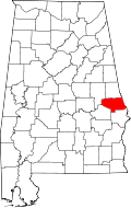
| State | Alabama |
| Counties | Lee |
| Area | |
• Total | 299 km2 (115.3 sq mi) |
| Population (July 2007) | |
• Total | 6,428 |
| • Density | 25/km2 (66/sq mi) |
| Time zone | UTC-6 (CST) |
| • Summer (DST) | UTC-5 (CDT) |
| ZIP code | 36874 |
| Area code | 334 |
| GNIS feature ID | 126233 [1] |
Salem is an unincorporated community east-centrally located in Lee County, Alabama, United States. It lies along U.S. Routes 280 and 431 between Opelika and Phenix City. It is part of the Auburn Metropolitan Area.