West Georgia (region)

Last updated
West Georgia
Region
Downtown Columbus, Georgia skyline.jpg
Downtown Columbus
Regions of Georgia (US state).png
West Georgia highlighted in green
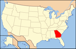
Map of USA GA.svg
Location of Georgia within the United States
CountryUnited States
State Georgia
Largest city Columbus
Population
 (2020)
  Total368,953
Demonym West Georgian
Website georgia.org/regions/west-georgia

West Georgia is a sixteen-county region in the U.S. state of Georgia, bordering Alabama. [1] Encompassing a portion of the Southern Rivers, West Georgia is anchored by Columbus, the state's second-largest city by population; its metropolitan statistical area, as of 2020, was Georgia's fourth-most populous metropolitan area. Tabulating the region's counties, West Georgia had a 2020 U.S. census population of 368,953.

Contents

Geography

According to the Georgia Department of Economic Development, West Georgia made up the following counties: Chattahoochee, Clay, Crisp, Dooly, Harris, Macon, Marion, Muscogee, Quitman, Randolph, Schley, Stewart, Sumter, Talbot, Taylor, and Webster. West Georgia borders the U.S. state of Alabama, being separated by the Chattahoochee River.

Demographics

As of the 2020 U.S. census, the counties comprising the region consisted of 368,953 residents.

Located within the Bible Belt, Christianity is West Georgia's predominant religion, and has been since British colonization of the Americas. According to the Association of Religion Data Archives in 2020, Protestantism was the largest form of Christianity practiced. The region's largest Christian denominations were the Southern Baptist Convention, non-denominational Protestants including the Christian Churches and Churches of Christ; the United Methodist Church and National Baptist Convention, USA. The Catholic Church was the largest non-Protestant Christian tradition in the region. [2]

Throughout West Georgia, Islam was the region's second-largest religion, followed by the Baha'i Faith and Judaism. [2]

Economy

The region's economy is primarily stimulated by the Columbus metropolitan area, with prominent employers being Fort Moore, the Muscogee County School District, Total System Services, and Columbus State University. [3]

Transportation

Air

Interstate

U. S. routes

Related Research Articles

<span class="mw-page-title-main">Stewart County, Georgia</span> County in Georgia, United States

Stewart County is a county located in the west central portion of the U.S. state of Georgia. As of the 2020 census, the population was 5,314. The county seat is Lumpkin. The county was created on December 23, 1830.

<span class="mw-page-title-main">Muscogee County, Georgia</span> County in Georgia, United States

Muscogee County is a county located on the central western border of the U.S. state of Georgia named after the Muscogee that originally inhabited the land with its western border with the state of Alabama that is formed by the Chattahoochee River. As of the 2020 census, the population was 206,922. Its county seat and only city is Columbus, with which it has been a consolidated city-county since the beginning of 1971.

<span class="mw-page-title-main">Harris County, Georgia</span> County in Georgia, United States

Harris County is a county located in the west-central portion of the U.S. state of Georgia; its western border with the state of Alabama is formed by the Chattahoochee River. As of the 2020 census, the population was 34,668. The county seat is Hamilton. The largest city in the county is Pine Mountain, a resort town that is home to the Franklin D. Roosevelt State Park. Harris County was created on December 14, 1827, and named for Charles Harris, a Georgia judge and attorney.

<span class="mw-page-title-main">Chattahoochee County, Georgia</span> County in Georgia, United States

Chattahoochee County, also known as Cusseta-Chattahoochee County, is a county located on the western border in central Georgia. As of the 2020 census, the population was 9,565. The county seat is Cusseta, with which the county shares a consolidated city-county government. The city of Cusseta remains a geographically distinct municipality within Chattahoochee County. The county was created on February 13, 1854.

<span class="mw-page-title-main">Phenix City, Alabama</span> City in Alabama, United States

Phenix City is a city in Lee and Russell counties in the U.S. state of Alabama, and the county seat of Russell County. As of the 2020 Census, the population of the city was 38,817.

<span class="mw-page-title-main">Cusseta, Georgia</span> Consolidated city-county in Georgia, United States

Cusseta is a city in Chattahoochee County, Georgia, United States. It is part of the Columbus, Georgia-Alabama metropolitan statistical area. The population was 9,565 in 2020. The city is the county seat of Chattahoochee County, with which it shares a consolidated city-county government. Despite this, Cusseta is not coterminous with the county; it remains a geographically distinct municipality within the county.

<span class="mw-page-title-main">Columbus, Georgia</span> Consolidated city-county in the United States

Columbus is a consolidated city-county located on the west-central border of the U.S. state of Georgia. Columbus lies on the Chattahoochee River directly across from Phenix City, Alabama. It is the county seat of Muscogee County, with which it officially merged in 1970; the original merger excluded Bibb City, which joined in 2000 after dissolving its own city charter.

<span class="mw-page-title-main">Bible Belt</span> Cultural region of the United States

The Bible Belt is a region of the Southern United States and one Midwestern state, the state of Missouri, in all of which socially conservative Protestant Christianity plays a strong role in society. Church attendance across the denominations is generally higher than the nation's average. The region contrasts with the religiously diverse Midwest and Great Lakes, and the Mormon corridor in Utah and southern Idaho.

<span class="mw-page-title-main">Chattahoochee River</span> River in Georgia, United States

The Chattahoochee River forms the southern half of the Alabama and Georgia border, as well as a portion of the Florida and Georgia border. It is a tributary of the Apalachicola River, a relatively short river formed by the confluence of the Chattahoochee and Flint rivers and emptying from Florida into Apalachicola Bay in the Gulf of Mexico. The Chattahoochee River is about 430 miles (690 km) long. The Chattahoochee, Flint, and Apalachicola rivers together make up the Apalachicola–Chattahoochee–Flint River Basin. The Chattahoochee makes up the largest part of the ACF's drainage basin.

<span class="mw-page-title-main">Southwest Georgia</span> Region in Georgia, United States

Southwest Georgia is a fourteen-county region in the U.S. state of Georgia. Commonly referred to as SOWEGA, the region is anchored by Albany, the most populous city and the region's sole metropolitan area. As of 2020, Southwest Georgia's population was 352,426.

<span class="mw-page-title-main">Columbus metropolitan area, Georgia</span> Metropolitan statistical area in Georgia, United States

The Columbus metropolitan area, officially the Columbus metropolitan statistical area, and colloquially known as the Chattahoochee Valley, is a metropolitan statistical area consisting of six counties in the U.S. state of Georgia and one county in Alabama, anchored by the city of Columbus.

<span class="mw-page-title-main">Coastal Georgia</span> Region in Georgia, United States

Coastal Georgia is a ten-county region in the U.S. state of Georgia, bordering South Carolina and Florida. It comprises a substantial portion of the state's Lower Coastal Plain. The region's largest city and metropolitan area is Savannah. Coastal Georgia's total population was 731,630 according to the 2020 United States census.

<span class="mw-page-title-main">Augusta metropolitan area</span> Metropolitan statistical area in Georgia South Carolina, United States

The Augusta metropolitan area, officially the Augusta-Richmond County metropolitan statistical area according to the U.S. Office of Management and Budget, Census Bureau and other agencies, is a metropolitan statistical area centered on the city of Augusta, Georgia. It straddles two U.S. states, Georgia and South Carolina, and includes the Georgia counties of Richmond, Burke, Columbia, Lincoln, and McDuffie as well as the South Carolina counties of Aiken and Edgefield. The official 2022 U.S. census estimate for the area was 624,083 residents, up from 611,000 at the 2020 U.S. census.

<span class="mw-page-title-main">Savannah metropolitan area</span> Metropolitan statistical area in Georgia, United States

The Savannah metropolitan area, officially named the Savannah metropolitan statistical area by the U.S. Office of Management and Budget, is a metropolitan statistical area in the U.S. state of Georgia. It is centered on the city of Savannah and encompasses three counties: Bryan, Chatham, and Effingham.

<span class="mw-page-title-main">Columbus–Auburn–Opelika combined statistical area</span> CSA in the United States

The Columbus–Auburn–Opelika, GA–AL Combined Statistical Area is a trading and marketing area made up of six counties in Georgia and two in Alabama. The statistical area includes two metropolitan areas: the Columbus metropolitan area and the Auburn–Opelika metropolitan area. As of 2021, the CSA had a population of 503,709.

<span class="mw-page-title-main">Southeast Georgia</span> 18-county region in Georgia, US

Southeast Georgia is an eighteen-county region within the U.S. state of Georgia, bordering Florida. The region includes a portion of Georgia's Lower Coastal Plain. Southeast Georgia's largest city is Valdosta, which forms the core of the Valdosta metropolitan area. The region's largest county by population is Lowndes, of which Valdosta is the county seat. The region had a total resident population of 416,498 in 2020.

<span class="mw-page-title-main">South Georgia (region)</span> Region in Georgia, United States

South Georgia is a seventeen-county region in the U.S. state of Georgia, with a 2020 population of 292,759.

<span class="mw-page-title-main">East Georgia (region)</span> Region in Georgia, United States

East Georgia is a thirteen-county region in the U.S. state of Georgia, bordering South Carolina. North of Coastal Georgia and the Lower Coastal Plain, part of the region lies in the Fall Line section of the state. The largest county by population in East Georgia is Richmond County, and its most populous city is Augusta, anchoring the Augusta metropolitan statistical area. Tabulating the region's counties, its population as of the 2020 U.S. census was 479,864.

<span class="mw-page-title-main">West Central Georgia</span> Region in Georgia, United States

West Central Georgia is a ten-county region in the U.S. state of Georgia, bordering Alabama. As of 2020, the region's population was 524,586.

<span class="mw-page-title-main">East Central Georgia</span> Region in Georgia, United States

East Central Georgia is a twelve-county region in the U.S. state of Georgia, with a 2020 census-tabulated population of 643,390. The region's largest city by population is Athens, forming the core of the Athens metropolitan area.

References

  1. "West Central South - Region 8". Georgia Department of Economic Development. Retrieved 2023-12-29.
  2. 1 2 "Congregational Membership Reports | US Religion". Association of Religion Data Archives. Retrieved 2024-01-29.
  3. Consolidated Government of Columbus, Georgia 2017 Comprehensive Financial Report