Cordele, Georgia

Last updated

Cordele, Georgia
Cordele City Hall.JPG
Cordele City Hall
Flag of Cordele, Georgia.png
Logo of Cordele, Georgia.png
Nickname: 
Watermelon Capital of the World
Motto: 
Gateway to South Georgia [1]
Crisp County Georgia Incorporated and Unincorporated areas Cordele Highlighted.svg
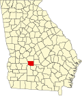
Location of Cordele in Georgia (left) and in Crisp County, Georgia (right)
Coordinates: 31°57′51″N83°46′38″W / 31.96417°N 83.77722°W / 31.96417; -83.77722
Country United States
State Georgia
County Crisp
Area
[2]
  Total
10.51 sq mi (27.21 km2)
  Land10.42 sq mi (26.99 km2)
  Water0.08 sq mi (0.22 km2)
Elevation
315 ft (96 m)
Population
 (2020)
  Total
10,220
  Density980.62/sq mi (378.61/km2)
Time zone UTC-5 (Eastern (EST))
  Summer (DST) UTC-4 (EDT)
ZIP Codes
31010, 31015
Area code 229
FIPS code 13-19616 [3]
GNIS feature ID0312971 [4]
Website www.cityofcordele.com

Cordele is a city in and the county seat of Crisp County, Georgia. [5] The population was 11,165 at the 2010 census, [6] and 10,220 in 2020.

Contents

Cordele calls itself the watermelon capital of the world. [7]

History

19th century

Cordele was incorporated on January 1, 1888, [8] and named for Cordelia Hawkins, eldest daughter of Colonel Samuel Hawkins, the president of the Savannah, Americus and Montgomery Railway. [9]

In November 1864, the area that is now Cordele served as the temporary capital of Georgia. During the last days of the Confederacy, Georgia's war governor Joseph E. Brown used his rural farmhouse to escape the wrath of Sherman's March to the Sea. During that time, the farmhouse, which Brown called "Dooly County Place," served as the official capital for only a few days. It was replaced in 1890 by the Suwanee Hotel, located in what became downtown Cordele. The hotel was destroyed by a fire in late 1994 and was rebuilt.

Cordele was founded in 1888 by J.E.D. Shipp of Americus. The town was located at the junction of two major railroads – the Savannah, Americus & Montgomery line, and the Georgia Southern & Florida. As the railroads brought more people and business to the newly settled territory, Cordele experienced phenomenal growth. Before 1905 Cordele was located in southern Dooly County, 9 miles (14 km) from the county seat in Vienna.

20th century

With Cordele's continued progress, many in the community felt the need for a seat of government to be closer than Vienna. Crisp County was formed in 1905 by taking a portion of southern Dooly County, and Cordele became its county seat.

By 1915, Cordele was home to several industries including an ice-making plant, mills for processing cotton products into cloth and oil, a fertilizer factory, and other small manufacturing outfits. [10]

By August 1930, Cordele housed the Crisp County Hydroelectric System, the first county-owned electric system. Located on the Flint River, the hydroelectric plant continues to operate, and the resulting Lake Blackshear has attracted residents to its waterfront properties.

On April 2, 1936, a tornado struck Cordele, killing 23 people.

Geography

Cordele is located north of the center of Crisp County at 31°57′51″N83°46′38″W / 31.96417°N 83.77722°W / 31.96417; -83.77722 (31.964178, -83.777277). [11] U.S. Route 41 passes through the city as Seventh Street and leads north 9 miles (14 km) to Vienna and south 20 miles (32 km) to Ashburn. U.S. Route 280 (16th Avenue) crosses US 41 in the center of the city and leads east 29 miles (47 km) to Abbeville and west 31 miles (50 km) to Americus. Interstate 75 passes through the east side of the city, with access from exits 99, 101, and 102, and leads 65 miles (105 km) north to Macon and 103 miles (166 km) south to the Florida state line. State Route 300 leads from the south side of the city 37 miles (60 km) southwest to Albany.

According to the U.S. Census Bureau, Cordele has a total area of 10.2 square miles (26.5 km2), of which 10.2 square miles (26.3 km2) is land and 0.077 square miles (0.2 km2), or 0.82%, is water. [6]

Climate

Cordele has a humid subtropical climate (Köppen climate classification Cfa), with mild winters and hot, humid summers.

Climate data for Cordele, Georgia (1991-2020 normals, extremes 1892–present)
MonthJanFebMarAprMayJunJulAugSepOctNovDecYear
Record high °F (°C)84
(29)
85
(29)
90
(32)
96
(36)
100
(38)
106
(41)
104
(40)
104
(40)
101
(38)
99
(37)
89
(32)
83
(28)
106
(41)
Mean daily maximum °F (°C)59.1
(15.1)
63.3
(17.4)
70.7
(21.5)
78.4
(25.8)
85.9
(29.9)
90.8
(32.7)
93.0
(33.9)
91.6
(33.1)
87.0
(30.6)
78.6
(25.9)
68.6
(20.3)
60.7
(15.9)
77.3
(25.2)
Mean daily minimum °F (°C)36.5
(2.5)
39.5
(4.2)
45.6
(7.6)
53.0
(11.7)
61.7
(16.5)
69.2
(20.7)
71.7
(22.1)
70.9
(21.6)
65.6
(18.7)
54.5
(12.5)
43.8
(6.6)
38.7
(3.7)
54.2
(12.4)
Record low °F (°C)−3
(−19)
9
(−13)
15
(−9)
30
(−1)
36
(2)
45
(7)
57
(14)
56
(13)
37
(3)
27
(−3)
9
(−13)
8
(−13)
−3
(−19)
Average rainfall inches (mm)4.67
(119)
4.33
(110)
4.88
(124)
4.39
(112)
2.98
(76)
4.86
(123)
4.54
(115)
4.09
(104)
4.54
(115)
2.61
(66)
3.20
(81)
5.04
(128)
50.13
(1,273)
Source: NOAA [12]

Demographics

Historical population
CensusPop.Note
1890 1,578
1900 3,473120.1%
1910 5,88369.4%
1920 6,53811.1%
1930 6,8805.2%
1940 7,92915.2%
1950 9,46219.3%
1960 10,60912.1%
1970 10,7331.2%
1980 11,1844.2%
1990 10,321−7.7%
2000 11,60812.5%
2010 11,147−4.0%
2020 10,220−8.3%
2023 (est.)9,868 [13] −3.4%
U.S. Decennial Census [14]
1850-1870 [15] 1870-1880 [16]
1890-1910 [17] 1920-1930 [18]
1940 [19] 1950 [20] 1960 [21]
1970 [22] 1980 [23] 1990 [24]
2000 [25] 2010 [26]
Cordele racial composition as of 2020 [27]
RaceNum.Perc.
White (non-Hispanic)2,60125.45%
Black or African American (non-Hispanic)6,81666.69%
Native American 60.06%
Asian 1561.53%
Pacific Islander 40.04%
Other/Mixed 3042.97%
Hispanic or Latino 3333.26%

As of the 2020 United States census, there were 10,220 people, 3,874 households, and 2,453 families residing in the city.

Crime

Cordele has the unfortunate distinction of being one of the highest rated cities or towns with regards crime. With a Total Crime Index of 1 making it safer than only 1% of US cities. [28] One's chance of becoming a victim of any crime here is one in fifteen in any given year.

Cordele City Commissioners

Five citizens of Cordele are elected to serve as the City Commissioners.

The current Cordele City Commissioners are: Jeanie Bartee, Wesley Rainey, Royce Reeves, Vesta Beal Shephard, and Chairman John Wiggins [29]

Representation in the Georgia State Legislature

In the Georgia State Senate, the City of Cordele is represented by Sen. Carden Summers. [30] In the Georgia House of Representatives, the City of Cordele is represented by Rep. Noel Williams Jr.

Representation in the United States House of Representatives

In the United States House of Representatives, the City of Cordele is represented by Rep. Sanford Bishop.

Georgia Veterans State Park

Boeing B-29 Superfortress exhibited at Georgia Veterans State Park Boeing B-29A-BN 293967 Cordele GA 14.12.02.R.jpg
Boeing B-29 Superfortress exhibited at Georgia Veterans State Park

To the west of Cordele town centre and located on Route 280 is the large Georgia Veterans State Park, which lies on the eastern edge of Lake Blackshear. This facility includes campgrounds, a resort hotel, and a golf course. There are also interesting displays of preserved military aircraft and helicopters and army tanks and other fighting vehicles. These displays are open to public viewing during daylight hours [31]

Arts and culture

Cordele was featured in the eighteenth episode of the Small Town News Podcast, an improv comedy podcast that takes listeners on a fun and silly virtual trip to a small town in America each week, in which the hosts improvise scenes inspired by local newspaper stories. [32]

Annual cultural events

Cordele hosts an annual Watermelon Festival each June. [33]

Museums and other points of interest

Titan I Titan I Cordele, GA.jpg
Titan I

In 1968 a Titan I missile was erected by the Rotary Club of Cordele at the intersection of I-75 and U.S. 280 East. [34]

Sports

Cordele is home to Cordele Motor Speedway formerly known as Crisp Motorsports Park, a 3/8-mile asphalt oval. It is home to the race series known as Speed Fest, which is sanctioned by the UARA National Tour. The series features four 125-lap races for the UARA National Tour. The track also hosts the World Crown 300 for UARA.

Education

Crisp County School District

The Crisp County School District holds pre-school to grade twelve, and consists of four elementary schools, a middle school, and a high school. [35] The district has 266 full-time teachers and over 4,337 students. [36]

Infrastructure

Major highways

The Cordele Inland Port is operated by a private company, Cordele Intermodal Services, which offers rail service via the Heart of Georgia Railroad and Georgia Central Railroad, from their rail ramp in Cordele to the Georgia Ports Authority in Savannah. Two class I railroads CSX and Norfolk Southern pass through Cordele. Shortline Railroad, Heart of Georgia currently interchanges with CSX in downtown Cordele.

Notable people

Bibliography

Related Research Articles

<span class="mw-page-title-main">Sumter County, Georgia</span> County in Georgia, United States

Sumter County is a county located in the west-central portion of the U.S. state of Georgia. As of the 2020 census, its population was 29,616. The county seat is Americus. The county was created on December 26, 1831.

<span class="mw-page-title-main">Crisp County, Georgia</span> County in Georgia, United States

Crisp County is a county located in the central portion of the U.S. state of Georgia. As of the 2020 census, the population was 20,128. The county seat is Cordele. The county was created on August 17, 1905, from Dooly County and named for Georgia Congressman Charles Frederick Crisp.

<span class="mw-page-title-main">Cusseta, Georgia</span> Consolidated city-county in Georgia, United States

Cusseta is a city in Chattahoochee County, Georgia, United States. It is part of the Columbus, Georgia-Alabama metropolitan statistical area. The population was 9,565 in 2020. The city is the county seat of Chattahoochee County, with which it shares a consolidated city-county government. Despite this, Cusseta is not coterminous with the county; it remains a geographically distinct municipality within the county.

<span class="mw-page-title-main">Roberta, Georgia</span> City in Georgia, United States

Roberta is a city in Crawford County, Georgia, United States. The population was 1,007 at the 2010 census. It is part of the Macon metropolitan statistical area.

<span class="mw-page-title-main">Arabi, Georgia</span> Town in Georgia, United States

Arabi is a town in Crisp County, Georgia, United States. As of 2020 its population was 447.

<span class="mw-page-title-main">Rhine, Georgia</span> Town in Georgia, United States

Rhine is a town in Dodge County, Georgia, United States. The population was 295 in 2020.

<span class="mw-page-title-main">Vienna, Georgia</span> City in Georgia, United States

The city of Vienna is the county seat of Dooly County, Georgia, United States. The population was 2,928 in 2020. Vienna is situated on the Flint River. It was established as Berrien in 1826. In 1833, its name was changed to Drayton. In 1841, it was renamed Vienna. Vienna was disincorporated at the time they changed the city's name to Vienna. The present name is after Vienna, in Austria.

<span class="mw-page-title-main">Fairburn, Georgia</span> City in Georgia, United States

Fairburn is a city in Fulton County, Georgia, United States, with a population of 16,483, according to the 2020 census. Though it has a rich history of its own, the city is now a closely linked suburb of Atlanta, which lies just 17 miles to the north.

<span class="mw-page-title-main">Hampton, Georgia</span> City in Georgia, United States

Hampton is a city in southwestern Henry County, Georgia, United States. The population as of the 2020 census was 8,368. It is a southeastern suburb in the Atlanta metropolitan area.

<span class="mw-page-title-main">Millen, Georgia</span> City in Georgia, United States

Millen is a city, and the county seat of Jenkins County, Georgia, United States. The population was 3,120 at the 2010 census, down from 3,492 at the 2000 census.

<span class="mw-page-title-main">Leesburg, Georgia</span> City in Georgia, United States

Leesburg is a city in and the county seat of Lee County, Georgia, United States. The population was 3,480 at the 2020 census, up from 2,896 at the 2010 census. It is part of the Albany, Georgia metropolitan statistical area.

<span class="mw-page-title-main">Smithville, Georgia</span> City in Georgia, United States

Smithville is a city in Lee County, Georgia, United States. The population was 593 in 2020. It is part of the Albany, Georgia metropolitan statistical area.

<span class="mw-page-title-main">Montezuma, Georgia</span> City in Georgia, United States

Montezuma is a city in Macon County, Georgia. The population was 3,047 at the 2020 census, down from 3,460 in 2010. It is home to the armory of Bravo Company, 648th Engineers of the Georgia Army National Guard.

<span class="mw-page-title-main">Oglethorpe, Georgia</span> City in Georgia, United States

Oglethorpe is a city in Macon County, Georgia, United States. The population was 995 at the 2020 census, down from 1,328 in 2010. The city is the county seat of Macon County. It was named for Georgia's founder, James Oglethorpe.

<span class="mw-page-title-main">Ellaville, Georgia</span> City in Georgia, United States

Ellaville is a city in Schley County, Georgia, United States. The population was 1,812 at the 2010 census. The city is the county seat of Schley County.

<span class="mw-page-title-main">Richland, Georgia</span> City in Georgia, United States

Richland is a city in Stewart County, Georgia, United States. Per the 2020 census, the population was 1,370.

<span class="mw-page-title-main">Americus, Georgia</span> City in Georgia, United States

Americus is the county seat of Sumter County, Georgia, United States. As of the 2020 census, the city had a population of 16,230. It is the principal city of the Americus Micropolitan Statistical Area, a micropolitan area that covers Schley and Sumter counties and had a combined population of 36,966 at the 2000 census.

<span class="mw-page-title-main">Plains, Georgia</span> City in Georgia, United States

Plains is a city in Sumter County, Georgia, United States. As of the 2020 census, the population of the city was 573. It was the home of Jimmy Carter and his wife Rosalynn, who were the 39th president and first lady of the United States from 1977 to 1981.

<span class="mw-page-title-main">Heart of Georgia Railroad</span>

The Heart of Georgia Railroad is a shortline railroad created in 1999 to lease and operate 177 miles (285 km) of track owned by the Georgia Department of Transportation between Mahrt, Alabama and Vidalia, Georgia, in the United States. The railroad has since expanded to include more than 233 miles (375 km) of track, reaching as far as Midville, Georgia. Initially only the portion from Rochelle to Preston, Georgia was utilized, with the Preston-Mahrt and Rochelle-Vidalia lines out of service. The Heart of Georgia also hosts the SAM passenger excursion train and is owned by parent company Atlantic Western Transportation Company.

Wenona is an unincorporated community and census-designated place (CDP) in Crisp County, Georgia, United States. It is on U.S. Route 41 where it is joined by Georgia State Route 33, 4 miles (6 km) south of Cordele, the county seat, and 5 miles (8 km) north of Arabi. Interstate 75 forms the eastern border of the CDP, with access from Exit 97.

References

  1. "City of Cordele Georgia Website". City of Cordele Georgia Website. Retrieved July 31, 2014.
  2. "2020 U.S. Gazetteer Files". United States Census Bureau. Retrieved December 18, 2021.
  3. "U.S. Census website". United States Census Bureau . Retrieved January 31, 2008.
  4. "US Board on Geographic Names". United States Geological Survey. October 25, 2007. Retrieved January 31, 2008.
  5. "Find a County". National Association of Counties. Archived from the original on May 31, 2011. Retrieved June 7, 2011.
  6. 1 2 "Geographic Identifiers: 2010 Demographic Profile Data (G001): Cordele city, Georgia". U.S. Census Bureau, American Factfinder. Archived from the original on February 12, 2020. Retrieved July 31, 2014.
  7. City of Cordele official website
  8. Krakow, Kenneth K. (1975). Georgia Place-Names: Their History and Origins (PDF). Macon, GA: Winship Press. p. 51. ISBN   0-915430-00-2.
  9. https://pubs.usgs.gov/wsp/0341/report.pdf Underground Waters of the Coastal Plain of Georgia. Stephenson, Veatch and Dole, 1915, p. 213
  10. "US Gazetteer files: 2010, 2000, and 1990". United States Census Bureau. February 12, 2011. Retrieved April 23, 2011.
  11. "NowData – NOAA Online Weather Data". National Oceanic and Atmospheric Administration. Retrieved November 17, 2021.
  12. "Annual Estimates of the Resident Population for Counties: April 1, 2020 to July 1, 2023". United States Census Bureau. Retrieved October 16, 2024.
  13. "Decennial Census of Population and Housing by Decade". United States Census Bureau.
  14. "1870 Census of Population - Georgia - Population of Civil Divisions less than Counties" (PDF). United States Census Bureau. 1870.
  15. "1880 Census of Population - Georgia - Population of Civil Divisions less than Counties" (PDF). United States Census Bureau. 1880.
  16. "1910 Census of Population - Georgia" (PDF). United States Census Bureau. 1910.
  17. "1930 Census of Population - Georgia" (PDF). United States Census Bureau. 1930. pp. 251–256.
  18. "1940 Census of Population - Georgia" (PDF). United States Census Bureau. 1940.
  19. "1950 Census of Population - Georgia" (PDF). United States Census Bureau. 1950.
  20. "1960 Census of Population - Population of County Subdivisions - Georgia" (PDF). United States Census Bureau. 1960.
  21. "1970 Census of Population - Population of County Subdivisions - Georgia" (PDF). United States Census Bureau. 1970.
  22. "1980 Census of Population - Number of Inhabitants - Georgia" (PDF). United States Census Bureau. 1980.
  23. "1990 Census of Population - Summary Social, Economic, and Housing Characteristics - Georgia" (PDF). United States Census Bureau. 1990.
  24. "2000 Census of Population - General Population Characteristics - Georgia" (PDF). United States Census Bureau. 2000.
  25. "2010 Census of Population - General Population Characteristics - Georgia" (PDF). United States Census Bureau. 2010.
  26. "Explore Census Data". data.census.gov. Retrieved December 15, 2021.
  27. https://crimegrade.org/safest-places-in-cordele-ga/ [ bare URL ]
  28. Cordele City Commissioners https://www.cityofcordele.com/city-commissioners.html
  29. "Georgia General Assembly".
  30. Ogden, p. 221-222
  31. "Small Town News".
  32. "Watermelon Days Festival | Cordele, Georgia". Archived from the original on April 2, 2015.
  33. "History of the Cordele, Georgia Missile Tourist Attraction". Archived from the original on August 10, 2006. Retrieved July 26, 2006.
  34. Georgia Board of Education [ permanent dead link ], Retrieved June 6, 2010.
  35. School Stats, Retrieved June 6, 2010.
  36. "Buster Brown". all music. Retrieved September 6, 2012.
  37. "Rap Blog: Lazer Dim 700 raps in the prophetic perfect tense". The FADER. Retrieved November 16, 2024.
  38. "Mac Hyman (1923-1963)". The New Georgia Encyclopedia. Retrieved September 6, 2012.
  39. "Joe Williams". all about jazz. Retrieved September 6, 2012.
  40. "Noel Williams, Jr.'s Biography". Vote Smart . Retrieved March 10, 2021.
  41. O'Neal, Erica (May 2, 2018). "House of Representatives Candidate: Noel Williams Jr". cordeledispatch.com. Retrieved March 10, 2021.