Sandersville, Georgia

Last updated

Sandersville, Georgia
Nickname: 
Kaolin Capital of the World
Washington County Georgia Incorporated and Unincorporated areas Sandersville Highlighted.svg
Location in Washington County and the state of Georgia
Coordinates: 32°58′55″N82°48′35″W / 32.98194°N 82.80972°W / 32.98194; -82.80972
Country United States
State Georgia
County Washington
Founded1796
Incorporated1812
Government
  TypeCouncil-Mayor
  MayorJames W. Andrews
Area
[1]
  Total12.99 sq mi (33.65 km2)
  Land12.87 sq mi (33.34 km2)
  Water0.12 sq mi (0.32 km2)
Elevation
446 ft (136 m)
Population
 (2020)
  Total5,813
  Density451.64/sq mi (174.38/km2)
Time zone UTC-5 (Eastern (EST))
  Summer (DST) UTC-4 (EDT)
ZIP code
31082
Area code 478
FIPS code 13-68208 [2]
GNIS feature ID0322445 [3]
Website www.sandersville.net

The city of Sandersville is the county seat [4] of Washington County, Georgia, United States. The population was 5,912 at the 2010 census. It is also a part of the Central Savannah River Area.

Contents

Sandersville is known as the "Kaolin Capital of the World" due to its abundance of kaolin. [5]

Geography

According to the United States Census Bureau, the city has a total area of 10.45 square kilometres (4.03 sq mi), of which 9.1 square miles (24 km2) is land and 0.1 square miles (0.26 km2) (0.87%) is water. The area is along the "Fall Line" that separates the Piedmont Plateau and the Atlantic Coastal Plain and is characterized by rolling hills, red clay, pine and hardwood forest, swamplands, and sand beds. The area tapers off from north to south and becomes more flat. Heading north it becomes more hilly with higher elevations.

Climate

Climate data for Sandersville, Georgia, 1991–2020 normals, extremes 1914present
MonthJanFebMarAprMayJunJulAugSepOctNovDecYear
Record high °F (°C)82
(28)
85
(29)
90
(32)
94
(34)
98
(37)
107
(42)
109
(43)
102
(39)
102
(39)
99
(37)
87
(31)
83
(28)
109
(43)
Mean maximum °F (°C)73.5
(23.1)
76.9
(24.9)
83.4
(28.6)
86.7
(30.4)
91.4
(33.0)
95.7
(35.4)
97.6
(36.4)
96.9
(36.1)
92.7
(33.7)
86.3
(30.2)
79.8
(26.6)
75.0
(23.9)
98.7
(37.1)
Average high °F (°C)57.9
(14.4)
61.3
(16.3)
68.7
(20.4)
76.0
(24.4)
83.1
(28.4)
88.5
(31.4)
91.6
(33.1)
89.9
(32.2)
85.0
(29.4)
76.3
(24.6)
66.9
(19.4)
59.7
(15.4)
75.4
(24.1)
Daily mean °F (°C)46.3
(7.9)
49.0
(9.4)
55.8
(13.2)
63.0
(17.2)
71.0
(21.7)
77.8
(25.4)
81.3
(27.4)
80.0
(26.7)
74.8
(23.8)
64.6
(18.1)
54.5
(12.5)
48.4
(9.1)
63.9
(17.7)
Average low °F (°C)34.7
(1.5)
36.7
(2.6)
42.8
(6.0)
50.0
(10.0)
58.8
(14.9)
67.2
(19.6)
70.9
(21.6)
70.0
(21.1)
64.5
(18.1)
52.9
(11.6)
42.1
(5.6)
37.2
(2.9)
52.3
(11.3)
Mean minimum °F (°C)19.0
(−7.2)
22.7
(−5.2)
28.3
(−2.1)
36.0
(2.2)
45.7
(7.6)
58.6
(14.8)
64.2
(17.9)
62.3
(16.8)
52.3
(11.3)
37.7
(3.2)
28.8
(−1.8)
23.9
(−4.5)
17.0
(−8.3)
Record low °F (°C)−3
(−19)
7
(−14)
14
(−10)
26
(−3)
36
(2)
45
(7)
50
(10)
55
(13)
35
(2)
24
(−4)
18
(−8)
4
(−16)
−3
(−19)
Average precipitation inches (mm)4.40
(112)
4.13
(105)
4.83
(123)
3.25
(83)
3.16
(80)
4.29
(109)
4.41
(112)
5.14
(131)
4.49
(114)
3.07
(78)
2.88
(73)
4.56
(116)
48.61
(1,236)
Average snowfall inches (cm)0.0
(0.0)
0.4
(1.0)
0.0
(0.0)
0.0
(0.0)
0.0
(0.0)
0.0
(0.0)
0.0
(0.0)
0.0
(0.0)
0.0
(0.0)
0.0
(0.0)
0.0
(0.0)
0.1
(0.25)
0.5
(1.25)
Average precipitation days (≥ 0.01 in)9.98.88.57.37.510.310.410.17.56.76.59.2102.7
Average snowy days (≥ 0.1 in)0.00.20.00.00.00.00.00.00.00.00.00.00.2
Source 1: NOAA [6]
Source 2: National Weather Service [7]

Demographics

Historical population
CensusPop.Note
1880 1,279
1890 1,76037.6%
1900 2,02314.9%
1910 2,64130.5%
1920 2,6952.0%
1930 3,01111.7%
1940 3,56618.4%
1950 4,48025.6%
1960 5,42521.1%
1970 5,5462.2%
1980 6,13710.7%
1990 6,2902.5%
2000 6,144−2.3%
2010 5,912−3.8%
2020 5,813−1.7%
U.S. Decennial Census [8]

2020 census

Sandersville Racial Composition [9]
RaceNum.Perc.
White 1,86132.01%
Black or African American 3,67563.22%
Native American 30.05%
Asian 320.55%
Other/Mixed 1322.27%
Hispanic or Latino 1101.89%

As of the 2020 United States Census, there were 5,813 people, 2,213 households, and 1,425 families residing in the city.

2011

As of the census [2] of 2011, there were 6,097 people, 2,315 households, and 1,568 families residing in the city. The population density was 672.1 inhabitants per square mile (259.5/km2). There were 2,566 housing units at an average density of 283.2 per square mile (109.3/km2). The racial makeup of the city was 59.03% African American, 39.76% White, 0.11% Native American, 0.60% Asian, 0.05% Pacific Islander, 0.03% from other races, and 0.41% from two or more races. Hispanic or Latino of any race were 0.24% of the population.

There were 2,362 households, out of which 31.8% had children under the age of 18 living with them, 37.2% were married couples living together, 25.8% had a female householder with no husband present, and 32.6% were non-families. 30.0% of all households were made up of individuals, and 13.3% had someone living alone who was 65 years of age or older. The average household size was 2.52 and the average family size was 3.13.

In the city, the population was spread out, with 28.0% under the age of 18, 7.8% from 18 to 24, 26.5% from 25 to 44, 21.8% from 45 to 64, and 15.9% who were 65 years of age or older. The median age was 37 years. For every 100 females, there were 79.6 males. For every 100 females age 18 and over, there were 72.4 males.

The median income for a household in the city was $27,201, and the median income for a family was $32,462. Males had a median income of $36,089 versus $21,765 for females. The per capita income for the city was $18,226. About 24.3% of families and 27.5% of the population were below the poverty line, including 36.2% of those under age 18 and 24.1% of those age 65 or over.

History

Established by British settlers in Creek territory in the 18th century, shortly after the American Revolution, the town of Sandersville became the county seat of Washington County in 1796. [10] [11] Creek leaders had not yet ceded their territory when Sandersville was settled. According to a book on Georgia place names, the city was named after M. Saunders, a local store owner. [12] The settlement was located at an intersection of Native American Indian trails, and later the site of Saunders' general store.

The town appears on Anthony Finley's 1827 map of Georgia. [13]

In 1864, during the Civil War, General William T. Sherman skirmished and then paused in Sandersville during his March to the Sea. Brief resistance to the advancing Union forces was centered on the courthouse. As they left, Sherman's troops burned both it and the jail, but left the rest of the town intact. [14] A new Washington County Courthouse was built in 1869.

The Sandersville Railroad was built in 1893 as a part of the Central of Georgia Railway, but still operates today as a privately owned shortline that connects to Norfolk Southern Railway's Georgia Division Savannah District at Tennille, Georgia, 4 miles to the south.

According to the U.S. National Archive, Nation of Islam leader Elijah Mohammad grew up in Sandersville in the 1890s and 1900s. [15] He is reported to have said that, in Sandersville, he witnessed three lynchings before the age of 10.
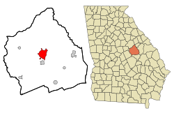
Economy

The economy of Sandersville was based on agriculture, particularly cotton, for many years. In the 1950s, an industry developed based on the mining and processing of kaolin found in the area. [14]

Education

Washington County School District

The Washington County School District holds pre-school to grade twelve, and consists of a primary and elementary school, a middle school, and a high school. [16] The district has 220 full-time teachers and over 3,821 students. [17]

Private education

Higher education

Sports

Sandersville was home to the minor league baseball teams, the Sandersville Giants (1955-1956) and Sandersville Wacos (1953-1954). Sandersville played in the Class D Georgia State League (GSL) from 1953 to 1956 and played at Sandersville Baseball Park. Baseball Hall of Fame inductee Willie McCovey played for the Sandersville Giants in 1955. The team folded along with the Georgia State League following the 1956 season. Sandersville was an affiliate of the Milwaukee Braves (1953) and New York Giants (1955-1956).[ citation needed ]

Newspaper

Sandersville has two newspapers: The Sandersville Progress and "The Spotlight". They both are published weekly. The Sandersville Progress began publication in 1870.

Notable people

See also

Related Research Articles

<span class="mw-page-title-main">Wilkes County, Georgia</span> County in Georgia, United States

Wilkes County is a county located in the east central portion of the U.S. state of Georgia. As of the 2020 census, the population was 9,565. The county seat is the city of Washington.

<span class="mw-page-title-main">Washington County, Georgia</span> County in Georgia, United States

Washington County is a county located in the U.S. state of Georgia. As of the 2020 census, the population was 19,988. The county seat is Sandersville. The county was established on February 25, 1784. It was named for Revolutionary War general George Washington.

<span class="mw-page-title-main">Lincoln County, Georgia</span> County in Georgia, United States

Lincoln County is a county located in the east central portion of the U.S. state of Georgia. As of the 2020 census, the population was 7,690. The county seat is Lincolnton. The county was created on February 20, 1796.

<span class="mw-page-title-main">Franklin County, Georgia</span> County in Georgia, United States

Franklin County is a county located in the northeastern part of the U.S. state of Georgia. As of the 2020 census, the population was 23,424. The county seat is Carnesville. On February 25, 1784, Franklin and Washington became Georgia's eighth and ninth counties, with Franklin named in honor of patriot Benjamin Franklin.

<span class="mw-page-title-main">Milledgeville, Georgia</span> City in Georgia, United States

Milledgeville is a city in and the county seat of Baldwin County in the U.S. state of Georgia. It is northeast of Macon and bordered on the east by the Oconee River. The rapid current of the river here made this an attractive location to build a city. It was the capital of Georgia from 1804 to 1868, including during the American Civil War. Milledgeville was preceded as the capital city by Louisville and was succeeded by Atlanta, the current capital. Today U.S. Highway 441 connects Milledgeville to Madison, Athens, and Dublin.

<span class="mw-page-title-main">Pembroke, Georgia</span> City and County Seat in Georgia, United States

Pembroke is a city and county seat in Bryan County, Georgia, United States. As of the 2020 census, the population of the city was 2,513. It is located approximately 35 miles west of Savannah, Georgia, and approximately 20 miles south of Statesboro, Georgia.

<span class="mw-page-title-main">Woodstock, Georgia</span> City in Georgia, United States

Woodstock is a city in Cherokee County, Georgia, United States. The population was 35,065 as of 2020 according to the US Census Bureau.

<span class="mw-page-title-main">Springfield, Georgia</span> City in Georgia, United States

Springfield is a city in Effingham County, Georgia, United States. The population was 2,852 at the 2010 census, up from 1,821 in 2000. The city is the county seat of Effingham County. Springfield is part of the Savannah Metropolitan Statistical Area.

<span class="mw-page-title-main">Mitchell, Georgia</span> Town in Georgia, United States

Mitchell is a town in Glascock County, Georgia, United States. The population was 199 at the 2010 census. Mitchell is home to the Mitchell Depot Historical Museum.

<span class="mw-page-title-main">Cairo, Georgia</span> City in Georgia, United States

Cairo is a city in Grady County, Georgia, United States. As of the 2020 census, the city had a population of 10,179. The city is the county seat of Grady County.

<span class="mw-page-title-main">Sparta, Georgia</span> Town in Georgia, United States

Sparta is a city in and the county seat of Hancock County, Georgia, United States. It is part of the Milledgeville Micropolitan Statistical Area. The city's population was 1,400 at the 2010 census.

<span class="mw-page-title-main">Monticello, Georgia</span> City in Georgia, United States

Monticello is the largest city in and the county seat of Jasper County, Georgia, United States. The city includes historic buildings such as the Jasper County Courthouse, Monticello High School and the Monticello Historic District. The population was 2,657 at the 2010 census. It is 56 miles (90 km) southeast of Atlanta.

<span class="mw-page-title-main">Millen, Georgia</span> City in Georgia, United States

Millen is a city, and the county seat of Jenkins County, Georgia, United States. The population was 3,120 at the 2010 census, down from 3,492 at the 2000 census.

<span class="mw-page-title-main">Wrightsville, Georgia</span> City in Georgia, United States

Wrightsville is a city in Johnson County, Georgia, United States. The population was 2,195 at the 2010 census, down from 2,223 at the 2000 census. The city limits include Johnson State Prison on the northeast side of town. The city is the county seat of Johnson County. Wrightsville is part of the Dublin Micropolitan Statistical Area.

<span class="mw-page-title-main">Lincolnton, Georgia</span> City in Georgia, United States

The city of Lincolnton is the county seat of Lincoln County, Georgia, United States. The population was 1,480 at the 2020 census. It contains numerous houses and historic districts listed on the National Register of Historic Places. Both the city and the county were named for General Benjamin Lincoln, who served in the Continental Army during the American Revolution.

<span class="mw-page-title-main">Glennville, Georgia</span> City in Georgia, United States

Glennville is a small city in southeastern Tattnall County, Georgia, United States. As of the 2020 census, the town had a population of 3,834.

<span class="mw-page-title-main">Lyons, Georgia</span> City in Georgia, United States

Lyons is a city in Toombs County, Georgia, United States. The population was 4,367 at the 2010 census, up from 4,169 in 2000. The city is the county seat of Toombs County.

<span class="mw-page-title-main">Washington, Georgia</span> City in Georgia, United States

Washington is the county seat of Wilkes County, Georgia, United States. Under its original name, Heard's Fort, it was for a brief time during the American Revolutionary War the Georgia state capital. It is noteworthy as the place where the Confederacy voted to dissolve itself, effectively ending the American Civil War.

<span class="mw-page-title-main">Newberry, South Carolina</span> City in South Carolina, United States

Newberry is a city in Newberry County, South Carolina, United States, in the Piedmont 43 miles northwest of Columbia. The charter was adopted in 1894. The population was 10,277 at the 2010 census. It is the county seat of Newberry County; at one time it was called Newberry Courthouse.

<span class="mw-page-title-main">Waynesboro, Georgia</span> City in Georgia, United States

Waynesboro is a city in Burke County, Georgia, United States. The population was 5,766 at the 2010 census. The city is the county seat of Burke County. It is part of the Augusta, Georgia metropolitan area.

References

  1. "2020 U.S. Gazetteer Files". United States Census Bureau. Retrieved December 18, 2021.
  2. 1 2 "U.S. Census website". United States Census Bureau . Retrieved January 31, 2008.
  3. "US Board on Geographic Names". United States Geological Survey. October 25, 2007. Retrieved January 31, 2008.
  4. "Find a County". National Association of Counties. Retrieved June 7, 2011.
  5. "Kaolin Capital of the World". City of Sandersville, GA. Retrieved August 27, 2018.
  6. "U.S. Climate Normals Quick Access – Station: Sandersville, GA". National Oceanic and Atmospheric Administration. Retrieved March 4, 2023.
  7. "NOAA Online Weather Data – NWS Atlanta". National Weather Service. Retrieved March 4, 2023.
  8. "Census of Population and Housing". Census.gov. Retrieved June 4, 2015.
  9. "Explore Census Data". data.census.gov. Retrieved December 6, 2021.
  10. State of Georgia. "City of Sandersville" . Retrieved September 1, 2009.
  11. Haveman, Christopher D. (August 7, 2009). "The Removal of the Creek Indians from the Southeast, 1825-1838".{{cite journal}}: Cite journal requires |journal= (help)
  12. Krakow, Kenneth K. (1975). Georgia Place-Names: Their History and Origins (PDF). Macon, GA: Winship Press. p. 197. ISBN   0-915430-00-2.
  13. "Georgia". Klokan Technologies GmbH. Retrieved June 26, 2020.
  14. 1 2 Hollingsworth, Brenda. "Washington County" . Retrieved September 1, 2009.
  15. "Elijah Muhammad". National Archives. August 25, 2016. Retrieved June 26, 2020.
  16. Georgia Board of Education, Retrieved June 29, 2010.
  17. School Stats, Retrieved June 29, 2010.
  18. Georgia Military College- Campus Locations, Retrieved June 29, 2010
  19. "Robert Edwards". nfl.com. Retrieved May 13, 2013.
  20. "Terrence Edwards". nfl.com. Retrieved May 13, 2013.
  21. "Marvin Lane Baseball Stats by Baseball Almanac". www.baseball-almanac.com. Retrieved January 23, 2010.
  22. "Greg Minor NBA & ABA Statistics". www.basketball-reference.com. Retrieved January 23, 2010.
  23. "Honorable Elijah Muhammad". August 14, 2013.
  24. "Takeo Spikes". nfl.com. Retrieved January 23, 2010.
  25. "Coot Veal Statistics and History - Baseball-Reference.com". www.baseball-reference.com. Retrieved January 23, 2010.