
Tattnall County is a county located in the southeast portion of the U.S. state of Georgia, located within the Magnolia Midlands, a part of the Historic South region. As of the 2020 census, the population was 22,842. The county seat is Reidsville. Tattnall County was created on December 5, 1801, from part of Montgomery County, Georgia by the Georgia General Assembly.

Richmond County is located in the state of Georgia in the U.S. As of the 2020 census, the population was 206,607. It is one of the original counties of Georgia, created on February 5, 1777. Following an election in 1995, Augusta consolidated governments with Richmond County. The consolidated entity is known as Augusta-Richmond County, or simply Augusta. Exempt are the cities of Hephzibah and Blythe, in southern Richmond County, which voted to remain separate. Richmond County is included in the Augusta-Richmond County, GA-SC metropolitan statistical area.

Columbia County is a county located in the east central portion of the U.S. state of Georgia. As of the 2020 census, the population was 156,010. The legal county seat is Appling, but the de facto seat of county government is Evans.

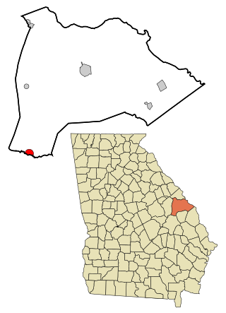
Burke County is a county located along the eastern border of the U.S. state of Georgia in the Piedmont. As of the 2020 census, the population was 24,596. The county seat is Waynesboro. Burke County is part of the Augusta-Richmond County, GA-SC metropolitan statistical area.

Barrow County is a county located in the north central portion of the U.S. state of Georgia. As of the 2020 census, its population was 83,505. Its county seat is Winder. Barrow County is included in the Atlanta–Sandy Springs–Roswell metropolitan statistical area.

Statham is a city in Barrow County, Georgia, United States. The population was 2,408 at the 2010 census, and 2,813 in 2020.

Winder is a city and the county seat of Barrow County, Georgia, United States. It is located east of Atlanta and is part of the Atlanta metropolitan area. The population was 18,338 at the 2020 census.
Midville is a city in Burke County, Georgia, United States. The population was 269 at the 2010 census, and 385 in 2020. It is part of the Augusta, Georgia metropolitan area.

Martinez is an unincorporated community and census-designated place (CDP) in Columbia County, Georgia, United States. It is a northwestern suburb of Augusta and is part of the Augusta, Georgia metropolitan area. The population was 34,535 at the 2020 census.

Clarkston is a city in DeKalb County, Georgia, United States. The population was 14,756 as of the 2020 census, up from 7,554 in 2010.
Druid Hills is a community which includes both a census-designated place (CDP) in unincorporated DeKalb County, Georgia, United States, as well as a neighborhood of the city of Atlanta. The CDP's population was 14,568 at the 2010 census. The CDP formerly contained the main campus of Emory University and the Centers for Disease Control and Prevention (CDC); however, they were annexed by Atlanta in 2018. The Atlanta-city section of Druid Hills is one of Atlanta's most affluent neighborhoods with a mean household income in excess of $238,500.

Redan is an unincorporated community and census-designated place (CDP) in DeKalb County, Georgia, United States. As of the 2020 census, the CDP had a total population of 31,749. It is a predominantly African American community in eastern DeKalb County, and is a suburb of Atlanta.

Sparta is a city in and the county seat of Hancock County, Georgia, United States. It used to be part of the Milledgeville micropolitan statistical area until 2023. The city's population was 1,400 at the 2010 census.

Hartwell is a city in Hart County, Georgia, United States. The population was 4,469 at the 2010 census. The city is the county seat of Hart County.

Thomson is a city and the county seat of McDuffie County, Georgia, United States. The population was 6,814 at the 2020 census. Thomson's nickname is "The Camellia City of the South", in honor of the thousands of camellia plants throughout the city. Thomson was founded in 1837 as a depot on the Georgia Railroad. It was renamed in 1853 for railroad official John Edgar Thomson and incorporated February 15, 1854 as a town and in 1870 as a city. It is part of the Augusta – Richmond County Metropolitan Statistical Area.

Warrenton is a city and the county seat of Warren County, Georgia, United States. The population was 1,744 in 2020.

Augusta is a city on the central eastern border of the U.S. state of Georgia. The city lies directly across the Savannah River from North Augusta, South Carolina at the head of its navigable portion. Georgia's third most populous city, Augusta is located in the Fall Line section of the state.

Waynesboro is a city and the county seat of Burke County, Georgia, United States. The population was 5,472 at the 2024 census. It is part of the Augusta, Georgia metropolitan area.
The Augusta metropolitan area, officially the Augusta-Richmond County metropolitan statistical area according to the U.S. Office of Management and Budget, Census Bureau and other agencies, is a metropolitan statistical area centered on the city of Augusta, Georgia. It straddles two U.S. states, Georgia and South Carolina, and includes the Georgia counties of Richmond, Burke, Columbia, Lincoln, and McDuffie as well as the South Carolina counties of Aiken and Edgefield. The official 2023 U.S. census estimate for the area was 629,429 residents, up from 611,000 at the 2020 U.S. census.

Hephzibah is a city in southern Richmond County, in the U.S. state of Georgia. It is part of the Augusta metropolitan area. The population was 4,011 at the 2010 census, and 3,830 in 2020. Hephzibah is a poetic name used in the Book of Isaiah (62:4) to refer to Jerusalem, meaning "My delight is in Her."


