Blackville, South Carolina | |
|---|---|
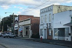 Downtown Blackville | |
 Location of Blackville, South Carolina | |
| Coordinates: 33°21′25″N81°16′22″W / 33.35694°N 81.27278°W | |
| Country | United States |
| State | South Carolina |
| County | Barnwell |
| Area | |
• Total | 9.03 sq mi (23.40 km2) |
| • Land | 8.93 sq mi (23.13 km2) |
| • Water | 0.10 sq mi (0.26 km2) |
| Elevation | 279 ft (85 m) |
| Population | |
• Total | 1,923 |
| • Density | 215.3/sq mi (83.12/km2) |
| Time zone | UTC-5 (Eastern (EST)) |
| • Summer (DST) | UTC-4 (EDT) |
| ZIP code | 29817 |
| Area codes | 803, 839 |
| FIPS code | 45-06490 [4] |
| GNIS feature ID | 2405276 [2] |
| Website | www |
Blackville is a small town in Barnwell County, South Carolina, United States. The population was 2,406 at the 2010 census. [5]
Contents
- History
- Geography
- Demographics
- 2020 census
- 2000 census
- Education
- Historic landmarks
- References
- External links
The town was named after Alexander Black, a railroad promoter. [6]


