Clearwater, South Carolina

Last updated
Clearwater, South Carolina
SCMap-doton-Clearwater.PNG
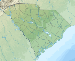
Location of Clearwater, South Carolina
Coordinates: 33°30′20″N81°54′27″W / 33.50556°N 81.90750°W / 33.50556; -81.90750 Coordinates: 33°30′20″N81°54′27″W / 33.50556°N 81.90750°W / 33.50556; -81.90750
Country Flag of the United States.svg  United States of America
State Flag of South Carolina.svg  South Carolina
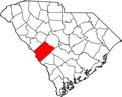
County Seal of Aiken County, South Carolina.png Aiken
Area
[1]
  Total4.31 sq mi (11.17 km2)
  Land4.19 sq mi (10.86 km2)
  Water0.12 sq mi (0.31 km2)
Elevation
148 ft (45 m)
Population
 (2020) [2]
  Total4,079
  Density972.81/sq mi (375.63/km2)
Time zone UTC-5 (Eastern (EST))
  Summer (DST) UTC-4 (EDT)
ZIP code
29822
Area code(s) 803, 839
FIPS code 45-14860 [3]
GNIS feature ID1231176 [4]

Clearwater is a census-designated place (CDP) in Aiken County, South Carolina. It lies near North Augusta, South Carolina, and is part of the Augusta, Georgia metropolitan area. Clearwater is located in historic Horse Creek Valley. The population was 4,370 at the time of the 2010 census. [5]

Contents

History

Clearwater was named after the Clearwater textile mill. [6]

Geography

Clearwater is located at 33°30′20″N81°54′27″W / 33.50556°N 81.90750°W / 33.50556; -81.90750 (33.505597, -81.907585), [7] 5 miles (8 km) east of downtown Augusta, Georgia. It is partially bordered by North Augusta (to the north and to the southwest), and the town of Burnettown is on Clearwater's eastern border.

According to the United States Census Bureau, the CDP has a total area of 4.3 square miles (11.2 km2), of which 4.2 square miles (10.8 km2) is land and 0.12 square miles (0.3 km2), or 2.82%, is water. [5]

Highways

Demographics

Historical population
CensusPop.
2020 4,079
U.S. Decennial Census [8]

2000 census

As of the census [3] of 2000, there were 4,199 people, 1,717 households, and 1,174 families residing in the CDP. The population density was 983.8 inhabitants per square mile (379.8/km2). There were 1,938 housing units at an average density of 454.1 per square mile (175.3/km2). The racial makeup of the CDP was 79.92% White, 16.08% African American, 0.60% Native American, 0.33% Asian, 0.02% Pacific Islander, 1.67% from other races, and 1.38% from two or more races. Hispanic or Latino of any race were 3.74% of the population.

There were 1,717 households, out of which 29.9% had children under the age of 18 living with them, 48.7% were married couples living together, 15.6% had a female householder with no husband present, and 31.6% were non-families. 26.7% of all households were made up of individuals, and 9.6% had someone living alone who was 65 years of age or older. The average household size was 2.44 and the average family size was 2.94.

In the CDP, the population was spread out, with 24.8% under the age of 18, 8.8% from 18 to 24, 29.8% from 25 to 44, 23.2% from 45 to 64, and 13.3% who were 65 years of age or older. The median age was 36 years. For every 100 females, there were 92.7 males. For every 100 females age 18 and over, there were 91.2 males.

The median income for a household in the CDP was $30,693, and the median income for a family was $36,528. Males had a median income of $32,135 versus $21,020 for females. The per capita income for the CDP was $14,902. About 13.8% of families and 20.2% of the population were below the poverty line, including 28.4% of those under age 18 and 17.7% of those age 65 or over.

2010 census

At the 2010 census, the total population was 4,370, of whom 0.64% were American Indian or Alaska native, 0.16% were Asian, 16.27% were African American, 0.05% were Native Hawaiian or other Pacific Islander, 69.61% were white, 11.33% were some other race, and 1.95% were of two or more races. Persons of Hispanic or Latino origin comprised 13.59% of the population. The male and female population was nearly balanced, with 49.84% and 50.16% of the total population, respectively.

8.17% of the population was under 5 years of age, 16.43% were age 5 to 17, 61.24% were age 18 to 64, and 14.16% were 65 years or older. [9]

2020 census

Racial composition [10]
RaceNum.Perc.
White (non-Hispanic)2,36057.86%
Black or African American (non-Hispanic)80319.69%
Native American 220.54%
Asian 90.22%
Pacific Islander 20.05%
Other/Mixed 1924.71%
Hispanic or Latino 69116.94%

As of the 2020 United States census, there were 4,079 people, 1,638 households, and 981 families residing in the CDP.

Related Research Articles

<span class="mw-page-title-main">South Highpoint, Florida</span> Census-designated place in Florida, United States

South Highpoint is a census-designated place (CDP) in Pinellas County, Florida, United States. The population was 5,195 at the 2010 census.

<span class="mw-page-title-main">Martinez, Georgia</span> Census-designated place in Georgia, United States

Martinez is a census-designated place (CDP) in Columbia County, Georgia, United States. It is a northwestern suburb of Augusta and is part of the Augusta, Georgia metropolitan area. The population was 35,795 at the 2010 census.

<span class="mw-page-title-main">Hawaiian Beaches, Hawaii</span> Census-designated place in Hawaii, United States

Hawaiian Beaches is a census-designated place (CDP) in Hawaiʻi County, Hawaiʻi, United States located in the District of Puna. The population was 4,280 at the 2010 census, up from 3,709 at the 2000 census.

<span class="mw-page-title-main">Clearwater, Kansas</span> City in Sedgwick County, Kansas

Clearwater is a city in Sedgwick County, Kansas, United States. As of the 2020 census, the population of the city was 2,653.

<span class="mw-page-title-main">Selby-on-the-Bay, Maryland</span> Former census-designated place in Maryland, United States

Selby-on-the-Bay is a census-designated place (CDP) in Anne Arundel County, Maryland, United States, for the 2000 census, at which time its population was 3,674. It was added to the Mayo CDP for the 2010 census.

<span class="mw-page-title-main">Maple Ridge, Ohio</span> Census-designated place in Ohio, United States

Maple Ridge is a census-designated place (CDP) in Mahoning County, Ohio, United States. The population was 761 at the 2010 census. It is part of the Youngstown-Warren metropolitan area.

<span class="mw-page-title-main">Belvedere, South Carolina</span> Census-designated place in South Carolina, United States of America

Belvedere is a census-designated place (CDP) and suburb of North Augusta in Aiken County, South Carolina, United States. It is part of the Augusta, Georgia metropolitan area. The population was 5,792 at the 2010 census.

<span class="mw-page-title-main">Burnettown, South Carolina</span> Town in South Carolina, United States of America

Burnettown is a town in Aiken County, South Carolina, United States. The population was 2,673 at the 2010 census. It is part of the Augusta, Georgia metropolitan area. Burnettown is located in historic Horse Creek Valley.

<span class="mw-page-title-main">Gloverville, South Carolina</span> Census-designated place in South Carolina, United States of America

Gloverville is a census-designated place (CDP) in Aiken County, South Carolina, United States. The population was 2,831 at the 2010 census. It is part of the Augusta, Georgia metropolitan area. Gloverville is located in historic Horse Creek Valley.

Murphys Estates is a neighborhood in Edgefield County, South Carolina, United States. The population was 1,441 at the 2010 census. It is part of the Augusta, Georgia metropolitan area. The largest-known Irish Traveller community in the US is in Murphy Village, South Carolina, which, as noted in a report by the Florida Ancient Order of Hibernians, is home to approximately 1,500 people with only 11 different surnames.

Wade Hampton is a census-designated place (CDP) in Greenville County, South Carolina, United States. The population was 20,622 at the 2010 census. It is named for American Civil War general and South Carolina governor Wade Hampton.

<span class="mw-page-title-main">Socastee, South Carolina</span> CDP in South Carolina, United States

Socastee is a census-designated place (CDP) in Horry County, South Carolina, United States. The population was 19,952 at the 2010 census.

<span class="mw-page-title-main">Oak Grove, South Carolina</span> Census-designated place in South Carolina, United States

Oak Grove is a census-designated place (CDP) in Lexington County, South Carolina, United States. The population was 10,291 at the 2010 census. It is part of the Columbia Metropolitan Statistical Area.

<span class="mw-page-title-main">Red Bank, South Carolina</span> Census-designated place in South Carolina, United States

Red Bank is an unincorporated community and census-designated place (CDP) in Lexington County, South Carolina, United States. The population was 9,617 at the 2010 census, up from 8,811 at the 2000 census. It is part of the Columbia, South Carolina Metropolitan Statistical Area.

<span class="mw-page-title-main">Willington, South Carolina</span> CDP in South Carolina, United States

Willington is a census-designated place (CDP) in McCormick County, South Carolina, United States. The population was 177 at the 2000 census.

<span class="mw-page-title-main">Boiling Springs, South Carolina</span> CDP in South Carolina, United States

Boiling Springs is a census-designated place (CDP) in Spartanburg County, South Carolina, United States. The population was 8,219 at the 2010 census.

<span class="mw-page-title-main">Roebuck, South Carolina</span> CDP in South Carolina, United States

Roebuck is a census-designated place (CDP) in Spartanburg County, South Carolina, United States. The population was 2,200 at the 2010 census.

<span class="mw-page-title-main">Valley Falls, South Carolina</span> CDP in South Carolina, United States

Valley Falls is a census-designated place (CDP) in Spartanburg County, South Carolina, United States. The population was 6,299 at the 2010 census.

<span class="mw-page-title-main">North Augusta, South Carolina</span> City in South Carolina, United States

North Augusta is a city in Aiken and Edgefield counties in the U.S. state of South Carolina, on the north bank of the Savannah River. The population was 21,348 at the 2010 census. The city is included in the Central Savannah River Area (CSRA) and is part of the Augusta, Georgia, metropolitan area.

<span class="mw-page-title-main">Elbow Lake, Becker County, Minnesota</span> Census-designated place in Minnesota, US

Elbow Lake is a census-designated place in Becker and Clearwater counties in Minnesota, United States. Its population was 95 at the 2010 census.

References

  1. "ArcGIS REST Services Directory". United States Census Bureau. Retrieved October 15, 2022.
  2. "Census Population API". United States Census Bureau. Retrieved Oct 15, 2022.
  3. 1 2 "U.S. Census website". United States Census Bureau . Retrieved 2008-01-31.
  4. "US Board on Geographic Names". United States Geological Survey. 2007-10-25. Retrieved 2008-01-31.
  5. 1 2 "Geographic Identifiers: 2010 Demographic Profile Data (G001): Clearwater CDP, South Carolina". U.S. Census Bureau, American Factfinder. Archived from the original on February 12, 2020. Retrieved August 6, 2013.
  6. Federal Writers' Project (1941). Palmetto Place Names. Sloane Printing Co. p. 35.
  7. "US Gazetteer files: 2010, 2000, and 1990". United States Census Bureau. 2011-02-12. Retrieved 2011-04-23.
  8. "Census of Population and Housing". Census.gov. Retrieved June 4, 2016.
  9. "Clearwater, SC Population - Census 2010 and 2000 Interactive Map, Demographics, Statistics, Quick Facts - CensusViewer".
  10. "Explore Census Data". data.census.gov. Retrieved 2021-12-14.