Riddleville, Georgia | |
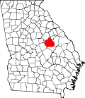
---|---|
Coordinates: 32°54′24″N82°39′52″W / 32.90667°N 82.66444°W Coordinates: 32°54′24″N82°39′52″W / 32.90667°N 82.66444°W | |
Country | United States |
State | Georgia |
County | Washington |
Area | |
• Total | 0.78 sq mi (2.03 km2) |
• Land | 0.77 sq mi (1.98 km2) |
• Water | 0.02 sq mi (0.05 km2) |
Elevation | 410 ft (125 m) |
Population (2020) | |
• Total | 80 |
• Density | 104.44/sq mi (40.31/km2) |
Time zone | UTC-5 (Eastern (EST)) |
• Summer (DST) | UTC-4 (EDT) |
FIPS code | 13-65156 [2] |
GNIS feature ID | 0332852 [3] |
Riddleville is a town in Washington County, Georgia, United States. The population was 124 at the 2000 census.
The community was named after Anderson Riddle, the original owner of the town site. [4] The Georgia General Assembly incorporated Riddleville as a town in 1859. [5]
Riddleville is located at 32°54′24″N82°39′52″W / 32.90667°N 82.66444°W (32.906541, -82.664385). [6]
According to the United States Census Bureau, the town has a total area of 0.8 square miles (2.1 km2), of which 0.8 square miles (2.1 km2) is land and 1.28% is water.
Historical population | |||
---|---|---|---|
Census | Pop. | %± | |
1880 | 195 | — | |
1900 | 178 | — | |
1910 | 140 | −21.3% | |
1920 | 149 | 6.4% | |
1930 | 121 | −18.8% | |
1940 | 115 | −5.0% | |
1950 | 106 | −7.8% | |
1960 | 111 | 4.7% | |
1970 | 143 | 28.8% | |
1980 | 154 | 7.7% | |
1990 | 79 | −48.7% | |
2000 | 124 | 57.0% | |
2010 | 96 | −22.6% | |
2020 | 80 | −16.7% | |
U.S. Decennial Census [7] |
At the 2000 census there were 124 people, 39 households, and 34 families living in the town. The population density was 160.4 inhabitants per square mile (61.9/km2). There were 46 housing units at an average density of 59.5 per square mile (23.0/km2). The racial makeup of the town was 70.97% White and 29.03% African American. [2] Of the 39 households 43.6% had children under the age of 18 living with them, 71.8% were married couples living together, 7.7% had a female householder with no husband present, and 10.3% were non-families. 7.7% of households were one person and 2.6% were one person aged 65 or older. The average household size was 3.18 and the average family size was 3.29.
The age distribution was 31.5% under the age of 18, 11.3% from 18 to 24, 25.0% from 25 to 44, 21.8% from 45 to 64, and 10.5% 65 or older. The median age was 33 years. For every 100 females, there were 85.1 males. For every 100 females age 18 and over, there were 97.7 males.
The median household income was $39,167 and the median family income was $42,500. Males had a median income of $36,250 versus $22,500 for females. The per capita income for the town was $15,012. There were no families and 2.9% of the population living below the poverty line, including no under eighteens and none of those over 64.
Washington County is a county located in the U.S. state of Georgia. As of the 2010 census, the population was 21,187. The county seat is Sandersville. The county was established on February 25, 1784. It was named for Revolutionary War general George Washington.
Fargo is a city in Clinch County, Georgia, United States. As of the 2020 census, the city had a population of 250. Formerly a town, it was incorporated by the Georgia state legislature in 1992, effective on April 1 of that year.
Broxton is a city in Coffee County, Georgia, United States. Per the 2020 census, the population was 1,060. It is known for its unique sandstone formation called Broxton Rocks along Rocky Creek 10 miles (16 km) north of town.
Garfield is a city in Emanuel County, Georgia, United States. The population was 201 at the 2010 census, up from 152 in 2000.
Nunez is a city in Emanuel County, Georgia, United States. The population was 147 at the 2010 census.
Stillmore is a city in Emanuel County, Georgia, United States. The population was 532 at the 2010 census, down from 730 in 2000.
Summertown is a city in Emanuel County, Georgia, United States. The population was 160 at the 2010 census.
Wadley is a city in Jefferson County, Georgia, United States. The population was 2,061 at the 2010 census.
The city of Lincolnton is the county seat of Lincoln County, Georgia, United States. The population was 1,480 at the 2020 census. It contains numerous houses and historic districts listed on the National Register of Historic Places. Both the city and the county were named for General Benjamin Lincoln, who served in the Continental Army during the American Revolution.
Ailey is a city in Montgomery County, Georgia, United States. As of the 2020 census, the city had a population of 519. It is part of the Vidalia Micropolitan Statistical Area.
Soperton is a city in Treutlen County, Georgia, United States. The population was 3,115 at the 2010 census, up from 2,824 in 2000. The city is the county seat of Treutlen County.
Camak is a town in Warren County, Georgia, United States. The town is located just off Interstate 20 between Atlanta and Augusta. The population was 165 at the 2000 census.
Davisboro is a city in Washington County, Georgia, United States. Per the 2020 census, the population was 1,832.
Deepstep is a town in Washington County, Georgia, United States. The population was 132 at the 2000 census.
Harrison is a town in Washington County, Georgia, United States. The population was 489 at the 2010 census.
Screven is a city in Wayne County, Georgia, United States. The population was 766 at the 2010 census. Although it was a railroad town as early as 1847, it was not officially chartered until August 19, 1907.
Rayle is a town in Wilkes County, Georgia, United States. The population was 139 at the 2000 census.
Keachi is a town in DeSoto Parish, Louisiana, United States. The population was 295 at the 2010 census. It is part of the Shreveport–Bossier City Metropolitan Statistical Area.
Bruno is a city in Pine County, Minnesota, United States. The population was 102 at the 2010 census.
Mason, also known as Mason City, is a town in Mason County, West Virginia, United States. The population was 865 at the 2020 census. It is part of the Point Pleasant, WV–OH Micropolitan Statistical Area.