Beech Island, South Carolina | |
---|---|
Coordinates: 33°25′39″N81°53′27″W / 33.42750°N 81.89083°W | |
Country | United States of America |
State | South Carolina |
County | Aiken |
Area | |
• Total | 5.02 sq mi (12.99 km2) |
• Land | 4.92 sq mi (12.74 km2) |
• Water | 0.10 sq mi (0.25 km2) |
Population | |
• Total | 1,421 |
• Density | 288.76/sq mi (111.50/km2) |
Time zone | UTC-5 (Eastern (EST)) |
• Summer (DST) | UTC-4 (EDT) |
ZIP code | 29842 |
Area codes | 803, 839 |
FIPS code | 45-04915 |
GNIS feature ID | 1245034 [3] |
Beech Island is an unincorporated community and census-designated place (CDP) in Aiken County, South Carolina, United States. [4] It was first listed as a CDP in the 2020 census with a population of 1,421. [5]
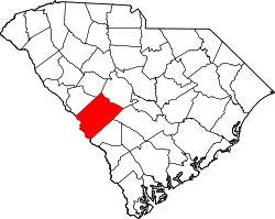
According to tradition, the community was first named "Beech Highland" on account of its lofty elevation, and over time the H was dropped, causing the present name to be adopted. [6]
Beech Island was primarily an agricultural community before the 1950s. Cotton, wheat, corn, and soybean were the major crops. This changed with the construction of Urquhart Station Power Station and the nearby Savannah River Nuclear Project. New highways were built to accommodate the workers commuting to the Nuclear Project. Commerce grew and the community began to change. In the 1960s Kimberly-Clark built a large manufacturing facility on what was once farmland, creating more jobs. The boom, however, was short-lived.
Beech Island's most famous resident was James Brown, who lived there for the last few decades of his life on a 60-acre (240,000 m2) estate. Brown is buried in the Thomas Family Home Crypt on Beech Island.
The Cedars, Fort Moore-Savano Town Site, Redcliffe Plantation State Historic Site, Oakland Plantation, and Zubly Cemetery are listed on the National Register of Historic Places. [7] [8]
Beech Island is also home to most of the television transmitters that serve the Augusta, GA MSA.
Census | Pop. | Note | %± |
---|---|---|---|
2020 | 1,421 | — | |
U.S. Decennial Census [9] 2020 [10] [2] |
Race / Ethnicity | Pop 2020 [10] | % 2020 |
---|---|---|
White alone (NH) | 694 | 48.84% |
Black or African American alone (NH) | 548 | 38.56% |
Native American or Alaska Native alone (NH) | 7 | 0.49% |
Asian alone (NH) | 7 | 0.49% |
Pacific Islander alone (NH) | 3 | 0.21% |
Some Other Race alone (NH) | 5 | 0.35% |
Mixed Race/Multi-Racial (NH) | 81 | 5.70% |
Hispanic or Latino (any race) | 76 | 5.35% |
Total | 1,421 | 100.00% |
Note: the US Census treats Hispanic/Latino as an ethnic category. This table excludes Latinos from the racial categories and assigns them to a separate category. Hispanics/Latinos can be of any race.
Roebuck is a census-designated place (CDP) in Spartanburg County, South Carolina, United States. The population was 2,200 at the 2010 census.
Floyd Dale, shown on federal maps as Floydale, is an unincorporated community and census-designated place (CDP) in Dillon County, South Carolina, United States. It was first listed as a CDP in the 2020 census with a population of 421.
Pauline is an unincorporated community and census-designated place (CDP) in Spartanburg County, South Carolina, United States. It was first listed as a CDP in the 2020 census with a population of 209.
Glenn Springs is an unincorporated community and census-designated place (CDP) in Spartanburg County, South Carolina, United States located at a spring. It was first listed as a CDP in the 2020 census with a population of 263.
Grandy is an unincorporated community and census-designated place (CDP) in Currituck County, North Carolina, USA. It was first listed as a CDP in the 2020 census with a population of 2,776. It is located along US 158 between the Currituck Sound and the North River.
Linville is an unincorporated community and census-designated place (CDP) in Avery County, North Carolina, United States. It was first listed as a CDP in the 2020 census with a population of 283. Centered just south of US 221 and NC 105, the community is known as a summer mountain resort and host of the Grandfather Mountain Highland Games, the largest modern Highland games events in North Carolina.
Long Creek is an unincorporated community and census-designated place (CDP) in western Oconee County, South Carolina, United States. It was first listed as a CDP in the 2020 census with a population of 96.
Hamer is an unincorporated community and census-designated place (CDP) in Dillon County, South Carolina, United States. It was first listed as a CDP in the 2020 census with a population of 820.
Litchfield Beach, also known simply as Litchfield, is an unincorporated community and census-designated place (CDP) in South Carolina, United States. It was first listed as a CDP in the 2020 census with a population of 8,370.
Little Rock is an unincorporated community and census-designated place (CDP) in Dillon County, South Carolina, United States. Per the 2020 census, the population was 658.
Adams Run is an unincorporated community and census-designated place (CDP) in Charleston County, South Carolina, United States. It was first listed as a CDP in the 2020 census with a population of 421.
Conestee is an unincorporated community and census-designated place (CDP) in Greenville County, South Carolina, United States. It was first listed as a CDP in the 2020 census with a population of 904.
Gillisonville is an unincorporated community and census-designated place (CDP) in Jasper County, in the U.S. state of South Carolina. It was first listed as a CDP in the 2020 census with a population of 183.
Edisto is an unincorporated community and census-designated place in Orangeburg County, South Carolina, United States. Its population was 2,058 as of the 2020 census. U.S. Route 601 passes through the community.
Emma is an unincorporated community and census-designated place (CDP) in Buncombe County, North Carolina, United States. It was first listed as a CDP in the 2020 census with a population of 2,174.
Roberdel, also known as Roberdell, is an unincorporated community and census-designated place (CDP) in Richmond County, North Carolina, United States. It was first listed as a CDP in the 2020 census with a population of 246.
Pine Ridge is an unincorporated community and census-designated place (CDP) in Darlington County, South Carolina, United States. It was first listed as a CDP prior to the 2020 census with a population of 807.
Ashwood is an unincorporated community and census-designated place (CDP) in Lee County, South Carolina, United States. It was first listed as a CDP prior to the 2020 census which showed a population of 116.
Keowee Key is a lakeside community and census-designated place (CDP) in Oconee County, South Carolina, United States. It is considered part of the Salem community. It was first listed as a CDP prior to the 2020 census with a population of 2,716.
Olympia is an urban unincorporated area and census-designated place (CDP) in Richland County, South Carolina, United States. It was first listed as a CDP prior to the 2020 census with a population of 1,087.