Belvedere, South Carolina

Last updated

Belvedere, South Carolina
SCMap-doton-Belvedere.PNG
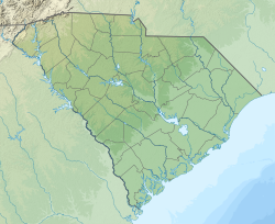
Location of Belvedere, South Carolina
Coordinates: 33°31′55″N81°56′36″W / 33.53194°N 81.94333°W / 33.53194; -81.94333
Country Flag of the United States.svg  United States of America
State Flag of South Carolina.svg  South Carolina
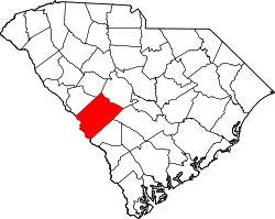
County Seal of Aiken County, South Carolina.png Aiken
Area
[1]
  Total3.43 sq mi (8.88 km2)
  Land3.42 sq mi (8.87 km2)
  Water0.01 sq mi (0.02 km2)
Elevation
486 ft (148 m)
Population
 (2020) [2]
  Total5,380
  Density1,571.72/sq mi (606.82/km2)
Time zone UTC-5 (Eastern (EST))
  Summer (DST) UTC-4 (EDT)
ZIP code
29841
Area codes 803, 839
FIPS code 45-05410 [3]
GNIS feature ID1231045 [4]

Belvedere is a census-designated place (CDP) and suburb of North Augusta in Aiken County, South Carolina, United States. It is part of the Augusta, Georgia metropolitan area. The population was 5,792 at the 2010 census. [5]

Contents

Belvedere (from Italian, meaning "beautiful sight") was so named for its scenic river views over the Savannah River. [6]

Geography

Belvedere is located in western Aiken County at 33°31′55″N81°56′36″W / 33.53194°N 81.94333°W / 33.53194; -81.94333 (33.531985, -81.943338). [7] It is surrounded by the city of North Augusta, though Belvedere lies to the northeast of the original city center. U.S. Route 25 (Edgefield Road) is the main road through the community, leading north to Interstate 20 just outside the CDP. Interstate 520 passes just to the east of the CDP.

According to the United States Census Bureau, the CDP has a total area of 3.5 square miles (9.1 km2), of which 0.008 square miles (0.02 km2), or 0.17%, is water. [5]

Highways

Demographics

Historical population
CensusPop.Note
2020 5,380
U.S. Decennial Census [8]

2000 Census

As of the census [3] of 2000, there were 5,631 people, 2,245 households, and 1,567 families residing in the CDP. The population density was 1,436.5 inhabitants per square mile (554.6/km2). There were 2,430 housing units at an average density of 619.9 per square mile (239.3/km2). The racial makeup of the CDP was 74.39% White, 23.64% African American, 0.09% Native American, 0.39% Asian, 0.04% Pacific Islander, 0.52% from other races, and 0.94% from two or more races. Hispanic or Latino of any race were 1.81% of the population.

There were 2,245 households, out of which 32.0% had children under the age of 18 living with them, 52.9% were married couples living together, 13.4% had a female householder with no husband present, and 30.2% were non-families. 26.5% of all households were made up of individuals, and 10.5% had someone living alone who was 65 years of age or older. The average household size was 2.51 and the average family size was 3.02.

In the CDP, the population was spread out, with 25.4% under the age of 18, 8.8% from 18 to 24, 30.0% from 25 to 44, 22.9% from 45 to 64, and 12.8% who were 65 years of age or older. The median age was 36 years. For every 100 females, there were 91.9 males. For every 100 females age 18 and over, there were 88.3 males.

The median income for a household in the CDP was $36,045, and the median income for a family was $40,264. Males had a median income of $31,768 versus $21,374 for females. The per capita income for the CDP was $16,336. About 11.0% of families and 12.0% of the population were below the poverty line, including 15.3% of those under age 18 and 5.4% of those age 65 or over.

2010 Census

At the 2010 census, the total population was 5,792, of whom 0.31% were American Indian or Alaska native, 0.41% were Asian, 26.23% were African American, 0.05% were Native Hawaiian or other Pacific Islander, 66.80% were white, 3.63% were some other race, and 2.57% were of two or more races. People of Hispanic or Latino origin of any race made up 5.96% of the population. Males comprised 48.46%, and females 51.54% of the population.

Persons under the age of 5 were 7.63% of the population, persons age 5 to 17 were 17.37%, age 18 to 64 were 60.01%, and age 65 and over were 14.99% of the population. [9]

2020 Census

Belvedere racial composition [10]
RaceNum.Perc.
White (non-Hispanic)3,06656.99%
Black or African American (non-Hispanic)1,41026.21%
Native American 120.22%
Asian 250.46%
Pacific Islander 40.07%
Other/Mixed 2825.24%
Hispanic or Latino 58110.8%

As of the 2020 United States census, there were 5,380 people, 2,251 households, and 1,452 families residing in the CDP.

Education

It is in the Aiken County Public School District. [11]

The CDP is divided between Belvedere Elementary School and North Augusta Middle School, and Mossy Creek Elementary School and Paul Knox Middle School. All areas of the CDP are zoned to North Augusta High School. [12]

Related Research Articles

<span class="mw-page-title-main">Aiken County, South Carolina</span> County in South Carolina, United States

Aiken County is a county in the U.S. state of South Carolina. As of the 2020 census, its population was 168,808. Its county seat and largest community is Aiken. Aiken County is a part of the Augusta-Richmond County, GA-SC Metropolitan Statistical Area. It is mostly in the Sandhills region, with the northern parts reaching in the Piedmont and southern parts reaching into the Coastal Plain.

<span class="mw-page-title-main">Desert Hills, Arizona</span> CDP in Mohave County, Arizona

Desert Hills is an unincorporated community and census-designated place (CDP) in Mohave County, Arizona, United States. The population was 2,764 at the 2020 census, up from 2,245 at the 2010 census.

<span class="mw-page-title-main">Andrews, Levy County, Florida</span> Census-designated place in Florida, United States

Andrews is a census-designated place (CDP) in Levy County, Florida, United States. The population was 837 at the 2020 census, up from 798 at the 2010 census. It is part of the Gainesville, Florida Metropolitan Statistical Area.

<span class="mw-page-title-main">Pakala Village, Hawaii</span> Census-designated place in Hawaii, United States

Pākalā Village is a census-designated place (CDP) in Kauaʻi County, Hawaiʻi, United States. The population was 286 at the 2020 census.

<span class="mw-page-title-main">Fallston, Maryland</span> Census-designated place in Maryland, United States

Fallston is a census-designated place (CDP) in Harford County, Maryland, United States. The population was 8,958 at the 2010 census, up from 8,427 in 2000. Fallston is a semi-rural community consisting mostly of farms and suburban-like developments.

<span class="mw-page-title-main">Augusta, Montana</span> Census-designated place in Montana, United States

Augusta is an unincorporated community and census-designated place (CDP) in Lewis and Clark County, Montana, United States. The population was 309 at the 2010 census and rose to 316 in the 2020 census. The most accepted version in the naming of this town is after Augusta Hogan, thought to be the first child born in this town, the daughter of J. D. Hogan, an early rancher.

<span class="mw-page-title-main">Shepherd, Montana</span> CDP in Montana, United States

Shepherd is a census-designated place (CDP) in Yellowstone County, Montana, United States. The population was 193 at the 2000 census. Shepherd is a Billings suburb located to the northeast. The unincorporated town was named after R.E. Shepherd, a prominent early settler and owner of the Billings Land and Irrigation Company and the Merchants National Bank. The post office opened in 1915.

<span class="mw-page-title-main">Burnettown, South Carolina</span> Town in South Carolina, United States of America

Burnettown is a town in Aiken County, South Carolina, United States. The population was 3,105 at the 2020 census. It is part of the Augusta, Georgia metropolitan area. Burnettown is located in historic Horse Creek Valley.

<span class="mw-page-title-main">Clearwater, South Carolina</span> Census-designated place in South Carolina, United States of America

Clearwater is a census-designated place (CDP) in Aiken County, South Carolina. It lies near North Augusta, South Carolina, and is part of the Augusta, Georgia metropolitan area. Clearwater is located in historic Horse Creek Valley. The population was 4,370 at the time of the 2010 census.

<span class="mw-page-title-main">Gloverville, South Carolina</span> Census-designated place in South Carolina, United States of America

Gloverville is a census-designated place (CDP) in Aiken County, South Carolina, United States. The population was 2,831 at the 2010 census. It is part of the Augusta, Georgia metropolitan area. Gloverville is located in historic Horse Creek Valley.

<span class="mw-page-title-main">Jackson, South Carolina</span> Town in South Carolina, United States of America

Jackson is a town in Aiken County, South Carolina, United States. The population was 1,700 at the 2010 census. It is part of the Augusta, Georgia metropolitan area.

<span class="mw-page-title-main">New Ellenton, South Carolina</span> City in South Carolina

New Ellenton is a city in Aiken County, South Carolina, United States. The population was 2,210 at the 2020 census. It is part of the Augusta, Georgia metropolitan area.

<span class="mw-page-title-main">Perry, South Carolina</span> Town in South Carolina, United States of America

Perry is a town in Aiken County, South Carolina, United States. The population was 233 at the 2010 census. It is part of the Augusta, Georgia metropolitan area.

<span class="mw-page-title-main">Salley, South Carolina</span> Town in South Carolina, United States of America

Salley is a town in Aiken County, South Carolina, United States. The population was 398 at the 2010 census. It is part of the Augusta, Georgia metropolitan area. Salley is known for hosting the Chitlin Strut, a town-wide festival, every November.

<span class="mw-page-title-main">Wagener, South Carolina</span> Town in South Carolina

Wagener is a town in Aiken County, South Carolina, United States. The population was 797 at the 2010 census, making it the largest settlement in the county north of the South Fork Edisto River. It is part of the Augusta, Georgia metropolitan area.

<span class="mw-page-title-main">Windsor, South Carolina</span> Town in South Carolina, United States of America

Windsor is a town in Aiken County, South Carolina, United States. The population was 121 at the 2010 census. It is part of the Augusta, Georgia metropolitan area.

<span class="mw-page-title-main">Saxon, South Carolina</span> CDP in South Carolina, United States

Saxon is a census-designated place (CDP) in Spartanburg County, South Carolina, United States. The population was 3,424 at the 2010 census.

<span class="mw-page-title-main">Valley Falls, South Carolina</span> CDP in South Carolina, United States

Valley Falls is a census-designated place (CDP) in Spartanburg County, South Carolina, United States. The population was 6,299 at the 2010 census.

<span class="mw-page-title-main">Monetta, South Carolina</span> Town in South Carolina, United States of America

Monetta is a town in Aiken and Saluda counties, South Carolina, United States. The population was 236 at the 2010 census.

<span class="mw-page-title-main">North Augusta, South Carolina</span> City in South Carolina, United States

North Augusta is a city in Aiken and Edgefield counties in the U.S. state of South Carolina, on the north bank of the Savannah River. It lies directly across the river, and state border, from Augusta, Georgia. The population was 24,379 at the 2020 census, making it the 21st-most populous city in South Carolina. The city is included in the Central Savannah River Area (CSRA) and is part of the Augusta, Georgia, metropolitan area.

References

  1. "ArcGIS REST Services Directory". United States Census Bureau. Retrieved October 15, 2022.
  2. "Census Population API". United States Census Bureau. Retrieved October 15, 2022.
  3. 1 2 "U.S. Census website". United States Census Bureau . Retrieved January 31, 2008.
  4. "US Board on Geographic Names". United States Geological Survey. October 25, 2007. Retrieved January 31, 2008.
  5. 1 2 "Geographic Identifiers: 2010 Demographic Profile Data (G001): Belvedere CDP, South Carolina". U.S. Census Bureau, American Factfinder. Archived from the original on February 12, 2020. Retrieved August 6, 2013.
  6. Federal Writers' Project (1941). Palmetto Place Names. Sloane Printing Co. p. 24.
  7. "US Gazetteer files: 2010, 2000, and 1990". United States Census Bureau. February 12, 2011. Retrieved April 23, 2011.
  8. "Census of Population and Housing". Census.gov. Retrieved June 4, 2016.
  9. "2010 Census Population of Belvedere, South Carolina - CensusViewer".
  10. "Explore Census Data". data.census.gov. Retrieved December 14, 2021.
  11. "2020 CENSUS - SCHOOL DISTRICT REFERENCE MAP: Aiken County, SC" (PDF). U.S. Census Bureau . Retrieved October 25, 2024. - Text list - Compare to school boundary map.
  12. "2019 - 20 Attendance Areas Maps". Aiken County Public School District . Retrieved October 25, 2024. - maps for ES, MS, and HS. Compare to the Aiken County school district map.