Gloverville, South Carolina

Last updated
Gloverville, South Carolina
Gloverville Post Office (2007).jpg
Gloverville Post Office
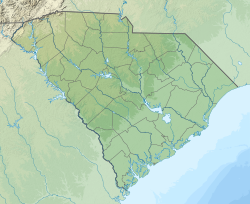
SCMap-doton-Gloverville.PNG
Location of Gloverville, South Carolina
Coordinates: 33°31′36″N81°49′24″W / 33.52667°N 81.82333°W / 33.52667; -81.82333 Coordinates: 33°31′36″N81°49′24″W / 33.52667°N 81.82333°W / 33.52667; -81.82333
Country Flag of the United States.svg  United States of America
State Flag of South Carolina.svg  South Carolina
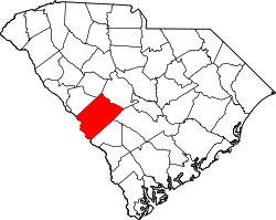
County Seal of Aiken County, South Carolina.png Aiken
Area
[1]
  Total3.64 sq mi (9.42 km2)
  Land3.63 sq mi (9.40 km2)
  Water0.01 sq mi (0.02 km2)
Elevation
203 ft (62 m)
Population
 (2020) [2]
  Total2,406
  Density663.18/sq mi (256.02/km2)
Time zone UTC-5 (Eastern (EST))
  Summer (DST) UTC-4 (EDT)
ZIP code
29828
Area code(s) 803, 839
FIPS code 45-29410 [3]
GNIS feature ID1231324 [4]

Gloverville is a census-designated place (CDP) in Aiken County, South Carolina, United States. The population was 2,831 at the 2010 census. [5] It is part of the Augusta, Georgia metropolitan area. Gloverville is located in historic Horse Creek Valley.

Contents

Geography

Gloverville is located in western Aiken County at 33°31′36″N81°49′24″W / 33.52667°N 81.82333°W / 33.52667; -81.82333 (33.526665, -81.823352). [6] Neighboring communities are Langley to the southwest, part of Burnettown to the northwest, Graniteville to the north, and Warrenville to the east. Gloverville is located 9 miles (14 km) east of downtown Augusta, Georgia, and 8 miles (13 km) southwest of downtown Aiken.

According to the United States Census Bureau, the Gloverville CDP has a total area of 3.6 square miles (9.4 km2), of which 0.0077 square miles (0.02 km2), or 0.25%, is water. [5]

Demographics

Historical population
CensusPop.
2020 2,406
U.S. Decennial Census [7]

2020 census

Gloverville racial composition [8]
RaceNum.Perc.
White (non-Hispanic)1,70170.7%
Black or African American (non-Hispanic)40316.75%
Native American 170.71%
Asian 40.17%
Other/Mixed 1305.4%
Hispanic or Latino 1516.28%

As of the 2020 United States census, there were 2,406 people, 1,119 households, and 686 families residing in the CDP.

2000 census

As of the census [3] of 2000, there were 2,805 people, 1,142 households, and 771 families residing in the CDP. The population density was 801.6 inhabitants per square mile (309.5/km2). There were 1,324 housing units at an average density of 378.4 per square mile (146.1/km2). The racial makeup of the CDP was 86.27% White, 10.91% African American, 0.32% Native American, 0.11% Asian, 0.36% from other races, and 2.03% from two or more races. Hispanic or Latino of any race were 1.21% of the population.

There were 1,142 households, out of which 31.9% had children under the age of 18 living with them, 46.8% were married couples living together, 16.4% had a female householder with no husband present, and 32.4% were non-families. 28.2% of all households were made up of individuals, and 10.6% had someone living alone who was 65 years of age or older. The average household size was 2.45 and the average family size was 2.99.

In the CDP, the population was spread out, with 26.9% under the age of 18, 10.2% from 18 to 24, 28.4% from 25 to 44, 23.4% from 45 to 64, and 11.1% who were 65 years of age or older. The median age was 34 years. For every 100 females, there were 94.4 males. For every 100 females age 18 and over, there were 90.4 males.

The median income for a household in the CDP was $24,679, and the median income for a family was $31,719. Males had a median income of $29,088 versus $18,143 for females. The per capita income for the CDP was $13,314. About 18.0% of families and 22.5% of the population were below the poverty line, including 29.6% of those under age 18 and 19.5% of those age 65 or over.

2010 census

As of 2010, the census reported a population of 2,831. Of this, 2,290 were White, (80.89%) 382 (13.49%) were Black or African American, 86 (3.04%) were two or more races, 46 (1.62%) were some other race, 21 (0.74%) were American Indian or Alaska Native 6 (0.21%) were Asian. [9]

Related Research Articles

<span class="mw-page-title-main">Concord, Alabama</span> CDP in Alabama, United States

Concord is a census-designated place in Jefferson County, Alabama, United States. At the 2010 census the population was 1,837, up from 1,809 in 2000. It is northwest from the Birmingham suburb of Hueytown.

<span class="mw-page-title-main">Pine Valley, California</span> Census-designated place in California, United States

Pine Valley is a community and census-designated place (CDP) in the Cuyamaca Mountains of the Mountain Empire area, in southeastern San Diego County, California. The population was 1,510 at the 2010 census, up from 1,501 at the 2000 census.

<span class="mw-page-title-main">Ferndale, Florida</span> Census-designated place in Florida

Ferndale is a census-designated place (CDP) in Lake County, Florida, United States. The population was 472 at the 2010 census, up from 233 at the 2000 census. It is part of the Orlando–Kissimmee Metropolitan Statistical Area.

<span class="mw-page-title-main">Buckingham, Florida</span> Census-designated place in Florida, United States

Buckingham is an unincorporated community and census-designated place (CDP) in Lee County, Florida, United States. The population was 4,443 at the 2020 census, up from 4,036 at the 2010 census. It is part of the Cape Coral-Fort Myers, Florida Metropolitan Statistical Area.

<span class="mw-page-title-main">Forest City, Florida</span> CDP in Florida, United States

Forest City is a census-designated place and an area in Seminole County, Florida, United States. Its historic center is now in the City of Altamonte Springs. Data in this article deals only with the unincorporated section. The population was 12,612 at the 2000 census. It is part of the Orlando–Kissimmee Metropolitan Statistical Area.

<span class="mw-page-title-main">Samsula-Spruce Creek, Florida</span> CDP in Florida, United States

Samsula-Spruce Creek is a census-designated place (CDP) in Volusia County, Florida, United States. The population was 5,047 at the 2010 census. While many households reside here, it is principally an agricultural area west of the cities of Port Orange and New Smyrna Beach.

<span class="mw-page-title-main">St. Pierre, Montana</span> Census-designated place in Montana, United States

St. Pierre is a census-designated place (CDP) in Hill County, Montana, United States, within the Rocky Boy Indian Reservation. The population of St. Pierre was 350 at the 2010 census, up from 289 in 2000.

<span class="mw-page-title-main">Clinton, Montana</span> CDP in Montana, United States

Clinton is a census-designated place (CDP) in Missoula County, Montana, United States. It is part of the 'Missoula, Montana Metropolitan Statistical Area'. The CDP was named for General Sir Henry Clinton. The population was 1,052 at the 2010 census, an increase from its population of 549 in 2000.

<span class="mw-page-title-main">Maple Ridge, Ohio</span> Census-designated place in Ohio, United States

Maple Ridge is a census-designated place (CDP) in Mahoning County, Ohio, United States. The population was 761 at the 2010 census. It is part of the Youngstown-Warren metropolitan area.

<span class="mw-page-title-main">Fernville, Pennsylvania</span> Census-designated place in Pennsylvania, United States

Fernville is a census-designated place (CDP) in Columbia County, Pennsylvania, United States. The population was 556 at the 2010 census. It is part of the Bloomsburg–Berwick Micropolitan Statistical Area.

<span class="mw-page-title-main">Hartstown, Pennsylvania</span> Census-designated place in Pennsylvania, United States

Hartstown is a census-designated place (CDP) in Crawford County, Pennsylvania, United States. The population was 201 at the 2010 census, down from 246 in 2000.

<span class="mw-page-title-main">Belvedere, South Carolina</span> Census-designated place in South Carolina, United States of America

Belvedere is a census-designated place (CDP) and suburb of North Augusta in Aiken County, South Carolina, United States. It is part of the Augusta, Georgia metropolitan area. The population was 5,792 at the 2010 census.

<span class="mw-page-title-main">Burnettown, South Carolina</span> Town in South Carolina, United States of America

Burnettown is a town in Aiken County, South Carolina, United States. The population was 2,673 at the 2010 census. It is part of the Augusta, Georgia metropolitan area. Burnettown is located in historic Horse Creek Valley.

<span class="mw-page-title-main">Clearwater, South Carolina</span> Census-designated place in South Carolina, United States of America

Clearwater is a census-designated place (CDP) in Aiken County, South Carolina. It lies near North Augusta, South Carolina, and is part of the Augusta, Georgia metropolitan area. Clearwater is located in historic Horse Creek Valley. The population was 4,370 at the time of the 2010 census.

<span class="mw-page-title-main">New Ellenton, South Carolina</span> City in South Carolina

New Ellenton is a city in Aiken County, South Carolina, United States. The population was 2,052 at the 2010 census. It is part of the Augusta, Georgia metropolitan area.

Murphys Estates is a neighborhood in Edgefield County, South Carolina, United States. The population was 1,441 at the 2010 census. It is part of the Augusta, Georgia metropolitan area. The largest-known Irish Traveller community in the US is in Murphy Village, South Carolina, which, as noted in a report by the Florida Ancient Order of Hibernians, is home to approximately 1,500 people with only 11 different surnames.

Dunean is a census-designated place (CDP) in Greenville County, South Carolina, United States. The population was 3,671 at the 2010 census, down from 4,158 in 2000. It is part of the Greenville–Mauldin–Easley Metropolitan Statistical Area.

Seven Oaks is a census-designated place (CDP) in Lexington County, South Carolina, United States, 8 miles (13 km) northwest of downtown Columbia, the state capital. The population of the CDP was 15,144 at the 2010 census. It is part of the Columbia Metropolitan Statistical Area.

<span class="mw-page-title-main">Utopia, Texas</span> Census-designated place in Texas, United States

Utopia is a census-designated place (CDP) in Uvalde County, Texas, United States. The population was 227 at the 2010 census.

<span class="mw-page-title-main">Pleasant Valley (CDP), New York</span> Census-designated place in New York, United States

Pleasant Valley is a census-designated place (CDP) in the southwestern part of the town of Pleasant Valley in Dutchess County, New York, United States. The population was 1,145 at the 2010 census. It is part of the Poughkeepsie–Newburgh–Middletown, NY Metropolitan Statistical Area as well as the larger New York–Newark–Bridgeport, NY-NJ-CT-PA Combined Statistical Area.

References

  1. "ArcGIS REST Services Directory". United States Census Bureau. Retrieved October 15, 2022.
  2. "Census Population API". United States Census Bureau. Retrieved Oct 15, 2022.
  3. 1 2 "U.S. Census website". United States Census Bureau . Retrieved 2008-01-31.
  4. "US Board on Geographic Names". United States Geological Survey. 2007-10-25. Retrieved 2008-01-31.
  5. 1 2 "Geographic Identifiers: 2010 Demographic Profile Data (G001): Gloverville CDP, South Carolina". U.S. Census Bureau, American Factfinder. Archived from the original on February 12, 2020. Retrieved August 6, 2013.
  6. "US Gazetteer files: 2010, 2000, and 1990". United States Census Bureau. 2011-02-12. Retrieved 2011-04-23.
  7. "Census of Population and Housing". Census.gov. Retrieved June 4, 2016.
  8. "Explore Census Data". data.census.gov. Retrieved 2021-12-14.
  9. "2010 Census Population of Gloverville, South Carolina - CensusViewer".