Murphys Estates, South Carolina

Last updated

Murphys Estates, South Carolina
Edgefield County South Carolina Incorporated and Unincorporated areas Murphys Estates Highlighted 4548900.svg
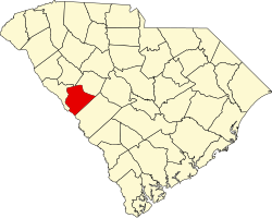
Location of Murphys Estates in Edgefield County, South Carolina
USA South Carolina location map.svg
Red pog.svg
Murphys Estates
Location in South Carolina
Usa edcp location map.svg
Red pog.svg
Murphys Estates
Location in the United States
Coordinates: 33°35′41″N81°56′28″W / 33.59472°N 81.94111°W / 33.59472; -81.94111
Country United States
State South Carolina
County Edgefield
Area
[1]
  Total2.06 sq mi (5.32 km2)
  Land2.05 sq mi (5.31 km2)
  Water0.00 sq mi (0.01 km2)
Elevation
571 ft (174 m)
Population
 (2020) [2]
  Total1,719
  Density837.72/sq mi (323.48/km2)
Time zone UTC-5 (Eastern (EST))
  Summer (DST) UTC-4 (EDT)
ZIP code
29860 [3]
Area code 803
FIPS code 45-48900 [4]
GNIS feature ID1852679 [5]

Murphys Estates (also commonly known as Murphy Village [lower-alpha 1] ) is a census-designated place (CDP) in Edgefield County, South Carolina, part of the larger Augusta metropolitan area. The population was 1,719 as of the 2020 census. [6] The community is notable for having the largest number of Irish Travellers in the United States. [7]

Contents

Geography

Murphys Estates is located along the southern border of Edgefield County at 33°35′41″N81°56′28″W / 33.59472°N 81.94111°W / 33.59472; -81.94111 (33.594591, -81.940999). [8] U.S. Route 25 passes through the community, leading south 8 miles (13 km) into North Augusta and north 17 miles (27 km) to Edgefield, the county seat. The community is 2 miles (3 km) north of Interstate 20 from Exit 5, labeled as the Edgefield/Johnston exit.

According to the United States Census Bureau, the CDP has a total area of 2.1 square miles (5.4 km2), all land. [9]

Culture

Irish Traveller Community

Having emigrated from Ireland to various parts of the United States, a large number of Catholic Travellers began to congregate at the Parish of Our Lady of Peace in North Augusta after its construction in 1948. The church's Irish priest, Rev. Fr. Joseph John Murphy, encouraged the Travellers to settle to the north of North Augusta, and so the community of Murphy Village was formed during the 1960s and 1970s. [10] [11] St. Edward Catholic Church was constructed in Murphy Village in 1964 to serve the Travellers. [12]

In the 2020 census, 7.1% of the population of Murphys Estates listed their ancestry as 'Irish', the largest ancestry group reported in the CDP; [9] however, the total number of Travellers has been estimated at 1,500. [7] Due to cultural differences, relations between the community and non-Travellers are sometimes tense; the group has been stereotyped by "outsiders" as being involved in criminal activity, forced marriages, and child abuse. [13] [11]

Demographics

Historical population
CensusPop.Note
2000 1,518
2010 1,441−5.1%
2020 1,71919.3%
U.S. Decennial Census [14]

2020 census

Murphys Estates racial composition [15]
RaceNum.Perc.
White (non-Hispanic)1,35078.53%
Black or African American (non-Hispanic)18310.65%
Native American 60.35%
Asian 120.7%
Other/Mixed 925.35%
Hispanic or Latino 764.42%

As of the 2020 United States census, there were 1,719 people, 461 households, and 355 families residing in the CDP. English was spoken at home by 97% of the population, and Spanish by 3%.

2000 census

As of the census [4] of 2000, there were 1,518 people, 534 households, and 410 families residing in the CDP. The population density was 757.2 inhabitants per square mile (292.4/km2). There were 595 housing units at an average density of 296.8 per square mile (114.6/km2). The racial makeup of the CDP was 91.30% White, 7.64% African American, 0.33% Native American, 0.13% Asian, and 0.59% from two or more races. Hispanic or Latino of any race were 0.13% of the population.

There were 534 households, out of which 37.3% had children under the age of 18 living with them, 56.9% were married couples living together, 15.7% had a female householder with no husband present, and 23.2% were non-families. 20.8% of all households were made up of individuals, and 6.6% had someone living alone who was 65 years of age or older. The average household size was 2.84 and the average family size was 3.31.

In the CDP, the population was spread out, with 28.2% under the age of 18, 8.3% from 18 to 24, 31.7% from 25 to 44, 24.0% from 45 to 64, and 7.8% who were 65 years of age or older. The median age was 34 years. For every 100 females, there were 92.4 males. For every 100 females age 18 and over, there were 82.3 males.

The median income for a household in the CDP was $25,972, and the median income for a family was $26,528. Males had a median income of $38,750 versus $15,450 for females. The per capita income for the CDP was $11,358. About 24.7% of families and 30.6% of the population were below the poverty line, including 40.7% of those under age 18 and 35.9% of those age 65 or over.

Related Research Articles

<span class="mw-page-title-main">McCormick County, South Carolina</span> County in South Carolina, United States

McCormick County is a county located in the U.S. state of South Carolina. As of the 2020 census, its population was 9,526, making it the second least-populous county in South Carolina. Its county seat is McCormick. The county was formed in 1916 from parts of Edgefield, Abbeville, and Greenwood counties.

<span class="mw-page-title-main">Edgefield County, South Carolina</span> County in South Carolina, United States

Edgefield County is a county located on the western border of the U.S. state of South Carolina. As of the 2020 census, its population was 25,657. Its county seat and largest municipality is Edgefield. The county was established on March 12, 1785.

<span class="mw-page-title-main">Aiken County, South Carolina</span> County in South Carolina, United States

Aiken County is a county in the U.S. state of South Carolina. As of the 2020 census, its population was 168,808. Its county seat and largest city is Aiken. Aiken County is a part of the Augusta-Richmond County, GA-SC Metropolitan Statistical Area. It is mostly in the Sandhills region, with the northern parts reaching in the Piedmont and southern parts reaching into the Coastal Plain.

<span class="mw-page-title-main">Richmond County, Georgia</span> Consolidated city-county in Georgia, United States

Richmond County is a county located in the U.S. state of Georgia. As of the 2020 census, the population was 206,607. It is one of the original counties of Georgia, created February 5, 1777. Following an election in 1995, the city of Augusta consolidated governments with Richmond County. The consolidated entity is known as Augusta-Richmond County, or simply Augusta. Exempt are the cities of Hephzibah and Blythe, in southern Richmond County, which voted to remain separate. Richmond County is included in the Augusta-Richmond County, GA-SC Metropolitan Statistical Area.

<span class="mw-page-title-main">Augusta, Montana</span> Census-designated place in Montana, United States

Augusta is an unincorporated community and census-designated place (CDP) in Lewis and Clark County, Montana, United States. The population was 309 at the 2010 census and rose to 316 in the 2020 census. The most accepted version in the naming of this town is after Augusta Hogan, thought to be the first child born in this town, the daughter of J. D. Hogan, an early rancher.

<span class="mw-page-title-main">West Smithfield, North Carolina</span> Former census-designated place in North Carolina, United States

West Smithfield was an unincorporated community and census-designated place and is now a district of Smithfield, North Carolina in Johnston County, North Carolina, United States. The population was last recorded separately from Smithfield in 2000, when 59 people resided in the CDP.

Sycamore is a census-designated place (CDP) in Sequoyah County, Oklahoma, United States. It is part of the Fort Smith, Arkansas-Oklahoma Metropolitan Statistical Area. The population was 150 at the 2000 census.

<span class="mw-page-title-main">Belvedere, South Carolina</span> Census-designated place in South Carolina, United States of America

Belvedere is a census-designated place (CDP) and suburb of North Augusta in Aiken County, South Carolina, United States. It is part of the Augusta, Georgia metropolitan area. The population was 5,792 at the 2010 census.

<span class="mw-page-title-main">Burnettown, South Carolina</span> Town in South Carolina, United States of America

Burnettown is a town in Aiken County, South Carolina, United States. The population was 3,105 at the 2020 census. It is part of the Augusta, Georgia metropolitan area. Burnettown is located in historic Horse Creek Valley.

<span class="mw-page-title-main">Clearwater, South Carolina</span> Census-designated place in South Carolina, United States of America

Clearwater is a census-designated place (CDP) in Aiken County, South Carolina. It lies near North Augusta, South Carolina, and is part of the Augusta, Georgia metropolitan area. Clearwater is located in historic Horse Creek Valley. The population was 4,370 at the time of the 2010 census.

<span class="mw-page-title-main">Gloverville, South Carolina</span> Census-designated place in South Carolina, United States of America

Gloverville is a census-designated place (CDP) in Aiken County, South Carolina, United States. The population was 2,831 at the 2010 census. It is part of the Augusta, Georgia metropolitan area. Gloverville is located in historic Horse Creek Valley.

<span class="mw-page-title-main">Johnston, South Carolina</span> Town in South Carolina, United States

Johnston is a town in Edgefield County, South Carolina, United States. The population was 2,362 at the 2010 census. It is part of the Augusta, Georgia, metropolitan area. The town's official welcome sign states that it is "Peach Capital of the World".

<span class="mw-page-title-main">Trenton, South Carolina</span> Town in South Carolina, United States

Trenton is a town in Edgefield County, South Carolina, United States. The population was 196 at the 2010 census, down from 226 in 2000.

<span class="mw-page-title-main">Socastee, South Carolina</span> CDP in South Carolina, United States

Socastee is a census-designated place (CDP) in Horry County, South Carolina, United States. The population was 19,952 at the 2010 census.

<span class="mw-page-title-main">Joanna, South Carolina</span> Census-designated place in South Carolina, United States

Joanna is an unincorporated community and census-designated place (CDP) in Laurens County, South Carolina, United States. The population was 1,539 at the 2010 census, down from 1,609 at the 2000 census. It is part of the Greenville–Mauldin–Easley Metropolitan Statistical Area.

<span class="mw-page-title-main">Oak Grove, South Carolina</span> Census-designated place in South Carolina, United States

Oak Grove is a census-designated place (CDP) in Lexington County, South Carolina, United States. The population was 10,291 at the 2010 census. It is part of the Columbia Metropolitan Statistical Area.

<span class="mw-page-title-main">Red Bank, South Carolina</span> Census-designated place in South Carolina, United States

Red Bank is an unincorporated community and census-designated place (CDP) in Lexington County, South Carolina, United States. The population was 9,617 at the 2010 census, up from 8,811 at the 2000 census. It is part of the Columbia, South Carolina Metropolitan Statistical Area.

<span class="mw-page-title-main">Modoc, South Carolina</span> CDP in South Carolina, United States

Modoc is a census-designated place (CDP) in McCormick County, South Carolina, United States. The population was 256 at the 2000 census, and 218 at the 2010 census, a decline of 14.8%.

<span class="mw-page-title-main">Roebuck, South Carolina</span> CDP in South Carolina, United States

Roebuck is a census-designated place (CDP) in Spartanburg County, South Carolina, United States. The population was 2,200 at the 2010 census.

<span class="mw-page-title-main">North Augusta, South Carolina</span> City in South Carolina, United States

North Augusta is a city in Aiken and Edgefield counties in the U.S. state of South Carolina, on the north bank of the Savannah River. It lies directly across the river, and state border, from Augusta, Georgia. The population was 24,379 at the 2020 census. The city is included in the Central Savannah River Area (CSRA) and is part of the Augusta, Georgia, metropolitan area.

References

Footnotes

  1. Murphys Estates is the name recognized by the US Census Bureau

Notes

  1. "ArcGIS REST Services Directory". United States Census Bureau. Retrieved October 15, 2022.
  2. "Census Population API". United States Census Bureau. Retrieved October 15, 2022.
  3. "Murphys Estates SC ZIP Code". zipdatamaps.com. 2023. Retrieved February 17, 2023.
  4. 1 2 "U.S. Census website". United States Census Bureau . Retrieved January 31, 2008.
  5. "US Board on Geographic Names". United States Geological Survey. October 25, 2007. Retrieved January 31, 2008.
  6. "Murphys Estates CDP, South Carolina". United States Census Bureau.
  7. 1 2 Egan, Casey (July 10, 2020). "Who are the Irish Travellers in the US?". IrishCentral.
  8. "US Gazetteer files: 2010, 2000, and 1990". United States Census Bureau. February 12, 2011. Retrieved April 23, 2011.
  9. 1 2 "Geographic Identifiers: 2010 Census Summary File 1 (G001): Murphys Estates CDP, South Carolina". American Factfinder. U.S. Census Bureau. Archived from the original on February 13, 2020. Retrieved March 22, 2016.
  10. "Short History of Irish Travellers" . Retrieved January 5, 2023.
  11. 1 2 "The Irish Traveller community of Murphy Village, South Carolina, USA". Travellers Times.
  12. "St. Edward Catholic Church". St. Edward. Retrieved January 5, 2023.
  13. Duke, Lynne (October 20, 2002). "Unwelcome Stares at Quiet Clan". The Washington Post . Retrieved June 21, 2022.
  14. "Census of Population and Housing". Census.gov. Retrieved June 4, 2016.
  15. "Explore Census Data". data.census.gov. Retrieved December 15, 2021.