Monetta, South Carolina

Last updated

Monetta, South Carolina
MonettaWaterTower.jpg
Water tower in Monetta
USA South Carolina location map.svg
Red pog.svg
Monetta
Location within the state of South Carolina
Coordinates: 33°50′59″N81°36′30″W / 33.84972°N 81.60833°W / 33.84972; -81.60833
Country Flag of the United States.svg  United States of America
State Flag of South Carolina.svg  South Carolina
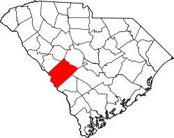
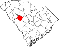
Counties Aiken, Saluda
Area
[1]
  Total0.69 sq mi (1.79 km2)
  Land0.69 sq mi (1.79 km2)
  Water0.00 sq mi (0.00 km2)
Elevation
630 ft (192 m)
Population
 (2020) [2]
  Total205
  Density297.10/sq mi (114.74/km2)
Time zone UTC-5 (Eastern (EST))
  Summer (DST) UTC-4 (EDT)
ZIP code
29105
Area code(s) 803, 839
FIPS code 45-47320 [3]
GNIS feature ID1224618 [4]

Monetta is a town in Aiken and Saluda counties, South Carolina, United States. The population was 236 at the 2010 census. [5]

Contents

The Aiken County portion of Monetta is part of the Augusta, Georgia metropolitan area. The Saluda County portion of Monetta is part of the Columbia, SC Metropolitan Area.

Geography

Monetta is located at 33°50′59″N81°36′30″W / 33.849642°N 81.608200°W / 33.849642; -81.608200 (33.849642, -81.608200), [6] near the southern corner of Saluda County and the northern corner of Aiken County. U.S. Route 1 passes through the town, leading northeast to Batesburg-Leesville and then Columbia, the state capital, and southwest to Aiken.

According to the United States Census Bureau, the town has a total area of 0.73 square miles (1.9 km2), all land. [5]

Demographics

Historical population
CensusPop.Note
1910 122
1920 13712.3%
1930 20348.2%
1940 114−43.8%
1950 84−26.3%
1960 10929.8%
1970 269146.8%
1980 2731.5%
1990 2854.4%
2000 220−22.8%
2010 2367.3%
2020 205−13.1%
U.S. Decennial Census [7] [2]

As of the census [3] of 2000, there were 220 people, 92 households, and 64 families living in the town. The population density was 298.7 inhabitants per square mile (115.3/km2). There were 108 housing units at an average density of 146.6 per square mile (56.6/km2). The racial makeup of the town was 73.64% White, 24.55% African American, and 1.82% from two or more races. Hispanic or Latino of any race were 5.00% of the population.

There were 92 households, out of which 34.8% had children under the age of 18 living with them, 51.1% were married couples living together, 15.2% had a female householder with no husband present, and 30.4% were non-families. 28.3% of all households were made up of individuals, and 15.2% had someone living alone who was 65 years of age or older. The average household size was 2.39 and the average family size was 2.92.

In the town, the population was spread out, with 24.5% under the age of 18, 6.8% from 18 to 24, 27.3% from 25 to 44, 26.8% from 45 to 64, and 14.5% who were 65 years of age or older. The median age was 40 years. For every 100 females, there were 76.0 males. For every 100 females age 18 and over, there were 78.5 males.

The median income for a household in the town was $28,750, and the median income for a family was $39,167. Males had a median income of $30,000 versus $21,875 for females. The per capita income for the town was $16,867. About 8.1% of families and 6.5% of the population were below the poverty line, including none of those under the age of eighteen and 10.3% of those 65 or over.

2010 Demographics

The following is from the 2010 Demographics Total Population 236 (100.00%)

Population by Race Black or African American alone 44 (18.64%) Some other race alone 9 (3.81%) Two or more races 10 (4.24%) White alone 173 (73.31%)

Population by Hispanic or Latino Origin (of any race) Persons Not of Hispanic or Latino Origin 204 (86.44%) Persons of Hispanic or Latino Origin 32 (13.56%)

Population by Gender Female 129 (54.66%) Male 107 (45.34%)

Population by Age Persons 0 to 4 years 8 (3.39%) Persons 5 to 17 years 43 (18.22%) Persons 18 to 64 years 147 (62.29%) Persons 65 years and over 38 (16.10%) [8]

Other demographics

In 2023, of the 205 residents, 111 lived in Aiken County and 94 lived in Saluda County. [9]

Education

Portions in both counties are in the Aiken County Public School District. [10] [11]

Ridge Spring-Monetta Middle-High School, which has a Monetta postal address, [12] and is outside of the city limits in unincorporated Aiken County, [9] is the secondary school of the area.

Areas of the district in the Monetta area and in Saluda County are zoned to Ridge Spring-Monetta Elementary School and Ridge Spring-Monetta Middle-High School. [13]

Related Research Articles

<span class="mw-page-title-main">Saluda County, South Carolina</span> County in South Carolina, United States

Saluda County is a county in the U.S. state of South Carolina. As of the 2020 census, the population was 18,862. Its county seat is Saluda. The county was formed from northern and eastern portions of Edgefield County.

<span class="mw-page-title-main">Newberry County, South Carolina</span> County in South Carolina, United States

Newberry County is a county located in the U.S. state of South Carolina. As of the 2020 census, its population was 37,719. Its county seat is Newberry. The name is of unknown origin, although one theory suggests that it was named by Quaker settlers in honor of their home of Newberry, a suburb of London in the United Kingdom. Newberry County comprises the Newberry, SC Micropolitan Statistical Area.

<span class="mw-page-title-main">Lexington County, South Carolina</span> County in South Carolina, United States

Lexington County is a county located in the U.S. state of South Carolina. As of the 2020 census, the population was 293,991. Its county seat and largest community is Lexington. The county was chartered in 1785 and was named in commemoration of Lexington, Massachusetts, the site of the Battle of Lexington in the American Revolutionary War. Lexington County is the sixth-most populous county in South Carolina by population and is part of the Columbia, SC Metropolitan Statistical Area. It is located in the Midlands region of South Carolina.

<span class="mw-page-title-main">Aiken County, South Carolina</span> County in South Carolina, United States

Aiken County is a county in the U.S. state of South Carolina. As of the 2020 census, its population was 168,808. Its county seat and largest community is Aiken. Aiken County is a part of the Augusta-Richmond County, GA-SC Metropolitan Statistical Area. It is mostly in the Sandhills region, with the northern parts reaching in the Piedmont and southern parts reaching into the Coastal Plain.

<span class="mw-page-title-main">Belvedere, South Carolina</span> Census-designated place in South Carolina, United States of America

Belvedere is a census-designated place (CDP) and suburb of North Augusta in Aiken County, South Carolina, United States. It is part of the Augusta, Georgia metropolitan area. The population was 5,792 at the 2010 census.

<span class="mw-page-title-main">Burnettown, South Carolina</span> Town in South Carolina, United States of America

Burnettown is a town in Aiken County, South Carolina, United States. The population was 3,105 at the 2020 census. It is part of the Augusta, Georgia metropolitan area. Burnettown is located in historic Horse Creek Valley.

<span class="mw-page-title-main">Clearwater, South Carolina</span> Census-designated place in South Carolina, United States of America

Clearwater is a census-designated place (CDP) in Aiken County, South Carolina. It lies near North Augusta, South Carolina, and is part of the Augusta, Georgia metropolitan area. Clearwater is located in historic Horse Creek Valley. The population was 4,370 at the time of the 2010 census.

<span class="mw-page-title-main">Jackson, South Carolina</span> Town in South Carolina, United States of America

Jackson is a town in Aiken County, South Carolina, United States. The population was 1,700 at the 2010 census. It is part of the Augusta, Georgia metropolitan area.

<span class="mw-page-title-main">New Ellenton, South Carolina</span> City in South Carolina

New Ellenton is a city in Aiken County, South Carolina, United States. The population was 2,210 at the 2020 census. It is part of the Augusta, Georgia metropolitan area.

<span class="mw-page-title-main">Salley, South Carolina</span> Town in South Carolina, United States of America

Salley is a town in Aiken County, South Carolina, United States. The population was 398 at the 2010 census. It is part of the Augusta, Georgia metropolitan area. Salley is known for hosting the Chitlin Strut, a town-wide festival, every November.

<span class="mw-page-title-main">Wagener, South Carolina</span> Town in South Carolina

Wagener is a town in Aiken County, South Carolina, United States. The population was 797 at the 2010 census, making it the largest settlement in the county north of the South Fork Edisto River. It is part of the Augusta, Georgia metropolitan area.

<span class="mw-page-title-main">Windsor, South Carolina</span> Town in South Carolina, United States of America

Windsor is a town in Aiken County, South Carolina, United States. The population was 121 at the 2010 census. It is part of the Augusta, Georgia metropolitan area.

<span class="mw-page-title-main">Johnston, South Carolina</span> Town in South Carolina, United States

Johnston is a town in Edgefield County, South Carolina, United States. The population was 2,362 at the 2010 census. It is part of the Augusta, Georgia, metropolitan area. The town's official welcome sign states that it is "Peach Capital of the World".

<span class="mw-page-title-main">Watts Mills, South Carolina</span> Census-designated place in South Carolina, United States

Wattsville is an unincorporated community in Laurens County, South Carolina, United States. The town name is derived from Watts Mill, a textile mill in the center of town. The area is listed as the Wattsville census-designated place (CDP) for statistical purposes. The population of the CDP was 1,635 at the 2010 census. It is part of the Greenville–Mauldin–Easley Metropolitan Statistical Area.

<span class="mw-page-title-main">West Columbia, South Carolina</span> City in South Carolina, US

West Columbia, formerly Brookland, is a city and commuter town in the suburban eastern sections of Lexington County, South Carolina, United States. According to the 2010 census, the population was 14,988, and the 2019 population estimate was 17,998. West Columbia is bordered to the east by Columbia, the state capital, across the Congaree River. It is near Columbia's city center or downtown district as well as the South Carolina State House and the Congaree Vista, known locally as "the Vista". The city is bordered to the south by its sister suburb, Cayce. A small portion of the city borders the town of Lexington to the east. West Columbia is part of the greater Columbia, SC metropolitan statistical area.

<span class="mw-page-title-main">Ridge Spring, South Carolina</span> Town in South Carolina, United States

Ridge Spring is a town in Saluda County, South Carolina, United States. The population was 737 at the 2010 census. It is part of the Columbia, SC Metropolitan Statistical Area. The Mayor-Elect is Ms. Qwendolyn Etheredge.

<span class="mw-page-title-main">Saluda, South Carolina</span> Town in South Carolina, United States

Saluda is a town in Saluda County, South Carolina, United States, along the Little Saluda River. The population was 3,565 at the 2010 census. It is the county seat of Saluda County.

<span class="mw-page-title-main">Ward, South Carolina</span> Town in South Carolina, United States

Ward is a town in Saluda County, South Carolina, United States. The population was 91 at the 2010 census.

<span class="mw-page-title-main">Valley Falls, South Carolina</span> CDP in South Carolina, United States

Valley Falls is a census-designated place (CDP) in Spartanburg County, South Carolina, United States. The population was 6,299 at the 2010 census.

<span class="mw-page-title-main">North Augusta, South Carolina</span> City in South Carolina, United States

North Augusta is a city in Aiken and Edgefield counties in the U.S. state of South Carolina, on the north bank of the Savannah River. It lies directly across the river, and state border, from Augusta, Georgia. The population was 24,379 at the 2020 census, making it the 21st-most populous city in South Carolina. The city is included in the Central Savannah River Area (CSRA) and is part of the Augusta, Georgia, metropolitan area.

References

  1. "ArcGIS REST Services Directory". United States Census Bureau. Retrieved October 15, 2022.
  2. 1 2 "Census Population API". United States Census Bureau. Retrieved October 15, 2022.
  3. 1 2 "U.S. Census website". United States Census Bureau . Retrieved January 31, 2008.
  4. "US Board on Geographic Names". United States Geological Survey. October 25, 2007. Retrieved January 31, 2008.
  5. 1 2 "Geographic Identifiers: 2010 Demographic Profile Data (G001): Monetta town, South Carolina". U.S. Census Bureau, American Factfinder. Archived from the original on February 12, 2020. Retrieved August 5, 2013.
  6. "US Gazetteer files: 2010, 2000, and 1990". United States Census Bureau. February 12, 2011. Retrieved April 23, 2011.
  7. "Census of Population and Housing". Census.gov. Retrieved June 4, 2015.
  8. "2010 Census Population of Monetta, South Carolina - CensusViewer".
  9. 1 2 "General Highway System Aiken County South Carolina" (PDF). South Carolina Department of Transportation. July 2023. Retrieved October 25, 2024. Ridge Spring-Monetta MS & HS
  10. "2020 CENSUS - SCHOOL DISTRICT REFERENCE MAP: Aiken County, SC" (PDF). U.S. Census Bureau . Retrieved October 25, 2024. - Text list
  11. "2020 CENSUS - SCHOOL DISTRICT REFERENCE MAP: Saluda County, SC" (PDF). U.S. Census Bureau . Retrieved October 25, 2024. - Text list
  12. "Home". Ridge Spring-Monetta Middle-High School . Retrieved October 25, 2024. 1071 Trojan Road Monetta, SC 29105
  13. "2019 - 20 Attendance Areas Maps". Aiken County Public School District . Retrieved October 25, 2024. - maps for ES, MS, and HS. Note the colored area off the map is Saluda County, while the area outlined in black is Aiken County.