Batesburg-Leesville, South Carolina

Last updated

Batesburg-Leesville, South Carolina
Nicknames: 
B-L, BB-LV, The Twin Cities
SCMap-doton-Batesburg-Leesville.PNG
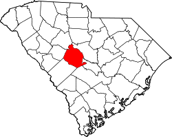
Location of Batesburg-Leesville within South Carolina.
Coordinates: 33°54′38″N81°32′14″W / 33.91056°N 81.53722°W / 33.91056; -81.53722
CountryUnited States
State South Carolina
Counties Lexington, Saluda
Government
   Mayor Lancer Shull
Area
[1]
  Total
8.29 sq mi (21.48 km2)
  Land8.20 sq mi (21.23 km2)
  Water0.10 sq mi (0.26 km2)
Elevation
[2]
643 ft (196 m)
Population
 (2020) [3]
  Total
5,270
  Density643.08/sq mi (248.28/km2)
  [4]
Time zone UTC−5 (EST)
  Summer (DST) UTC−4 (EDT)
ZIP codes
29006, 29070
Area codes 803, 839
FIPS code 45-04300 [5]
GNIS feature ID1692657 [2]
Website www.batesburg-leesville.org

Batesburg-Leesville is a town located in Lexington and Saluda counties, South Carolina, United States. The town's population was 5,362 as of the 2010 census [4] and an estimated 5,415 in 2019. [6]

Contents

History

The town of Batesburg-Leesville was formed in 1992 by the consolidation of the neighboring towns of Batesburg and Leesville. [7] Leesville was incorporated on February 23, 1875, and Batesburg on May 31, 1877. [7] The first mayor of Batesburg-Leesville was also the last mayor of Batesburg, Dr. Elza S. "Sandy" Spradley, Jr. Spradley had been a practicing pharmacist and business owner in the town, a town council member, a member of the Batesburg Water Commission, a founding member of the community’s rescue squad, and an 18-year Fire Chief on the Batesburg Fire Department, retiring after 33 years. Batesburg was named for Captain Tom Bates, a prominent citizen of the community and a captain in the American Civil War. Leesville was named for Colonel John W. Lee, a prominent resident of the community. [8]

Hartley House (1830), located on U.S. Highway 1 across from the old Batesburg Graded School Hartley House, Batesburg-Leesville,South Carolina.jpg
Hartley House (1830), located on U.S. Highway 1 across from the old Batesburg Graded School

The D. D. D. Barr House, Batesburg Commercial Historic District, Simon Bouknight House, Cartledge House, Cedar Grove Lutheran Church, Church Street Historic District, Broadus Edwards House, Hampton Hendrix Office, Hartley House, Henry Franklin Hendrix House, Thomas Galbraith Herbert House, J.B. Holman House, A.C. Jones House, Leesville College Historic District, Crowell Mitchell House, McKendree Mitchell House, Mitchell-Shealy House, Old Batesburg Grade School, John Jacob Rawl House, Rawl-Couch House, Southern Railway Depot, and Rev. Frank Yarborough House are listed on the National Register of Historic Places. [9] [10]

Batesburg's Southern Railway Depot (1900) now located in the Wilson Street Park Batesburg's Southern Railway Depot (1900).jpg
Batesburg's Southern Railway Depot (1900) now located in the Wilson Street Park

In February 1946 a black World War II veteran, Sergeant Isaac Woodard, was removed from a Greyhound bus in Batesburg after an argument with the driver. While still in uniform he was severely beaten by local police officers, including Sheriff Lynwood Shull, and permanently blinded. The attack became a cause celebre, becoming the subject of multiple radio commentaries by Orson Welles in July and August 1946, [11] and the subject of Woody Guthrie's song, The Blinding of Isaac Woodard. Due to South Carolina's reluctance to pursue the case, President Harry S. Truman ordered a federal investigation. Shull was federally indicted and later acquitted by an all-white jury. This incident helped lead to Truman setting up the President's Committee on Civil Rights and issuing Executive Order 9981 desegregating the armed forces.

In early 2018, the town of Batesburg-Leesville, with Town Attorney Christian Spradley, Police Chief W. Wallace Oswald, and Mayor Lancer Shull (no relation to Linwood Shull [ citation needed ]), reopened the Woodard case to consider dismissing the 1946 charges. During a regular term of municipal court on June 5, 2018, Woodard's "drunk and disorderly" case was reopened and the conviction was vacated by Town Judge Robert Cook. [12]

After a fundraising campaign, [13] a permanent historic plaque now stands on the corner of West Church Street and Fulmer Street in old Batesburg commemorating the civil rights incident at the site of the original police station. [14]

Leesville United Methodist Church (1909) on U.S. Highway 1 Leesville United Methodist Church (1909).jpg
Leesville United Methodist Church (1909) on U.S. Highway 1
Former Batesburg Graded School (1912) on U.S. Highway 1 Lexington School District Three Administration Offices.jpg
Former Batesburg Graded School (1912) on U.S. Highway 1
Barr-Price Funeral Home (1909) - Part of the Leesville College Historic District Barr-Price Funeral Home.jpg
Barr-Price Funeral Home (1909) - Part of the Leesville College Historic District

Law and government

Batesburg-Leesville is served by a council-manager style government. The town employs approximate 60 full-time employees, and 35 volunteer firefighters. The town operated from a $7.4 million budget in Fiscal Year 2018–2019. [15]

Mayor

Batesburg-Leesville's mayor is Lancer Shull. [16]

Town council

The town council [16] comprises eight elected council persons representing single-member districts. The current council members are:

Administration

William Theodore "Ted" Luckadoo is the town manager and oversees the day-to-day administrative functions of the town. Luckadoo was named the third town manager of consolidated Batesburg-Leesville in 2014. Jason "Jay" Hendrix was named the assistant town manager on August 8, 2019. [17]

Fire department

The Batesburg-Leesville Fire Department [18] consists of two stations, five career staff members and 41 volunteer firefighters as of September 2019. The two stations are located in the town's two historic business districts and are still identified as the Batesburg station and the Leesville station. The department boasts an Insurance Services Office Class 3/3B rating.

Economy

Historic Leesville Business District - Main Street Main Street Leesville.jpg
Historic Leesville Business District - Main Street
Historic Batesburg Business District - Oak Street Oak Street Batesburg.jpg
Historic Batesburg Business District - Oak Street

Top employers

The top employer in Batesburg-Leesville is Lexington County School District Three with four different schools and a district office. The next is Ansaldo STS, which has a 184,000 sq ft (17,100 m2) manufacturing facility.

Poultry industry

The town's economic dependence on poultry harvesting is apparent due to the presence of two large processing plants: Amick Farms and Columbia Farms. These assist in making Lexington County the top poultry producer in the state.

Poultry festival

The South Carolina Poultry Festival (formerly the Ridge Poultry Festival) has been held on the second Saturday in May since 1987. The festival features live music, food vendors, craft vendors, a carnival, a parade, and to conclude the event a cake auction and fireworks show.

Education

Public schools

The public school system in all parts of Batesburg-Leesville census-designated place is administered by Lexington County School District Three, [19] [20] which consists of: [21]

All sports teams associated with School District Three use a panther as their mascot. The Panthers' colors are purple, gold, and blue

Historic public schools

The Batesburg-Leesville Primary School opened in 1984. At that time the district began operating just four schools, as they consolidated smaller, older schools into the new school. Historical schools which closed in 1984 included Hampton Elementary School (1954), Utopia Elementary School (1953), Leesville Elementary School and Batesburg Primary School.

The Batesburg-Leesville Elementary School opened 1996 and replaced the Old Batesburg Grade School [23] which had served the fourth and fifth grades and now serves as the Lexington School District Three Administrative Office. The new school allowed third grade to be shifted from the B-L Primary School to the new Elementary School give the current school breakdown by grade.

The Batesburg-Leesville Middle School opened in 1999. This led to the closing of the old middle school campus which had originally been built as Batesburg-Leesville High School in 1921 with numerous additions through the years.

The Batesburg-Leesville High School opened in 1975. The new school was built on the former Summerland College campus on Summerland Avenue. The construction of a new school had been spurred by integration and student population increases. With integration a former building of Summerland College was used as a middle school in the early 1970s but a fire heavily damaged the building and eventually sped up the construction of the new high school. The first class to graduate in Panther Stadium was the class of 1976.

Prior to racial integration statewide, the local African-American students attended Twin-City High School and Hampton School. Twin-City High School was located on Maple Street in Batesburg where the Twin-City High School Park is now located. The park is owned by the Twin-City Alumni Association. The original two-story wooden Hampton School (1922) was replaced in 1954 by a single-story brick structure on South Lee Street in Leesville. The original wooden building was subsequently torn down, but a marker remains under a large tree in the parking lot of Friendship Baptist Church on South Lee Street. Other "colored" schools included Leesville Colored Primary School and Batesburg-Saluda Colored School.

There were other older schools which had closed previously to include Delmar School which was located a few miles outside of town. View the Delmar School historical marker at. [24] More photographs of these old school buildings may be seen at SC School Insurance Photos 1935-50.

Private schools

W. Wyman King Academy and the Ridge Christian School are private, nondenominational Christian schools accepting students in grades K-12.

Colleges and universities

In 2008, Midlands Technical College opened a new Batesburg-Leesville satellite campus in the Leesville Historic District. The campus is within the boundaries of the Leesville College Park at the intersection of Main Street and College Street.

Historic colleges

Leesville College Park and old classroom building, summer 2018 Leesville College Park, Batesburg-Leesville, South Carolina.jpg.jpg
Leesville College Park and old classroom building, summer 2018

Library

Batesburg-Leesville has a public library, a branch of the Lexington County Public Library. [26]

Media

Newspapers

Batesburg-Leesville is served weekly by The Twin-City News, which specifically focuses on local news, as well as that from immediately surrounding areas (mostly Gilbert and Monetta). It minimizes national or world news. The Twin-City News was established in 1925 and is Batesburg-Leesville's oldest continuously operating business.

The town is also served by The State newspaper, which circulates amid most of the state.

In 2007, Lexington County Chronicle and The Dispatch-News began appearing at town stores and business to complement their subscribers in the area. This newspaper covers all county governments, state, national, and international news, to the extent such news concerns Lexington County residents.

Radio

Batesburg-Leesville has only one radio station transmitting from within its borders, WBLR 1430 AM. However, Batesburg-Leesville is in range of several radio stations broadcasting from the surrounding areas, including:

Television

Over-the-air channels receivable in Batesburg-Leesville include:

Alternatively, digital cable providers Time Warner Cable and Pond Branch Telecommunications collectively cover the majority of the greater Batesburg-Leesville area.

Geography

Batesburg-Leesville is located in western Lexington County at 33°54′38″N81°32′14″W / 33.91056°N 81.53722°W / 33.91056; -81.53722 (33.909767, -81.534296). [27] A small portion of the town extends west into Saluda County.

According to the United States Census Bureau, the town has a total area of 8.3 sq mi (21.5 km2), of which 0.1 sq mi (0.3 km2), or 1.19%, are covered by water. [28]

Batesburg-Leesville is located along the Atlantic Seaboard Fall Line which separates the Piedmont region from the Atlantic coastal plain. Historically, U.S. Route 1 followed this line, and it presently separates the north and south sides of the duel town. Typically in this vicinity, the Piedmont area has a clay soil surface, while the Coastal Plain is sandy.

Demographics

Historical population
CensusPop.Note
1880 286
1890 52884.6%
1900 97183.9%
1910 1,995105.5%
1920 2,84842.8%
1930 2,839−0.3%
1940 2,9333.3%
1950 3,1698.0%
1960 3,80620.1%
1970 4,0366.0%
1980 4,023−0.3%
1990 4,0821.5%
2000 5,51735.2%
2010 5,362−2.8%
2020 5,270−1.7%
U.S. Decennial Census [29] [3]

2020 census

Batesburg-Leesville racial composition [30]
RaceNum.Perc.
White (non-Hispanic)2,57548.86%
Black or African American (non-Hispanic)2,19141.57%
Native American 100.19%
Asian 310.59%
Pacific Islander 40.08%
Other/Mixed 1482.81%
Hispanic or Latino 3115.9%

As of the 2020 United States census, there were 5,270 people, 2,046 households, and 1,458 families residing in the town.

As of 2023, of the 5,270 people, about 4,830 live in Lexington County and 440 live in Saluda County. [31]

2000 census

As of the U.S. Census [5] of 2000, there were 5,517 people, 2,167 households, and 1,482 families residing in the town. The population density was 751.4 inhabitants per square mile (290.1/km2). There were 2,446 housing units at an average density of 333.2 units per square mile (128.6 units/km2).

The racial makeup of the town was 52.82% White, 45.66% African American, 0.29% Native American, 0.20% Asian, 0.40% from other races, and 0.63% from two or more races. Hispanic or Latino of any race were 1.61% of the local population.

There were 2,167 households, of which 31.2% had children under the age of 18 living with them, 42.0% were married couples living together, 22.2% had a female householder with no husband present, and 31.6% were non-families. 28.3% of all households were made up of individuals, and 13.7% had someone living alone who was 65 years of age or older. The average household size was 2.50, and the average family size was 3.03.

In the town, the population was spread out, with 26.5% under the age of 18, 8.4% from 18 to 24, 25.2% from 25 to 44, 22.6% from 45 to 64, and 17.3% who were 65 years of age or older. The median age was 38 years. For every 100 females, there were 83.3 males. For every 100 females age 18 and over, there were 76.5 males.

The median income for a household in the town was $32,865, and the median income for a family was $40,040. Males had a median income of $32,447 versus $22,196 for females. The per capita income for the town was $16,078. About 16.1% of families and 18.0% of the population were below the poverty line, including 25.9% of those under age 18 and 12.5% of those age 65 or over.

Notable people

Notable figures who were born in, lived in, or are otherwise associated with Batesburg-Leesville include:

Athletes

Musicians

Governmental and Military

Related Research Articles

<span class="mw-page-title-main">Columbia, South Carolina</span> Capital city of South Carolina, United States

Columbia is the capital city of the U.S. state of South Carolina. With a population of 136,632 at the 2020 census, it is the second-most populous city in South Carolina. The city serves as the county seat of Richland County, and a portion of the city extends into neighboring Lexington County. It is the center of the Columbia, SC Metropolitan Statistical Area, which had an estimated population of 858,302 in 2023, and is the 70th-most populous metropolitan statistical area in the United States. The name Columbia is a poetic term used for the United States, derived from the name of Christopher Columbus, who explored for the Spanish Crown. Columbia is often abbreviated as Cola, leading to its nickname as "Soda City".

<span class="mw-page-title-main">Saluda County, South Carolina</span> County in South Carolina, United States

Saluda County is a county in the U.S. state of South Carolina. As of the 2020 census, the population was 18,862. Its county seat is Saluda. The county was formed from northern and eastern portions of Edgefield County.

<span class="mw-page-title-main">Lexington County, South Carolina</span> County in South Carolina, United States

Lexington County is a county located in the U.S. state of South Carolina. As of the 2020 census, the population was 293,991. Its county seat and largest community is Lexington. The county was chartered in 1785 and was named in commemoration of Lexington, Massachusetts, the site of the Battle of Lexington in the American Revolutionary War. Lexington County is the sixth-most populous county in South Carolina by population and is part of the Columbia, SC Metropolitan Statistical Area. It is located in the Midlands region of South Carolina.

<span class="mw-page-title-main">Chapin, South Carolina</span> Town in South Carolina, United States

Chapin, popularly known as the "Capital of Lake Murray", is a small lake town located at the northern tip of Lexington County, South Carolina, United States. Lake Murray separates Chapin from the rest of Lexington County. The population of Chapin was 1,445 according to the 2010 census, and an estimated 1,633 in 2019.

<span class="mw-page-title-main">Lexington, South Carolina</span> Town in South Carolina, USA

Lexington is the most populous town in and the county seat of Lexington County, South Carolina, United States. It is a suburb of the state capital, Columbia. The population was 23,568 at the 2020 Census, and it is the second-most populous municipality in the greater Columbia area. The 2022 estimated population is 24,626. According to the Central Midlands Council of Governments, the greater Lexington area had an estimated population of 111,549 in 2020 and is considered the fastest-growing area in the Midlands.

<span class="mw-page-title-main">West Columbia, South Carolina</span> City in South Carolina, US

West Columbia, formerly Brookland, is a city and commuter town in the suburban eastern sections of Lexington County, South Carolina, United States. According to the 2010 census, the population was 14,988, and the 2019 population estimate was 17,998. West Columbia is bordered to the east by Columbia, the state capital, across the Congaree River. It is near Columbia's city center or downtown district as well as the South Carolina State House and the Congaree Vista, known locally as "the Vista". The city is bordered to the south by its sister suburb, Cayce. A small portion of the city borders the town of Lexington to the east. West Columbia is part of the greater Columbia, SC metropolitan statistical area.

<span class="mw-page-title-main">Ridge Spring, South Carolina</span> Town in South Carolina, United States

Ridge Spring is a town in Saluda County, South Carolina, United States. The population was 737 at the 2010 census. It is part of the Columbia, SC Metropolitan Statistical Area. The Mayor-Elect is Ms. Qwendolyn Etheredge.

<span class="mw-page-title-main">Monetta, South Carolina</span> Town in South Carolina, United States of America

Monetta is a town in Aiken and Saluda counties, South Carolina, United States. The population was 236 at the 2010 census.

<span class="mw-page-title-main">Irmo, South Carolina</span> Town in South Carolina, United States

Irmo is a town in Lexington and Richland counties, South Carolina, United States and a suburb of Columbia. It is part of the Columbia Metropolitan Statistical Area and is located 12 miles (19 km) northwest of the city center. The population of Irmo was 11,569 at the 2020 census.

<span class="mw-page-title-main">Isaac Woodard</span> American WWII veteran and victim of racial abuse

Isaac Woodard Jr. was an American soldier and victim of racial violence. An African-American World War II veteran, on February 12, 1946, hours after being honorably discharged from the United States Army, he was attacked while still in uniform by South Carolina police as he was taking a bus home. The attack and his injuries sparked national outrage and galvanized the civil rights movement in the United States.

<span class="mw-page-title-main">U.S. Route 1 in South Carolina</span> Section of U.S. Highway in South Carolina, United States

U.S. Highway 1 (US 1) is a 170.540-mile (274.458 km) north–south U.S. Highway that crosses South Carolina from southwest to northeast and connects the cities of North Augusta, Aiken, Lexington, Columbia, Camden, and Cheraw.

<span class="mw-page-title-main">Columbia metropolitan area, South Carolina</span> Combined Statistical Area in South Carolina, United States

As defined by the U.S. Office of Management and Budget, and used by the U.S. Census Bureau for statistical purposes only, the Columbia, SC Metropolitan Statistical Area, is an area consisting of six counties in central South Carolina, anchored by the city of Columbia. The current population has an estimation of 837,092. It is the second-largest metropolitan statistical area in the state of South Carolina, since the Anderson metropolitan statistical area was combined with Greenville's following the 2010 census.

<span class="mw-page-title-main">Simon Bouknight House</span> Historic house in South Carolina, United States

Simon Bouknight House is a historic home located at Batesburg-Leesville, Lexington County, South Carolina. It was built in 1890, and is a one-story, weatherboarded Victorian cottage under a gabled roof. It has a gabled projecting central porch supported by four regularly spaced slender wood posts; front and end gables with cornice returns and centered, diamond-shaped windows; and corbeled chimneys. The house is set on a lattice brick foundation.

<span class="mw-page-title-main">Cartledge House</span> Historic house in South Carolina, United States

Cartledge House is a historic home located at Batesburg-Leesville, Lexington County, South Carolina. It was built about 1898, and is a two-story, Victorian-era weatherboard dwelling. It consists of a rectangular central block under a hipped roof with sheet metal shingles and a truncated ridge. Double gallery porches wrap around the front and side elevations on both stories ornamented by Tuscan order colonettes and turned balustrades. The front roof slope features a steep cross gable pierced by a circular vent.

<span class="mw-page-title-main">McKendree Mitchell House</span> Historic house in South Carolina, United States

McKendree Mitchell House is a historic home located at Batesburg-Leesville, Lexington County, South Carolina. It was built in 1873, and is a 1+12-story, Greek Revival style cottage on a brick foundation. It is sheathed in weatherboard and features a projecting central gabled portico.

<span class="mw-page-title-main">Old Batesburg Grade School</span> United States historic place

Old Batesburg Grade School, also known as Batesburg Elementary School, is a historic elementary school building located at Batesburg-Leesville, Lexington County, South Carolina. It was built about 1912, and is a two-story, brick Neo-Classical school building with a central tetrastyle portico and flanking pavilions. The central portico has four colossal Tuscan order columns. An auditorium is located at the rear of the building. Wing additions were added about 1945. It was the town's first public school, housing grades 1–11.

<span class="mw-page-title-main">South Carolina Highway 391</span> State highway in South Carolina, United States

South Carolina Highway 391 (SC 391) is a 34.920-mile-long (56.198 km) state highway in the U.S. state of South Carolina. The highway connects rural areas of Aiken County with Prosperity, via Batesburg-Leesville.

Lexington County School District Three (LCSD3), also known as Batesburg-Leesville Schools, is a school district headquartered in Batesburg-Leesville, South Carolina.

<span class="mw-page-title-main">Lexington County Public Library</span>

The Lexington County Public Library is the public library system of Lexington County, South Carolina. It has 10 branches, including its 48,000 sq ft (4,500 m2) Main Library, built in 1998. The library has branches in Batesburg-Leesville, West Columbia, Chapin, Gaston, Gilbert, Irmo, Lexington, Pelion, South Congaree, and Swansea. The library also has mobile library services, including a browsing mobile library bus with scheduled routes throughout Lexington County, home delivery services and Materials by Mail.

References

  1. "ArcGIS REST Services Directory". United States Census Bureau. Retrieved October 15, 2022.
  2. 1 2 U.S. Geological Survey Geographic Names Information System: Batesburg-Leesville, South Carolina
  3. 1 2 "Census Population API". United States Census Bureau. Retrieved October 15, 2022.
  4. 1 2 "Total Population: 2010 Census DEC Summary File 1 (P1), Batesburg-Leesville town, South Carolina". data.census.gov. U.S. Census Bureau. Retrieved December 23, 2020.
  5. 1 2 "U.S. Census website". United States Census Bureau . Retrieved January 31, 2008.
  6. "Population and Housing Unit Estimates". United States Census Bureau. May 24, 2020. Retrieved May 27, 2020.
  7. 1 2 "Batesburg-Leesville" . Retrieved May 17, 2020.
  8. Federal Writers' Project (1941). Palmetto Place Names. Sloane Printing Co. p. 23 and 64.
  9. "National Register Information System". National Register of Historic Places . National Park Service. July 9, 2010.
  10. "National Register of Historic Places Listings". Weekly List of Actions Taken on Properties: 11/15/10 through 11/19/10. National Park Service. November 26, 2010.[ permanent dead link ]
  11. "Listen To Orson Welles Denounce Police Brutality Against Black WWII Veteran". Newsweek.com. February 18, 2021. Archived from the original on February 18, 2021. Retrieved April 28, 2021.
  12. "Town honors an African-American WWII veteran blinded in a 1946 police beating". CNN. February 11, 2019. Retrieved February 14, 2019.
  13. "Civil rights historians tell little known story of WWII vet - Stripes". Archived from the original on February 9, 2019. Retrieved February 8, 2019.
  14. "SGT. Isaac Woodard Historical Marker Dedication - Town of Batesburg Leesville". Archived from the original on February 9, 2019. Retrieved February 8, 2019.
  15. "FY 2018-2019 Budget" (PDF). Town of Batesburg-Leesville. Archived from the original (PDF) on August 17, 2018. Retrieved August 17, 2018.
  16. 1 2 "Mayor and Council - Town of Batesburg Leesville". batesburg-leesville.org. Archived from the original on November 16, 2017. Retrieved November 16, 2017.
  17. "Office of Town Manager". Town of Batesburg-Leesville. Archived from the original on September 27, 2019. Retrieved September 15, 2019.
  18. "Fire Department - Town of Batesburg Leesville".
  19. "2020 CENSUS - SCHOOL DISTRICT REFERENCE MAP: Lexington County, SC" (PDF). U.S. Census Bureau . Retrieved October 25, 2024. - Text list
  20. "2020 CENSUS - SCHOOL DISTRICT REFERENCE MAP: Saluda County, SC" (PDF). U.S. Census Bureau . Retrieved October 25, 2024. - Text list
  21. "Batesburg-Leesville Area Schools". Batesburg-Leesville. Archived from the original on January 12, 2023. Retrieved January 11, 2023.
  22. "Batesburg-Leesville Primary School". blps.lex3.org. Retrieved December 17, 2024.
  23. "S11211301437".
  24. "Delmar School Historical Marker". www.hmdb.org.
  25. "Archived copy" (PDF). Archived from the original (PDF) on December 24, 2016. Retrieved October 11, 2018.{{cite web}}: CS1 maint: archived copy as title (link)
  26. "Locations". Lexington County Public Library. Retrieved September 28, 2022.
  27. "US Gazetteer files: 2010, 2000, and 1990". United States Census Bureau. February 12, 2011. Retrieved April 23, 2011.
  28. "2019 U.S. Gazetteer Files". United States Census Bureau. Retrieved July 29, 2020.
  29. "Census of Population and Housing". Census.gov. Retrieved June 4, 2015.
  30. "Explore Census Data". data.census.gov. Retrieved December 14, 2021.
  31. "General Highway System Lexington County, South Carolina" (PDF). South Carolina Department of Transportation. February 2023. Retrieved October 25, 2024.
  32. Reports, Author: Staff (October 24, 2019). "Batesburg-Leesville Mayor chosen for elite statewide fellowship". The Twin-City News. Retrieved May 17, 2021.{{cite web}}: |first= has generic name (help)
  33. "About". Riley Mayors' Design Fellowship. March 21, 2018. Retrieved May 17, 2021.