Dillon, South Carolina

Last updated

Dillon, South Carolina
Dillon, SC June 2013 - panoramio.jpg
Downtown Dillon from the Amtrak station in June 2013.
Dillon, SC City Seal.png
Motto: 
"Your First Stop in SC"
SCMap-doton-Dillon.PNG
Location of Dillon in South Carolina
Coordinates: 34°25′4″N79°22′5″W / 34.41778°N 79.36806°W / 34.41778; -79.36806
CountryUnited States
State South Carolina
County Dillon
Named for James W. Dillon
Government
  TypeCouncil-Manager Form of Government
   Mayor Pro Tempore Dr. Phil Wallace
Area
[1]
  Total5.37 sq mi (13.91 km2)
  Land5.34 sq mi (13.83 km2)
  Water0.03 sq mi (0.08 km2)
Elevation
112 ft (34 m)
Population
 (2020) [2]
  Total6,384
  Density1,195.95/sq mi (461.73/km2)
Time zone UTC−5 (EST)
  Summer (DST) UTC−4 (EDT)
ZIP code
29536
Area code(s) 843, 854
FIPS code 45-19420 [3]
GNIS feature ID1222024 [4]
Website www.cityofdillonsc.us

Dillon is a city in Dillon County in eastern South Carolina, United States. It is the county seat and largest city of Dillon County. [5] It was established on December 22, 1888. Both the name of the city and county comes from James W. Dillon, an early settler and key figure in bringing a railroad through the area. The population was 6,788 in the 2010 U.S. census. [6]

Contents

History

The County was founded in 1910 from a portion Marion County. The County and the City of Dillon are named for prosperous local citizen James W. Dillon (1826-1913), an Irishman who settled there and led a campaign to bring the railroad into the community. The result of this effort was the construction of the Wilson Short Cut Railroad, which later became part of the Atlantic Coast Line Railroad, and which brought greater prosperity to the area by directly linking Dillon County to the national network of railroads. For many decades, residents of Dillon County were farmers growing cotton and tobacco. Timber harvesting remains a major industry in the County. Dillon County has seen a growth in manufacturing and distribution centers over the past 20 years due in part to Interstate 95 which runs through the County north-south. [7]

Geography

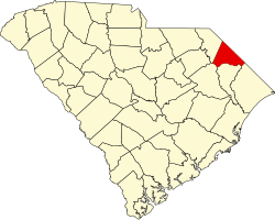
Dillon is located near the center of Dillon County in the Pee Dee region of northeastern South Carolina. The Little Pee Dee River, a tributary of the Pee Dee River, runs just east of the city.

U.S. Routes 301 and 501 pass through the city as Second Avenue, leading northeast 7 miles (11 km) to Interstate 95 at South of the Border along the North Carolina line, and southwest 6.5 miles (10.5 km) to Latta. Interstate 95 passes northeast of the city, with access from Exits 190 and 193. I-95 leads northeast 25 miles (40 km) to Lumberton, North Carolina, and southwest 28 miles (45 km) to Florence. South Carolina Highway 9 passes through the center of town, leading northwest 26 miles (42 km) to Bennettsville and southeast 13 miles (21 km) to Lake View. South Carolina Highway 57 follows SC 9 through Dillon but leads north 14 miles (23 km) to the North Carolina border and south 17 miles (27 km) to Mullins. SC 9 and 57 follow Main Street southeast out of town. South Carolina Highway 34 follows Main Street northwest out of town, leading west 33 miles (53 km) to Darlington.

According to the U.S. Census Bureau, Dillon has a total area of 5.3 square miles (13.6 km2), of which 0.01 square miles (0.03 km2), or 0.21%, is water. [6] The Little Pee Dee River flows southwards 2 miles (3 km) east of the center of town.

Climate

Climate data for Dillon, South Carolina (1991–2020 normals, extremes 1904–1917, 1936–2019)
MonthJanFebMarAprMayJunJulAugSepOctNovDecYear
Record high °F (°C)81
(27)
85
(29)
97
(36)
94
(34)
102
(39)
107
(42)
105
(41)
106
(41)
102
(39)
100
(38)
89
(32)
82
(28)
107
(42)
Mean maximum °F (°C)74.3
(23.5)
77.2
(25.1)
82.5
(28.1)
86.9
(30.5)
92.2
(33.4)
96.6
(35.9)
97.9
(36.6)
97.0
(36.1)
92.7
(33.7)
87.3
(30.7)
80.1
(26.7)
75.0
(23.9)
99.3
(37.4)
Mean daily maximum °F (°C)56.3
(13.5)
60.0
(15.6)
67.5
(19.7)
76.1
(24.5)
83.1
(28.4)
89.0
(31.7)
92.2
(33.4)
90.4
(32.4)
85.1
(29.5)
76.3
(24.6)
66.9
(19.4)
59.0
(15.0)
75.2
(24.0)
Daily mean °F (°C)44.1
(6.7)
47.0
(8.3)
53.6
(12.0)
62.0
(16.7)
70.1
(21.2)
77.5
(25.3)
81.1
(27.3)
79.5
(26.4)
73.9
(23.3)
63.6
(17.6)
53.4
(11.9)
46.8
(8.2)
62.7
(17.1)
Mean daily minimum °F (°C)31.9
(−0.1)
33.9
(1.1)
39.7
(4.3)
47.8
(8.8)
57.2
(14.0)
66.1
(18.9)
69.9
(21.1)
68.7
(20.4)
62.7
(17.1)
50.9
(10.5)
39.9
(4.4)
34.6
(1.4)
50.3
(10.2)
Mean minimum °F (°C)18.0
(−7.8)
20.8
(−6.2)
26.5
(−3.1)
34.7
(1.5)
45.8
(7.7)
57.1
(13.9)
63.8
(17.7)
61.3
(16.3)
52.3
(11.3)
36.3
(2.4)
26.2
(−3.2)
22.0
(−5.6)
16.0
(−8.9)
Record low °F (°C)−1
(−18)
5
(−15)
11
(−12)
24
(−4)
30
(−1)
42
(6)
49
(9)
48
(9)
36
(2)
18
(−8)
12
(−11)
2
(−17)
−1
(−18)
Average precipitation inches (mm)3.96
(101)
3.26
(83)
3.89
(99)
3.72
(94)
3.62
(92)
4.28
(109)
5.50
(140)
5.41
(137)
4.79
(122)
3.96
(101)
3.11
(79)
3.13
(80)
48.63
(1,235)
Average snowfall inches (cm)0.7
(1.8)
trace0.0
(0.0)
0.0
(0.0)
0.0
(0.0)
0.0
(0.0)
0.0
(0.0)
0.0
(0.0)
0.0
(0.0)
0.0
(0.0)
0.0
(0.0)
0.1
(0.25)
0.8
(2.0)
Average precipitation days (≥ 0.01 in)8.37.47.46.57.88.89.29.06.65.65.77.790.0
Average snowy days (≥ 0.1 in)0.40.20.00.00.00.00.00.00.00.00.00.20.8
Source: NOAA [8] [9]

Economy

In the spring of 2018, Dillon Inland Port was constructed, furthering economic growth based on the Port of Charleston. [10]

Demographics

Historical population
CensusPop.Note
1890 82
1900 1,0151,137.8%
1910 1,75773.1%
1920 2,20525.5%
1930 2,73123.9%
1940 3,86741.6%
1950 5,17133.7%
1960 6,17319.4%
1970 6,3913.5%
1980 7,06010.5%
1990 6,829−3.3%
2000 6,316−7.5%
2010 6,7887.5%
2020 6,384−6.0%
U.S. Decennial Census [11] [2]

2020 census

Dillon racial composition [12]
RaceNum.Perc.
White (non-Hispanic)2,47538.77%
Black or African American (non-Hispanic)3,41853.54%
Native American 620.97%
Asian 400.63%
Other/Mixed 2163.38%
Hispanic or Latino 1732.71%

As of the 2020 United States census, there were 6,384 people, 2,159 households, and 1,364 families residing in the city.

2010 census

The population grew 7.5 percent from the 2000 to 2010. The city is 53.1% Black or African American, 42.8% White or Caucasian persons, 1.6% American Indian or Alaska Native persons, 1.2% persons of Hispanic or Latino origin, and 1.2% persons reporting two or more races.

There was a recorded 2,454 households, averaging between two and three (2.57) people per household, as well as 2,916 housing units within the city. Of the 2,916 housing units 13.7% were multi-unit structures. The average value of a housing unit was $101,800 for owner occupied units. The census also showed that the population density of Dillon was 1,299.1 persons per square mile. The land area of the city of Dillon was 5.23 square miles. The median household income was found to be $30,455 with a rate of 30.4% of people living in poverty. [13]

Government

Dillon's government is a city manager-council type.

The current mayor is Tally McColl.

Wellness center

The city of Dillon offers a public wellness center, located at 1647 Commerce Drive. The $4.1 million facility was built in 2008. It is a 40,000-square-foot (3,700 m2) building that offers exercise equipment, a sauna, gymnasium, walking track, and meeting rooms. It also offers rooms for rental. The exercise facilities can be used for a fee of $5, or memberships are available at monthly rates. [14]

Education

Public education in Dillon is administered by Dillon District Four Schools. [15] The district operates East Elementary, South Elementary, Stewart Heights Elementary, Lake View Elementary, Gordon Elementary, Dillon Middle School, Dillon High School and Lake View High School.

Dillon Christian School is a private institution.

Northeastern Technical College offers secondary education.

Dillon has a public library, a branch of the Dillon County Library. [16]

Transportation

Highways

Downtown Dillon is the intersection of US 301, US 501, SC 9, SC 34 and SC 57. I-95 has two exits to Dillon, and it is planned that I-73 will serve Dillon as part of a future southward expansion. In August 2023, Dillon got a 40 stall Version 3 Tesla Supercharger station, the largest in the southeastern United States. [17]

Rail

Amtrak, the national rail passenger carrier, provides daily service from Dillon with the Palmetto , which runs between Savannah, Georgia, and New York City on the South End Subdivision. Trains stop at the Dillon station, originally opened for passenger use by the Atlantic Coast Line Railroad in 1904. A second line known as the Andrews Subdivision, formerly owned by the Seaboard Air Line Railroad runs through Dillon, but only carries freight. CSX owns both railroad lines which cross Dillon.

Media

The Dillon Herald is the city of Dillon's newspaper. The paper was established in 1894 and is the oldest "continuously operated" business in Dillon County. [18]

Dillon Observer is an online newspaper in Dillon, South Carolina. Dillon Observer was established in 2020.

Notable people

Related Research Articles

<span class="mw-page-title-main">Pickens County, South Carolina</span> County in South Carolina, United States

Pickens County is located in the northwest part of the U.S. state of South Carolina. As of the 2020 census, its population was 131,404. Its county seat is Pickens. The county was created in 1826. It is part of the Greenville-Anderson-Greer, SC Metropolitan Statistical Area.

<span class="mw-page-title-main">Orangeburg County, South Carolina</span> County in South Carolina, United States

Orangeburg County is a county located in the U.S. state of South Carolina. As of the 2020 census, the population was 84,223. Its county seat is Orangeburg. The county was created in 1769.

<span class="mw-page-title-main">Marlboro County, South Carolina</span> County in South Carolina, United States

Marlboro County is a county located in the Pee Dee region on the northern border of the U.S. state of South Carolina. As of the 2020 census, its population was 26,667. Its county seat is Bennettsville. The Great Pee Dee River runs through it.

<span class="mw-page-title-main">Marion County, South Carolina</span> County in South Carolina, United States

Marion County is a county located in the coastal plain of the U.S. state of South Carolina. As of the 2020 census, its population was 29,183. Its county seat is Marion. It is a majority-minority county.

<span class="mw-page-title-main">Horry County, South Carolina</span> County in South Carolina, United States

Horry County is the easternmost county in the U.S. state of South Carolina. As of the 2020 census, its population was 351,029. It is the fourth-most populous county in South Carolina. The county seat is Conway.

<span class="mw-page-title-main">Georgetown County, South Carolina</span> County in South Carolina, United States

Georgetown County is a county located in the U.S. state of South Carolina. As of the 2020 census, the population was 63,404. Its county seat is Georgetown. The county was founded in 1769. It is named for George III of the United Kingdom.

<span class="mw-page-title-main">Florence County, South Carolina</span> County in South Carolina, United States

Florence County is a county located in the U.S. state of South Carolina. As of the 2020 census, its population was 137,059. Its county seat is Florence.

<span class="mw-page-title-main">Dillon County, South Carolina</span> County in South Carolina, United States

Dillon County is a county located in the U.S. state of South Carolina. As of the 2020 census, the county's population was 28,292. The county seat is Dillon.

<span class="mw-page-title-main">Darlington County, South Carolina</span> County in South Carolina, United States

Darlington County is a county in the U.S. state of South Carolina. As of the 2020 census, its population was 62,905. Its county seat is Darlington. Hartsville is the largest community in the county. Darlington County is home to the Darlington Raceway, which hosts the annual NASCAR Southern 500. Darlington County is also home to Coker College in Hartsville. Darlington County was named by an act in March 1785.

<span class="mw-page-title-main">Chesterfield County, South Carolina</span> County in South Carolina, United States

Chesterfield County is a county located in the U.S. state of South Carolina. As of the 2020 census, its population was 43,273. Its county seat is Chesterfield. The largest community in the county is Cheraw. It is located north of the Midlands, in the Pee Dee region, on its border with North Carolina.

<span class="mw-page-title-main">Hartsville, South Carolina</span> City in South Carolina, United States

Hartsville is the largest city in Darlington County, South Carolina, United States. It was chartered on December 11, 1891. The population was 7,764 at the 2010 census. Hartsville was chosen as an All-America City in 1996 and again in 2016. Hartsville has also been a National Arbor Day Foundation Tree City since 1986.

<span class="mw-page-title-main">Society Hill, South Carolina</span> Town in South Carolina, United States

Society Hill is a town in Darlington County, South Carolina, United States alongside the Pee Dee River. It is the oldest community in Darlington County and one of the first towns founded in South Carolina. The town was once the intellectual center of the Pee Dee region. However, the town's fortunes declined in the 19th century after rivers became less important as means of transportation. It is part of the Florence Metropolitan Statistical Area.

<span class="mw-page-title-main">Latta, South Carolina</span> Town in South Carolina, United States

Latta is a town in Dillon County, South Carolina, United States. Latta is the second most populous town in Dillon County. As of the 2010 census, it had a population of 1,379.

<span class="mw-page-title-main">Florence, South Carolina</span> City in South Carolina, United States

Florence is a city in and the county seat of Florence County, South Carolina, United States. It lies at the intersection of Interstates 20 and 95 and is the eastern terminus of the former. It is the primary city within the Florence metropolitan area. The area forms the core of the historical Pee Dee region of South Carolina, which includes the eight counties of northeastern South Carolina, along with sections of southeastern North Carolina. As of the 2020 census, the population of the city was 39,899, making it the 10th-most populous city in the state.

<span class="mw-page-title-main">Johnsonville, South Carolina</span> City in South Carolina, United States

Johnsonville is a city in Florence County, South Carolina, United States. The population was 1,480 at the 2010 census. It is part of the Florence Metropolitan Statistical Area.

<span class="mw-page-title-main">Lake City, South Carolina</span> City in South Carolina, United States

Lake City is a city in Florence County, South Carolina, United States. The population was 6,675 at the 2010 census. Located in central South Carolina, it is south of Florence and included as part of the Florence Metropolitan Statistical Area.

<span class="mw-page-title-main">Loris, South Carolina</span> City in South Carolina, United States

Loris is a city in Horry County, South Carolina, United States. The population was 2,396 at the 2010 census, up from 2,079 in 2000.

<span class="mw-page-title-main">North Myrtle Beach, South Carolina</span> City in South Carolina, United States

North Myrtle Beach is a city in Horry County, South Carolina, United States. It was created in 1968 from four existing municipalities, and is located about 15 miles (24 km) northeast of Myrtle Beach. It serves as one of the primary tourist destinations along the Grand Strand. As of the 2010 census, the population was 13,752, and in 2019 the estimated population was 16,819. It is part of the Myrtle Beach-Conway-North Myrtle Beach, SC Metropolitan Statistical Area, which had a combined population of 449,295 as of 2016.

<span class="mw-page-title-main">Kershaw, South Carolina</span> Town in South Carolina, United States

Kershaw is a town in Lancaster County, South Carolina, United States. It was incorporated in 1888. As of the 2010 census, the population was 1,803, and as of 2019 the estimated population was 2,321. The Haile Gold Mine, where gold was discovered in 1825, is 3 miles (5 km) from town and was at one time the largest single producer of gold in the Appalachian region.

<span class="mw-page-title-main">Marion, South Carolina</span> City in South Carolina, United States

Marion is a city in and the county seat of Marion County, South Carolina, United States. It is named for Francis Marion, a brigadier general from South Carolina in the American Revolutionary War. The population was 6,939 at the 2010 census.

References

  1. "ArcGIS REST Services Directory". United States Census Bureau. Retrieved October 15, 2022.
  2. 1 2 "Census Population API". United States Census Bureau. Retrieved October 15, 2022.
  3. "U.S. Census website". United States Census Bureau . Retrieved January 31, 2008.
  4. "US Board on Geographic Names". United States Geological Survey. October 25, 2007. Retrieved January 31, 2008.
  5. "Find a County". National Association of Counties. Archived from the original on May 31, 2011. Retrieved June 7, 2011.
  6. 1 2 "Geographic Identifiers: 2010 Demographic Profile Data (G001): Dillon city, South Carolina". U.S. Census Bureau, American Factfinder. Archived from the original on February 13, 2020. Retrieved January 5, 2016.
  7. https://www.dilloncountysc.org/community/history/#:~:text=The%20County%20was%20founded%20in,the%20railroad%20into%20the%20community.
  8. "NOWData – NOAA Online Weather Data". National Oceanic and Atmospheric Administration. Retrieved October 10, 2023.
  9. "Summary of Monthly Normals 1991–2020". National Oceanic and Atmospheric Administration. Retrieved October 10, 2023.
  10. "SC Ports Breaks Ground on Inland Port Dillon". March 13, 2017.
  11. "Census of Population and Housing". Census.gov. Retrieved June 4, 2015.
  12. "Explore Census Data". data.census.gov. Retrieved December 10, 2021.
  13. "Census Quickfacts". Archived from the original on November 4, 2011.
  14. "Dillon City Home Inspections | the Home Inspectors Service".
  15. "Homepage". Dillon School District Four. Retrieved June 8, 2019.
  16. "South Carolina libraries and archives". SCIWAY. Retrieved June 8, 2019.
  17. "Interactive Supercharger map" . Retrieved September 12, 2023.
  18. "The Dillon Herald".
  19. Gabe Friedman (September 15, 2014). "11 Facts About Jewish South Carolina from Politicians to the Hebrew Hammer". forward.com. Retrieved September 15, 2014.