Latta, South Carolina

Last updated

Latta, South Carolina
Latta, South Carolina water tower.JPG
Latta water tower
SCMap-doton-Latta.PNG
Location of Latta within South Carolina
Coordinates: 34°20′18″N79°25′59″W / 34.33833°N 79.43306°W / 34.33833; -79.43306
Country United States
State South Carolina
County Dillon
Settledc.1887
IncorporatedMarch 1890
Named for Captain Robert Latta
Government
  Type strong council
  Town AdministratorJarett Taylor [1]
Area
[2]
  Total1.10 sq mi (2.84 km2)
  Land1.10 sq mi (2.84 km2)
  Water0.00 sq mi (0.00 km2)
Elevation
105 ft (32 m)
Population
 (2020) [3]
  Total1,296
  Density1,182.48/sq mi (456.66/km2)
Time zone UTC-5 (EST)
  Summer (DST) UTC-4 (EDT)
ZIP code
29565
Area code(s) 843, 854
FIPS code 45-40480 [4]
GNIS feature ID1246298 [5]
Website www.townoflatta.sc.gov

Latta is a town in Dillon County, South Carolina, United States. Latta is the second most populous town in Dillon County. [6] As of the 2010 census, it had a population of 1,379. [7]

Contents

History

Latta was established in 1887. [6] The town arose from a need for a railroad, which helped to eliminate "the need to travel to Wilmington, North Carolina, in order to reach many points in South Carolina." [6] Thus, the Atlantic Coast Line Railroad built two depots; one in the city of Dillon and the other 7 miles (11 km) to the south in Latta. [6] The depots were completed in 1888. [6] Many families were drawn to this area, and in March 1890, "the town of Latta was incorporated by the state legislature and received its charter." [6]

The town was named for the Latta family of settlers. [8] More specifically, it was named after Captain Robert Latta, who was from York County, South Carolina; he orchestrated the engineering for the Atlantic Coast Line Railroad. [6] Captain Latta not only surveyed the area for the railroad, but he also constructed the original plans for the town of Latta. [6] Because of Latta's railroad facilities, the town grew rapidly, especially from 1900 to 1910. [6]

Latta has an established historic district, mostly located on Main Street, and many of these structures are listed in the National Register of Historic Places. [6] Latta has about 55 properties, constructed between ca. 1890 and ca. 1930, that are a part of the historic district. [9] Furthermore, Latta is home to one of the 13 Carnegie public library buildings in South Carolina. [10] The Latta library opened in 1914 and is "one of five of South Carolina's original 14 Carnegie libraries still in use as a library." [11] The post office in Latta has been in operation since 1888. [12]

In April 2014, Mayor Earl Bullard fired Police Chief Crystal Moore, allegedly because Moore is lesbian. Bullard said on the telephone, "I would much rather have — and I will say this to anybody's face — somebody who drank and drank too much taking care of my child than I had somebody whose lifestyle is questionable around children. … I'm not going to let two women stand up there and hold hands and let my child be aware of it. And I'm not going to see them do it with two men neither." [13]

In June 2014, Latta residents voted in favor of changing from a "strong mayor" government to a "strong council" government, [14] which allowed the town council to reinstate Crystal Moore as Latta's police chief, which they did unanimously on June 28, 2014.

Registered historic sites

The following are listed on the National Register of Historic Places: [15] Joel Allen House, Catfish Creek Baptist Church, Early Cotton Press, John Hayes Farmstead, Latta Downtown Historic District, Latta Historic District No. 1, Latta Historic District No. 2, McMillan House, and Old Ebenezer Church.

Geography

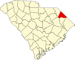
Latta is located in southern Dillon County at 34°20′18″N79°25′59″W / 34.33833°N 79.43306°W / 34.33833; -79.43306 (34.338459, -79.432997). [16] U.S. Routes 301 and 501 pass through the center of town as Second Avenue, leading northeast 6 miles (10 km) to Dillon, the county seat. US 501 leads south 12 miles (19 km) to Marion, while US 301 diverges from US 501 south of town and leads southwest 24 miles (39 km) to Florence. South Carolina Highway 917 is Main Street in Latta, leading west 6 miles (10 km) to Interstate 95 at Exit 181, and southeast 15 miles (24 km) to Mullins.

According to the United States Census Bureau, the town has a total area of 1.1 square miles (2.8 km2), all land. [7]

Demographics

Historical population
CensusPop.Note
1900 453
1910 1,358199.8%
1920 1,079−20.5%
1930 1,1668.1%
1940 1,33414.4%
1950 1,60220.1%
1960 1,90118.7%
1970 1,764−7.2%
1980 1,8042.3%
1990 1,565−13.2%
2000 1,239−20.8%
2010 1,37911.3%
2020 1,296−6.0%
U.S. Decennial Census [17] [3]

As of the census [4] of 2000, there were 1,410 people, 580 households, and 399 families residing in the town. The population density was 1,358.9 inhabitants per square mile (524.7/km2). There were 665 housing units at an average density of 640.9 per square mile (247.5/km2). The racial makeup of the town was 57.94% White, 40.50% African American, 0.71% Native American, 0.07% from other races, and 0.78% from two or more races. Hispanic or Latino of any race were 0.64% of the population.

There were 580 households, out of which 25.9% had children under the age of 18 living with them, 43.6% were married couples living together, 21.4% had a female householder with no husband present, and 31.2% were non-families. 29.7% of all households were made up of individuals, and 15.7% had someone living alone who was 65 years of age or older. The average household size was 2.43 and the average family size was 3.01.

In the town, the population was spread out, with 24.0% under the age of 18, 8.9% from 18 to 24, 23.8% from 25 to 44, 25.2% from 45 to 64, and 18.2% who were 65 years of age or older. The median age was 41 years. For every 100 females, there were 74.7 males. For every 100 females age 18 and over, there were 68.3 males. The median income for a household in the town was $25,833, and the median income for a family was $36,406. Males had a median income of $30,714 versus $19,583 for females. The per capita income for the town was $17,451. About 16.5% of families and 21.2% of the population were below the poverty line, including 24.9% of those under age 18 and 31.4% of those age 65 or over.

Education

Public education in Latta is administered by Latta School District. [18] The district operates Latta Elementary School, Latta Middle School and Latta High School.

Latta has a public library, a branch of the Dillon County Library. [19]

Notable people

Related Research Articles

<span class="mw-page-title-main">Dillon County, South Carolina</span> County in South Carolina, United States

Dillon County is a county located in the U.S. state of South Carolina. As of the 2020 census, the county's population was 28,292. The county seat is Dillon.

<span class="mw-page-title-main">Clarkton, North Carolina</span> Town in North Carolina, United States

Clarkton is a town in Bladen County, North Carolina, United States. The population was 837 at the 2010 census.

<span class="mw-page-title-main">Weldon, North Carolina</span> Town in North Carolina, United States

Weldon is a town in Halifax County, North Carolina, United States. The population was 1,655 at the 2010 census. It is part of the Roanoke Rapids, North Carolina Micropolitan Statistical Area.

<span class="mw-page-title-main">Webster, North Carolina</span> Town in North Carolina, United States

Webster is a town in Jackson County, North Carolina, United States. As of the 2010 census, the population was 363, down from 486 in 2000.

<span class="mw-page-title-main">Belton, South Carolina</span> City in South Carolina, United States

Belton is a city in eastern Anderson County, South Carolina. The population was 4,134 at the 2010 census.

<span class="mw-page-title-main">Barnwell, South Carolina</span> City in South Carolina, United States

Barnwell is a city in and county seat of Barnwell County, South Carolina, United States, located along U.S. Route 278. The population was 4,750 at the 2010 census.

<span class="mw-page-title-main">Blackville, South Carolina</span> Town in South Carolina, United States

Blackville is a small town in Barnwell County, South Carolina, United States. The population was 2,406 at the 2010 census.

<span class="mw-page-title-main">Williston, South Carolina</span> Town in South Carolina, United States

Williston is a town in Barnwell County, South Carolina, United States. The population was 3,139 at the 2010 census.

<span class="mw-page-title-main">Moncks Corner, South Carolina</span> Town in South Carolina, United States

Moncks Corner is a town in and the county seat of Berkeley County, South Carolina, United States. The population was 7,885 at the 2010 census. As defined by the U.S. Census Bureau, Moncks Corner is included within the Charleston-North Charleston-Summerville Metropolitan Statistical Area.

<span class="mw-page-title-main">St. Stephen, South Carolina</span> Town in South Carolina, United States

St. Stephen is a town in Berkeley County, South Carolina, United States. The population was 1,697 at the 2010 census.

<span class="mw-page-title-main">Blacksburg, South Carolina</span> Town in South Carolina, United States

Blacksburg is a small town in Cherokee County, South Carolina, United States. The population was 1,848 at the 2010 census. The communities of Cherokee Falls, Kings Creek, Cashion Crossroads, Buffalo, and Mount Paran are located near the town.

<span class="mw-page-title-main">Chesterfield, South Carolina</span> Town in South Carolina, United States

Chesterfield is a town in Chesterfield County, South Carolina, United States. The population was 1,472 at the 2010 census. It is the county seat of Chesterfield County. At the time of the 2010 census, Chesterfield was the least populous of all of South Carolina's county seats.

<span class="mw-page-title-main">McBee, South Carolina</span> Town in South Carolina, United States

McBee is a town in Chesterfield County, South Carolina, United States. As of the 2010 census, the population was 867. McBee is approximately 36 miles (58 km) northwest of Florence and 62 miles (100 km) northeast of Columbia.

<span class="mw-page-title-main">Dillon, South Carolina</span> City in South Carolina, United States

Dillon is a city in Dillon County in eastern South Carolina, United States. It is the county seat and largest city of Dillon County. It was established on December 22, 1888. Both the name of the city and county comes from James W. Dillon, an early settler and key figure in bringing a railroad through the area. The population was 6,788 in the 2010 U.S. census.

<span class="mw-page-title-main">Lake View, South Carolina</span> Town in South Carolina, United States

Lake View is a town in Dillon County, South Carolina, United States. The population was 807 at the 2010 census.

<span class="mw-page-title-main">Johnston, South Carolina</span> Town in South Carolina, United States

Johnston is a town in Edgefield County, South Carolina, United States. The population was 2,362 at the 2010 census. It is part of the Augusta, Georgia, metropolitan area. The town's official welcome sign states that it is "Peach Capital of the World".

<span class="mw-page-title-main">Ridgeway, South Carolina</span> Town in South Carolina, United States

Ridgeway is a town in Fairfield County, South Carolina, United States. The population was 319 at the 2010 census. It is part of the Columbia, South Carolina Metropolitan Statistical Area.

<span class="mw-page-title-main">Kershaw, South Carolina</span> Town in South Carolina, United States

Kershaw is a town in Lancaster County, South Carolina, United States. It was incorporated in 1888. As of the 2010 census, the population was 1,803, and as of 2019 the estimated population was 2,321. The Haile Gold Mine, where gold was discovered in 1825, is 3 miles (5 km) from town and was at one time the largest single producer of gold in the Appalachian region.

<span class="mw-page-title-main">Marion, South Carolina</span> City in South Carolina, United States

Marion is a city in and the county seat of Marion County, South Carolina, United States. It is named for Francis Marion, a brigadier general from South Carolina in the American Revolutionary War. The population was 6,939 at the 2010 census.

<span class="mw-page-title-main">Chesnee, South Carolina</span> City in South Carolina, United States

Chesnee is a city in Spartanburg and Cherokee counties, in the U.S. state of South Carolina. The population was 868 as of the 2010 census.

References

  1. "Latta town adminstrator [sic] releases statement on firing of police chief". wistv.com. Columbia, South Carolina. Archived from the original on November 15, 2016. Retrieved May 8, 2017.
  2. "ArcGIS REST Services Directory". United States Census Bureau. Retrieved October 15, 2022.
  3. 1 2 "Census Population API". United States Census Bureau. Retrieved October 15, 2022.
  4. 1 2 "U.S. Census website". United States Census Bureau . Retrieved January 31, 2008.
  5. "US Board on Geographic Names". United States Geological Survey. October 25, 2007. Retrieved January 31, 2008.
  6. 1 2 3 4 5 6 7 8 9 10 "History". www.townoflatta.sc.gov. Retrieved September 17, 2015.
  7. 1 2 "Geographic Identifiers: 2010 Demographic Profile Data (G001): Latta town, South Carolina". U.S. Census Bureau, American Factfinder. Archived from the original on February 13, 2020. Retrieved January 5, 2016.
  8. Gannett, Henry (1905). The Origin of Certain Place Names in the United States. U.S. Government Printing Office. p.  182.
  9. "National Register Sites in South Carolina". www.nationalregister.sc.gov. Retrieved September 18, 2015.
  10. "Carnegie Library buildings in South Carolina". www.libsci.sc.edu. Retrieved September 18, 2015.
  11. "Latta Library". May 12, 2014. Retrieved September 18, 2015.
  12. "Dillon County". Jim Forte Postal History. Retrieved June 12, 2015.
  13. Latta council fights for chief's job; Morning News, 2014
  14. Latta voters approve 'strong council' government; Morning News; June 24, 2014.
  15. "National Register Information System". National Register of Historic Places . National Park Service. July 9, 2010.
  16. "US Gazetteer files: 2010, 2000, and 1990". United States Census Bureau. February 12, 2011. Retrieved April 23, 2011.
  17. "Census of Population and Housing". Census.gov. Retrieved June 4, 2015.
  18. "Homepage". Latta Schools. Retrieved June 8, 2019.
  19. "South Carolina libraries and archives". SCIWAY. Retrieved June 8, 2019.