Little Rock, South Carolina | |
|---|---|
 Little Rock  Little Rock | |
| Coordinates: 34°28′05″N79°22′50″W / 34.46806°N 79.38056°W [1] | |
| Country | United States |
| State | South Carolina |
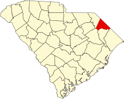
| County | Dillon |
| Area | |
• Total | 2.46 sq mi (6.37 km2) |
| • Land | 2.46 sq mi (6.37 km2) |
| • Water | 0 sq mi (0.00 km2) |
| Elevation | 131 ft (40 m) |
| Population | |
• Total | 658 |
| • Density | 267.6/sq mi (103.34/km2) |
| Time zone | UTC-5 (Eastern (EST)) |
| • Summer (DST) | UTC-4 (EDT) |
| ZIP code | 29567 [4] |
| Area codes | 843, 854 |
| GNIS feature ID | 2812949 [1] |
Little Rock is an unincorporated community and census-designated place (CDP) in Dillon County, South Carolina, United States. [1] Per the 2020 census, the population was 658. [5]
Contents
The community is at the northwest end of the concurrency between South Carolina Highways 9 and 57.
The James W. Hamer House and St. Paul's Methodist Church are listed on the U.S. National Register of Historic Places. [6] The median home price in Little Rock was $37,900 in 2017. There is no metro area in Little Rock. [7]
The only railroad service within Little Rock is the CSX Andrews Subdivision, a former Seaboard Air Line Railroad line that now serves only freight.