Floydale | |
|---|---|
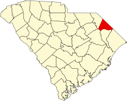
 Floydale Location within the state of South Carolina | |
| Coordinates: 34°19′26″N79°20′10″W / 34.32389°N 79.33611°W | |
| Country | United States |
| State | South Carolina |
| County | Dillon |
| Area | |
• Total | 2.03 sq mi (5.25 km2) |
| • Land | 2.03 sq mi (5.25 km2) |
| • Water | 0 sq mi (0.00 km2) |
| Population | |
• Total | 421 |
| • Density | 207.6/sq mi (80.16/km2) |
| Time zone | UTC-5 (Eastern (EST)) |
| • Summer (DST) | UTC-4 (EDT) |
| FIPS code | 45-25945 |
| GNIS feature ID | 2812952 [3] |
Floyd Dale, shown on federal maps as Floydale, is an unincorporated community and census-designated place (CDP) in Dillon County, South Carolina, United States. It was first listed as a CDP in the 2020 census with a population of 421. [4]
Contents
Near Floyd Dale, there is the Diversified Communications Tower, a guyed mast, which is one of the tallest constructions in the world. This town is home to the Benton family, for whom the main road is named.
The Meekins Barn and Smith Tobacco Barn are listed on the U.S. National Register of Historic Places. [5]