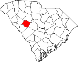
Saluda, South Carolina

Last updated

Saluda, South Carolina
Downtown Saluda, SC.jpg
Downtown Saluda
Saluda, SC Town Seal.png
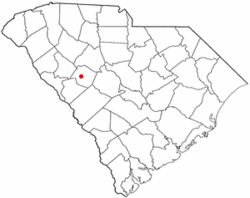
SCMap-doton-Saluda.PNG
Coordinates: 34°0′11″N81°46′18″W / 34.00306°N 81.77167°W / 34.00306; -81.77167
Country United States
State South Carolina
County Saluda
Area
[1]
  Total
3.29 sq mi (8.52 km2)
  Land3.25 sq mi (8.41 km2)
  Water0.04 sq mi (0.11 km2)
Elevation
479 ft (146 m)
Population
 (2020) [2]
  Total
3,122
  Density960.91/sq mi (371.05/km2)
Time zone UTC-5 (EST)
  Summer (DST) UTC-4 (EDT)
ZIP code
29138
Area codes 864, 821
FIPS code 45-63250 [3]
GNIS feature ID1250737 [4]
Website www.townofsaluda.com

Saluda is a town in Saluda County, South Carolina, United States, along the Little Saluda River. The population was 3,565 at the 2010 census. It is the county seat of Saluda County. [5]

Contents

Geography

Saluda is located at 34°0′11″N81°46′18″W / 34.00306°N 81.77167°W / 34.00306; -81.77167 (34.003131, -81.771691). [6]

According to the United States Census Bureau, the town has a total area of 3.3 square miles (8.5 km2), of which 3.2 square miles (8.3 km2) is land and 0.04 square miles (0.10 km2) (1.22%) is water.

The town is shaped like a circle.

Demographics

Historical population
CensusPop.Note
1900 289
1910 610111.1%
1920 1,20397.2%
1930 1,38114.8%
1940 1,5169.8%
1950 1,5945.1%
1960 2,08931.1%
1970 2,44216.9%
1980 2,75212.7%
1990 2,7981.7%
2000 3,0669.6%
2010 3,56516.3%
2020 3,122−12.4%
U.S. Decennial Census [7] [2]

2020 census

Saluda racial composition [8]
RaceNum.Perc.
White (non-Hispanic)78225.05%
Black or African American (non-Hispanic)96330.85%
Native American 60.19%
Asian 70.22%
Other/Mixed 892.85%
Hispanic or Latino 1,27540.84%

As of the 2020 United States census, there were 3,122 people, 1,126 households, and 756 families residing in the town.

2000 census

As of the census [3] of 2000, there were 3,066 people, 1,103 households, and 788 families residing in the town. The population density was 947.1 inhabitants per square mile (365.7/km2). There were 1,211 housing units at an average density of 374.1 per square mile (144.4/km2). The racial makeup of the town was 48.76% White, 40.48% African American, 0.23% Native American, 9.95% from other races, and 0.59% from two or more races. Hispanic or Latino of any race were 19.37% of the population.

There were 1,103 households, out of which 33.6% had children under the age of 18 living with them, 40.8% were married couples living together, 24.6% had a female householder with no husband present, and 28.5% were non-families. 24.5% of all households were made up of individuals, and 11.4% had someone living alone who was 65 years of age or older. The average household size was 2.75 and the average family size was 3.21.

In the town, the population was spread out, with 28.0% under the age of 18, 12.2% from 18 to 24, 28.1% from 25 to 44, 18.6% from 45 to 64, and 13.1% who were 65 years of age or older. The median age was 31 years. For every 100 females, there were 97.9 males. For every 100 females age 18 and over, there were 93.9 males.

The median income for a household in the town was $26,964, and the median income for a family was $31,042. Males had a median income of $25,208 versus $19,921 for females. The per capita income for the town was $13,032. About 22.9% of families and 28.5% of the population were below the poverty line, including 37.4% of those under age 18 and 18.5% of those age 65 or over.

History

Prior to the formation of Saluda County in 1896, the town was named Redbank and was renamed to match the county it became the seat of.

The Bonham House, Butler Family Cemetery, Marsh-Johnson House, Old Strother Place, Saluda Old Town Site, Saluda Theatre, Stevens-Dorn Farmstead, and Whitehall are listed on the National Register of Historic Places. [9]

Education

It is in the Saluda County School District. [10] Saluda County School District includes five public schools: Hollywood Elementary, Saluda Primary, Saluda Elementary, Saluda Middle, and Saluda High School. It also has a private school known as W. Wyman Kings Academy; and two other public schools, Saluda Opportunity School, and Saluda County Adult Education. It has a college center which is Piedmont Technical College Saluda County Center. [11] Based on the information given about fifty-nine percent of the students enrolled in the district during the years 2018-2022 were white, twenty-two percent of the students were Black or African American, twenty-one percent of the students were Hispanic or Latino, one percent were American Indian/ Alaska Native and the rest were some other race or more than one race. About sixty-six percent of the students aged five and above spoke English only at home, and 2.7 percent of the students have a disability. [12]

Saluda has a public library, a branch of the Saluda County Library. [13]

Notable people

Related Research Articles

<span class="mw-page-title-main">Fannin County, Texas</span> County in Texas, United States

Fannin County is a county in the far northeast of the U.S. state of Texas, on the border with Oklahoma. As of the 2020 census, its population was 35,662. The county seat is Bonham.

<span class="mw-page-title-main">Saluda County, South Carolina</span> County in South Carolina, United States

Saluda County is a county in the U.S. state of South Carolina. As of the 2020 census, the population was 18,862. Its county seat is Saluda. The county was formed from northern and eastern portions of Edgefield County.

<span class="mw-page-title-main">Newberry County, South Carolina</span> County in South Carolina, United States

Newberry County is a county located in the U.S. state of South Carolina. As of the 2020 census, its population was 37,719. Its county seat is Newberry. The name is of unknown origin, although one theory suggests that it was named by Quaker settlers in honor of their home of Newberry, a suburb of London in the United Kingdom. Newberry County comprises the Newberry, SC Micropolitan Statistical Area.

<span class="mw-page-title-main">Conoy Township, Pennsylvania</span> Township in Pennsylvania, United States

Conoy Township is a township in northwestern Lancaster County, Pennsylvania, United States. At the 2020 census, the population was 3,373.

<span class="mw-page-title-main">Los Alamos, California</span> Place in California, United States

Los Alamos is an unincorporated community in Santa Barbara County, California, United States. Located in the Los Alamos Valley, the town of Los Alamos is considered to be a part of the Santa Ynez Valley community. Los Alamos is also connected to other cities Vandenberg SFB, Lompoc, Buellton, Solvang, and other Santa Barbara County cities. It is 140 miles northwest of Los Angeles and 281 miles (452 km) south of San Francisco. The population was 1,839 at the 2020 census, down from 1,890 at the 2010 census. For statistical purposes, the United States Census Bureau has defined Los Alamos as a census-designated place (CDP).

<span class="mw-page-title-main">Alamo, Indiana</span> Town in Indiana, United States

Alamo is a town in Ripley Township, Montgomery County, in the U.S. state of Indiana. The population was 66 at the 2020 census, unchanged from 2010.

<span class="mw-page-title-main">Pittston, Maine</span> Town in the state of Maine, United States

Pittston is a town in Kennebec County, Maine, United States. The population was 2,875 at the 2020 census. The town was named after the family of John Pitt, who were early settlers. Pittston is included in the Augusta, Maine micropolitan New England City and Town Area.

<span class="mw-page-title-main">Purdy, Missouri</span> City in Missouri, United States

Purdy is a city in Purdy Township, Barry County, Missouri, United States, on the foothills of the Ozarks, eight miles south of Monett and twelve miles north of Cassville along Highway 37. The population was 1,098 at the 2010 census.

<span class="mw-page-title-main">Alamo, New Mexico</span> Census-designate place in Socorro County, New Mexico, United States

Alamo is a census-designated place (CDP) in Socorro County, New Mexico, United States. The population was 1,085 at the 2010 census. It is the largest community on the Alamo Navajo Indian Reservation.

<span class="mw-page-title-main">Fredericktown, Ohio</span> Village in Ohio, United States

Fredericktown is a village in Knox County, Ohio, United States. The population was 2,648 at the 2020 census.

<span class="mw-page-title-main">Hyde, Pennsylvania</span> Census-designated place in Pennsylvania, United States

Hyde is an unincorporated community and census-designated place (CDP) in Clearfield County, Pennsylvania, United States. The population was 1,303 at the 2020 census.

<span class="mw-page-title-main">Johnston, South Carolina</span> Town in South Carolina, United States

Johnston is a town in Edgefield County, South Carolina, United States. The population was 2,362 at the 2010 census. It is part of the Augusta, Georgia, metropolitan area. The town's official welcome sign states that it is "Peach Capital of the World".

<span class="mw-page-title-main">West Columbia, South Carolina</span> City in South Carolina, US

West Columbia, formerly Brookland, is a city and commuter town in the suburban eastern sections of Lexington County, South Carolina, United States. According to the 2010 census, the population was 14,988, and the 2019 population estimate was 17,998. West Columbia is bordered to the east by Columbia, the state capital, across the Congaree River. It is near Columbia's city center or downtown district as well as the South Carolina State House and the Congaree Vista, known locally as "the Vista". The city is bordered to the south by its sister suburb, Cayce. A small portion of the city borders the town of Lexington to the east. West Columbia is part of the greater Columbia, SC metropolitan statistical area.

<span class="mw-page-title-main">Ridge Spring, South Carolina</span> Town in South Carolina, United States

Ridge Spring is a town in Saluda County, South Carolina, United States. The population was 737 at the 2010 census. It is part of the Columbia, SC Metropolitan Statistical Area. The Mayor-Elect is Ms. Qwendolyn Etheredge.

<span class="mw-page-title-main">Ward, South Carolina</span> Town in South Carolina, United States

Ward is a town in Saluda County, South Carolina, United States. The population was 91 at the 2010 census.

<span class="mw-page-title-main">Alamo, Tennessee</span> Town in Tennessee, United States

Alamo is a town in Crockett County, Tennessee, United States. Its population was 2,461 at the time of the 2010 U.S. Census. Alamo, located in the central part of West Tennessee, is the county seat of Crockett County.

<span class="mw-page-title-main">Bonham, Texas</span> City in Texas, United States

Bonham is a city and is the county seat of Fannin County, Texas, United States. The population was 10,408 at the 2020 census. James Bonham sought the aid of James Fannin at the Battle of the Alamo. Bonham is part of the Texoma region in northern Texas and southern Oklahoma.

<span class="mw-page-title-main">Verona, Virginia</span> CDP in Virginia, United States

Verona is a census-designated place (CDP) in Augusta County, Virginia, United States. The population was 4,239 at the 2010 census. It is part of the Staunton–Waynesboro Micropolitan Statistical Area.

<span class="mw-page-title-main">Monetta, South Carolina</span> Town in South Carolina, United States of America

Monetta is a town in Aiken and Saluda counties, South Carolina, United States. The population was 236 at the 2010 census.

<span class="mw-page-title-main">Piedmont, South Carolina</span> CDP in South Carolina, United States

Piedmont is a census-designated place (CDP) along the Saluda River in Anderson and Greenville counties in the U.S. state of South Carolina. The population was 5,411 at the 2020 census.

References

  1. "ArcGIS REST Services Directory". United States Census Bureau. Retrieved October 15, 2022.
  2. 1 2 "Census Population API". United States Census Bureau. Retrieved October 15, 2022.
  3. 1 2 "U.S. Census website". United States Census Bureau . Retrieved January 31, 2008.
  4. "US Board on Geographic Names". United States Geological Survey. October 25, 2007. Retrieved January 31, 2008.
  5. "Find a County". National Association of Counties. Retrieved June 7, 2011.
  6. "US Gazetteer files: 2010, 2000, and 1990". United States Census Bureau. February 12, 2011. Retrieved April 23, 2011.
  7. "Census of Population and Housing". Census.gov. Retrieved June 4, 2015.
  8. "Explore Census Data". data.census.gov. Retrieved December 15, 2021.
  9. "National Register Information System". National Register of Historic Places . National Park Service. July 9, 2010.
  10. "2020 CENSUS - SCHOOL DISTRICT REFERENCE MAP: Saluda County, SC" (PDF). U.S. Census Bureau . Retrieved October 25, 2024. - Text list
  11. "Education | Saluda County". saludacounty.sc.gov. Retrieved November 22, 2024.
  12. "ACS School District Profile 2018-22". nces.ed.gov. Retrieved November 22, 2024.
  13. "Locations & Hours". Greenville County Library System. Retrieved June 13, 2019.
  14. Congressional biography