Pelzer is a town in Anderson County, South Carolina, United States, along the Saluda River. The population was 89 at the 2010 census, and grew to 1,344 at the 2020 census.

Ridge Spring is a town in Saluda County, South Carolina, United States. The population was 737 at the 2010 census. It is part of the Columbia, SC Metropolitan Statistical Area. The Mayor-Elect is Ms. Qwendolyn Etheredge.
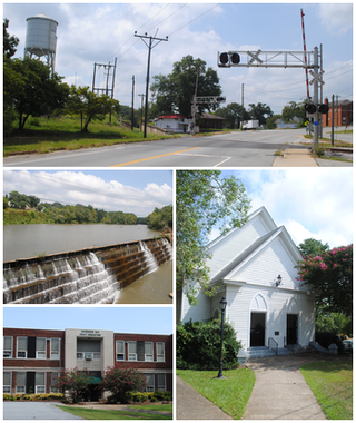
Saluda is a town in Saluda County, South Carolina, United States, along the Little Saluda River. The population was 3,565 at the 2010 census. It is the county seat of Saluda County.

Poinsett Bridge is the oldest bridge in South Carolina and perhaps in the entire southeastern United States. Named for Joel Roberts Poinsett, it was built in 1820 as part of a road from Columbia, South Carolina, to Saluda Mountain. The stone bridge, which includes a 14-foot (4.3 m) Gothic arch and stretches 130 feet (40 m) over Little Gap Creek, may have been designed by Robert Mills, architect of the Washington Monument. Though no longer in use, the bridge remains largely intact and is part of the 400-acre (161.9 ha) Poinsett Bridge Heritage Preserve. There is a nature trail a few hundred yards from the bridge. The bridge, about which ghost stories have been told for decades, is located off U.S. Highway 25 north of Greenville, South Carolina. The bridge was added to the National Register of Historic Places in 1970.

This is a list of the National Register of Historic Places listings in Saluda County, South Carolina.
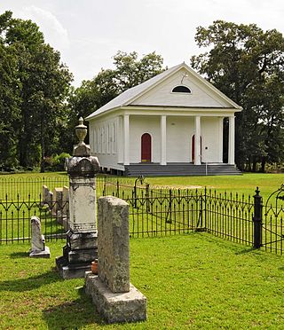
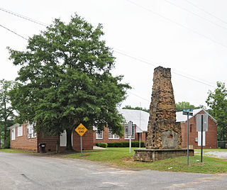
Spann Methodist Church and Cemetery is a historic Methodist church and cemetery located at 150 Church Street in Ward, Saluda County, South Carolina. The church was established c. 1840 and built in 1873. Unchanged since building, it is a one-story, frame meeting house form church with Greek Revival style elements. The front facade features an engaged tetrastyle portico with a pedimented gable roof. The cemetery was established about 1842, and includes a significant collection of funerary art dating to the late-19th and early-20th centuries.

McKendree Mitchell House is a historic home located at Batesburg-Leesville, Lexington County, South Carolina. It was built in 1873, and is a 1+1⁄2-story, Greek Revival style cottage on a brick foundation. It is sheathed in weatherboard and features a projecting central gabled portico.
Saluda Factory Historic District is a national historic district located at West Columbia, Lexington County, South Carolina. It encompasses three contributing sites associated with the development of the area along the Saluda River; Saluda Factory, Camp Sorghum and old State Road. The Saluda Factory ruins consist of the granite foundation and sluices from a textile mill that operated on the river between the years 1834 and 1884. The Camp Sorghum site was the site of a Confederate prison camp. It held 1,300 Union soldiers, who were confined there from the autumn of 1864 to February 1865, and subsequently transferred to Charlotte, North Carolina. The old State Road, originally the Cherokee Path, bounded Saluda Factory and Camp Sorghum on the east.

Webb-Coleman House, also known as Christian's Post Office, is a historic home located near Chappells, Saluda County, South Carolina. It was built between 1800 and 1825, and is a 2+1⁄2-story, five-bay, Federal style farmhouse. It has a gable roof and is sheathed in weatherboard. A one-story, frame wing was added in the mid-19th century and in 1915, a one-story, gable-roofed, frame ell and shed-roofed porch. Also on the property are the contributing mid-to late-19th century cotton house, an early-20th century garage, an early 1930s dollhouse, and an early-20th century tenant house. The house operated as a post office from 1833 to 1844.

Bonham House, also known as Flat Grove, is a historic home located near Saluda, Saluda County, South Carolina. It was built around 1780, and is a two-story, log "dogtrot house." The house sits on fieldstone pillars. It was the boyhood home of Battle of the Alamo soldier James Bonham and his brother politician Milledge Luke Bonham, who served as governor of South Carolina during the American Civil War.

Marsh-Johnson House, also known as Robert Johnson House, is a historic home located near Saluda, Saluda County, South Carolina. It was built about 1817, and is a two-story, log farmhouse sheathed in weatherboard. The house sits on a brick foundation and has a one-story, shed-roofed porch. It is considered one of the earliest and intact log residences in South Carolina. The house rests on massive brick piers, which are laid in Flemish bond. A one-story, shed-roofed porch with wooden foundation piers and four rough hewn tree trunks supporting the roof spans the façade. Many of the windows retain their batten shutters.

Stevens–Dorn Farmstead, also known as the Peter M. Dorn Homeplace, is a historic home and farmstead located near Saluda, Saluda County, South Carolina. The house was built in three phases between 1880 and 1900, and is a one-story, rectangular, frame dwelling. The house consists of 1 1/2 rooms, with three major front doors and one minor front door. Also on the property are a contributing woodshed/buggy house, smokehouse, corn crib, and barn, all built about 1880; and three brooder houses dated to about 1945.

Whitehall is a historic home located at Saluda, Saluda County, South Carolina. It was built in about 1893, and is a Classical Revival style frame dwelling with a two-story, rectangular main block with additions. Two façades feature tetrastyle, two-story porticos with Corinthian order columns. Also on the property are 11 outbuildings. It has two sunken rice patties. It was the home of the locally prominent Etheredge family.
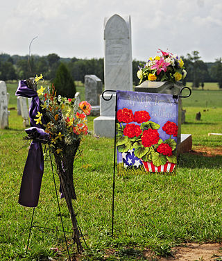
Butler Family Cemetery is a historic family cemetery located near Saluda, Saluda County, South Carolina. It is located behind the Butler Methodist Church. It was established about 1802, and includes the graves of members of one of South Carolina's leading families. Notable burials include: William Butler (1759–1821), Pierce Mason Butler (1798–1847) and Andrew Pickens Butler (1796–1857).

Saluda Theatre is a historic movie theater located at Saluda, Saluda County, South Carolina. It was built in 1936, and is a two-story, stuccoed masonry building in the Art Deco style. The theater closed in 1981. It was restored after 1987, and is home to the Saluda Players.
Ridge Hill High School, also known as Ridge Spring Star Community Center, is a historic high-school building for African-American students located at Ridge Spring, Saluda County, South Carolina. It was built in 1934, and is a large, one-story, H-shaped building with a central multipurpose room and six classrooms. Ridge Hill was used as a high school until the 1956–1957 school year. It remains in use as a community center.
Saluda Old Town Site is a historic archaeological site located near Saluda, Saluda County, South Carolina. Archaeological remains indicate the site was occupied between 5,000 and 2,000 years ago. It was the site of a town of the Saluda people of the late-17th and early-18th century. On July 2, 1755, it was the site of a treaty signing recognizing the sovereignty of the King of England over all 360,000 square miles of Cherokee lands in South Carolina. In 1769, those lands formed the Ninety-Six District.

Building at 303 Saluda Avenue, also known as John C. Heslep House, is a historic home located at Columbia, South Carolina. It was built about 1917 as a two-story brick residence, then remodeled and rebuilt in the Spanish Colonial Revival style in 1927–1928. It features a low-pitched tile roof, coarse stucco walls, and cast iron balconies. Also on the property is a contributing guest house.

Saluda Main Street Historic District is a national historic district located at Saluda, Polk County, North Carolina. The district encompasses 16 contributing buildings, 1 contributing site, and 1 contributing structure in the central business district of Saluda. It includes buildings dated from about 1878 to 1946 and notable examples of Late Gothic Revival and Stick style / Eastlake movement architecture. Notable buildings include the Saluda Presbyterian Church (1895-1896), former Saluda Depot, the Saluda City Hall (1896-1907), the M. A. Pace Store (1905-1910), Thompson's Store (1905-1910), Pebbledash Building (1911-1916), Top Service Station (1930s), and the former United States Post Office.

The Hanckel-Barclay House, also known as Chestnut Hill, is a historic house in the Dunn's Rock community near Brevard, Transylvania County, North Carolina, bordered by the French Broad River and US Highway 276. The house was listed on the National Register of Historic Places in 1999.


