National Register of Historic Places listings in Cherokee County, South Carolina

Last updated

Location of Cherokee County in South Carolina Map of South Carolina highlighting Cherokee County.svg
Location of Cherokee County in South Carolina

This is a list of the National Register of Historic Places listings in Cherokee County, South Carolina.

Contents

This is intended to be a complete list of the properties and districts on the National Register of Historic Places in Cherokee County, South Carolina, United States. The locations of National Register properties and districts for which the latitude and longitude coordinates are included below, may be seen in a map. [1]

There are 25 properties and districts listed on the National Register in the county. Another 4 properties and districts were once listed but have been removed.


    This National Park Service list is complete through NPS recent listings posted August 5, 2022. [2]

Map all coordinates using: OpenStreetMap  
Download coordinates as: KML

Current listings

[3] Name on the Register [4] ImageDate listed [5] Location City or townDescription
1 Archeological Site 38CK1 December 10, 1980
(#80003661)
Address Restricted
Gaffney
2 Archeological Site 38CK44 December 10, 1980
(#80003662)
Address Restricted
Gaffney
3 Archeological Site 38CK45 December 10, 1980
(#80003663)
Address Restricted
Gaffney
4 Carnegie Free Library
Carnegie Free Library CarnegieFreeLibrary 9887.jpg
Carnegie Free Library
June 2, 2000
(#00000587)
210 N. Limestone St.
35°04′25″N81°38′54″W / 35.073611°N 81.648333°W / 35.073611; -81.648333 (Carnegie Free Library)
Gaffney
5 Coopersville Ironworks Site (38CK2) and Susan Furnace Site (38CK67) November 13, 1976
(#76001699)
Address Restricted
Gaffney
6 Cowpens Furnace Site (38CK73)
Cowpens Furnace Site (38CK73) Cowpens Iron Furnace, 1000 feet East of County Road 34 & Cherokee Creek Bridge, Gaffney (Cherokee County, South Carolina).jpg
Cowpens Furnace Site (38CK73)
May 8, 1987
(#87000704)
Address Restricted
Gaffney
7 Cowpens National Battlefield
Cowpens National Battlefield Cowpens - main sign 2.JPG
Cowpens National Battlefield
October 15, 1966
(#66000072)
2 miles (3.2 km) east of Chesnee at the junction of South Carolina Highways 11 and 110
35°08′02″N81°48′40″W / 35.133889°N 81.811111°W / 35.133889; -81.811111 (Cowpens National Battlefield)
Chesnee
8 Winnie Davis Hall
Winnie Davis Hall Winnie Davis Hall.jpg
Winnie Davis Hall
April 29, 1977
(#77001219)
1115 College Dr.
35°03′23″N81°39′00″W / 35.056389°N 81.65°W / 35.056389; -81.65 (Winnie Davis Hall)
Gaffney
9 Ellen Furnace Site (38CK68) May 8, 1987
(#87000705)
Address Restricted
Gaffney
10 Gaffney Commercial Historic District
Gaffney Commercial Historic District Gaffney HIstorical District.jpg
Gaffney Commercial Historic District
March 27, 1986
(#86000602)
Roughly N. Limestone St. between Cherokee Ave. and E. Meadow St.
35°04′20″N81°38′50″W / 35.072222°N 81.647222°W / 35.072222; -81.647222 (Gaffney Commercial Historic District)
Gaffney
11 Gaffney Residential Historic District
Gaffney Residential Historic District Gaffeny Residential Historic District.jpg
Gaffney Residential Historic District
March 27, 1986
(#86000601)
Roughly bounded by Floyd Baker Boulevard, Johnson and Thompson Sts., Rutledge and Fairview Aves., and Limestone St.
35°04′01″N81°38′54″W / 35.066944°N 81.648333°W / 35.066944; -81.648333 (Gaffney Residential Historic District)
Gaffney
12 Zeno Hicks House
Zeno Hicks House Zeno Hicks House.jpg
Zeno Hicks House
February 9, 1989
(#89000002)
U.S. Route 221 and Mill Gap Rd.
35°09′07″N81°51′21″W / 35.151944°N 81.855833°W / 35.151944; -81.855833 (Zeno Hicks House)
Chesnee
13 Irene Mill Finishing Plant
Irene Mill Finishing Plant Irene Mill Finishing Plant.jpg
Irene Mill Finishing Plant
March 27, 1986
(#86000591)
Western side of Buford St. between Liberty and Logan Sts.
35°04′28″N81°38′36″W / 35.074444°N 81.643333°W / 35.074444; -81.643333 (Irene Mill Finishing Plant)
Gaffney
14 Jefferies House
Jefferies House Jeffries House.jpg
Jefferies House
March 27, 1986
(#86000594)
306 S. Grannard St.
35°04′16″N81°39′11″W / 35.071111°N 81.653056°W / 35.071111; -81.653056 (Jefferies House)
Gaffney
15 King's Creek Furnace Site (38CK71) May 8, 1987
(#87000707)
Address Restricted
Kings Creek
16 Kings Mountain National Military Park
Kings Mountain National Military Park Kings Mountain Monument, South Carolina.jpg
Kings Mountain National Military Park
October 15, 1966
(#66000079)
Northwest of Bethany on South Carolina Highway 161
35°08′16″N81°23′22″W / 35.137778°N 81.389444°W / 35.137778; -81.389444 (Kings Mountain National Military Park)
Bethany Extends into York County
17 Kings Mountain State Park Historic District
Kings Mountain State Park Historic District Kings Mountain State Park Entrance.jpg
Kings Mountain State Park Historic District
March 14, 2008
(#08000185)
1277 Park Rd.
35°07′50″N81°20′44″W / 35.130579°N 81.345549°W / 35.130579; -81.345549 (Kings Mountain State Park Historic District)
Blacksburg
18 Limestone Springs Historic District
Limestone Springs Historic District Limestone College.png
Limestone Springs Historic District
March 27, 1986
(#86000597)
O'Neal St. extension and Limestone College campus
35°03′14″N81°38′53″W / 35.053889°N 81.648056°W / 35.053889; -81.648056 (Limestone Springs Historic District)
Gaffney
19 Magness-Humphries House
Magness-Humphries House Magnes Humphries House.jpg
Magness-Humphries House
October 20, 2001
(#01001159)
101 Grassy Pond Rd.
35°08′08″N81°40′26″W / 35.135556°N 81.673889°W / 35.135556; -81.673889 (Magness-Humphries House)
Gaffney
20 Mulberry Chapel Methodist Church
Mulberry Chapel Methodist Church Mulberry Chapel United Methodist Church - Pacolet, SC.jpg
Mulberry Chapel Methodist Church
June 21, 2012
(#12000370)
582 Asbury Rd.
34°55′48″N81°39′15″W / 34.93003333°N 81.65416667°W / 34.93003333; -81.65416667 (Mulberry Chapel Methodist Church)
Pacolet vicinity
21 Nesbitt's Limestone Quarry (38CK69) May 8, 1987
(#87000710)
Address Restricted
Gaffney
22 Nuckolls-Jefferies House
Nuckolls-Jefferies House Nuckolls-Jefferies House.jpg
Nuckolls-Jefferies House
April 18, 2007
(#07000336)
571 Asbury Rd.
34°55′56″N81°39′40″W / 34.932096°N 81.661089°W / 34.932096; -81.661089 (Nuckolls-Jefferies House)
Pacolet
23 Settlemyer House
Settlemyer House Settlemeyer House.jpg
Settlemyer House
March 27, 1986
(#86000598)
915 N. Limehouse St.
35°04′47″N81°38′36″W / 35.079722°N 81.643333°W / 35.079722; -81.643333 (Settlemyer House)
Gaffney
24 Shiloh Presbyterian Church Cemetery
Shiloh Presbyterian Church Cemetery Old Shiloh Presbyterian Church Cemetery 1780-1916.jpg
Shiloh Presbyterian Church Cemetery
December 22, 2011
(#11000954)
Elm St., 0.9 miles (1.4 km) south of U.S. Route 29
35°10′09″N81°25′57″W / 35.169297°N 81.432442°W / 35.169297; -81.432442 (Shiloh Presbyterian Church Cemetery)
Blacksburg Extends into Cleveland County, North Carolina
25 Thicketty Mountain Ore Pits (38CK74) May 8, 1987
(#87000711)
Address Restricted
Shady Grove Church

Former listings

[3] Name on the RegisterImageDate listedDate removedLocationCity or townDescription
1 Robbs House March 27, 1986
(#86000593)
March 15, 2000310 W. Buford St.
Gaffney Demolished on January 17, 1991. [6]
2 Sarratt House March 27, 1986
(#86000599)
March 15, 2000217 Marion St.
Gaffney Demolished.
3 Victor Cotton Oil Company Complex March 27, 1986
(#86000596)
March 15, 2000West side of Frederick St. between Hill St. and Johnson St.
Gaffney Demolished.
4 West End Elementary School March 27, 1986
(#86000600)
March 15, 2000Floyd Baker Blvd. and Broad St.
Gaffney Demolished.

See also

Related Research Articles

National Register of Historic Places listings in Richland County, South Carolina

This is a list of the National Register of Historic Places listings in Richland County, South Carolina.

National Register of Historic Places listings in Sumter County, South Carolina

This is a list of the National Register of Historic Places listings in Sumter County, South Carolina.

National Register of Historic Places listings in York County, South Carolina

This is a list of the National Register of Historic Places listings in York County, South Carolina.

National Register of Historic Places listings in Darlington County, South Carolina

This is a list of items on the National Register of Historic Places listings in Darlington County, South Carolina.

National Register of Historic Places listings in Lancaster County, South Carolina

This is a list of the National Register of Historic Places listings in Lancaster County, South Carolina.

National Register of Historic Places listings in Union County, South Carolina

This is a list of the National Register of Historic Places listings in Union County, South Carolina.

National Register of Historic Places listings in Florence County, South Carolina

This is a list of the National Register of Historic Places listings in Florence County, South Carolina.

National Register of Historic Places listings in Laurens County, South Carolina

This is a list of the National Register of Historic Places listings in Laurens County, South Carolina.

National Register of Historic Places listings in Abbeville County, South Carolina

This is a list of the National Register of Historic Places listings in Abbeville County, South Carolina.

National Register of Historic Places listings in Allendale County, South Carolina

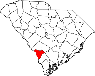
This is a list of the National Register of Historic Places listings in Allendale County, South Carolina.

National Register of Historic Places listings in Anderson County, South Carolina

This is a list of the National Register of Historic Places listings in Anderson County, South Carolina.

National Register of Historic Places listings in Bamberg County, South Carolina

This is a list of the National Register of Historic Places listings in Bamberg County, South Carolina.

National Register of Historic Places listings in Dillon County, South Carolina

This is a list of the National Register of Historic Places listings in Dillon County, South Carolina.

National Register of Historic Places listings in Dorchester County, South Carolina

This is a list of the National Register of Historic Places listings in Dorchester County, South Carolina.

National Register of Historic Places listings in Greenwood County, South Carolina

This is a list of the National Register of Historic Places listings in Greenwood County, South Carolina.

National Register of Historic Places listings in Kershaw County, South Carolina

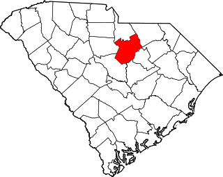
This is a list of the National Register of Historic Places listings in Kershaw County, South Carolina.

National Register of Historic Places listings in Marlboro County, South Carolina

This is a list of the National Register of Historic Places listings in Marlboro County, South Carolina.

National Register of Historic Places listings in Saluda County, South Carolina

This is a list of the National Register of Historic Places listings in Saluda County, South Carolina.

National Register of Historic Places listings in Cherokee County, North Carolina

This list includes properties and districts listed on the National Register of Historic Places in Cherokee County, North Carolina. Click the "Map of all coordinates" link to the right to view an online map of all properties and districts with latitude and longitude coordinates in the table below.

National Register of Historic Places listings in Clay County, North Carolina

This list includes properties and districts listed on the National Register of Historic Places in Clay County, North Carolina. Click the "Map of all coordinates" link to the right to view a Google map of all properties and districts with latitude and longitude coordinates in the table below.

References

  1. The latitude and longitude information provided in this table was derived originally from the National Register Information System, which has been found to be fairly accurate for about 99% of listings. Some locations in this table may have been corrected to current GPS standards.
  2. National Park Service, United States Department of the Interior, "National Register of Historic Places: Weekly List Actions", retrieved August 5, 2022.
  3. 1 2 Numbers represent an alphabetical ordering by significant words. Various colorings, defined here, differentiate National Historic Landmarks and historic districts from other NRHP buildings, structures, sites or objects.
  4. "National Register Information System". National Register of Historic Places . National Park Service. March 13, 2009.
  5. The eight-digit number below each date is the number assigned to each location in the National Register Information System database, which can be viewed by clicking the number.
  6. "Historic home is razed". The Gaffney Ledger . January 18, 1991. p. 2A. Retrieved August 22, 2022 via Newspapers.com.