Lexington, South Carolina | |
|---|---|
 | |
 Seal | |
| Motto: "Town of Progress" | |
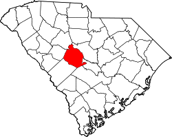
 Lexington Location in South Carolina  Lexington Location in the United States | |
| Coordinates: 33°59′52″N81°13′51″W / 33.99778°N 81.23083°W | |
| Country | United States |
| State | South Carolina |
| County | Lexington County |
| Established | 1861 |
| Named after | Battles of Lexington and Concord [a] |
| Government | |
| • Type | Mayor-Council |
| • Body | Lexington Town Council |
| Area | |
• Total | 12.12 sq mi (31.38 km2) |
| • Land | 11.97 sq mi (31.00 km2) |
| • Water | 0.15 sq mi (0.38 km2) |
| Elevation | 315 ft (96 m) |
| Population | |
• Total | 23,568 |
| • Rank | 22nd |
| • Density | 1,968.9/sq mi (760.19/km2) |
| Time zone | UTC−5 (Eastern (EST)) |
| • Summer (DST) | UTC−4 (EDT) |
| ZIP codes | 29071, 29072, 29073 |
| Area codes | 803, 839 |
| FIPS code | 45-41335 [4] |
| GNIS feature ID | 2406014 [2] |
| Website | www |
Lexington is the most populous town in and the county seat of Lexington County, South Carolina, United States. [5] It is a suburb of the state capital, Columbia. The population was 23,568 at the 2020 Census, [6] and it is the second-most populous municipality in the greater Columbia area. The 2022 estimated population is 24,626. [7] According to the Central Midlands Council of Governments, the greater Lexington area [b] had an estimated population of 111,549 in 2020 and is considered the fastest-growing area in the Midlands. [8]
Contents
- History
- Colonial Period
- Post-revolution
- Recent history
- National Register of Historic Places
- Government
- Elected Officials
- Geography
- Climate
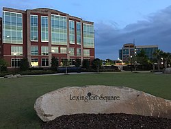
- Economy
- Transportation
- Public transportation
- Roads and highways
- Tourism
- Demographics
- 2020 census
- 2010 census
- Education
- Library
- Neighboring towns and cities
- Notable people
- Notes
- References
- External links