Gilbert, South Carolina

Last updated

Gilbert, South Carolina
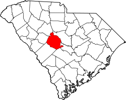
SCMap-doton-Gilbert.PNG
Location of Gilbert, South Carolina
Coordinates: 33°55′32″N81°23′40″W / 33.92556°N 81.39444°W / 33.92556; -81.39444
Country United States
State South Carolina
County Lexington
Area
[1]
  Total2.77 sq mi (7.18 km2)
  Land2.71 sq mi (7.02 km2)
  Water0.06 sq mi (0.16 km2)
Elevation
[2]
541 ft (165 m)
Population
 (2020) [3]
  Total571
  Density210.70/sq mi (81.36/km2)
Time zone UTC-5 (Eastern (EST))
  Summer (DST) UTC-4 (EDT)
ZIP code
29054
Area code(s) 803, 839
FIPS code 45-29050 [4]
GNIS feature ID1245735 [2]
Website www.townofgilbertsc.com

Gilbert is a town in Lexington County, South Carolina, United States. The population was 569 at the 2010 census. It is part of the Columbia, South Carolina Metropolitan Statistical Area.

Contents

History

The David Jefferson Griffith House and Music Hall Evangelical Lutheran Church were listed on the U.S. National Register of Historic Places in 1983. [5]

Geography

According to the United States Census Bureau, the town has a total area of 2.3 square miles (6.0 km2), of which 2.3 square miles (6.0 km2) is land and 0.1 square miles (0.26 km2) (2.58%) is water.

Demographics

Historical population
CensusPop.Note
1880 141
1890 115−18.4%
1900 17854.8%
1910 162−9.0%
1920 22639.5%
1930 2354.0%
1940 153−34.9%
1950 17212.4%
1960 171−0.6%
1970 1868.8%
1980 21113.4%
1990 32453.6%
2000 50054.3%
2010 56513.0%
2020 5711.1%
U.S. Decennial Census [6] [3]

As of the census [4] of 2000, there were 500 people, 181 households, and 148 families residing in the town. The population density was 220.7 inhabitants per square mile (85.2/km2). There were 195 housing units at an average density of 86.1 per square mile (33.2/km2). The racial makeup of the town was 94.60% White, 3.60% African American, 0.20% Native American, 0.20% Asian, 0.20% from other races, and 1.20% from two or more races. Hispanic or Latino of any race were 1.60% of the population.

There were 181 households, out of which 53.0% had children under the age of 18 living with them, 56.4% were married couples living together, 16.6% had a female householder with no husband present, and 18.2% were non-families. 16.0% of all households were made up of individuals, and 6.6% had someone living alone who was 65 years of age or older. The average household size was 2.76 and the average family size was 3.05.

In the town, the population was spread out, with 33.2% under the age of 18, 7.0% from 18 to 24, 32.4% from 25 to 44, 19.6% from 45 to 64, and 7.8% who were 65 years of age or older. The median age was 32 years. For every 100 females, there were 93.8 males. For every 100 females age 18 and over, there were 96.5 males.

The median income for a household in the town was $46,563, and the median income for a family was $52,500. Males had a median income of $35,707 versus $25,000 for females. The per capita income for the town was $19,909. About 8.9% of families and 8.6% of the population were below the poverty line, including 11.3% of those under age 18 and 15.6% of those age 65 or over.

Arts and culture

Gilbert hosts the annual Lexington County Peach Festival, held in July. [7]

Gilbert has a public library, a branch of the Lexington County Library. [8]

Education

Public education in Gilbert is administered by Lexington County School District One. [9] The district operates Centerville Elementary School, Gilbert Elementary School, Gilbert Middle School, and Gilbert High School.

Related Research Articles

<span class="mw-page-title-main">Lexington County, South Carolina</span> County in South Carolina, United States

Lexington County is a county located in the U.S. state of South Carolina. As of the 2020 census, the population was 293,991. Its county seat and largest community is Lexington. The county was chartered in 1785 and was named in commemoration of Lexington, Massachusetts, the site of the Battle of Lexington in the American Revolutionary War. Lexington County is the sixth-most populous county in South Carolina by population and is part of the Columbia, SC Metropolitan Statistical Area. It is located in the Midlands region of South Carolina.

<span class="mw-page-title-main">Peach Orchard, Arkansas</span> City in Arkansas, United States

Peach Orchard is a city in Clay County, Arkansas, United States. The population was 135 at the 2010 census.

<span class="mw-page-title-main">Stanley, North Carolina</span> Town in North Carolina, United States

Stanley is a town in Gaston County, North Carolina, United States. The population was 3,556 at the 2010 census.

<span class="mw-page-title-main">Candor, North Carolina</span> Town in North Carolina, United States

Candor is a town in Montgomery County, North Carolina, United States. The population was 840 at the 2010 census. Candor is the home of the North Carolina Peach Festival, which is held every year on the third Saturday of July. The town's welcome sign reads: Welcome to Candor. Peach Capital.

<span class="mw-page-title-main">Rutherfordton, North Carolina</span> Town in North Carolina, United States

Rutherfordton is a town and the county seat of Rutherford County, North Carolina, United States. The population was 4,213 at the 2010 census.

<span class="mw-page-title-main">Johnston, South Carolina</span> Town in South Carolina, United States

Johnston is a town in Edgefield County, South Carolina, United States. The population was 2,362 at the 2010 census. It is part of the Augusta, Georgia, metropolitan area. The town's official welcome sign states that it is "Peach Capital of the World".

<span class="mw-page-title-main">Gaston, South Carolina</span> Town in South Carolina, United States

Gaston is a town in Lexington County, South Carolina, United States. The population was 1,645 at the 2010 census. It is part of the Columbia, South Carolina Metropolitan Statistical Area.

<span class="mw-page-title-main">Pelion, South Carolina</span> Town in South Carolina, United States

Pelion is a town in Lexington County, South Carolina, United States. The population was 674 at the 2010 census. It is part of the Columbia, South Carolina Metropolitan Statistical Area.

Pine Ridge is a town in Lexington County, South Carolina, United States. The population was 2,064 at the 2010 census. It is part of the Columbia, South Carolina Metropolitan Statistical Area.

<span class="mw-page-title-main">Red Bank, South Carolina</span> Census-designated place in South Carolina, United States

Red Bank is an unincorporated community and census-designated place (CDP) in Lexington County, South Carolina, United States. The population was 9,617 at the 2010 census, up from 8,811 at the 2000 census. It is part of the Columbia, South Carolina Metropolitan Statistical Area.

Seven Oaks is a census-designated place (CDP) in Lexington County, South Carolina, United States, 8 miles (13 km) northwest of downtown Columbia, the state capital. The population of the CDP was 15,144 at the 2010 census. It is part of the Columbia Metropolitan Statistical Area.

<span class="mw-page-title-main">South Congaree, South Carolina</span> Town in South Carolina, United States

South Congaree is a town in Lexington County, South Carolina, United States. The population was 2,306 at the 2010 census. It is part of the Columbia, South Carolina Metropolitan Statistical Area.

Springdale is a town in Lexington County, South Carolina, United States. The population was 2,636 at the 2010 census. It is part of the Columbia Metropolitan Statistical Area.

<span class="mw-page-title-main">Summit, South Carolina</span> Town in South Carolina, United States

Summit is a town in Lexington County, South Carolina, United States. The population was 402 at the 2010 census. It is part of the Columbia, South Carolina Metropolitan Statistical Area.

<span class="mw-page-title-main">Swansea, South Carolina</span> Town in South Carolina, United States

Swansea is a town in Lexington County, South Carolina, United States. The population was 827 at the 2010 census. It is part of the Columbia, South Carolina Metropolitan Statistical Area.

<span class="mw-page-title-main">West Columbia, South Carolina</span> City in South Carolina, United States

West Columbia, formerly Brookland, is a city and commuter town in the suburban eastern sections of Lexington County, South Carolina, United States. According to the 2010 census, the population was 14,988, and the 2019 population estimate was 17,998. West Columbia is bordered to the east by Columbia, the state capital, across the Congaree River. It is near Columbia's city center or downtown district as well as the South Carolina State House and the Congaree Vista, known locally as "the Vista." The city is bordered to the south by its sister suburb, Cayce. A small portion of the city borders the town of Lexington to the east. West Columbia is part of the greater Columbia, SC metropolitan statistical area.

<span class="mw-page-title-main">Lexington, Tennessee</span> City in Tennessee, United States

Lexington is a city in Henderson County, Tennessee, United States. Lexington is midway between Memphis and Nashville, lying 10 miles (16 km) south of Interstate 40, which connects the two cities. The population was 7,956 at the 2020 census. It is the county seat of Henderson County.

<span class="mw-page-title-main">West Logan, West Virginia</span> Town in West Virginia, United States

West Logan is a town along the Guyandotte River in Logan County, West Virginia, United States. The population was 400 at the 2020 census. For unknown reasons, some sources report West Logan to lay west of the county seat at Logan, attributing to this fact the name.

<span class="mw-page-title-main">Gilbert, West Virginia</span> Town in West Virginia, United States

Gilbert is a town in Mingo County, West Virginia, United States, along the Guyandotte River. The population was 333 at the 2020 census. Gilbert was incorporated in 1918 and named for Gilbert Creek, which derives its name from the name of an early traveler in the area who was killed by Native Americans. Gilbert is known nationwide for the Hatfield-McCoy ATV Trails that are located in the area. There are a number of lodges and restaurants in Gilbert.

<span class="mw-page-title-main">Irmo, South Carolina</span> Town in South Carolina, United States

Irmo is a town in Lexington and Richland counties, South Carolina, United States and a suburb of Columbia. It is part of the Columbia Metropolitan Statistical Area and is located 12 miles (19 km) northwest of the city center. The population of Irmo was 11,097 at the 2010 census.

References

  1. "ArcGIS REST Services Directory". United States Census Bureau. Retrieved October 15, 2022.
  2. 1 2 U.S. Geological Survey Geographic Names Information System: Gilbert, South Carolina
  3. 1 2 "Census Population API". United States Census Bureau. Retrieved October 15, 2022.
  4. 1 2 "U.S. Census website". United States Census Bureau . Retrieved January 31, 2008.
  5. "National Register Information System". National Register of Historic Places . National Park Service. March 13, 2009.
  6. "Census of Population and Housing". Census.gov. Retrieved June 4, 2015.
  7. "About". Lexington County Peach Festival. Retrieved June 13, 2019.
  8. "Locations & Hours". Greenville County Library System. Retrieved June 13, 2019.
  9. "Homepage". Lexington County School District One. Retrieved June 13, 2019.