Seven Oaks, South Carolina

Last updated • 2 min readFrom Wikipedia, The Free Encyclopedia

Seven Oaks, South Carolina
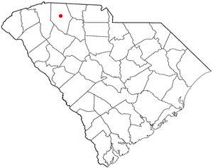
USA South Carolina location map.svg
Red pog.svg
Seven Oaks
Location in South Carolina
Usa edcp location map.svg
Red pog.svg
Seven Oaks
Location in the United States
Coordinates: 34°2′57″N81°8′31″W / 34.04917°N 81.14194°W / 34.04917; -81.14194
CountryUnited States
State South Carolina
County Lexington
Area
[1]
  Total7.77 sq mi (20.11 km2)
  Land7.65 sq mi (19.82 km2)
  Water0.11 sq mi (0.30 km2)
Elevation
[2]
217 ft (66 m)
Population
 (2020) [3]
  Total14,652
  Density1,914.79/sq mi (739.32/km2)
Time zone UTC−5 (Eastern (EST))
  Summer (DST) UTC−4 (EDT)
FIPS code 45-65207 [4]
GNIS feature ID1867530 [2]

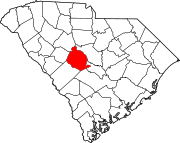
Seven Oaks is a census-designated place (CDP) in Lexington County, South Carolina, United States, 8 miles (13 km) northwest of downtown Columbia, the state capital. The population of the CDP was 15,144 at the 2010 census. [5] It is part of the Columbia Metropolitan Statistical Area.

Contents

Geography

Seven Oaks is located in northeastern Lexington County at 34°2′57″N81°8′31″W / 34.04917°N 81.14194°W / 34.04917; -81.14194 (34.049200, -81.141948). [6] It is bordered to the northwest by the city of Irmo, to the southeast by Columbia and West Columbia, and to the northeast by unincorporated St. Andrews in neighboring Richland County. The CDP contains the neighborhoods of Challedon, Whitehall, Grenadier, and Woodland Hills.

I-26 runs through the northeast side of Seven Oaks, with access from Exit 104 (Piney Grove Road) and Exit 106 (Saint Andrews Road). I-20 passes through the southern part of the community, with access from Exit 63 (Bush River Road). I-26 and I-20 intersect at an interchange on the eastern border of the community.

According to the United States Census Bureau, the Seven Oaks CDP has a total area of 7.7 square miles (20.0 km2), of which 7.6 square miles (19.8 km2) are land and 0.1 square miles (0.3 km2), or 1.47%, are water. [7] The Saluda River forms the southwest border of the CDP.

Demographics

Historical population
CensusPop.Note
2020 14,652
U.S. Decennial Census [8]

2020 census

Seven Oaks racial composition [9]
RaceNum.Perc.
White (non-Hispanic)7,41050.57%
Black or African American (non-Hispanic)5,22335.65%
Native American 310.21%
Asian 4382.99%
Pacific Islander 470.32%
Other/Mixed 7104.85%
Hispanic or Latino 7935.41%

As of the 2020 United States census, there were 14,652 people, 6,703 households, and 4,174 families residing in the CDP.

2000 census

At the 2000 census there were 15,755 people, 6,633 households, and 4,324 families living in the CDP. The population density was 2,007.9 inhabitants per square mile (775.3/km2). There were 6,979 housing units at an average density of 889.4 per square mile (343.4/km2). The racial makeup of the CDP was 73.51% White, 21.50% African American, 0.33% Native American, 2.81% Asian, 0.06% Pacific Islander, 0.58% from other races, and 1.21% from two or more races. Hispanic or Latino of any race were 1.89%. [4]

Of the 6,633 households 30.4% had children under the age of 18 living with them, 50.5% were married couples living together, 11.8% had a female householder with no husband present, and 34.8% were non-families. 27.9% of households were one person and 6.8% were one person aged 65 or older. The average household size was 2.35 and the average family size was 2.89.

The age distribution was 23.3% under the age of 18, 9.5% from 18 to 24, 30.7% from 25 to 44, 25.2% from 45 to 64, and 11.3% 65 or older. The median age was 36 years. For every 100 females, there were 89.0 males. For every 100 females age 18 and over, there were 85.1 males.

The median household income was $47,019 and the median family income was $58,890. Males had a median income of $37,508 versus $27,940 for females. The per capita income for the CDP was $22,388. About 4.6% of families and 6.8% of the population were below the poverty line, including 11.3% of those under age 18 and 4.8% of those age 65 or over.

Related Research Articles

<span class="mw-page-title-main">Whale Pass, Alaska</span> Second Class City in Alaska, United States

Whale Pass is a second class city in Prince of Wales-Hyder Census Area, Alaska, United States. The population was 31 at the 2010 census, down from 58 in 2000.

Tazlina is a census-designated place (CDP) in the Copper River Census Area, Alaska, United States. At the 2020 census the population was 244, down from 297 in 2010.

<span class="mw-page-title-main">Bluewater, Arizona</span> CDP in La Paz County, Arizona

Bluewater is a census-designated place (CDP) on the Colorado River Indian Reservation in La Paz County, Arizona, United States. The population was 725 at the 2010 census.
<span class="mw-page-title-main">South San Gabriel, California</span> Census-designated place in California, United States

South San Gabriel is a census-designated place (CDP) in Los Angeles County, California, United States. The population was 8,070 at the 2010 census, up from 7,595 at the 2000 census.

<span class="mw-page-title-main">San Carlos Park, Florida</span> Census-designated place in Florida, United States

San Carlos Park is a census-designated place (CDP) in Lee County, Florida, United States. The population was 18,563 at the 2020 census. It is part of the Cape Coral-Fort Myers, Florida Metropolitan Statistical Area.
<span class="mw-page-title-main">Three Oaks, Florida</span> Census-designated place in Florida, United States

Three Oaks is a census-designated place (CDP) in Lee County, Florida, United States. The population was 3,592 at the 2010 census, up from 2,255 at the 2000 census. It is part of the Cape Coral-Fort Myers, Florida Metropolitan Statistical Area.

<span class="mw-page-title-main">Tice, Florida</span> Census-designated place in Florida, United States

Tice is an unincorporated community and census-designated place (CDP) in Lee County, Florida, United States. As of the 2020 census, the CDP population was 4,853. It is part of the Cape Coral-Fort Myers, Florida Metropolitan Statistical Area.

<span class="mw-page-title-main">Oak Ridge, Florida</span> Census-designated place in Florida, United States

Oak Ridge is a census-designated place and unincorporated area in Orange County, Florida, United States. The population was 22,685 at the 2010 census. It is part of the Orlando–Kissimmee–Sanford, Florida Metropolitan Statistical Area.

<span class="mw-page-title-main">Willow Oak, Florida</span> Census-designated place in Florida, United States

Willow Oak is a census-designated place (CDP) in western Polk County, Florida, United States. The population was 4,917 at the 2000 census. It is part of the Lakeland–Winter Haven Metropolitan Statistical Area.

<span class="mw-page-title-main">Whitemarsh Island, Georgia</span> Census-designated place in Georgia, United States

Whitemarsh Island is a census-designated place (CDP) in Chatham County, Georgia, United States. The population was 6,983 at the 2020 U.S Census. It is part of the Savannah Metropolitan Statistical Area. The communities of Whitemarsh Island are a relatively affluent suburb of Savannah.

<span class="mw-page-title-main">Massac, Kentucky</span> Census-designated place in Kentucky, United States

Massac is a census-designated place (CDP) in McCracken County, Kentucky, United States. The population was 4,635 at the 2020 census. It is part of the Paducah, KY-IL Micropolitan Statistical Area.

<span class="mw-page-title-main">Centerville, South Carolina</span> CDP in South Carolina, United States

Centerville is a census-designated place (CDP) in Anderson County, South Carolina. The population was 7,185 at the 2020 census.

<span class="mw-page-title-main">Winnsboro Mills, South Carolina</span> Census-designated place in South Carolina, United States

Winnsboro Mills is an unincorporated community and census-designated place (CDP) in Fairfield County, South Carolina, United States. The population was 1,898 at the 2010 census, down from 2,263 at the 2000 census. It is part of the Columbia, South Carolina Metropolitan Statistical Area.

<span class="mw-page-title-main">Oak Grove, South Carolina</span> Census-designated place in South Carolina, United States

Oak Grove is a census-designated place (CDP) in Lexington County, South Carolina, United States. The population was 10,291 at the 2010 census. It is part of the Columbia Metropolitan Statistical Area.

<span class="mw-page-title-main">Red Bank, South Carolina</span> Census-designated place in South Carolina, United States

Red Bank is an unincorporated community and census-designated place (CDP) in Lexington County, South Carolina, United States. The population was 9,617 at the 2010 census, up from 8,811 at the 2000 census. It is part of the Columbia, South Carolina Metropolitan Statistical Area.
<span class="mw-page-title-main">Lake Murray of Richland, South Carolina</span> Census-designated place in South Carolina, United States

Lake Murray of Richland is a census-designated place (CDP) in Richland County, South Carolina, United States. The population was 5,484 at the 2010 census. It is part of the Columbia, South Carolina Metropolitan Statistical Area.

<span class="mw-page-title-main">St. Andrews, South Carolina</span> Census-designated place in South Carolina, United States

St. Andrews is a census-designated place (CDP) in Richland County, South Carolina, United States. The population was 20,493 at the 2010 census. It is part of the Columbia, South Carolina Metropolitan Statistical Area.
<span class="mw-page-title-main">Saxon, South Carolina</span> CDP in South Carolina, United States

Saxon is a census-designated place (CDP) in Spartanburg County, South Carolina, United States. The population was 3,424 at the 2010 census.

<span class="mw-page-title-main">Scenic Oaks, Texas</span> Census-designated place in Texas, United States

Scenic Oaks is a census-designated place (CDP) in Bexar County, Texas, United States. It is part of the San Antonio Metropolitan Statistical Area. The population was 10,458 at the 2010 census, up from 4,957 at the 2010 census.

<span class="mw-page-title-main">Beaver, West Virginia</span> Census-designated place in West Virginia, United States

Beaver is a census-designated place (C.D.P.) in Raleigh County, West Virginia, United States. The population was 1,308 at the 2010 census.

References

  1. "ArcGIS REST Services Directory". United States Census Bureau. Retrieved October 15, 2022.
  2. 1 2 U.S. Geological Survey Geographic Names Information System: Seven Oaks, South Carolina
  3. "Census Population API". United States Census Bureau. Retrieved October 15, 2022.
  4. 1 2 "U.S. Census website". United States Census Bureau . Retrieved January 31, 2008.
  5. "Total Population: 2010 Census DEC Summary File 1 (P1), Seven Oaks CDP, South Carolina". data.census.gov. U.S. Census Bureau. Retrieved December 29, 2020.
  6. "US Gazetteer files: 2010, 2000, and 1990". United States Census Bureau. February 12, 2011. Retrieved April 23, 2011.
  7. "2019 U.S. Gazetteer Files". United States Census Bureau. Retrieved December 29, 2020.
  8. "Census of Population and Housing". Census.gov. Retrieved June 4, 2016.
  9. "Explore Census Data". data.census.gov. Retrieved December 14, 2021.