White Knoll, South Carolina | |
|---|---|
 White Knoll  White Knoll | |
| Coordinates: 33°53′57″N81°13′36″W / 33.89917°N 81.22667°W | |
| Country | United States |
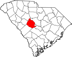
| State | South Carolina |
| County | Lexington |
| Area | |
• Total | 6.18 sq mi (16.00 km2) |
| • Land | 6.12 sq mi (15.85 km2) |
| • Water | 0.06 sq mi (0.15 km2) |
| Elevation | 312 ft (95 m) |
| Population | |
• Total | 7,858 |
| • Density | 1,284.41/sq mi (495.92/km2) |
| Time zone | UTC-5 (Eastern (EST)) |
| • Summer (DST) | UTC-4 (EDT) |
| ZIP Code | 29073 (Lexington) |
| Area codes | 803/839 |
| FIPS code | 45-77042 |
| GNIS feature ID | 2807072 [2] |
White Knoll is an unincorporated area and census-designated place (CDP) in Lexington County, South Carolina, United States. It was first listed as a CDP in the 2020 census [2] with a population of 7,858. [4]
Contents
The CDP is in central Lexington County, bordered to the north by Red Bank and 5 miles (8 km) south of Lexington, the county seat. South Carolina Highway 6 passes through the community, leading north to Lexington and southeast 15 miles (24 km) to Swansea.
White Knoll High School is in the northern part of the community on the south side of Platt Springs Road.