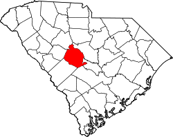
Pine Ridge, South Carolina

Last updated

Pine Ridge, South Carolina
USA South Carolina location map.svg
Red pog.svg
Pine Ridge
Location in South Carolina
Usa edcp location map.svg
Red pog.svg
Pine Ridge
Location in the United States
Coordinates: 33°54′39″N81°6′27″W / 33.91083°N 81.10750°W / 33.91083; -81.10750
Country United States
State South Carolina
County Lexington
Established1958
Area
[1]
  Total4.72 sq mi (12.21 km2)
  Land4.70 sq mi (12.17 km2)
  Water0.02 sq mi (0.04 km2)
Elevation
[2]
256 ft (78 m)
Population
 (2020) [3]
  Total2,167
  Density461.26/sq mi (178.08/km2)
Time zone UTC-5 (Eastern (EST))
  Summer (DST) UTC-4 (EDT)
ZIP code
29169
Area code(s) 803, 839
FIPS code 45-56950 [4]
GNIS feature ID1250127 [2]
Website www.townofpineridgesc.com

Pine Ridge is a town in Lexington County, South Carolina, United States. The population was 2,064 at the 2010 census. It is part of the Columbia, South Carolina Metropolitan Statistical Area.

Contents

Geography

Pine Ridge is located at 33°54′39″N81°6′27″W / 33.91083°N 81.10750°W / 33.91083; -81.10750 (33.910857, -81.107635). [5]

According to the United States Census Bureau, the town has a total area of 3.7 square miles (9.7 km2), of which 3.7 square miles (9.6 km2) is land and 0.27% is water.

Demographics

Historical population
CensusPop.Note
1960 329
1970 63392.4%
1980 1,287103.3%
1990 1,73134.5%
2000 1,593−8.0%
2010 2,06429.6%
2020 2,1675.0%
U.S. Decennial Census [6] [3]

As of the census [4] of 2000, there were 1,593 people, 606 households, and 458 families residing in the town. The population density was 429.1 inhabitants per square mile (165.7/km2). There were 626 housing units at an average density of 168.6 per square mile (65.1/km2). The racial makeup of the town was 92.78% White, 5.15% African American, 0.31% Native American, 0.88% Asian, 0.19% from other races, and 0.69% from two or more races. Hispanic or Latino of any race were 1.19% of the population.

There were 606 households, out of which 37.5% had children under the age of 18 living with them, 61.7% were married couples living together, 10.4% had a female householder with no husband present, and 24.4% were non-families. 19.8% of all households were made up of individuals, and 5.1% had someone living alone who was 65 years of age or older. The average household size was 2.63 and the average family size was 3.05.

In the town, the population was spread out, with 26.6% under the age of 18, 7.6% from 18 to 24, 29.8% from 25 to 44, 28.4% from 45 to 64, and 7.6% who were 65 years of age or older. The median age was 37 years. For every 100 females, there were 95.0 males. For every 100 females age 18 and over, there were 92.9 males.

The median income for a household in the town was $48,750, and the median income for a family was $54,514. Males had a median income of $35,243 versus $28,846 for females. The per capita income for the town was $18,534. About 6.6% of families and 9.1% of the population were below the poverty line, including 12.2% of those under age 18 and 17.5% of those age 65 or over.

Education

Pine Ridge has a public library, a branch of the Lexington County Library. [7]

Related Research Articles

<span class="mw-page-title-main">Pine Ridge, Alabama</span> Town in Alabama, United States

Pine Ridge is a town in DeKalb County, Alabama, United States. It incorporated in 1982. At the 2020 census, the population was 263.

<span class="mw-page-title-main">Pine Island Ridge, Florida</span> Neighborhood in Broward, Florida, United States

Pine Island Ridge was a census-designated place (CDP) in Broward County, Florida, United States. The population was 5,199 at the 2000 census. Formerly a part of unincorporated Broward County, Pine Island Ridge was annexed into the town of Davie, Florida on 15 September 2006, and is now a neighborhood of that town.

<span class="mw-page-title-main">Pelican Bay, Florida</span> Census-designated place in Florida

Pelican Bay is a census-designated place (CDP) in Collier County, Florida, United States. The population was 6,346 at the 2010 census. It is part of the Naples–Marco Island Metropolitan Statistical Area.

<span class="mw-page-title-main">Pine Ridge, Collier County, Florida</span> Census-designated place in Florida

Pine Ridge is a census-designated place (CDP) in Collier County, Florida, United States. The population was 1,918 at the 2010 census. It is part of the Naples–Marco Island Metropolitan Statistical Area.

<span class="mw-page-title-main">Mascotte, Florida</span> City in Florida

Mascotte is a city in Lake County, Florida, United States. As of the 2020 census, the population was 6,609, up from 5,101 in 2010. It is part of the Orlando–Kissimmee–Sanford Metropolitan Statistical Area.

<span class="mw-page-title-main">Harlem Heights, Florida</span> Census-designated place in Florida, United States

Harlem Heights is an unincorporated community and census-designated place (CDP) in Lee County, Florida, United States. The population was 1,930 at the 2020 census, down from 1,975 at the 2010 census. It is part of the Cape Coral-Fort Myers, Florida Metropolitan Statistical Area.

<span class="mw-page-title-main">Elkville, Illinois</span> Village in Illinois, United States

Elkville is a village in Jackson County, Illinois, United States. The population was 928 at the 2010 census, down from 1,001 at the 2000 census. As of 2018 the estimated population was 871.

<span class="mw-page-title-main">Sabattus, Maine</span> Town in the state of Maine, United States

Sabattus is a town in Androscoggin County, Maine, United States. The population was 5,044 at the 2020 census. It is included in both the Lewiston-Auburn, Maine Metropolitan Statistical Area and the Lewiston-Auburn, Maine Metropolitan New England City and Town Area. The town was formerly known as "Webster", and changed its name to "Sabattus" in 1971, in honor of a former Anasagunticook Indian chief. The village of Sabattus is in the northwestern corner of the town, at the outlet of Sabattus Pond.

<span class="mw-page-title-main">New Paris, Pennsylvania</span> Borough in Pennsylvania, United States

New Paris is a borough in Bedford County, Pennsylvania, United States. The population was 192 at the 2020 census.

<span class="mw-page-title-main">Johnston, South Carolina</span> Town in South Carolina, United States

Johnston is a town in Edgefield County, South Carolina, United States. The population was 2,362 at the 2010 census. It is part of the Augusta, Georgia, metropolitan area. The town's official welcome sign states that it is "Peach Capital of the World".

<span class="mw-page-title-main">South Congaree, South Carolina</span> Town in South Carolina, United States

South Congaree is a town in Lexington County, South Carolina, United States. The population was 2,306 at the 2010 census. It is part of the Columbia, South Carolina Metropolitan Statistical Area.

<span class="mw-page-title-main">Ridge Spring, South Carolina</span> Town in South Carolina, United States

Ridge Spring is a town in Saluda County, South Carolina, United States. The population was 737 at the 2010 census. It is part of the Columbia, SC Metropolitan Statistical Area. The Mayor-Elect is Ms. Qwendolyn Etheredge.

<span class="mw-page-title-main">Oglala, South Dakota</span> CDP in South Dakota, United States

Oglala is a census-designated place (CDP) in West Oglala Lakota Unorganized Territory equivalent, Oglala Lakota County, South Dakota, United States. The population was 1,282 at the 2020 census. Its location is in the northwest of the Pine Ridge Indian Reservation.

<span class="mw-page-title-main">Pine Ridge, South Dakota</span> CDP in South Dakota, United States

Pine Ridge is a census-designated place (CDP) and the most populous community in Oglala Lakota County, South Dakota, United States. The population was 3,138 at the 2020 census. It is the tribal headquarters of the Oglala Sioux Tribe on the Pine Ridge Indian Reservation.

<span class="mw-page-title-main">Wounded Knee, South Dakota</span> CDP in South Dakota, United States

Wounded Knee is a census-designated place (CDP) on the Pine Ridge Indian Reservation in Oglala Lakota County, South Dakota, United States. The population was 364 at the 2020 census.

<span class="mw-page-title-main">Powellton, West Virginia</span> CDP in West Virginia, United States

Powellton is a census-designated place (CDP) in Fayette County, West Virginia, United States. The population was 619 at the 2010 census.

<span class="mw-page-title-main">Bancroft, West Virginia</span> Town in West Virginia, United States

Bancroft is a town in Putnam County, West Virginia, United States, along the Kanawha River. The population was 389 at the 2020 census. It is part of the Huntington–Ashland metropolitan area.

<span class="mw-page-title-main">Pine Valley, Wisconsin</span> Town in Wisconsin, United States

Pine Valley is a town in Clark County in the U.S. state of Wisconsin. The population was 1,121 at the 2000 census. The unincorporated community of Sidney is located in the town.

Birnamwood is a town in Shawano County, Wisconsin, United States. The population was 711 at the 2000 census. The unincorporated community of Shepley is located partially in the town. The Village of Birnamwood is located mostly within the town.

<span class="mw-page-title-main">Walton (town), New York</span> Town in New York, United States

Walton is a town in Delaware County, New York, United States. The population was 5,270 at the 2020 census. The town is in the west-central part of the county and contains the village of Walton. The town claims to be the "Scarecrow Capital of the World."

References

  1. "ArcGIS REST Services Directory". United States Census Bureau. Retrieved October 15, 2022.
  2. 1 2 U.S. Geological Survey Geographic Names Information System: Pine Ridge, South Carolina
  3. 1 2 "Census Population API". United States Census Bureau. Retrieved October 15, 2022.
  4. 1 2 "U.S. Census website". United States Census Bureau . Retrieved January 31, 2008.
  5. "US Gazetteer files: 2010, 2000, and 1990". United States Census Bureau. February 12, 2011. Retrieved April 23, 2011.
  6. "Census of Population and Housing". Census.gov. Retrieved June 4, 2015.
  7. "Locations & Hours". Greenville County Library System. Retrieved June 13, 2019.