Oak Grove, South Carolina

Last updated

Oak Grove, South Carolina
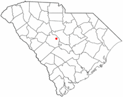
SCMap-doton-OakGrove.PNG
Location of Oak Grove, South Carolina
Coordinates: 33°58′26″N81°9′23″W / 33.97389°N 81.15639°W / 33.97389; -81.15639
Country United States
State South Carolina
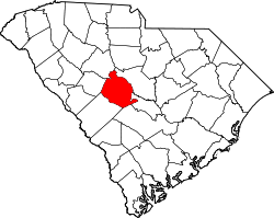
County Lexington
Area
[1]
  Total7.61 sq mi (19.71 km2)
  Land7.58 sq mi (19.64 km2)
  Water0.03 sq mi (0.07 km2)
Elevation
[2]
341 ft (104 m)
Population
 (2020) [3]
  Total12,899
  Density1,700.59/sq mi (656.63/km2)
Time zone UTC-5 (Eastern (EST))
  Summer (DST) UTC-4 (EDT)
FIPS code 45-51720 [4]
GNIS feature ID2407593 [2]

Oak Grove is a census-designated place (CDP) in Lexington County, South Carolina, United States. The population was 10,291 at the 2010 census. [5] It is part of the Columbia Metropolitan Statistical Area.

Contents

Geography

Oak Grove is located in eastern Lexington County at 33°58′48″N81°8′25″W / 33.98000°N 81.14028°W / 33.98000; -81.14028 (33.980098, -81.140291), [6] 8 miles (13 km) west of downtown Columbia, the state capital. It is bordered to the east by West Columbia and to the southeast by Springdale. U.S. Route 1 (Augusta Road) is the main road through Oak Grove; it leads east (northbound) into Columbia and west (southbound) 5 miles (8 km) to Lexington, the county seat.

According to the United States Census Bureau, the CDP has a total area of 6.4 square miles (16.7 km2), of which 0.02 square miles (0.04 km2), or 0.26%, are water. [7]

Demographics

Historical population
CensusPop.Note
2020 12,899
U.S. Decennial Census [8]

2020 census

Oak Grove racial composition [9]
RaceNum.Perc.
White (non-Hispanic)8,90469.03%
Black or African American (non-Hispanic)1,58012.25%
Native American 350.27%
Asian 2501.94%
Pacific Islander 10.01%
Other/Mixed 6635.14%
Hispanic or Latino 1,46611.37%

As of the 2020 United States census, there were 12,899 people, 4,446 households, and 2,640 families residing in the CDP.

2000 census

As of the census [4] of 2000, there were 8,183 people, 3,368 households, and 2,320 families residing in the CDP. The population density was 1,214.2 inhabitants per square mile (468.8/km2). There were 3,626 housing units at an average density of 538.0 per square mile (207.7/km2). The racial makeup of the CDP was 88.45% White, 8.19% African American, 0.34% Native American, 1.03% Asian, 0.01% Pacific Islander, 0.82% from other races, and 1.16% from two or more races. Hispanic or Latino of any race were 2.25% of the population.

There were 3,368 households, out of which 32.3% had children under the age of 18 living with them, 52.9% were married couples living together, 12.7% had a female householder with no husband present, and 31.1% were non-families. 25.0% of all households were made up of individuals, and 7.9% had someone living alone who was 65 years of age or older. The average household size was 2.43 and the average family size was 2.90.

In the CDP, the population was spread out, with 24.2% under the age of 18, 7.2% from 18 to 24, 35.2% from 25 to 44, 23.6% from 45 to 64, and 9.8% who were 65 years of age or older. The median age was 36 years. For every 100 females, there were 93.7 males. For every 100 females age 18 and over, there were 91.9 males.

The median income for a household in the CDP was $42,338, and the median income for a family was $48,904. Males had a median income of $31,511 versus $25,845 for females. The per capita income for the CDP was $19,509. About 2.6% of families and 4.8% of the population were below the poverty line, including 5.3% of those under age 18 and 7.5% of those age 65 or over.
Related Research Articles

<span class="mw-page-title-main">Indian Falls, California</span> Census-designated place in California, United States

Indian Falls is a census-designated place (CDP) in Plumas County, California, United States. The population was 54 at the 2010 census, up from 37 at the 2000 census.

<span class="mw-page-title-main">August, California</span> Census-designated place in California, United States

August is a census-designated place (CDP) in San Joaquin County, California, United States. The population was 8,628 at the 2020 census, up from 8,390 at the 2010 census.

<span class="mw-page-title-main">San Carlos Park, Florida</span> Census-designated place in Florida, United States

San Carlos Park is a census-designated place (CDP) in Lee County, Florida, United States. The population was 18,563 at the 2020 census. It is part of the Cape Coral-Fort Myers, Florida Metropolitan Statistical Area.

<span class="mw-page-title-main">Three Oaks, Florida</span> Census-designated place in Florida, United States

Three Oaks is a census-designated place (CDP) in Lee County, Florida, United States. The population was 3,592 at the 2010 census, up from 2,255 at the 2000 census. It is part of the Cape Coral-Fort Myers, Florida Metropolitan Statistical Area.

<span class="mw-page-title-main">Oak Ridge, Florida</span> Census-designated place in Florida, United States

Oak Ridge is a census-designated place and unincorporated area in Orange County, Florida, United States. The population was 22,685 at the 2010 census. It is part of the Orlando–Kissimmee–Sanford, Florida Metropolitan Statistical Area.

<span class="mw-page-title-main">Vine Grove, Kentucky</span> City in Kentucky, United States

Vine Grove is a home rule-class city in Hardin County, Kentucky, United States. The population was 4,520 at the 2010 census, up from 4,169 at the 2000 census. It is part of the Elizabethtown–Fort Knox Metropolitan Statistical Area.

<span class="mw-page-title-main">West Hattiesburg, Mississippi</span> Census-designated place in Mississippi, United States

West Hattiesburg is an unincorporated area and census-designated place (CDP) in Lamar County, Mississippi, west of the city of Hattiesburg and east of the community of Oak Grove. It is part of the Hattiesburg metropolitan area. It had a decline in population from 6,305 at the 2000 census to 5,909 at the 2010 census.

<span class="mw-page-title-main">Pleasant Grove, Ohio</span> CDP in Ohio, United States

Pleasant Grove is a census-designated place (CDP) in Muskingum County, Ohio, United States. The population was 2,016 at the 2000 census.

<span class="mw-page-title-main">Oak Grove, Oregon</span> Unincorporated community in the state of Oregon, United States

Oak Grove is an unincorporated community in Clackamas County, Oregon, United States, in the Portland metropolitan area. For statistical purposes, the United States Census Bureau has defined Oak Grove as a census-designated place (CDP). The census definition of the area may not precisely correspond to local understanding of the area with the same name. The population was 16,629 at the 2010 census.

<span class="mw-page-title-main">Rickreall, Oregon</span> Unincorporated community in the state of Oregon, United States

Rickreall is an unincorporated community in Polk County, Oregon, United States. For statistical purposes, the United States Census Bureau has defined Rickreall as a census-designated place (CDP). The census definition of the area may not precisely correspond to local understanding of the area with the same name. The population of the CDP was 76 at the 2020 census. Rickreall is part of the Salem Metropolitan Statistical Area. Rickreall Creek runs along the community's southern edge.

<span class="mw-page-title-main">Eyers Grove, Pennsylvania</span> Census-designated place in Pennsylvania, United States

Eyers Grove is a census-designated place in Columbia County, Pennsylvania, United States. It is part of Northeastern Pennsylvania. The population was 102 at the 2020 census. It is part of the Bloomsburg-Berwick micropolitan area.

<span class="mw-page-title-main">Fernville, Pennsylvania</span> Census-designated place in Pennsylvania, United States

Fernville is a census-designated place (CDP) in Columbia County, Pennsylvania, United States. It is part of Northeastern Pennsylvania. The population was 556 at the 2010 census. It is part of the Bloomsburg-Berwick micropolitan area.

<span class="mw-page-title-main">Red Bank, South Carolina</span> Census-designated place in South Carolina, United States

Red Bank is an unincorporated community and census-designated place (CDP) in Lexington County, South Carolina, United States. The population was 9,617 at the 2010 census, up from 8,811 at the 2000 census. It is part of the Columbia, South Carolina Metropolitan Statistical Area.

Seven Oaks is a census-designated place (CDP) in Lexington County, South Carolina, United States, 8 miles (13 km) northwest of downtown Columbia, the state capital. The population of the CDP was 15,144 at the 2010 census. It is part of the Columbia Metropolitan Statistical Area.

<span class="mw-page-title-main">St. Andrews, South Carolina</span> Census-designated place in South Carolina, United States

St. Andrews is a census-designated place (CDP) in Richland County, South Carolina, United States. The population was 20,493 at the 2010 census. It is part of the Columbia, South Carolina Metropolitan Statistical Area.

Oak Grove is a census-designated place (CDP) in Washington County, Tennessee, United States. The population was 4,425 at the 2010 census. It is part of the Johnson City Metropolitan Statistical Area, which is a component of the Johnson City–Kingsport–Bristol, TN-VA Combined Statistical Area – commonly known as the "Tri-Cities" region.

<span class="mw-page-title-main">West Side Highway, Washington</span> Former CDP in Washington, United States

West Side Highway was a census-designated place (CDP) in Cowlitz County, Washington, named after a state highway running north–south between Longview and Castle Rock. As of the 2010 census, the CDP population was 5,517. Prior to the 2020 census, the CDP was split into two new CDPs, Beacon Hill and Lexington.

<span class="mw-page-title-main">Mirrormont, Washington</span> Census-designated place in Washington, United States

Mirrormont is a census-designated place (CDP) in King County, Washington, United States, south of Issaquah. The population was 3,858 at the 2020 census. Within the last decade, the area has seen a shift in development as larger homes have been constructed in Cedar Grove, the Highlands at Tiger Mountain and Mirrormont.

<span class="mw-page-title-main">Arapahoe, Wyoming</span> Census-designated place in Wyoming, United States

Arapahoe is a census-designated place (CDP) in Fremont County, Wyoming, United States. The population was 1,656 at the 2010 census. A Catholic mission was founded here in 1884. St Stephen's Mission Church, located near Arapahoe, is part of the Catholic mission.

<span class="mw-page-title-main">Walpole (CDP), Massachusetts</span> Census-designated place in Massachusetts, United States

Walpole is a small census-designated place (CDP) located within the much larger town of Walpole in Norfolk County, Massachusetts, United States. Walpole Town as it is called by the US Census Bureau, also includes a much larger population. The population of the Census Designated Place was 5,918 at the 2010 census.

References

  1. "ArcGIS REST Services Directory". United States Census Bureau. Retrieved October 15, 2022.
  2. 1 2 U.S. Geological Survey Geographic Names Information System: Oak Grove, South Carolina
  3. "Census Population API". United States Census Bureau. Retrieved October 15, 2022.
  4. 1 2 "U.S. Census website". United States Census Bureau . Retrieved January 31, 2008.
  5. "Total Population: 2010 Census DEC Summary File 1 (P1), Oak Grove CDP, South Carolina". data.census.gov. U.S. Census Bureau. Retrieved December 29, 2020.
  6. "US Gazetteer files: 2010, 2000, and 1990". United States Census Bureau. February 12, 2011. Retrieved April 23, 2011.
  7. "2019 U.S. Gazetteer Files". United States Census Bureau. Retrieved December 29, 2020.
  8. "Census of Population and Housing". Census.gov. Retrieved June 4, 2016.
  9. "Explore Census Data". data.census.gov. Retrieved December 14, 2021.