Socastee, South Carolina | |
---|---|
Coordinates: 33°41′N79°0′W / 33.683°N 79.000°W | |
Country | United States |
State | South Carolina |
County | Horry |
Area | |
• Total | 13.88 sq mi (35.96 km2) |
• Land | 13.37 sq mi (34.62 km2) |
• Water | 0.52 sq mi (1.34 km2) |
Elevation | 16 ft (5 m) |
Population | |
• Total | 22,213 |
• Density | 1,661.90/sq mi (641.64/km2) |
Time zone | UTC−5 (EST) |
• Summer (DST) | UTC−4 (EDT) |
ZIP Code | 29588 |
FIPS code | 45-67390 [3] |
GNIS feature ID | 1226740 [4] |
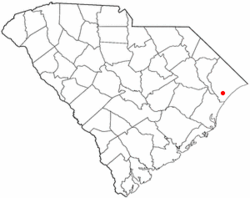
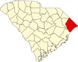
Socastee is a census-designated place (CDP) in Horry County, South Carolina, United States. The population was 19,952 at the 2010 census.
Socastee is an Indigenous American name referred to as "Sawkastee" in a 1711 land grant to Percival Pawley. A skirmish between small forces of American and British troops occurred near Socastee Creek in 1781. By the 1870s, the Socastee community was a significant center for the production and distribution of naval stores such as turpentine and tar. This area included a saw mill, turpentine distilleries, cotton gin, grist mill, cooper shop and general store. The Socastee Historic District was listed in the National Register of Historic Places in 2002.
Socastee is located at 33°41′N79°0′W / 33.683°N 79.000°W (33.686 -78.993). [5]
According to the United States Census Bureau, the CDP has a total area of 13.9 square miles (36.0 km2), of which 13.4 square miles (34.6 km2) is land and 0.5 square mile (1.4 km2) (3.81%) is water.
Census | Pop. | Note | %± |
---|---|---|---|
2020 | 22,213 | — | |
U.S. Decennial Census [6] |
Race | Num. | Perc. |
---|---|---|
White (non-Hispanic) | 15,734 | 70.83% |
Black or African American (non-Hispanic) | 1,627 | 7.32% |
Native American | 91 | 0.41% |
Asian | 443 | 1.99% |
Pacific Islander | 33 | 0.15% |
Other/Mixed | 1,226 | 5.52% |
Hispanic or Latino | 3,059 | 13.77% |
As of the 2020 United States census, there were 22,213 people, 8,798 households, and 5,903 families residing in the CDP.
As of the census [3] of 2000, there were 14,295 people, 5,593 households, and 3,820 families living in the CDP. The population density was 1,069.1 inhabitants per square mile (412.8/km2). There were 6,356 housing units at an average density of 475.4 per square mile (183.6/km2). The racial makeup of the CDP was 86.81% White, 7.01% African American, 0.35% Native American, 2.10% Asian, 0.13% Pacific Islander, 2.01% from other races, and 1.59% from two or more races. Hispanic or Latino of any race were 4.66% of the population.
There were 5,593 households, out of which 33.1% had children under the age of 18 living with them, 52.4% were married couples living together, 11.3% had a female householder with no husband present, and 31.7% were non-families. 22.7% of all households were made up of individuals, and 4.6% had someone living alone who was 65 years of age or older. The average household size was 2.54 and the average family size was 2.97.
In the CDP, the population was spread out, with 24.3% under the age of 18, 9.7% from 18 to 24, 34.9% from 25 to 44, 22.7% from 45 to 64, and 8.4% who were 65 years of age or older. The median age was 34 years. For every 100 females, there were 102.0 males. For every 100 females age 18 and over, there were 101.4 males.
The median income for a household in the CDP was $40,436, and the median income for a family was $45,994. Males had a median income of $28,845 versus $21,782 for females. The per capita income for the CDP was $18,069. About 5.6% of families and 9.3% of the population were below the poverty line, including 13.7% of those under age 18 and 7.8% of those age 65 or over.
Socastee has a public library, a branch of the Horry County Memorial Library. [8]
Salem is a census-designated place (CDP) in Saline County, Arkansas, United States. Per the 2020 census, the population was 2,544. It is part of the Little Rock–North Little Rock–Conway Metropolitan Statistical Area.
Newport Coast is a community south of the main body of the city of Newport Beach, California. It was a separate census-designated place in Orange County, California, United States, until 2001, when it was annexed into Newport Beach. Newport Beach, California's estimated population is 86,160 according to the most recent United States census estimates. Newport Beach, California is the 96th largest city in California based on official 2017 estimates from the US Census Bureau.
Camp Pendleton Mainside is a census-designated place (CDP) in San Diego County, California, located at the southeast corner of the Marine Corps Base Camp Pendleton. Per the 2020 census, the population was 9,683. It was formerly known as Camp Pendleton North, but its name was changed for the 2020 Census. Along with Camp Pendleton South, it is one of two CDPs located on the base.
Bystrom is a census-designated place (CDP) in Stanislaus County, California, United States. The population was 4,008 at the 2010 census, down from 4,518 at the 2000 census. It is part of the Modesto Metropolitan Statistical Area.
Tipton is a census-designated place (CDP) in Tulare County, California, United States. The population was 2,543 at the 2010 census, up from 1,790 at the 2000 census.
Broad Brook is a neighborhood and census-designated place (CDP) in the town of East Windsor, Hartford County, Connecticut, United States. As of the 2010 census, the CDP population was 4,069.
Lakewood Park is a Census-designated place in St. Lucie County, Florida, United States. The population was 11,323 at the 2010 census. It is part of the Port St. Lucie Metropolitan Statistical Area.
Port Reading is a census-designated place and unincorporated community located within Woodbridge Township, in Middlesex County, in the U.S. state of New Jersey. As of the 2010 U.S. census, Port Reading's population was 3,728.
Twin Lakes is a census-designated place (CDP) in McKinley County, New Mexico, United States. The population was 1,069 at the 2000 census.
Terryville is a census-designated place (CDP) in the Town of Brookhaven, Suffolk County, New York, United States. The population was 11,849 at the 2010 census.
Weigelstown is a census-designated place (CDP) in York County, Pennsylvania, United States. The population was 12,875 at the 2010 census.
Aynor is a small town in Horry County, South Carolina, United States, south of Galivants Ferry. The population was 560 at the 2010 census and estimated in 2018 to be 934. Aynor High School consistently ranks as one of the best schools in Horry County and South Carolina.
Bucksport is an unincorporated community and census-designated place (CDP) in Horry County, South Carolina, United States. The population was 876 at the 2010 census. It is a rural port on the Atlantic Intracoastal Waterway at the merger point with the Waccamaw River. The port has some services available for boaters and is also home to the Bucksport Restaurant.
Forestbrook is a census-designated place (CDP) in Horry County, South Carolina, United States. The population was 4,612 at the 2010 census, up from 3,391 at the 2000 census.
Garden City, sometimes known as Garden City Beach, is a census-designated place (CDP) in Horry County, South Carolina, United States. The population was 9,209 at the 2010 census. Garden City Beach is located directly south of Surfside Beach. The developed part of the beach extends south beyond the limits of the Garden City CDP, into Georgetown County, and ends on a peninsula at the mouth of Murrells Inlet.
Little River is a census-designated place (CDP) in Horry County, South Carolina, United States. The population was 11,711 at the 2020 census.
Red Hill is a census-designated place (CDP) in Horry County, South Carolina, United States. The population was 13,223 at the 2010 census, up from 10,509 at the 2000 census.
Milton is a census-designated place (CDP) in the town of Milton in Saratoga County, New York, United States. The population was 2,692 at the 2000 census.
Minetto is a hamlet in Oswego County, New York, United States. The population was 1,069 at the 2010 census.
Pepperell is a census-designated place (CDP) comprising the main village in the town of Pepperell in Middlesex County, Massachusetts, United States. The population was 2,390 at the 2020 census, out of 11,604 in the entire town of Pepperell.