Forestbrook, South Carolina

Last updated
Forestbrook, South Carolina
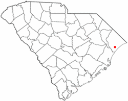
SCMap-doton-Forestbrook.PNG
Location in South Carolina
Coordinates: 33°43′15″N78°57′54″W / 33.72083°N 78.96500°W / 33.72083; -78.96500 Coordinates: 33°43′15″N78°57′54″W / 33.72083°N 78.96500°W / 33.72083; -78.96500
Country United States
State South Carolina
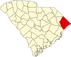
County Horry
Area
[1]
  Total3.67 sq mi (9.51 km2)
  Land3.67 sq mi (9.51 km2)
  Water0.00 sq mi (0.00 km2)
Elevation
16 ft (5 m)
Population
 (2020) [2]
  Total6,656
  Density1,813.62/sq mi (700.23/km2)
Time zone UTC-5 (EST)
  Summer (DST) UTC-4 (EDT)
ZIP Code
29579
FIPS code 45-26372 [3]
GNIS feature ID1243725 [4]

Forestbrook is a census-designated place (CDP) in Horry County, South Carolina, United States. The population was 4,612 at the 2010 census, [5] up from 3,391 at the 2000 census.

Contents

Geography

Forestbrook is located in southern Horry County at 33°43′15″N78°57′54″W / 33.72083°N 78.96500°W / 33.72083; -78.96500 (33.720943, -78.964919). [6] It is 5 miles (8 km) northwest of Myrtle Beach and 10 miles (16 km) southeast of Conway, the Horry county seat. U.S. Route 501 forms the northeast border of the community, and the northwest border follows South Carolina Highway 31, the Carolina Bays Parkway. The southeast border of the CDP is Socastee Swamp.

According to the United States Census Bureau, the CDP has a total area of 3.7 square miles (9.7 km2), all land. [5]

Demographics

Historical population
CensusPop.Note
2020 6,656
U.S. Decennial Census [7]

2020 census

Forestbrook racial composition [8]
RaceNum.Perc.
White (non-Hispanic)5,38680.92%
Black or African American (non-Hispanic)4006.01%
Native American 210.32%
Asian 721.08%
Pacific Islander 80.12%
Other/Mixed 3575.36%
Hispanic or Latino 4126.19%

As of the 2020 United States census, there were 6,656 people, 2,528 households, and 1,936 families residing in the CDP.

2000 census

As of the census [3] of 2000, there were 3,391 people, 1,277 households, and 994 families residing in the CDP. The population density was 933.1 people per square mile (360.7/km2). There were 1,358 housing units at an average density of 373.7/sq mi (144.4/km2). The racial makeup of the CDP was 87.91% White, 9.08% African American, 0.38% Native American, 0.94% Asian, 0.56% from other races, and 1.12% from two or more races. Hispanic or Latino of any race were 1.83% of the population.

There were 1,277 households, out of which 39.2% had children under the age of 18 living with them, 63.1% were married couples living together, 11.7% had a female householder with no husband present, and 22.1% were non-families. 15.5% of all households were made up of individuals, and 4.1% had someone living alone who was 65 years of age or older. The average household size was 2.65 and the average family size was 2.96.

In the CDP, the population was spread out, with 26.8% under the age of 18, 7.5% from 18 to 24, 33.4% from 25 to 44, 23.3% from 45 to 64, and 9.0% who were 65 years of age or older. The median age was 36 years. For every 100 females, there were 93.1 males. For every 100 females age 18 and over, there were 90.6 males.

The median income for a household in the CDP was $45,982, and the median income for a family was $48,268. Males had a median income of $27,061 versus $23,164 for females. The per capita income for the CDP was $18,990. About 4.0% of families and 5.0% of the population were below the poverty line, including 7.6% of those under age 18 and 6.3% of those age 65 or over.
See also

Related Research Articles

<span class="mw-page-title-main">Butters, North Carolina</span> Census-designated place in North Carolina, United States

Butters is a census-designated place (CDP) in Bladen County, North Carolina, United States. As of the 2010 census, the population was 294.

<span class="mw-page-title-main">West Smithfield, North Carolina</span> Former census-designated place in North Carolina, United States

West Smithfield was an unincorporated community and census-designated place and is now a district of Smithfield, North Carolina in Johnston County, North Carolina, United States. The population was last recorded separately from Smithfield in 2000, when 59 people resided in the CDP.

Delway is a census-designated place (CDP) in Sampson County, North Carolina, United States. The population was 270 at the 2000 census.

Plain View is a census-designated place (CDP) in Sampson County, North Carolina, United States. The population was 1,820 at the 2000 census.

Mar-Mac is a census-designated place (CDP) in Wayne County, North Carolina, United States. The population was 3,011 at the 2007 census. It is included in the Goldsboro, North Carolina Metropolitan Statistical Area.

<span class="mw-page-title-main">Burnettown, South Carolina</span> Town in South Carolina, United States of America

Burnettown is a town in Aiken County, South Carolina, United States. The population was 2,673 at the 2010 census. It is part of the Augusta, Georgia metropolitan area. Burnettown is located in historic Horse Creek Valley.

<span class="mw-page-title-main">Clearwater, South Carolina</span> Census-designated place in South Carolina, United States of America

Clearwater is a census-designated place (CDP) in Aiken County, South Carolina. It lies near North Augusta, South Carolina, and is part of the Augusta, Georgia metropolitan area. Clearwater is located in historic Horse Creek Valley. The population was 4,370 at the time of the 2010 census.

Parker is a census-designated place (CDP) in Greenville County, South Carolina, United States. The population was 11,431 at the 2010 census, up from 10,760 in 2000. It is part of the Greenville–Mauldin–Easley Metropolitan Statistical Area.

<span class="mw-page-title-main">Cokesbury, South Carolina</span> Census-designated place in South Carolina, United States

Cokesbury is a census-designated place (CDP) in Greenwood County, South Carolina, United States. The population was 215 at the 2010 census, down from 279 in 2000.

Atlantic Beach is a town in Horry County, South Carolina, United States, part of the Grand Strand tourist region. The population was 334 at the 2010 census. Most of the land around the town is annexed into the city of North Myrtle Beach.

<span class="mw-page-title-main">Bucksport, South Carolina</span> Census-designated place in South Carolina, United States

Bucksport is an unincorporated community and census-designated place (CDP) in Horry County, South Carolina, United States. The population was 876 at the 2010 census. It is a rural port on the Atlantic Intracoastal Waterway at the merger point with the Waccamaw River. The port has some services available for boaters and is also home to the Bucksport Restaurant.

<span class="mw-page-title-main">Garden City, South Carolina</span> Census-designated place in South Carolina, United States

Garden City, sometimes known as Garden City Beach, is a census-designated place (CDP) in Horry County, South Carolina, United States. The population was 9,209 at the 2010 census. Garden City Beach is located directly south of Surfside Beach. The developed part of the beach extends south beyond the limits of the Garden City CDP, into Georgetown County, and ends on a peninsula at the mouth of Murrells Inlet.

<span class="mw-page-title-main">Little River, South Carolina</span> CDP in South Carolina, United States

Little River is a census-designated place (CDP) in Horry County, South Carolina, United States. The population was 11,711 at the 2020 census.

<span class="mw-page-title-main">Loris, South Carolina</span> City in South Carolina, United States

Loris is a city in Horry County, South Carolina, United States. The population was 2,396 at the 2010 census, up from 2,079 in 2000.

<span class="mw-page-title-main">Red Hill, South Carolina</span> Census-designated place in South Carolina, United States

Red Hill is a census-designated place (CDP) in Horry County, South Carolina, United States. The population was 13,223 at the 2010 census, up from 10,509 at the 2000 census.

<span class="mw-page-title-main">Socastee, South Carolina</span> CDP in South Carolina, United States

Socastee is a census-designated place (CDP) in Horry County, South Carolina, United States. The population was 19,952 at the 2010 census.

<span class="mw-page-title-main">Modoc, South Carolina</span> CDP in South Carolina, United States

Modoc is a census-designated place (CDP) in McCormick County, South Carolina, United States. The population was 256 at the 2000 census, and 218 at the 2010 census, a decline of 14.8%.

Wilkinson Heights is a census-designated place (CDP) in Orangeburg County, South Carolina, United States. The population was 3,068 at the 2000 census.

<span class="mw-page-title-main">Ladson, South Carolina</span> Census-designated place in South Carolina, United States

Ladson is a census-designated place (CDP) in Berkeley, Charleston and Dorchester counties in the U.S. state of South Carolina. The population was 13,790 at the 2010 census. It is named in honor of the Ladson family, one of the oldest planter and merchant families in the Charleston area; one of its members was lieutenant governor James Ladson.

<span class="mw-page-title-main">Bangor Base, Washington</span> Census-designated place in Washington, United States

Bangor Base is a census-designated place (CDP) in Kitsap County, Washington, within U.S. Naval Base Kitsap on the Kitsap Peninsula. Its population was 6,054 at the 2010 census.

References

  1. "ArcGIS REST Services Directory". United States Census Bureau. Retrieved October 15, 2022.
  2. "Census Population API". United States Census Bureau. Retrieved Oct 15, 2022.
  3. 1 2 "U.S. Census website". United States Census Bureau . Retrieved 2008-01-31.
  4. "US Board on Geographic Names". United States Geological Survey. 2007-10-25. Retrieved 2008-01-31.
  5. 1 2 "Geographic Identifiers: 2010 Census Summary File 1 (G001): Forestbrook CDP, South Carolina". American Factfinder. U.S. Census Bureau. Archived from the original on February 13, 2020. Retrieved January 26, 2018.
  6. "US Gazetteer files: 2010, 2000, and 1990". United States Census Bureau. 2011-02-12. Retrieved 2011-04-23.
  7. "Census of Population and Housing". Census.gov. Retrieved June 4, 2016.
  8. "Explore Census Data". data.census.gov. Retrieved 2021-12-15.