This article needs additional citations for verification .(December 2020) |
Burgess, South Carolina | |
|---|---|
| Burgess, South Carolina | |
| Nicknames: Burgess Community, The Burgess Community | |
 | |
| Country | United States |
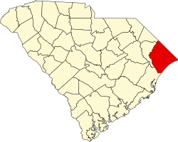
| State | South Carolina |
| County | Horry County |
| Founded as Marlow | May 6, 1880 |
| Named changed to Burgess | Aug 15, 1906 |
| Area | |
• Total | 28 sq mi (70 km2) |
| Population (2018-2019) | |
• Total | 31,037 |
| Time zone | UTC−5 (EST) |
| • Summer (DST) | UTC−4 (EDT) |
| ZIP Code | 29576 and 29588 |
| Area code | 843 |
| Website | The Greater Burgess Community Association |
Burgess is an unincorporated community in Horry County, South Carolina, United States, along South Carolina Highway 707 and is located between the southern boundary between Horry and Georgetown counties. Burgess is roughly 28 square miles in area and is flanked on the west by the Waccamaw River and U.S. 17 Bypass to the east. [1] Burgess appears on the Brookgreen Gardens U.S. Geological Survey Map. [2]