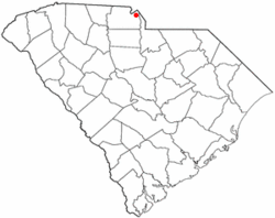
Fort Mill, also known as Fort Mill Township, is a town in York County, South Carolina, United States. It is a suburb of Charlotte, North Carolina. As of the 2020 census, the population of the town was 24,521.[8] Some businesses and residents in the Indian Land community of neighboring Lancaster County share a Fort Mill mailing address, but the official town boundary extends only within York County.
The town of Fort Mill was established in 1873, getting its name from its location between two points, the first, a fort constructed by British in colonial times to protect the Catawba Indians from marauding tribes to the north, and the second point of Webb's Mill.[9] The Catawba Indians made their home in present-day Fort Mill for many years. Scots-Irish settlers began arriving in the 1750s and 1760s and a small settlement soon developed. Fort Mill grew rapidly in the late 19th century as textile mills were established. After many textile mill shut-downs the town continued to grow rapidly and became a major suburb of Charlotte.
Highlights in Fort Mill's history include:
In the mid-18th century, William Spratt and his wife Elizabeth were traveling through upper South Carolina in their wagon. They spent a night among the friendly Catawba Indians and were invited to stay and live in the area on a large tract of land given to them. They became the first white settlers in the Fort Mill area and their descendants still reside there. Their descendant, John Spratt, represented the area in the U.S. House of Representatives from 1983 to 2011.
The town of Fort Mill was the site of the last Confederate Government Cabinet meeting (1865).[2]Jefferson Davis and the Confederate Cabinet passed through the area during their flight from Richmond in 1865. The last meeting of the full Confederate Cabinet was held at the White Homestead in Fort Mill. Fort Mill's Confederate Park contains the nation's only monument to slaves laboring on the Confederate side of the American Civil War.
According to the United States Census Bureau, the town has a total area of 19.97 square miles (51.7km2), of which 19.71 square miles (51.0km2) is land and 0.26 square miles (0.67km2) (1.30%) is water.[5]Interstate 77 passes through the western portions of the town, and exit 85 is signed "South Carolina Highway 160/Fort Mill." SC 160 is the main east–west street in Fort Mill.
The town of Fort Mill held a final public hearing in October 2008 on a proposed annexation that doubled the town's physical size.[11] Fort Mill has three golf courses. The town also maintains six parks: Harris Street Park, Steele Street Park, Doby Bridge Park, Calhoun Street Park, Veterans Park and Walter Elisha Park. Three of the six parks have picnic shelters, children's playgrounds, and restrooms. Doby Bridge and Harris Street Parks have lighted baseball fields, with Steele Street and Harris Street Parks having basketball courts, and Steele Street Park having a small water park.[2] The town also maintains a banquet hall rentable through the parks and recreation department.
Climate
Fort Mill is located in a humid subtropical climate, Cfa in the Köppen climate classification. This means that the city experiences four distinct seasons, although the variation between the seasons is not as pronounced as in other parts of the United States. Generally, daytime maximum temperatures in the summer are around 90°F (32°C), with nighttime low temperatures of approximately 70°F (21°C). In winter, daytime maxima average around 50°F (10°C) while nighttime low temperatures are near 30°F (−1°C). Occasional readings as high as 105°F (41°C) are seen, reaching a high of 108°F (42°C) in 2007 or as low as −5°F (−21°C) in 1989. Summers are generally humid and prone to thunderstorms, while winters are rainy with sleet and occasional snow. Snow might fall during the winter but usually does not accumulate or persist as ground cover. Fort Mill experiences rainfall related to tropical cyclones but is generally too far inland to experience damaging winds. Fort Mill has not had any direct hits from any tropical systems since 1989, when Hurricane Hugo devastated the area.
As of the 2020 census, there were 24,521 people, 6,130 households, and 4,854 families residing in the town.
2010 census
At the 2010 census,[7] there were 10,811 people, 4,168 households, and 2,184 families residing in the town. The population density was 661.6 people per square mile. There were 4,479 housing units at an average density of 676.9 per square mile. The racial makeup of the town was 77.6% White, 17.6% African American, 0.4% Native American, 1.3% Asian, and 2.1% from two or more races. Hispanic or Latino of any race were 2.9% of the population.
There were 2,890 households, out of which 43.8% had children under the age of 18 living with them, 56.2% were married couples living together, 17.2% had a female householder with no husband present, and 24.4% were non-families. 21.8% of all households were made up of individuals, and 8.4% had someone living alone who was 65 years of age or older. The average household size was 2.67 and the average family size was 3.14.
In the town, the population was spread out, with 31.1% under the age of 18, 6.1% from 18 to 24, 32.4% from 25 to 44, 20.0% from 45 to 64, and 11.1% who were 65 years of age or older. The median age was 33.7 years. For every 100 females, there were 86.7 males. For every 100 females age 18 and over, there were 79.0 males.
The median income for a household in the town was $68,250, and the median income for a family was $79,495. Males had a median income of $58,986 versus $40,819 for females. The per capita income for the town was $36,548. About 7.2% of families and 9.5% of the population were below the poverty line, including 13.6% of those under age 18 and 8.1% of those age 65 or over.
Fort Mill is home to numerous attractions and, while a growing town, it has access to many amenities outside its jurisdiction in the nearby cities of Charlotte and Rock Hill.
Upper Room Chapel is a replica of Jerusalem's Upper Room where the Last Supper was held.
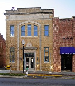
Fort Mill Downtown Historic District is the location of Confederate Park, Memorial Park, and several retail shops. The Fort Mill Times (ceased publication 2020) and Fort Mill Magazine are also located on Main Street. One of the Confederate monuments in Confederate Park is the loyal slaves monument, dedicated to the proposition that slaves were loyal and gladly helpful to the Confederacy.
Annually, Fort Mill is home to the St. Phillip Neri Italian Festival at the local Catholic parish and the Strawberry Festival held at Walter Elisha Park.
Fort Mill is also known for its peach orchards and the Anne Springs Close Greenway, an extensive nature preserve consisting of approximately 2,300 acres (9.3km2) of lakes, forests, and pastures that provide trails for hiking, biking, and horseback riding.
Media
Fort Mill is covered by a local newspaper, The Tega Cay Sun. The Tega Cay Sun started as a daily online newspaper and is now printed monthly.[19] Magazines include Life in the Mill and 29708.
Sports
Fort Mill is the Home of the PrimeTime Players, a Minor League Basketball Franchise who currently plays in the East Coast Basketball League . The PrimeTime Players are four-time Minor League champions, having won Championships in the TRBL 2012-2014 and the ECBL in 2015. The PrimeTime Players play their home games at Banks Street Gym at 490 Academy Street.
Fort Mill is also home to Carolina Crown, a competitive drum and bugle corps. As a member of Drum Corps International (DCI), Carolina Crown won one World Class championship (2013), won the silver medal three times (2009, 2012, 2015), the bronze medal three times (2016, 2017, 2023), and one Division II championship (1993).
Government
The government of Fort Mill takes place within the framework of a Council-Manager Form. Currently, the town council of Fort Mill consists of six board members, two of whom serve from at-large districts, while the remainder of the council represent each of four wards. Elections are held in accordance with United States election regulations every two years, and council members serve staggered four year terms.[2] The town council meets the second Monday of each month. The town of Fort Mill currently has four boards and commissions. These are the Zoning Board of Appeals, the Planning Commission, the Historical Review Board, and the Housing Authority Board. Members of boards and commissions are appointed on a volunteer basis.
The current mayor is Guynn Savage, who was sworn on January 12, 2016.[20]
Fort Mill is currently represented by the following legislators:[2]
Fort Mill and northern portions of its township are represented in the South Carolina House by R. Raye Felder(R) as part of South Carolina House district 26.[2]
↑Bradley, Francis (August 31, 1958). "Palmetto Place Names"(PDF). The State. Archived(PDF) from the original on February 18, 2018. Retrieved February 17, 2018.
This page is based on this Wikipedia article Text is available under the CC BY-SA 4.0 license; additional terms may apply. Images, videos and audio are available under their respective licenses.