Dorchester County is named for its first settlement area, which was established by Congregationalists in 1696. These settlers applied the name "Dorchester" after their last residence in Dorchester, Massachusetts.[4]
Dorchester was not established as a separate county until 1897. However, when it was separately established, it came from parts of the neighboring Colleton and Berkeley counties.[5]
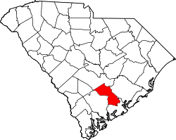
Geography
Interactive map of Dorchester County
According to the U.S. Census Bureau, the county has a total area of 571.18 square miles (1,479.3km2), of which 568.59 square miles (1,472.6km2) is land and 2.59 square miles (6.7km2) (0.45%) is water.[6]
As of the 2020 census, there were 161,540 people, 57,768 households, and 41,473 families residing in the county.
2010 census
At the 2010 census, there were 136,555people, 50,259households, and 36,850families living in the county.[15][13] The population density was 238.2 inhabitants per square mile (92.0/km2). There were 55,186 housing units at an average density of 96.3 unitsper square mile (37.2 units/km2).[16] The racial makeup of the county was 67.8% white, 25.8% black or African American, 1.5% Asian, 0.7% American Indian, 0.1% Pacific islander, 1.4% from other races, and 2.6% from two or more races. Those of Hispanic or Latino origin made up 4.4% of the population.[15] In terms of ancestry,[17]
Of the 50,259households, 40.3% had children under the age of 18 living with them, 52.6% were married couples living together, 16.0% had a female householder with no husband present, 26.7% were non-families, and 21.6% of households were made up of individuals. The average household size was 2.68 and the average family size was 3.11. The median age was 35.6 years.[15]
The median household income was $55,034 and the median family income was $63,847. Males had a median income of $45,659 versus $32,221 for females. The per capita income for the county was $24,497. About 9.0% of families and 11.2% of the population were below the poverty line, including 16.4% of those under age 18 and 9.1% of those age 65 or over.[18]
2000 census
At the 2000 census, there were 96,413 people, 34,709 households, and 26,309 families living in the county. The population density was 168 peopleper square mile (65 people/km2). There were 37,237 housing units at an average density of 65 unitsper square mile (25 units/km2). The racial makeup of the county was 71.05% White, 25.08% Black or African American, 0.73% Native American, 1.13% Asian, 0.07% Pacific Islander, 0.59% from other races, and 1.36% from two or more races. 1.79% of the population were Hispanic or Latino of any race.[19] Of the 34,709 households 40.00% had children under the age of 18 living with them, 57.20% were married couples living together, 14.60% had a female householder with no husband present, and 24.20% were non-families. 20.20% of households were one person and 6.50% were one person aged 65 or older. The average household size was 2.72 and the average family size was 3.13.
The age distribution was 28.90% under the age of 18, 7.70% from 18 to 24, 31.60% from 25 to 44, 22.60% from 45 to 64, and 9.10% 65 or older. The median age was 35 years. For every 100 females, there were 95.80 males. For every 100 females age 18 and over, there were 91.70 males.
The median household income was $43,316 and the median family income was $50,177. Males had a median income of $35,423 versus $24,405 for females. The per capita income for the county was $18,840. About 7.10% of families and 9.70% of the population were below the poverty line, including 11.40% of those under age 18 and 13.30% of those age 65 or over.
Law and government
The governing body of Dorchester County was established in 1970, and was known as the Dorchester County Board of Directors with terms to commence in January 1971. Upon commencement, the body was re-titled as the “Dorchester County Council” and its meeting dates were determined by state law to be held the 1st and 3rd Monday of every month. The seven-member County Council is elected by single-member districts. Dorchester County operates under the Council-Administrator form of government whereby County Council appoints a County Administrator to oversee the day-to-day functions of county government. Jason L. Ward has served as the County Administrator since 2004. He is aided by a Deputy County Administrator and Chief Financial Officer (Daniel T. Prentice), Deputy County Administrator for Public Safety (Mario Formisano), and Assistant County Administrator for Communuity Services (Bryan Havir). This management team oversees multiple departments within their respective directorate.
In addition to senior management reporting to County Council through the County Administrator, seven Countywide elected officials serve four year terms and oversee the following functions:
Dorchester County is served by the Dorchester County Sheriff's Office. The current Sheriff is Sam Richardson. They maintain the L.C. Knight Dorchester County Detention Center which opened in 2016.
Economy
In 2022, the GDP of Dorchester County was $5.3 billion (about $30,938 per capita).[23] The real GDP was $4.5 billion ($26,635 per capita) in chained 2017 dollars.[24] Between 2022-2023, the unemployment rate has fluctuated between 2.6-2.9%.[25]
1 2 "Dorchester County"(PDF). Community Profiles (4000035). Columbia, SC: S.C. Department of Employment & Workforce - Business Intelligence Department. April 19, 2024.
This page is based on this Wikipedia article Text is available under the CC BY-SA 4.0 license; additional terms may apply. Images, videos and audio are available under their respective licenses.