The first settlement in Summerville began after the American Revolutionary War; it was called Pineland Village in 1785. Development in the area resulted from plantation owners who resided in the Charleston area and came to Summerville to escape seasonal insects and their attendant swamp fever.[11]
Summerville became an official town on December 17, 1847. That year, the town passed a law against cutting down trees, the nation's first such law, and a $25 fine ($843.70in 2024) was issued to anyone who did so without permission. The town's official seal reads "Sacra Pinus Esto (The Pine is Sacred)".[12]
The 1886 Charleston earthquake affected Summerville, which resulted in a fire that reduced many of the buildings in the town square to ruins.[13] During this earthquake, the Old White Meeting House Ruins and Cemetery, located near Summerville, was also destroyed.[14] Today, Summerville is located within the Middleton Place-Summerville Seismic Zone, which is the most active seismic zone in South Carolina.[15]
In 1899, the International Congress of Physicians (or "Tuberculosis Congress"[11]) listed Summerville as one of the world's two best areas for treatment of and recovery from lung and throat disorders, due to its dry and sandy location and the many pine trees that release turpentine derivatives into the air. This notation is credited with aiding Summerville's commercial and residential development.[12]
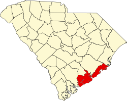
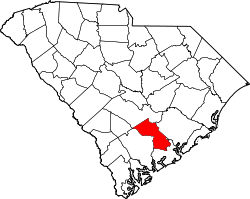
The center of Summerville is in southeastern Dorchester County; the town extends northeast into Berkeley and Charleston counties. It is bordered to the east by the town of Lincolnville and to the southeast by the city of North Charleston. Summerville's town limits extend south as far as the Ashley River next to Old Fort Dorchester State Historical Park.
U.S. Route 78 passes near the center of Summerville, leading southeast 24 miles (39km) to downtown Charleston and northwest 29 miles (47km) to Interstate 95 at St. George. Interstate 26 leads through Summerville's northeast corner, with access from Exit 199, leading southeast to Charleston and northwest 90 miles (140km) to Columbia.
According to the United States Census Bureau, the town has a total area of 22.67 square miles (58.7km2), of which 22.54 square miles (58.4km2) is land and 0.14 square miles (0.36km2) (5.24%) is water.[7]
As of the 2020 census, there were 50,915 people, 19,374 households, and 13,130 families residing in the town.
In 2023, of the 70,270 people in Summerville, about 42,960 of them were in Dorchester County, 5,405 of them were in Berkeley County, and 2,550 of them were in Charleston County.[21]
At the 2010 census,[9] there were 43,392 people residing in 16,181 households in the town. Summerville's population density is 2,404.7 inhabitants per square mile.
There were 16,181 households, of which 38.6% had children under the age of 18 living with them, 48.9% were married couples living together, 15.4% had a female householder with no husband present, and 31.0% were non-families. 25.3% of all households were made up of individuals, and 8.8% had someone living alone who was 65 years of age or older. The average household size was 2.55.
In the town, 27.0% of the population was under the age of 18, and 10.5% was 65 years of age or older. The median age was 34.7 years.
The median income for a household in the town was $54,677. About 11.2% of the population was below the poverty line. The median value of an owner-occupied home was $182,000.
Culture
Starting in 1972, Summerville has supported the Summerville Family YMCA in hosting the annual Flowertown Festival to support health and wellness programs at the YMCA.[23] It is South Carolina's largest arts and crafts festival. It is held during the last weekend of March or the first weekend of April in the Summerville Azalea Park. It often coincides with the annual Cooper River Bridge Run held in Charleston the same weekend. During the three days of the Flowertown Festival, Summerville sees about 200,000 visitors. Admission and parking is free to all who attend. No alcohol or pets are permitted at the festival. About 200 artists from around the country are invited and display their works for purchase. Area restaurants are featured in the festival's "Taste" section, where tickets can be purchased to sample their offerings. Children can enjoy the carnival in the Children's Jubilee/Kids Fest section.
In 1925, these flowers led Summerville's Chamber of Commerce to adopt the slogan "Flower Town in the Pines."
Summerville claims the title "The Birthplace of Sweet Tea."[24] A recipe for sweet iced tea published in Texas native Marion Cabell's 1879 cookbook Housekeeping in Old Virginia has been cited as evidence against this claim.[25]
Government
Summerville has a council form of government, with a town council acting as the chief legislative and executive body of the municipality. Day-to-day operations and legislation implementation are delegated to a town administrator hired to assist the town council in its executive functions. The council has seven members: a mayor elected at-large and six other members elected from single-member districts. By tradition, the mayor presides over council meetings and serves as spokesperson for the council. Summerville has had five mayors in the past fifteen years: Berlin G. Myers (1972-2011), Bill Collins (2011-2016), Wiley Johnson (2016–2020), Ricky Waring (2020-2024), and Russ Touchberry (2024- ).
Fire department
The Town of Summerville Fire & Rescue comprises 97 full-time firefighters and 19 volunteers.[26] These firemen operate out of six stations across town and are subdivided into five engine companies and two ladder companies. Also included in the department is the Fire Marshall Office, which comprises a chief fire marshall and two assistants. The department operates on a 24/48 schedule and maintains a Class 1 ISO rating. In 2025, the 2026 budget for the Summerville Fire Department was estimated at $12.8 million.[27] The current fire chief is Brent Melcher.[28][29]
Police department
The Town of Summerville Police Department consists of 120 sworn officers and 29 civilian staff members, with 2.33 full-time law enforcement officers per 1,000 residents.[30] The estimated 2026 budget for the Summerville Police Department was $15.4 million.[31] The current chief of police is Doug Wright.[32]
EMS and medical centers
Emergency medical services for the town are provided primarily by Dorchester County EMS. In some cases, these services are provided by both Charleston and Berkley County EMS, due to small parts of the town being in these counties.
While the city of Charleston is the primary medical center for the area, Summerville is home to the Summerville Medical Center and many different MUSC campuses, which serve the town.[33]
Crime
This table shows the service statistics collected by the Summerville Police Department. In 2023 the Summerville Police Department received 94,446 calls for service, resulting in 2,030 arrests.[34]
This page is based on this Wikipedia article Text is available under the CC BY-SA 4.0 license; additional terms may apply. Images, videos and audio are available under their respective licenses.