Garrett County is the westernmost county of the U.S. state of Maryland. As of the 2020 census, the population was 28,806, making it the third-least populous county in Maryland. Its county seat is Oakland. The county was named for John Work Garrett (1820–1884), president of the Baltimore and Ohio Railroad. Created from Allegany County, Maryland in 1872, it was the last Maryland county to be formed.

Interstate 79 (I-79) is an Interstate Highway in the Eastern United States, designated from I-77 in Charleston, West Virginia, north to Pennsylvania Route 5 (PA 5) and PA 290 in Erie, Pennsylvania. It is a primary thoroughfare through western Pennsylvania and West Virginia and makes up part of an important corridor to Buffalo, New York, and the Canadian border. Major metropolitan areas connected by I-79 include Charleston and Morgantown in West Virginia and Greater Pittsburgh and Erie in Pennsylvania.

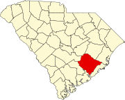
Dorchester County is a county located in the U.S. state of South Carolina. As of the 2020 census, the population was 161,540. Its county seat is St. George.

Berkeley County is a county in the U.S. state of South Carolina. As of the 2020 census, its population was 229,861. Its county seat is Moncks Corner, and the largest city is Goose Creek. After two previous incarnations of Berkeley County, the current county was created in 1882. Berkeley County is included in the Charleston-North Charleston, SC Metropolitan Statistical Area.

Chesterfield Charter Township is a charter township of Macomb County in the U.S. state of Michigan. As of the 2020 census the population was 45,376.

Townville is a borough in Crawford County, Pennsylvania, United States. The population was 328 at the 2020 census, up from 323 at the 2010 census.

Jamestown is a town in Berkeley County, South Carolina, United States. The population was 72 at the 2010 census.

Moncks Corner is a town in and the county seat of Berkeley County, South Carolina, United States. The population was 7,885 at the 2010 census. As defined by the U.S. Census Bureau, Moncks Corner is included within the Charleston-North Charleston-Summerville Metropolitan Statistical Area.

St. Stephen is a town in Berkeley County, South Carolina, United States. The population was 1,697 at the 2010 census.

Awendaw is a small fishing town in Charleston County, South Carolina, United States. The population was 1,294 at the 2010 census. Awendaw is part of the Charleston, South Carolina metropolitan area.

Folly Beach is a public city on Folly Island in Charleston County, South Carolina, United States. The population was 2,617 at the 2010 census, up from 2,116 in 2000. Folly Beach is within the Charleston-North Charleston-Summerville metropolitan area and the Charleston-North Charleston Urbanized Areas.

McClellanville is a small fishing town in rural Charleston County, South Carolina, United States. The population was 1,040 at the 2010 census. It is situated on the Atlantic coast, on land surrounded by Francis Marion National Forest, and has traditionally derived its livelihood from the Atlantic Ocean and coastal marshes by fishing, shrimping and oystering. McClellanville is part of the Charleston-North Charleston-Summerville metropolitan area and the Charleston-North Charleston Urbanized Area.

Mount Pleasant is a large suburban town in Charleston County, South Carolina, United States. In the Low Country, it is the fourth largest municipality and largest town in South Carolina, and for several years was one of the state's fastest-growing areas, doubling in population between 1990 and 2000. The population was 90,801 at the 2020 census.

Bucksport is an unincorporated community and census-designated place (CDP) in Horry County, South Carolina, United States. The population was 876 at the 2010 census. It is a rural port on the Atlantic Intracoastal Waterway at the merger point with the Waccamaw River. The port has some services available for boaters and is also home to the Bucksport Restaurant.

Bowman is a town in Orangeburg County, South Carolina, United States. The population was 968 at the 2010 census, a decline from 1,198 in 2000.

Kingstree is a city and the county seat of Williamsburg County, South Carolina, United States. The population was 3,328 at the 2010 census.

Lane is a town in Williamsburg County, South Carolina, United States. The population was 508 at the 2010 census.

Goose Creek is the most populous city in Berkeley County in the U.S. state of South Carolina. The population was 45,946 at the 2020 census, making it the 7th most populous city in the state. Most of the Naval Weapons Station Charleston is in Goose Creek. As defined by the U.S. Office of Management and Budget, and used only by the U.S. Census Bureau and other federal agencies for statistical purposes, Goose Creek is included within the Charleston–North Charleston–Summerville Metropolitan Area and the Charleston–North Charleston Urbanized Area.

Lucius Mendel Rivers was a Democratic U.S. Representative from South Carolina, representing the Charleston-based 1st congressional district for nearly 30 years. As chair of the House Armed Services Committee, Rivers developed a reputation for his unwavering support of American involvement in the Vietnam War. His reputation suffered as the American public at large turned against further escalation in the Vietnam War. In 1968, Rivers condemned American servicemen who attempted to stop the My Lai massacre, labeling them as "traitors". Rivers served in the House until his death in 1970.
North Charleston Air Force Station is a closed United States Air Force General Surveillance Radar station. It is located in the City of North Charleston, South Carolina. It was closed in 1980.


