Folly Beach, South Carolina

Last updated

Folly Beach, South Carolina
Folly-Beach-from-pier-sc.jpg
Folly Beach
SCMap-doton-FollyBeach.PNG
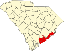
Location of Folly Beach in South Carolina
Coordinates: 32°39′58″N79°56′21″W / 32.66611°N 79.93917°W / 32.66611; -79.93917
CountryUnited States
State South Carolina
County Charleston
Incorporated1938 (town), 1973 (city)
Government
   Mayor Tim Goodwin
Area
[1]
  Total18.87 sq mi (48.87 km2)
  Land12.51 sq mi (32.39 km2)
  Water6.36 sq mi (16.48 km2)
Elevation
16 ft (5 m)
Population
 (2020) [2]
  Total2,078
  Density166.15/sq mi (64.15/km2)
Time zone UTC-5 (EST)
  Summer (DST) UTC-4 (EDT)
ZIP code
29439
Area code 843, 854
FIPS code 45-26035 [3]
GNIS feature ID1231287 [4]
Website www.cityoffollybeach.com

Folly Beach is a public city on Folly Island in Charleston County, South Carolina, United States. The population was 2,617 at the 2010 census, [5] up from 2,116 in 2000. Folly Beach is within the Charleston-North Charleston-Summerville metropolitan area and the Charleston-North Charleston Urbanized Areas.

Contents

History

The Folly North Site (38CH1213) and Secessionville Historic District are listed on the National Register of Historic Places. [6]

Geography

Folly Beach is 11 miles (18 km) south of downtown Charleston at 32°39′58″N79°56′21″W / 32.66611°N 79.93917°W / 32.66611; -79.93917 (32.666152, -79.939213), [7] along the Atlantic Ocean.

Center Street at Folly Beach Center Street on Folly Beach.jpg
Center Street at Folly Beach

According to the United States Census Bureau, the city has an area of 18.9 square miles (48.9 km2), of which 12.5 square miles (32.4 km2) is land and 6.4 square miles (16.5 km2), or 33.72%, is water. [5]

Known to Charleston locals as "the Edge of America" [8] , Folly Beach is home to numerous surf spots, the most popular being the Washout, 10th Street and the Folly Beach Pier. Despite its usually calm conditions, Folly Beach has gained prominence as one of the more popular surf spots along the East Coast. Folly Beach is an eclectic beach community with surf shops, restaurants, gift shops, offices, and bars along Center Street; the main road and gateway to the community. [9]

Endangered North Atlantic right whales, the state animal of Georgia and South Carolina, migrate along the coast during the migration seasons. [10]

Demographics

Historical population
CensusPop.Note
1960 1,137
1970 1,1571.8%
1980 1,47827.7%
1990 1,398−5.4%
2000 2,11651.4%
2010 2,61723.7%
2020 2,078−20.6%
U.S. Decennial Census [11] [2]

2020 census

Folly Beach racial composition [12]
RaceNum.Perc.
White (non-Hispanic)1,95193.89%
Black or African American (non-Hispanic)160.77%
Native American 40.19%
Asian 80.38%
Other/Mixed 713.42%
Hispanic or Latino 281.35%

As of the 2020 United States census, there were 2,078 people, 1,401 households, and 716 families residing in the city.

2019

As of the census of 2019, [13] there were 2,660 people, 1,060 households, and 489 families residing in the city. The population density was 172.7 inhabitants per square mile (66.7/km2). There were 1,747 housing units at an average density of 142.5 per square mile (55.0/km2). The racial makeup of the city was 96.6% White, 0.8% African American, 0.5% Native American, 0.2% Asian, 0.5% from other races, and 1.4% from two or more races. Hispanic or Latino of any race were 1.4% of the population.

Under Folly Beach Pier Folly Beach Pier.jpg
Under Folly Beach Pier

There were 1,060 households, out of which 13.0% had children under the age of 18 living with them, 38.0% were married couples living together, 4.9% had a female householder with no husband present, and 53.8% were non-families. 33.6% of all households were made up of individuals, and 6.3% had someone living alone who was 65 years of age or older. The average household size was 2.00 and the average family size was 2.51.

In the city, the age distribution of the population shows 10.9% under the age of 18, 13.6% from 18 to 24, 33.5% from 25 to 44, 29.6% from 45 to 64, and 12.4% who were 65 years of age or older. The median age was 41 years. For every 100 females, there were 104.2 males. For every 100 females age 18 and over, there were 104.6 males.

The median income for a household in the city was $46,935, and the median income for a family was $66,058. Males had a median income of $76,014 versus $33,450 for females. [13] The per capita income for the city was $30,493. About 4.6% of families and 12.5% of the population were below the poverty line, including 8.7% of those under age 18 and 2.5% of those age 65 or over.

Government

The city is run by an elected strong mayor-council government system.

Mayor

Tim Goodwin

Council members

DJ Rich, Katherine Houghton, E.D., William Farley, Billy Grooms, Eddie Ellis, and Chris Bizzell

Voting patterns

In 2006, the city's residents voted against Amendment 1, which sought to ban same-sex marriage in South Carolina. Statewide, the measure passed by 78% to 22%, but the voters of Folly Beach rejected it by a vote of 503 (49%) to 528 (51%). [14]

County parks

The Charleston County Park and Recreation Commission (CCPRC) operates numerous facilities in Charleston County. In Folly Beach, the county operates Folly Beach County Park, Folly Beach Fishing Pier and the Folly River Boat Landing.

Education

There is one school district in the county, Charleston County School District. [15]

It is zoned to James Island Elementary School, [16] Camp Road Middle School, [17] and James Island Charter High School. [18]

Landmarks

Folly Boat Folly Boat.jpg
Folly Boat

The Folly Boat, located on Folly Road, is an unofficial symbol of Folly Beach.

Related Research Articles

<span class="mw-page-title-main">Colleton County, South Carolina</span> County in South Carolina, United States

Colleton County is a county in the Lowcountry region of the U.S. state of South Carolina. As of the 2020 census, the population was 38,604. Its county seat is Walterboro. The county is named after Sir John Colleton, 1st Baronet, one of the eight Lords Proprietor of the Province of Carolina. After two previous incarnations, the current Colleton County was created in 1800.

<span class="mw-page-title-main">Charleston County, South Carolina</span> County in South Carolina, United States

Charleston County is located in the U.S. state of South Carolina along the Atlantic coast. As of the 2020 census, the population was 408,235, making it the third-most populous county in South Carolina. Its county seat is Charleston. It is also the largest county in the state by total area, although Horry County has a larger land area. The county was created in 1800 by an act of the South Carolina State Legislature.

<span class="mw-page-title-main">Berkeley County, South Carolina</span> County in South Carolina, United States

Berkeley County is a county in the U.S. state of South Carolina. As of the 2020 census, its population was 229,861. Its county seat is Moncks Corner, and the largest community is Goose Creek. After two previous incarnations of Berkeley County, the current county was created in 1882. Berkeley County is included in the Charleston-North Charleston, SC Metropolitan Statistical Area.

<span class="mw-page-title-main">Onslow County, North Carolina</span> County in North Carolina, United States

Onslow County is a county located in the U.S. state of North Carolina. As of the 2020 census, the population was 204,576. Its county seat is Jacksonville. The county was created in 1734 as Onslow Precinct and gained county status in 1739. Onslow County comprises the Jacksonville, NC Metropolitan Statistical Area. The southern border of the county is the coast of the Atlantic Ocean.

<span class="mw-page-title-main">Charleston, Arkansas</span> City in Arkansas, United States

Charleston is a city in Franklin County, Arkansas, United States, and along with Ozark is one of the two county seats of Franklin County. It is part of the Fort Smith, Arkansas-Oklahoma Metropolitan Statistical Area. The population was 2,494 at the 2010 census, down from 2,965 in 2000.

<span class="mw-page-title-main">Haleʻiwa, Hawaii</span> Census-designated place in Hawaii, United States

Haleʻiwa is a North Shore community and census-designated place (CDP) in the Waialua District of the island of Oʻahu, City and County of Honolulu. Haleʻiwa is located on Waialua Bay, the mouth of Anahulu Stream. A small boat harbor is located here, and the shore of the bay is surrounded by Haleʻiwa Beach Park and Haleʻiwa Aliʻi Beach Park. Further west from the center of town is Kaiaka State Recreation Area on Kiaka Point beside Kaiaka Bay.

<span class="mw-page-title-main">Kawela Bay, Hawaii</span> Census-designated place in Hawaii, United States

Kawela Bay is a census-designated place and small community in the Koʻolauloa District on the northern coast of the island of Oʻahu, City & County of Honolulu, Hawaii, United States. In Hawaiian, ka wela means "the heat". As of the 2020 census, the CDP had a population of 325.

<span class="mw-page-title-main">Carolina Beach, North Carolina</span> Town in North Carolina, United States

Carolina Beach is a beach town in New Hanover County, North Carolina, United States, situated about 12 miles (19 km) south of Wilmington International Airport in southeastern coastal North Carolina. As of the 2020 census, the city population was 6,564. It is part of the Wilmington metropolitan area. The community of Wilmington Beach was annexed by the town in 2000.

<span class="mw-page-title-main">Pendleton, South Carolina</span> Town in South Carolina, United States

Pendleton is a town in Anderson County, South Carolina, United States. The population was 3,489 at the 2020 census. It is a sister city of Stornoway in the Outer Hebrides of Scotland.

<span class="mw-page-title-main">Parris Island, South Carolina</span> District of the city of Port Royal, South Carolina

Parris Island is a district of the city of Port Royal, South Carolina on an island of the same name. It became part of the city with the annexation of the Marine Corps Recruit Depot Parris Island on October 11, 2002. For statistical purposes, the United States Census Bureau previously defined Parris Island as a census-designated place (CDP) when it was an unincorporated area of Beaufort County. The population was 4,841 at the 2000 census. As defined by the U.S. Census Bureau, Parris Island is included within the Beaufort Urban Cluster and the larger Hilton Head Island–Beaufort Micropolitan Statistical Area.

<span class="mw-page-title-main">Isle of Palms, South Carolina</span> Barrier island on the coast of South Carolina, United States

Isle of Palms is a city in Charleston County, South Carolina, United States. At the 2010 census, the population was 4,133. Isle of Palms is a barrier island on the South Carolina coast. The city is included within the Charleston-North Charleston-Summerville metropolitan area and the Charleston-North Charleston Urbanized Area. The town lies along a narrow strip of land, hugging the beach, separated from the mainland by the Intracoastal Waterway. It is a community of both vacation home owners and year-round residents, with large beachfront homes, resorts, and local restaurants. Beach volleyball is popular in the summer, and the "Windjammer" club hosts several tournaments throughout the year.

<span class="mw-page-title-main">Kiawah Island, South Carolina</span> Island in South Carolina, United States

Kiawah is a sea island, or barrier island, on the Atlantic coast of the United States. Located 25 miles (40 km) southwest of Charleston in Charleston County, South Carolina, it is primarily a private beach and golf resort. It is home to the Kiawah Island Golf Resort, with spacious villas, beaches, large and acclaimed golf courses, and other attractions. As of the 2010 census, Kiawah Island's population was 1,626, up from 1,163 at the 2000 census. The island is part of the Charleston-North Charleston-Summerville metropolitan area. Alternative spellings and variants of the name itself include "Kiawa", "Kittiwar", and "Kittiwah". Census Tract 21.04, located on the island, has a per capita income of $168,369, the highest in South Carolina.

<span class="mw-page-title-main">Seabrook Island, South Carolina</span> Town in South Carolina, United States

Seabrook Island, formerly known as Simmons Island, is a barrier island in Charleston County, South Carolina, United States. The population was 1,714 at the 2010 census, up from 1,250 in 2000.

<span class="mw-page-title-main">Edisto Beach, South Carolina</span> Town in South Carolina, United States

Edisto Beach is a town in Colleton County, South Carolina, United States. Edisto Beach's population was 414 as of the 2010 census, down from 641 in 2000. The town limits include only the developed coastal area of Edisto Island within Colleton County, while the majority of the island consists of unincorporated land in Charleston County. Due to its status as a bedroom community, Edisto Beach is among the most affluent communities in the state.

<span class="mw-page-title-main">Walterboro, South Carolina</span> City in South Carolina, United States

Walterboro is a city in Colleton County, South Carolina, United States. The city's population was 5,398 at the 2010 census. It is the county seat of Colleton County. Walterboro is located 48 miles (77 km) west of Charleston and is located near the ACE Basin region in the South Carolina Lowcountry.

<span class="mw-page-title-main">Pamplico, South Carolina</span> Town in South Carolina, United States

Pamplico is a town in southeastern Florence County, South Carolina, United States. The population was 1,226 at the 2010 census. It is part of the Florence Metropolitan Statistical Area.

<span class="mw-page-title-main">Loris, South Carolina</span> City in South Carolina, United States

Loris is a city in Horry County, South Carolina, United States. The population was 2,396 at the 2010 census, up from 2,079 in 2000.

<span class="mw-page-title-main">North Myrtle Beach, South Carolina</span> City in South Carolina, United States

North Myrtle Beach is a city in Horry County, South Carolina, United States. It was created in 1968 from four existing municipalities, and is located about 15 miles (24 km) northeast of Myrtle Beach. It serves as one of the primary tourist destinations along the Grand Strand.

<span class="mw-page-title-main">Ridgeland, South Carolina</span> Town in South Carolina, United States

Ridgeland is a town in Jasper and Beaufort counties, South Carolina, United States. The population was 3,749 at the 2020 census, a 7.1% decrease from 2010. It has been the county seat of Jasper County since the county's formation in 1912. As defined by the U.S. Census Bureau, Ridgeland is included within the Hilton Head Island–Bluffton metropolitan area.

<span class="mw-page-title-main">Folly Island</span> Barrier island of South Carolina, United States

Folly Island is a barrier island in the Atlantic Ocean near Charleston, South Carolina. It is one of the Sea Islands and is within the boundaries of Charleston County, South Carolina. During the American Civil War, the 7-square-mile (18 km2) island served as a major staging area for troops of the Union Army that were attacking Confederate forces in the Charleston region. The largest settlement on Folly Island is Folly Beach.

References

  1. "ArcGIS REST Services Directory". United States Census Bureau. Retrieved October 15, 2022.
  2. 1 2 "Census Population API". United States Census Bureau. Retrieved October 15, 2022.
  3. "U.S. Census website". United States Census Bureau . Retrieved January 31, 2008.
  4. "US Board on Geographic Names". United States Geological Survey. October 25, 2007. Retrieved January 31, 2008.
  5. 1 2 "Geographic Identifiers: 2010 Census Summary File 1 (G001): Folly beach city, South Carolina". U.S. Census Bureau, American Factfinder. Archived from the original on February 13, 2020. Retrieved June 25, 2015.
  6. "National Register Information System". National Register of Historic Places . National Park Service. July 9, 2010.
  7. "US Gazetteer files: 2010, 2000, and 1990". United States Census Bureau. February 12, 2011. Retrieved April 23, 2011.
  8. Pisarro, Marcelo (2024). Pasajes sonoros: Escritos sobre música, volumen I. AZ Editora. p. 146. ISBN   9789873507939.{{cite book}}: CS1 maint: date and year (link)
  9. "En el borde de América". La Agenda - Ideas y cultura en la Ciudad. Archived from the original on February 16, 2020. Retrieved February 16, 2020.
  10. "Rare right whale spotted off Folly Beach - Post and Courier". www.postandcourier.com. Archived from the original on January 19, 2016.
  11. "Census of Population and Housing". Census.gov. Retrieved June 4, 2015.
  12. "Explore Census Data". data.census.gov. Retrieved December 15, 2021.
  13. 1 2 Bureau, US Census. "Search Results". The United States Census Bureau. Retrieved September 14, 2020.{{cite web}}: |last= has generic name (help)
  14. "Charleston County election results by precinct: 2006 general election".
  15. "2020 CENSUS - SCHOOL DISTRICT REFERENCE MAP: Charleston County, SC" (PDF). U.S. Census Bureau . Retrieved February 8, 2024. - Text list
  16. "Elementary school for Folly Island" (PDF). Charleston County School District . Retrieved February 8, 2024. - Generated from here.
  17. "Middle school for Folly Island" (PDF). Charleston County School District . Retrieved February 8, 2024. - Generated from here.
  18. "High school for Folly Island" (PDF). Charleston County School District . Retrieved February 8, 2024. - Generated from here.