Lincolnville, South Carolina | |
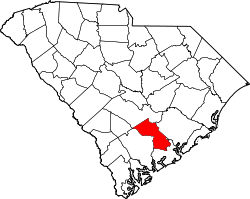
---|---|
Coordinates: 33°0′31″N80°9′28″W / 33.00861°N 80.15778°W | |
Country | United States |
State | South Carolina |
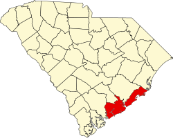
Counties | Charleston, Dorchester |
Government | |
• Mayor | Enoch Dickerson |
Area | |
• Total | 1.20 sq mi (3.12 km2) |
• Land | 1.20 sq mi (3.12 km2) |
• Water | 0.00 sq mi (0.00 km2) |
Elevation | 79 ft (24 m) |
Population | |
• Total | 1,147 |
• Density | 952.66/sq mi (367.96/km2) |
Time zone | UTC-5 (EST) |
• Summer (DST) | UTC-4 (EDT) |
ZIP code | 29485 [3] |
Area code(s) | 843 and 854 |
FIPS code | 45-41740 [4] |
GNIS feature ID | 1231482 [5] |
Lincolnville is a town in Charleston County, South Carolina, United States. A very small portion of the town extends into Dorchester County. The population was 1,139 at the 2010 census, [6] up from 904 in 2000.
Lincolnville is part of the Charleston-North Charleston-Summerville metropolitan area.
Lincolnville is located at 33°0′31″N80°9′28″W / 33.00861°N 80.15778°W (33.008579, -80.157737). [7] It is bordered by the town of Summerville to the north, west, and south. Lincoln Avenue is the main street through the town, leading northwest towards the center of Summerville and southeast into Ladson. Downtown Charleston is 23 miles (37 km) to the southeast.
According to the United States Census Bureau, Lincolnville has a total area of 1.2 square miles (3.1 km2), all land. [6]
Census | Pop. | Note | %± |
---|---|---|---|
1880 | 350 | — | |
1890 | 388 | 10.9% | |
1900 | 40 | −89.7% | |
1910 | 341 | 752.5% | |
1920 | 247 | −27.6% | |
1930 | 600 | 142.9% | |
1940 | 261 | −56.5% | |
1950 | 278 | 6.5% | |
1960 | 420 | 51.1% | |
1970 | 504 | 20.0% | |
1980 | 808 | 60.3% | |
1990 | 716 | −11.4% | |
2000 | 904 | 26.3% | |
2010 | 1,139 | 26.0% | |
2020 | 1,147 | 0.7% | |
U.S. Decennial Census [8] [2] |
Race | Num. | Perc. |
---|---|---|
White (non-Hispanic) | 394 | 34.35% |
Black or African American (non-Hispanic) | 500 | 43.59% |
Native American | 10 | 0.87% |
Asian | 9 | 0.78% |
Pacific Islander | 1 | 0.09% |
Other/Mixed | 79 | 6.89% |
Hispanic or Latino | 154 | 13.43% |
As of the 2020 United States census, there were 1,147 people, 806 households, and 461 families residing in the town.
As of the census [4] of 2000, there were 904 people, 347 households, and 232 families residing in the town. The population density was 794.1 inhabitants per square mile (306.6/km2). There were 371 housing units at an average density of 325.9 per square mile (125.8/km2). The racial makeup of the town was 50.66% White, 45.80% African American, 1.22% Native American, 0.33% from other races, and 1.99% from two or more races. Hispanic or Latino of any race were 1.00% of the population.
There were 347 households, out of which 30.3% had children under the age of 18 living with them, 40.3% were married couples living together, 20.7% had a female householder with no husband present, and 33.1% were non-families. 26.2% of all households were made up of individuals, and 7.2% had someone living alone who was 65 years of age or older. The average household size was 2.59 and the average family size was 3.13.
In the town, the population was spread out, with 28.4% under the age of 18, 6.4% from 18 to 24, 30.2% from 25 to 44, 23.7% from 45 to 64, and 11.3% who were 65 years of age or older. The median age was 35 years. For every 100 females, there were 101.3 males. For every 100 females age 18 and over, there were 97.9 males.
The median income for a household in the town was $29,583, and the median income for a family was $31,932. Males had a median income of $30,114 versus $20,000 for females. The per capita income for the town was $16,311. About 21.0% of families and 23.5% of the population were below the poverty line, including 33.2% of those under age 18 and 23.4% of those age 65 or over.
Lincolnville was founded in 1867 by seven African-American men, including Reverend Richard Harvey Cain, Daniel Adger, Marc Buffett, Reverend Lewis Ruffin Nichols, Hector Grant, Reverend M.B. Salters and Walter Steele, who left their former home of Charleston to escape the racial discrimination they felt subject to in that environment. Amos Williams joined them as a signer of Lincolnville's original charter. Riding the local South Carolina Special train to examine properties for sale by the South Carolina Railroad Company, the men settled on this area that was then known as "Pump Pond" for its use as a train stopping point for water, wood and coal. [10] The men signed a contract with the railroad company to purchase 620 acres (2.5 km2) for $1,000. [11]
After paying the agreed amount in full, a charter for establishment of the town was applied for and later received on December 14, 1889. The name "Lincolnville" was given to the settlement in honor of Abraham Lincoln. [10] [12]
The city is run by an elected mayor–council government system. The mayor is Enoch Dickerson [13] as of November 2021. The city council members include James C. Hampton, Larry Brown, Betty J. Weldon, Tyrone E. Aiken, Karla K. Locklear.[ when? ]
Dorchester County is a county located in the U.S. state of South Carolina. As of the 2020 census, the population was 161,540. Its county seat is St. George.
Colleton County is in the Lowcountry region of the U.S. state of South Carolina. As of the 2020 census, the population was 38,604. Its county seat is Walterboro. The county is named after Sir John Colleton, 1st Baronet, one of the eight Lords Proprietor of the Province of Carolina. After two previous incarnations, the current Colleton County was created in 1800.
Berkeley County is a county in the U.S. state of South Carolina. As of the 2020 census, its population was 229,861. Its county seat is Moncks Corner, and the largest city is Goose Creek. After two previous incarnations of Berkeley County, the current county was created in 1882. Berkeley County is included in the Charleston-North Charleston, SC Metropolitan Statistical Area.
Lincolnville is a town in Waldo County, Maine, United States. The population was 2,312 at the 2020 census. Lincolnville is the mainland terminal for Maine State Ferry Service transport to Islesboro.
Bonneau is a town in Berkeley County, South Carolina, United States. The population was 487 at the 2010 census. It is part of the Charleston–North Charleston–Summerville Metropolitan Statistical Area.
Jamestown is a town in Berkeley County, South Carolina, United States. The population was 72 at the 2010 census.
Moncks Corner is a town in and the county seat of Berkeley County, South Carolina, United States. The population was 7,885 at the 2010 census. As defined by the U.S. Census Bureau, Moncks Corner is included within the Charleston-North Charleston-Summerville Metropolitan Statistical Area.
St. Stephen is a town in Berkeley County, South Carolina, United States. The population was 1,697 at the 2010 census.
Folly Beach is a public city on Folly Island in Charleston County, South Carolina, United States. The population was 2,617 at the 2010 census, up from 2,116 in 2000. Folly Beach is within the Charleston-North Charleston-Summerville metropolitan area and the Charleston-North Charleston Urbanized Areas.
McClellanville is a small fishing town in rural Charleston County, South Carolina, United States. The population was 1,040 at the 2010 census. It is situated on the Atlantic coast, on land surrounded by Francis Marion National Forest, and has traditionally derived its livelihood from the Atlantic Ocean and coastal marshes by fishing, shrimping and oystering. McClellanville is part of the Charleston-North Charleston-Summerville metropolitan area and the Charleston-North Charleston Urbanized Area.
Meggett is a town in Charleston County, South Carolina, United States. The population was 1,226 at the 2010 census. Meggett is part of the Charleston-North Charleston-Summerville metropolitan area.
Ravenel is a town in Charleston County, South Carolina, United States. The population was 2,465 at the 2010 census. Ravenel is part of the Charleston-North Charleston-Summerville metropolitan area.
Rockville is a town in Charleston County, South Carolina, United States, that was founded in 1784. The population was 134 at the 2010 census. Rockville is part of the Charleston-North Charleston-Summerville metropolitan area.
Harleyville is a town in Dorchester County, South Carolina, United States. The population was 677 at the 2010 census, up from 594 at the 2000 census. Harleyville is part of the Charleston-North Charleston-Summerville metropolitan area. As of 2018 the population is 696.
Reevesville is a town in Dorchester County, South Carolina, United States. The population was 196 at the 2010 census. As defined by the U.S. Office of Management and Budget, and used by the U.S. Census Bureau for statistical purposes only, Reevesville is included within the Charleston-North Charleston-Summerville metropolitan area.
Ridgeville is a town in Dorchester County, South Carolina, United States. The population was 1,979 at the 2010 census, up from 1,690 at the 2000 census. Ridgeville is part of the Charleston-North Charleston-Summerville metropolitan area.
Saint George is a town in Dorchester County, South Carolina, United States. The population was 2,084 at the 2010 census, eight fewer than in 2000 census. It has been the county seat of Dorchester County since the latter's formation from Colleton County in 1897.
Goose Creek is the most populous city in Berkeley County in the U.S. state of South Carolina. The population was 45,946 at the 2020 census, making it the 7th most populous city in the state. Most of the Naval Weapons Station Charleston is in Goose Creek. As defined by the U.S. Office of Management and Budget, and used only by the U.S. Census Bureau and other federal agencies for statistical purposes, Goose Creek is included within the Charleston–North Charleston–Summerville Metropolitan Area and the Charleston–North Charleston Urbanized Area.
Ladson is a census-designated place (CDP) in Berkeley, Charleston and Dorchester counties in the U.S. state of South Carolina. The population was 13,790 at the 2010 census. It is named in honor of the Ladson family, one of the oldest planter and merchant families in the Charleston area; one of its members was lieutenant governor James Ladson.
Summerville is a town in the U.S. state of South Carolina situated mostly in Dorchester County, with small portions in Berkeley and Charleston counties. It is part of the Charleston-North Charleston-Summerville Metropolitan Statistical Area. Summerville's population at the 2020 census was 50,915.