Adams Run, South Carolina | |
---|---|
Coordinates: 32°43′15″N80°20′53″W / 32.72083°N 80.34806°W | |
Country | United States |
State | South Carolina |
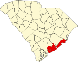
County | Charleston |
Area | |
• Total | 1.42 sq mi (3.67 km2) |
• Land | 1.42 sq mi (3.67 km2) |
• Water | 0.00 sq mi (0.00 km2) |
Elevation | 30 ft (9 m) |
Population | |
• Total | 421 |
• Density | 297.11/sq mi (114.69/km2) |
Time zone | UTC-5 (Eastern (EST)) |
• Summer (DST) | UTC-4 (EDT) |
ZIP code | 29426 |
Area codes | 843, 854 |
GNIS feature ID | 1220137 [3] |
Adams Run is an unincorporated community and census-designated place (CDP) in Charleston County, South Carolina, United States. It was first listed as a CDP in the 2020 census with a population of 421. [4]
Adams Run has a post office with ZIP code 29426, which opened on August 15, 1843. [5] [6]
Christ Church is one of the oldest churches in Adams Run, SC. It's located just a few hundred yards away from the post office. While the congregation was organized around 1835, this church was not constructed until after the Civil War. Completed in 1887, it was built using materials from the first church, which was located at nearby Willtown Bluff, an historic settlement. [7]
In 1962 Christ Church merged with another church, St. Paul’s in Meggett. The consolidated church was called ChristSt. Paul's Episcopal Church. The congregation is now an Anglican parish and worships in a new sanctuary across from the historic St. Paul's; the new sanctuary was completed in 2008.
Although regular Sunday services are no longer held in the Adams Run church, ChristSt. Paul's Church often opens the historic sanctuary for special occasions. Christ Church at Adams Run, as well as its grounds and graveyard, are maintained by Christ St.Paul's.
The Barnwell House, Grove Plantation, King Cemetery, Summit Plantation House, Wilkinson-Boineau House, and Willtown Bluff are listed on the National Register of Historic Places. [8]
Census | Pop. | Note | %± |
---|---|---|---|
2020 | 421 | — | |
U.S. Decennial Census [9] 2020 [10] [2] |
Race / Ethnicity | Pop 2020 [10] | % 2020 |
---|---|---|
White alone (NH) | 125 | 30 |
Black or African American alone (NH) | 261 | 62 |
Native American or Alaska Native alone (NH) | 0 | nil |
Asian alone (NH) | 0 | nil |
Pacific Islander alone (NH) | 0 | nil |
Some Other Race alone (NH) | 1 | nil |
Mixed Race/Multi-Racial (NH) | 13 | 3 |
Hispanic or Latino (any race) | 21 | 5 |
Total | 421 | 100% |
Tornado, also called Upper Falls, is a census-designated place (CDP) in Kanawha County, West Virginia, United States.
Yadkin College is a census-designated place (CDP) in rural Davidson County, North Carolina, United States, located 9 miles (14 km) northwest of Lexington. Contrary to its name, it is not part of Yadkin County.
Coinjock is an unincorporated community and census-designated place (CDP) in Currituck County, North Carolina, United States. As of the 2010 census it had a population of 335. It is located on U.S. Route 158 between Barco and Grandy, about 20 miles (32 km) south of the Virginia state line, and is at mile marker 50 on the southern portion of the Albemarle and Chesapeake Canal, on the Intracoastal Waterway. Church's Island to the east of Coinjock in the Currituck Sound has a village called Waterlily, which uses the postal address of Coinjock as well. The island's name is due to a decayed church that was once a landmark of the tiny community. Coinjock is bordered by Currituck Sound to the east; the North River lies to the west. Its ZIP Code is 27923.
Advance is an unincorporated community and census-designated place (CDP) in Davie County, North Carolina, United States. It is seventy-five miles northeast of Charlotte. As of the 2010 census it had a population of 1,138. It is located along North Carolina Highway 801 just south of Bermuda Run. Advance is part of the Piedmont Triad region of North Carolina.
Pauline is an unincorporated community and census-designated place (CDP) in Spartanburg County, South Carolina, United States. It was first listed as a CDP in the 2020 census with a population of 209.
Grandy is an unincorporated community and census-designated place (CDP) in Currituck County, North Carolina, USA. It was first listed as a CDP in the 2020 census with a population of 2,776. It is located along US 158 between the Currituck Sound and the North River.
Smithtown is an unincorporated community and census-designated place (CDP) in northern Yadkin County, North Carolina, United States. It was first listed as a CDP in the 2020 census with a population of 224.
Uniontown is an unincorporated community and census-designated place (CDP) in Crawford County, Arkansas, United States. It is located on Arkansas Highway 220 near the Oklahoma border, 4.5 miles (7.2 km) west-northwest of Cedarville. Uniontown has a post office with ZIP code 72955.
Little Rock is an unincorporated community and census-designated place (CDP) in Dillon County, South Carolina, United States. Per the 2020 census, the population was 658.
Lobeco is an unincorporated community and census-designated place (CDP) located in Beaufort County, South Carolina, United States. Per the 2020 census, the population was 292.
Oley, also called Friedensburg, is a census-designated place (CDP) that is located on Routes 73 and 662 in northern Oley Township, Berks County, United States.
Glenwood is an unincorporated community and census-designated place in McDowell County, North Carolina, United States, with a rich musical heritage. It was first listed as a CDP in the 2020 census with a population of 501. Glenwood is located along U.S. Route 221, 5 miles (8.0 km) south-southeast of Marion. Glenwood has a post office with ZIP code 28737.
Cliffside is an unincorporated community and census-designated place (CDP) in southeastern Rutherford County, North Carolina, United States. Its population was 611 as of the 2010 census. Cliffside has a post office with ZIP code 28024. U.S. Route 221 Alternate and North Carolina Highway 120 pass through the community.
South Mills is an unincorporated community and census-designated place (CDP) in Camden County, North Carolina, United States. Its population was 454 as of the 2010 census. South Mills has a post office with ZIP code 27976, which opened on March 2, 1840. The community is located near U.S. Route 17, and U.S. Route 17 Business and North Carolina Highway 343, and future Interstate 87 pass through the community.
Crouse is an unincorporated community and census-designated place (CDP) in Lincoln County, North Carolina, United States. It was first listed as a CDP in the 2020 census with a population of 322. Crouse has a post office with ZIP code 28033.
Paulina is an unincorporated community and census-designated place in St. James Parish, Louisiana, United States. It was first listed in the 2010 census with a population of 1,178. The community is located on the east bank of the Mississippi River in the eastern part of the parish, west of Lutcher and across the river from Vacherie. Paulina has a post office with ZIP code 70763.
Box Springs is an unincorporated community and census-designated place (CDP) in Talbot County, Georgia, United States. The community is located in the county's extreme southwestern corner, 12.2 miles (19.6 km) southwest of Talbotton. Box Springs has a post office with ZIP code 31801.
Elliott is an unincorporated community and census-designated place (CDP) in Lee County, South Carolina, United States. It was first listed as a CDP in the 2020 census with a population of 370.
Ruby is a hamlet in Ulster County, New York, United States. The community is 6.3 miles (10.1 km) north of Kingston. Ruby has a post office with ZIP code 12475, which opened on June 2, 1896. The population was 918 at the 2020 census.
Parkers Ferry is a small unincorporated community in Charleston County, South Carolina. Neighboring communities include Willtown Bluff, Jericho, Osborne, and Adams Run. Parker's Ferry falls within Adams Run's zip code, 29426. The elevation of Parkers Ferry is 20 feet, and it is in the Eastern Time Zone. Penny Creek is the primary water source of this community.