Mount Pleasant, South Carolina

Last updated

Mount Pleasant
BooneHall2.jpg
Mount Pleasant, SC Town Seal.png
USA South Carolina location map.svg
Red pog.svg
Location in South Carolina
Coordinates: 32°47′13″N79°52′35″W / 32.78694°N 79.87639°W / 32.78694; -79.87639
CountryUnited States
State South Carolina
County Charleston
SettledJuly 6, 1680
Founded1776 (Greenwich)
1803 (Mount Pleasant)
Consolidated 1837 [1]
Named for Hibben House [2]
Government
   Mayor Will Haynie
Area
[3]
  Total58.66 sq mi (151.92 km2)
  Land49.55 sq mi (128.32 km2)
  Water9.11 sq mi (23.60 km2)  15.53%
Elevation
16 ft (5 m)
Population
 (2020) [4]
  Total90,801
  Estimate 
(2022)
94,545
  Rank 3rd in South Carolina
  Density1,832.70/sq mi (707.60/km2)
Time zone UTC−5 (EST)
  Summer (DST) UTC−4 (EDT)
ZIP codes
29464-29466, 29429
Area code 843, 854
FIPS code 45-48535 [5]
GNIS feature ID1224770 [6]
Website www.tompsc.com

Mount Pleasant is a large suburban town in Charleston County, South Carolina, United States. In the Lowcountry, it is the fourth-most populous municipality in South Carolina, and for several years was one of the state's fastest-growing areas, doubling in population between 1990 and 2000. The population was 90,801 at the 2020 census. [7] It is part of the Charleston metropolitan area. [8]

Contents

At the foot of the Arthur Ravenel Bridge is Patriots Point, a naval and maritime museum, home to the World War II aircraft carrier USS Yorktown, which is now a museum ship. The Ravenel Bridge, an eight-lane highway that is part of U.S. Route 17 and was completed in 2005, spans the Cooper River and links Mount Pleasant with the city of Charleston. [9]

History

The site of Mount Pleasant was originally occupied by the Sewee people, an Algonquian language-speaking tribe. The first European settlers arrived from England on July 6, 1680, under the leadership of Captain Florentia O'Sullivan. Captain O'Sullivan had been granted 2,340 acres (950 ha), which included not only the island later named for him, but also the future site of Mount Pleasant. On the earliest map of the time, this area was called "North Point". [10]

In 1696, 51 new settlers arrived. Each family was allotted several hundred acres in the area that became known as Christ Church parish. In 1706 the Province of Carolina withstood several attacks by the Spanish and the French from their settlements to the south and were victorious in defeating French invaders in an area known as "Abcaw".

St. Andrew's Church was built in 1857 as a chapel of ease for Christ Church Parish and today is part of the Mount Pleasant Historic District. Mt Pleasant St Andrews Episcopal 1.jpg
St. Andrew's Church was built in 1857 as a chapel of ease for Christ Church Parish and today is part of the Mount Pleasant Historic District.

The area of "Abcaw" was Hobcaw Plantation, located between Shem Creek and the Wando River. Later, it was also known as Shipyard Plantation. Its access to deep water and abundance of good timber made it ideal for the development of a prosperous shipbuilding enterprise. Lands adjacent to Hobcaw Point were owned at different times by several different English families, many of which maintained ferries which served Mount Pleasant. By 1721, 107 families were living in Christ Church parish, including 400 whites and 637 enslaved Africans or African Americans. As the area was developed for large plantations, enslaved Africans and African Americans made up the chief labor force of the slave society. Based on this history, the majority of the population in the town was African American through the 19th and early 20th centuries.

In 1754, Charles Pinckney acquired a 715-acre plantation, cultivating the commodity crops of rice and indigo. It became known as Snee Farm near here. His son Charles retained the plantation until 1817. It was operated as a plantation through the 19th century.

On September 24, 1860, a public meeting was held in Mount Pleasant; it resulted in the first secession resolution passed in the state. The secession convention met in Charleston on December 20, 1860. With the advent of the Civil War, Battery Guerry and an adjacent floating battery between Mount Pleasant and Sullivan's Island were instrumental in defense of the city. They were also bases for attacks on Fort Sumter. The city was defended by a line of fortifications from Elliot's Creek at Boone Hall to Copahee Sound. Mount Pleasant was the secret training ground for the nine-man crew of the Confederate submarine H. L. Hunley. This small vessel was launched from Breach Inlet in 1864 to attack and sink the USS Housatonic.

View from the old Pitt Street Bridge in Old Village Pitt street bridge in old village.jpg
View from the old Pitt Street Bridge in Old Village

The original plank-and-barrel footbridge, later known as the Pitt Street Bridge at the foot of the Old Village area in Mount Pleasant, was used by the crew of the H.L. Hunley to cross to Breach Inlet to test the submarine. In 1899 the original wooden plank bridge was replaced by a trolley bridge.

A generation later, in 1929 a steel drawbridge was built for vehicle access between Sullivan's Island and Mount Pleasant. The Pitt Street bridge was dismantled in 1945, but the remains are visible in the Intracoastal Waterway. The area has been maintained since then as the Pickett Bridge Recreation Area. [11] It was named for Charleston doctor Otis Pickett.

The "Old Village" is Mount Pleasant's oldest neighborhood; the oldest home, 111 Hibben Street (the Hibben House) was constructed in 1755 by Jacob Motte, a descendant of French Huguenots who had immigrated to South Carolina to escape religious persecution. [12]

In the early 21st century, the Old Village is centered on the Pitt Street Shops at the northwestern end of the street. Among them is the Pitt Street Pharmacy, which was featured on the Food Network. [13] It has operated at this location for more than 60 years.

The numerous slaves were freed during and after the Civil War. In 1875 African Americans made up 73% of the population in Charleston County. [14]

Scanlonville

Some of the freedmen developed Scanlonville, one of the first African-American communities to be formed after the Civil War in the Charleston area. Today it is a neighborhood within Mount Pleasant, having been annexed by the city. Robert Scanlon, a freedman carpenter, purchased the 614-acre (248 ha) property known as Remley's Plantation, bordering Charleston harbor along the Wando River in Mount Pleasant. Scanlon was the president and founder of the Charleston Land Company, formed by 100 local freedmen who pooled their limited resources and paid $10 per share, in order to purchase large tracts of land in the area. The Charleston Land Company divided this tract into smaller lots so that freedmen could have their own land. Remley's Plantation was divided into farm lots and city lots (which were smaller) to form the community of Scanlonville. The Charleston Land Company and Scanlonville are one of four known cooperative real estate development ventures among African-American freedmen after the Civil War. Remley Point Cemetery is in Scanlonville.

Fishing boats on Shem Creek Shem Creek Boats.JPG
Fishing boats on Shem Creek

Riverside

West of Scanlonville is Riverside. During the Jim Crow years of much of the 20th century, this was known as the largest and oldest of five "black beaches" in Charleston County. It was established when public facilities were segregated under state law. Riverside officially opened in 1930 and featured a dance pavilion, athletics field, bathhouse, playground, and a boardwalk along the Wando River. Riverside Pavilion was the only venue where black city residents could see African-American musical legends such as Duke Ellington, Count Basie, Louis Armstrong, B.B. King, and Ivory Joe Hunter, who also performed in whites-only venues. Music performances at the Pavilion spawned juke joints, or night clubs, in Scanlonville and eventually a hotel called White's Paradise. James Brown was known to have frequented this hotel.

Exploring the marshes Mount Pleasant - South Carolina.jpg
Exploring the marshes

After the original park owner died in 1975, operations of the Riverside property were taken over by Charleston County. It eventually sold the property to a real estate company, which developed this area as a private gated community. Public access to the waterfront ended. [15]

Hurricane Hugo and growth that followed

On September 21, 1989, Mount Pleasant was hit by Hurricane Hugo, a Category Four hurricane. While the town was spared from the worst of the storm (Category 4 conditions were suffered by areas further north of the city), the town and its neighboring barrier islands still had severe damage. Children who lived through the storm were featured in an early episode of Nickelodeon's Nick News , along with children who lived through Hurricane Andrew.

Development continued. A year after the storm, more people moved to the area, and the town had its largest growth spurt. It increased from a population of roughly 23,000 in 1990 to one of roughly 47,000 in 2000.

County seat

The county seat for Berkeley County was located in Mount Pleasant from 1882 until 1895, when it was moved to Moncks Corner.

Bridges

Shem Creek Shem Creek.png
Shem Creek

In 1928, a bridge from the Charleston Peninsula to Mount Pleasant was built. Spanning Town Creek and the Cooper River, and crossing the uninhabited Drum Island, the two-lane Grace Memorial Bridge was opened as a toll bridge. A second and larger bridge, the Silas N. Pearman Bridge, opened in 1966.

On July 16, 2005, the eight-lane Arthur Ravenel Bridge opened for automotive traffic, replacing the two aging bridges. It is one of the longest cable-stayed bridges in the Western Hemisphere. A week before the new bridge officially opened, pedestrians were allowed to cross the bridge, and commemorative coins were distributed. Also, a fireworks display was part of the ceremonies before the official opening. Several cars from the same time period as the Grace Memorial Bridge, including several restored Model A Fords, made a final crossing of the old bridges. [10] The remaining portions of the old bridges were demolished. Local residents watched as the bridges were demolished by explosives over several weeks, through the summer of 2006.

In 2004, Mount Pleasant became one of the first municipalities in the United States to pass a "pay-before-you-pump" gas ordinance. It was intended to reduce stealing of gas that had accompanied rising prices. [16]

Historic sites

The Auld Mound, Buzzard's Island Site, Christ Church, Cook's Old Field Cemetery, Long Point Plantation (38CH321), Lucas Family Cemetery, Mount Pleasant Historic District, Oakland Plantation House, Old Berkeley County Courthouse, Paul Pritchard Shipyard, Remley Point Cemetery, Slave Street, Smokehouse, and Allee, Boone Hall Plantation, Charles Pinckney National Historic Site, USS Clamagore (SS-343), USS Laffey (DD-724), and USS Yorktown (CV-10) are listed on the National Register of Historic Places. [17]

Geography

Mount Pleasant, South Carolina
Interactive map of Mount Pleasant

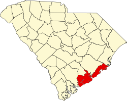
Mount Pleasant is located in central Charleston County at 32°49′23″N79°50′44″W / 32.82306°N 79.84556°W / 32.82306; -79.84556 (32.823189, -79.845477), on the east side of Charleston Harbor and the tidal Wando River. It is bordered to the south by the city of Sullivan's Island and to the west and northwest, across the harbor and river, by the city of Charleston. Over time, the town limits have pushed northeastward from the Old Village area 24 miles (39 km) along U.S. Route 17, nearly as far as Awendaw.

Mount Pleasant is separated from Charleston by the Cooper River. For many years, the town was populated largely on a seasonal basis by Charleston residents wealthy enough to afford summer homes across the river from the Charleston peninsula, where they would go believing they could escape the regular summer "fevers". The population of Mount Pleasant was centered in "Old Village". [10]

According to the United States Census Bureau, the town has a total area of 58.66 square miles (151.9 km2), of which 49.55 square miles (128.3 km2) is land and 9.11 square miles (23.6 km2) (15.53%) is water. [3]

Airport

The town of Mount Pleasant is served by the Charleston International Airport. It is located in the City of North Charleston and is about 12 miles (19 km) northwest of Mount Pleasant. It is the busiest passenger airport in South Carolina ( IATA : CHS, ICAO : KCHS). The airport shares runways with the adjacent Charleston Air Force Base. Mount Pleasant Regional Airport also known as "Faison Field" and LRO, is a public airport located within the town limits 9 miles (14 km) northeast of the central business district of Mount Pleasant. Both airports are owned and operated by the Charleston County Aviation Authority.

Demographics

Historical population
CensusPop.Note
1880 783
1890 1,13845.3%
1900 2,25297.9%
1910 1,346−40.2%
1920 1,57517.0%
1930 1,415−10.2%
1940 1,69820.0%
1950 1,8579.4%
1960 5,116175.5%
1970 6,15520.3%
1980 14,464135.0%
1990 30,108108.2%
2000 47,60958.1%
2010 67,84342.5%
2020 90,80133.8%
2022 (est.)94,545 [7] 4.1%
U.S. Decennial Census [18]
2020 [7] [4]

2020 census

Mount Pleasant racial composition [19]
RaceNum.Perc.
White (non-Hispanic)79,47687.53%
Black or African American (non-Hispanic)2,9843.29%
Native American 1170.13%
Asian 2,0122.22%
Pacific Islander 270.03%
Other/Mixed 2,9503.25%
Hispanic or Latino 3,2353.56%

As of the 2020 census, there were 90,801 people, 36,111 households, and 24,203 families residing in the town.

2010 census

At the 2010 census, [5] there were 67,843 people, 19,025 households, and 12,860 families residing in the city. The population density was 1,136.5 inhabitants per square mile (438.8/km2). There were 20,197 housing units at an average density of 482.1 per square mile (186.1/km2). The racial makeup of the city was 90.17% White, 7.25% African American, 0.17% Native American, 1.18% Asian, 0.02% Pacific Islander, 0.39% from other races, and 0.82% from two or more races. Hispanic or Latino of any race were 1.33% of the population.

There were 19,025 households, out of which 33.9% had children under the age of 18 living with them, 56.9% were married couples living together, 8.3% had a female householder with no husband present, and 32.4% were non-families. 24.1% of all households were made up of individuals, and 6.0% had someone living alone who was 65 years of age or older. The average household size was 2.47 and the average family size was 2.99.

In the town, the age distribution of the population shows 25.1% under the age of 18, 6.5% from 18 to 24, 35.3% from 25 to 44, 22.8% from 45 to 64, and 10.3% who were 65 years of age or older. The median age was 36 years. For every 100 females, there were 92.0 males. For every 100 adult females, there were 88.3 adult males.

The median income for a household in the town was $61,054, and the median income for a family was $71,165. Males had a median income of $50,673 versus $31,640 for females. The per capita income for the city was $30,823. About 3.2% of families and 5.0% of the population were below the poverty line, including 5.3% of those under age 18 and 6.6% of those age 65 or over.

Broadcast television

These TV stations have studios in and broadcast from Mount Pleasant:

Government

The Town of Mt. Pleasant is run by an elected mayor–council government. As of August 2021, the town council is composed of the mayor (Will Haynie) and eight at-large council members (Howard R. Chapman, P.E., Brenda Corley, Laura Hyatt, Kathy Landing, Tom O’Rouke, Jake Rambo, Gary Santos, and Guang Ming Whitley). [20] The appointed town administrator is Eric DeMoura. [21]

Public safety

Fire and emergency services

The Mount Pleasant Fire Department has provided fire suppression and emergency services since 1837, initially as a volunteer agency, and today as a full-time fire department. Today, the fire department has 118 paid personnel augmented by 15 volunteers. It is internationally accredited by the Commission on Fire Accreditation International (CFAI). The Mt. Pleasant Fire Department was originally accredited in 2001 becoming the first accredited fire department in the state of South Carolina. Firefighters work twenty-four-hour rotating shifts. The corporate area and its surroundings are served by seven strategically located fire stations. The fire department administrative office is located within the City Municipal Complex. Mount Pleasant fire stations are staffed daily by 33 personnel. In 2007, under the supervision of Chief Herb Williams and Captain Robert Wronski, the Mount Pleasant Fire Department established a "Paramedic Engine" program, in which firefighters trained as Paramedics will carry the same equipment on the fire engines as in the ambulances. Currently, all engines in Mt Pleasant are now operating as "Paramedic Engines". This means in the event Charleston County EMS is delayed, the Mount Pleasant Fire Department will be able to provide life-saving procedures until the ambulance arrives.

Police

The Mount Pleasant Police Department, a 2006 CALEA Flagship Award recipient, [22] employs 132 sworn officers and 43 civilian personnel, serving the entire municipal population. The police department, which is a nationally accredited agency, sanctioned by the Commission on Accreditation for Law Enforcement Agencies, has adopted the problem-oriented policing philosophy of service delivery, which requires officers to work together with citizens to identify community problems, determine the underlying cause, and develop solutions which address these causes in order to resolve the problem. Led by Chief Carl Ritchie, the police response time to the majority of the calls for service beats the national average. Encompassing 52 square miles (135 km2), the department has split the town into eight patrol neighborhoods. Each patrol neighborhood is assigned to a specific officer on each shift. [23]

Notable people

Schools

Mount Pleasant's public schools are part of the Charleston County School District. [25]

Elementary schools (public)

Middle schools (public)

Both Laing Middle School and Moultrie Middle School served as the town's high schools before Wando High School was built in 1973.

High schools (public)

Private schools

County parks

Boardwalk at Palmetto Islands County Park Palmetto Islands Park Boardwalk 2.jpg
Boardwalk at Palmetto Islands County Park

The Charleston County Park and Recreation Commission (CCPRC) operates numerous facilities within Charleston County. The following are in Mount Pleasant. [29]

Shopping

Mount Pleasant is growing in commercial retail stores, boutiques, including:

See also

Related Research Articles

<span class="mw-page-title-main">Charleston, South Carolina</span> City in South Carolina, United States

Charleston is the most populous city in the U.S. state of South Carolina, the county seat of Charleston County, and the principal city in the Charleston metropolitan area. The city lies just south of the geographical midpoint of South Carolina's coastline on Charleston Harbor, an inlet of the Atlantic Ocean formed by the confluence of the Ashley, Cooper, and Wando rivers. Charleston had a population of 150,227 at the 2020 census. The population of the Charleston metropolitan area, comprising Berkeley, Charleston, and Dorchester counties, was estimated to be 849417 in 2023. It ranks as the third-most populous metropolitan statistical area in the state, and the 71st-most populous in the United States.

<span class="mw-page-title-main">Charleston County, South Carolina</span> County in South Carolina, United States

Charleston County is located in the U.S. state of South Carolina along the Atlantic coast. As of the 2020 census, the population was 408,235, making it the third-most populous county in South Carolina. Its county seat is Charleston. It is also the largest county in the state by total area, although Horry County has a larger land area. The county was created in 1800 by an act of the South Carolina State Legislature.

<span class="mw-page-title-main">Berkeley County, South Carolina</span> County in South Carolina, United States

Berkeley County is a county in the U.S. state of South Carolina. As of the 2020 census, its population was 229,861. Its county seat is Moncks Corner, and the largest community is Goose Creek. After two previous incarnations of Berkeley County, the current county was created in 1882. Berkeley County is included in the Charleston-North Charleston, SC Metropolitan Statistical Area.

<span class="mw-page-title-main">Pendleton, South Carolina</span> Town in South Carolina, United States

Pendleton is a town in Anderson County, South Carolina, United States. The population was 3,489 at the 2020 census. It is a sister city of Stornoway in the Outer Hebrides of Scotland.

<span class="mw-page-title-main">Bluffton, South Carolina</span> Town in South Carolina, United States

Bluffton is a town in southern Beaufort County, South Carolina, United States. The population as of the 2020 census was 27,716, an increase of over 120% since the 2010 census, making it the 17th-most populous municipality and one of the fastest growing municipalities in South Carolina. It is primarily located around U.S. Route 278, between Hilton Head Island and Interstate 95. The Lowcountry town's original one square mile area, now known as Old Town, is situated on a bluff along the May River. Bluffton is a primary town within the Hilton Head Island-Bluffton-Port Royal, SC Metropolitan Statistical Area.

<span class="mw-page-title-main">Isle of Palms, South Carolina</span> Barrier island on the coast of South Carolina, United States

Isle of Palms is a city in Charleston County, South Carolina, United States. At the 2010 census, the population was 4,133. Isle of Palms is a barrier island on the South Carolina coast. The city is included within the Charleston-North Charleston-Summerville metropolitan area and the Charleston-North Charleston Urbanized Area. The town lies along a narrow strip of land, hugging the beach, separated from the mainland by the Intracoastal Waterway. It is a community of both vacation home owners and year-round residents, with large beachfront homes, resorts, and local restaurants. Beach volleyball is popular in the summer, and the "Windjammer" club hosts several tournaments throughout the year.

<span class="mw-page-title-main">Sullivan's Island, South Carolina</span> Town in South Carolina, United States

Sullivan's Island, historically known as O'Sullivan's Island, is a town and island in Charleston County, South Carolina, United States, at the entrance to Charleston Harbor, with a population of 1,791 at the 2010 census, and 1,891 people in 2020. The town is part of the Charleston metropolitan area, and is considered a very affluent suburb of Charleston.

<span class="mw-page-title-main">Georgetown, South Carolina</span> City in South Carolina, United States

Georgetown is the third oldest city in the U.S. state of South Carolina and the county seat of Georgetown County, in the Lowcountry. As of the 2010 census it had a population of 9,163. Located on Winyah Bay at the confluence of the Black, Great Pee Dee, Waccamaw, and Sampit rivers, Georgetown is the second largest seaport in South Carolina, handling over 960,000 tons of materials a year, while Charleston is the largest.

<span class="mw-page-title-main">Edisto Island</span> Unincorporated area in South Carolina, United States

Edisto Island is one of South Carolina's Sea Islands, the larger part of which lies in Charleston County, with its southern tip in Colleton County. Edisto Beach is in Colleton County, and the Charleston County part of the island is unincorporated.

<span class="mw-page-title-main">Goose Creek, South Carolina</span> City in South Carolina, United States

Goose Creek is the most populous city in Berkeley County in the U.S. state of South Carolina. The population was 45,946 at the 2020 census, making it the 7th-most populous city in the state. Most of the Naval Weapons Station Charleston is in Goose Creek. As defined by the U.S. Office of Management and Budget, and used only by the U.S. Census Bureau and other federal agencies for statistical purposes, Goose Creek is included within the Charleston-North Charleston, SC Metropolitan Statistical Area.

<span class="mw-page-title-main">North Charleston, South Carolina</span> City in South Carolina, United States

North Charleston is a city in Berkeley, Charleston, and Dorchester counties in the U.S. state of South Carolina. As of the 2020 census, North Charleston had a population of 114,852, making it the third-most populous city in the state, and the 248th-most populous city in the United States. North Charleston is a principal city within the Charleston-North Charleston, SC Metropolitan Statistical Area, which had an estimated population of 849,417 in 2023.

<span class="mw-page-title-main">Cooper River (South Carolina)</span> Tidal river of South Carolina, United States

The Cooper River is a mainly tidal river in the U.S. state of South Carolina. The cities of Mt. Pleasant, Charleston, North Charleston, Goose Creek, Moncks Corner, and Hanahan are located along the river. Short and wide, the river is joined first by the blackwater East Branch and then farther downstream at the tidal Wando River. Almost immediately thereafter, the Cooper River widens into its estuary and unites with the Ashley River to form the Charleston Harbor.

<span class="mw-page-title-main">Interstate 526</span> Highway in South Carolina

Interstate 526 (I-526) is a 19.56-mile (31.48 km) auxiliary route of I-26, providing a partial beltway around Charleston, South Carolina, in the United States. The route serves several purposes, firstly, as a bypass for through traffic on U.S. Route 17 (US 17) to avoid downtown Charleston, and, secondly, for traffic on I-26 bound for the coastal towns located north and south of Charleston. The route is not yet complete, as the western terminus it is planned for the route to be extended an additional 10 miles (16 km). After the eastern terminus, the roadway continues as a short business route, known as Interstate 526 Business.

<span class="mw-page-title-main">James Island, South Carolina</span> Town in South Carolina, United States

James Island is a town in Charleston County, South Carolina, United States. It is located in the central and southern parts of James Island. James Island is included within the Charleston-North Charleston-Summerville metropolitan area and the Charleston-North Charleston Urbanized Area.

<span class="mw-page-title-main">Charles Pinckney National Historic Site</span> National Historic Site of the United States

The Charles Pinckney National Historic Site is a unit of the United States National Park Service, preserving a portion of Charles Pinckney's Snee Farm plantation and country retreat. The site is located at 1254 Long Point Road, Mount Pleasant, South Carolina. Pinckney (1757-1824) was a member of a prominent political family in South Carolina. He fought in the American Revolutionary War, was held for a period as prisoner in the North, and returned to the state in 1783. Pinckney, a Founding Father of the United States, served as a delegate to the constitutional convention where he contributed to drafting the United States Constitution.

<span class="mw-page-title-main">Wando High School</span> High school in South Carolina, United States

Wando High School is a public high school within the Charleston County School District, located in Mt. Pleasant, South Carolina, United States. The school serves students living in Mount Pleasant and other suburban portions of eastern Charleston County. Established in 1973, the school was re-built in 2004 to accommodate the town's rapid growth during the 1990s.

<span class="mw-page-title-main">James B. Edwards Bridge</span> Bridge in Charleston - Mount Pleasant, South Carolina

The James B. Edwards Bridge, also referred to as the Wando River Bridge, is a pair of pre-cast post-tensioned concrete box girder bridges that span the Wando River between Mount Pleasant and Daniel Island on Interstate 526 (I-526) in South Carolina.

<span class="mw-page-title-main">South Carolina Highway 41</span> State highway in South Carolina

South Carolina Highway 41 (SC 41) is a 121.5-mile (195.5 km) state highway, connecting the Charleston region with eastern portions of the Pee Dee region in South Carolina. It serves as an alternative route to U.S. Route 52.

<span class="mw-page-title-main">Remley Point Cemetery</span> Historic cemetery in Charleston County, South Carolina

Remley Point Cemetery is a cemetery located in the Scanlonville community in Mt. Pleasant, South Carolina. It contains 41 marked graves ranging from 1867 to 1989, but residents claim there may be over 1,000 people, largely African American, buried there. It was added to the National Register of Historic Places in 2p02.

References

  1. "Mount Pleasant Historic District, Charleston County (Mount Pleasant)". South Carolina Department of Archives and History. Retrieved March 11, 2023.
  2. "Old Village Historic District". www.tompsc.com. Retrieved December 7, 2022.
  3. 1 2 "ArcGIS REST Services Directory". United States Census Bureau. Retrieved October 15, 2022.
  4. 1 2 "Census Population API". United States Census Bureau. Retrieved October 15, 2022.
  5. 1 2 "U.S. Census website". United States Census Bureau . Retrieved May 14, 2011.
  6. "US Board on Geographic Names". United States Geological Survey. October 25, 2007. Retrieved January 31, 2008.
  7. 1 2 3 "QuickFacts: Mount Pleasant town, South Carolina". United States Census Bureau. Retrieved September 14, 2022.
  8. "Charleston-North Charleston, SC Metropolitan Statistical Area" (PDF). census.gov. Retrieved September 10, 2023.
  9. "The Pulse Real Estate Charleston, SC » Mt. Pleasant". thepulsecharleston.com.
  10. 1 2 3 "Mt. Pleasant". Charleston Private Boat Tours.
  11. "Crisp, Adam. Otis Picket Bridge Recreation Area (Pitt Street Bridge)". mountpleasant-sc.patch.com. Archived from the original on February 13, 2013. Retrieved February 8, 2013.
  12. "Eddleman, Joe. A Survey of Historic Homes & Building in the Old Village of Mt. Pleasant, SC". mountpleasant-sc.patch.com. Retrieved February 8, 2013.
  13. "Brown, Alton. The South Shall Fry Again, Episode AB0101". foodnetwork.com. Retrieved July 29, 2006.
  14. Melinda Meeks Hennessy, "Racial Violence During Reconstruction: The 1876 Riots in Charleston and Cainhoy", South Carolina Historical Magazine, Vol. 86, No. 2, (April 1985), 104-106 (subscription required)
  15. "Scanlonville". Mount Pleasant, SC.
  16. "Rising gas prices mean more thievery at pumps". Rutland Herald. June 5, 2005. Retrieved January 17, 2008.
  17. "National Register Information System". National Register of Historic Places . National Park Service. July 9, 2010.
  18. "U.S. Decennial Census". Census.gov. Retrieved February 17, 2015.
  19. "Explore Census Data". data.census.gov. Retrieved December 15, 2021.
  20. "Town Council | Mount Pleasant, SC - Official Website". www.tompsc.com. Retrieved August 15, 2021.
  21. "City Administrator". Town of Mount Pleasant. Retrieved January 2, 2015.
  22. "Calea Flagship Agency Program". calea.org. Archived from the original on June 24, 2009.
  23. "Police | Mount Pleasant, SC - Official Website". www.tompsc.com. Retrieved November 6, 2022.
  24. Zolvinski, Steve (June 4, 1988). "Task Force 160 Activated As Regiment". The Leaf-Chronicle . Clarksville, TN. p. 1 via Newspapers.com.
  25. "Schools directory". Charleston County School District. Archived from the original on August 29, 2007. Retrieved January 17, 2008.
  26. "Wando High School / Homepage".
  27. "Lucy Garrett Beckham High School / Homepage".
  28. "Lucy Beckham High School almost fully staffed, prepared to open this fall".
  29. "Charleston County Parks and Recreation - Official Website". ccprc.com.