Williamston, South Carolina

Last updated

Williamston
WilliamstonSCMon.png
Top, left to right: Downtown Williamston, the grave of West Allen Williams (founder of Williamston) in Williamston Springs Mineral Park, water tower at the Williamston Mill, Williamston Municipal Center
Williamston, SC Town Flag.jpg
Williamston, SC Town Seal.jpg
SCMap-doton-Williamston.PNG
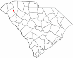
Location of Williamston, South Carolina
Coordinates: 34°37′24″N82°29′50″W / 34.62333°N 82.49722°W / 34.62333; -82.49722 [1]
CountryUnited States
State South Carolina
County Anderson
Area
[2]
  Total
3.73 sq mi (9.65 km2)
  Land3.69 sq mi (9.55 km2)
  Water0.035 sq mi (0.09 km2)
Elevation
[1]
804 ft (245 m)
Population
 (2020) [3]
  Total
4,043
  Density1,096/sq mi (423.2/km2)
Time zone UTC−5 (Eastern (EST))
  Summer (DST) UTC−4 (EDT)
ZIP code
29697
Area codes 864, 821
FIPS code 45-77875 [4]
GNIS feature ID2406888 [1]
Website www.williamstonsc.us

Williamston is a town in Anderson County, South Carolina. The population was 4,043 at the 2020 census. [5] [6]

Contents

Geography

Williamston is located in northeastern Anderson County. The twin towns of Pelzer and West Pelzer are 2 miles (3 km) to the north. Anderson, the county seat, is 15 miles (24 km) to the southwest.

According to the United States Census Bureau, the town has a total area of 3.7 square miles (9.5 km2), of which 3.6 square miles (9.4 km2) is land and 0.04 square miles (0.1 km2), or 1.01%, is water. [7]

Demographics

Historical population
CensusPop.Note
1890 935
1900 9916.0%
1910 1,95797.5%
1920 2,32218.7%
1930 2,235−3.7%
1940 2,50912.3%
1950 2,78210.9%
1960 3,72133.8%
1970 3,9917.3%
1980 4,3108.0%
1990 3,876−10.1%
2000 3,791−2.2%
2010 3,9343.8%
2020 4,0432.8%
2022 (est.)4,1482.6%
U.S. Decennial Census [8] [3]

2020 census

Williamston racial composition [9]
RaceNum.Perc.
White (non-Hispanic)3,11777.1%
Black or African American (non-Hispanic)51712.79%
Native American 230.57%
Asian 60.15%
Pacific Islander 10.02%
Other/Mixed 1453.59%
Hispanic or Latino 2345.79%

As of the 2020 United States census, there were 4,043 people, 1,963 households, and 1,092 families residing in the town.

2000 census

As of the census [4] of 2000, there were 3,791 people, 1,590 households, and 1,090 families residing in the town. The population density was 1,056.2 inhabitants per square mile (407.8/km2). There were 1,762 housing units at an average density of 490.9 units per square mile (189.5 units/km2). The racial makeup of the town was 80.80% White, 17.67% African American, 0.08% Native American, 0.11% Asian, 0.66% from other races, and 0.69% from two or more races. Hispanic or Latino of any race were 1.74% of the population.

There were 1,590 households, out of which 27.6% had children under the age of 18 living with them, 49.9% were married couples living together, 14.0% had a female householder with no husband present, and 31.4% were non-families. 28.8% of all households were made up of individuals, and 14.7% had someone living alone who was 65 years of age or older. The average household size was 2.38 and the average family size was 2.91.

In the town, the population was spread out, with 22.8% under the age of 18, 7.4% from 18 to 24, 28.3% from 25 to 44, 22.7% from 45 to 64, and 18.9% who were 65 years of age or older. The median age was 40 years. For every 100 females, there were 91.7 males. For every 100 females age 18 and over, there were 86.7 males.

The median income for a household in the town was $31,458, and the median income for a family was $37,679. Males had a median income of $30,585 versus $21,771 for females. The per capita income for the town was $14,085. About 9.4% of families and 12.3% of the population were below the poverty line, including 10.3% of those under age 18 and 13.3% of those age 65 or over.

Education

Public schools in the Pelzer/Williamston/West Pelzer area are administered by Anderson District One. The public elementary schools in Anderson district one are Cedar Grove Elementary, Powdersville Elementary, Concrete Primary, Spearman Elementary, Hunt Meadows Elementary, West Pelzer Elementary, Palmetto Elementary, and Wren Elementary. The Middle schools are Palmetto Middle, Wren Middle, and Powdersville Middle. High schools are; Palmetto High School, Palmetto High Freshman Academy, Powdersville High School, Wren High School, and Wren High School Freshman Academy. [10]

Willimaston has a public library, a branch of the Anderson County Library System. [11]

Emergency Services

References

  1. 1 2 3 U.S. Geological Survey Geographic Names Information System: Williamston, South Carolina
  2. "ArcGIS REST Services Directory". United States Census Bureau. Retrieved October 15, 2022.
  3. 1 2 "Census Population API". United States Census Bureau. Retrieved October 15, 2022.
  4. 1 2 "U.S. Census website". United States Census Bureau . Retrieved January 31, 2008.
  5. "Population and Housing Unit Estimates". United States Census Bureau. 2016.
  6. "Population and Housing Unit Estimates". United States Census Bureau. Retrieved November 18, 2017.
  7. "Geographic Identifiers: 2010 Demographic Profile Data (G001): Williamston town, South Carolina". U.S. Census Bureau, American Factfinder. Archived from the original on February 12, 2020. Retrieved August 8, 2013.
  8. "Census of Population and Housing". Census.gov. Retrieved June 4, 2015.
  9. "Explore Census Data". data.census.gov. Retrieved December 14, 2021.
  10. "Schools / Primary & Elementary Schools". Anderson1.k12.sc.us. Retrieved January 2, 2018.
  11. "South Carolina libraries and archives". SCIWAY. Retrieved June 7, 2019.