Midlands of South Carolina

Last updated
The eight counties that usually compose the Midlands. The midlands of south carolina.PNG
The eight counties that usually compose the Midlands.

The Midlands region of South Carolina is the middle area of the state. The region's main center is Columbia, the state's capital. The Midlands is so named because it is halfway point between the Upstate and the Lowcountry.[ citation needed ] The main area code is 803.

Contents

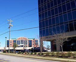
The area has become a major business center in the state, for its growing production of paper products, textile, medical supplies and steel. It is also a center for farming and medical care. The area is also involved in attractions and tourism, featuring shopping, fishing and amusement.

As of the 2020 census the Midlands population was 1,019,439.

Counties

The Midlands area of South Carolina includes at least these eight counties:

Usually included

This region is largely coextensive with the Columbia metropolitan area (which includes Newberry and Orangeburg counties) but .

The middle portion of Orangeburg County is located in the Midlands, while the western part is located in the Central Savannah River Area and the eastern part is considered to be located in the Lowcountry. Other than being designated to the Augusta, GA market, Aiken County is also frequently listed as part of the Central Savannah River Area.

Cities

Columbia skyline coming from North Main St. S5001683.JPG
Columbia skyline coming from North Main St.
New Lexington Courthouse Lexington, South Carolina Courthouse.jpg
New Lexington Courthouse

Primary cities

(including county and 2020 census count)

Suburban towns and cities over 10,000 in population

(including county and 2020 census bureau population estimates)

Suburbs with less than 10,000 inhabitants

(including county and 2020 census bureau population data)

Unincorporated communities

(2020 Census Figures)

Higher education

Media

The region is served by four commercial television stations, WLTX CBS 19, WOLO ABC 25, WACH FOX 57, and WIS 10.

The state's second largest newspaper, The State, is published here.

Major highways

Related Research Articles

<span class="mw-page-title-main">Richland County, South Carolina</span> County in South Carolina, United States

Richland County is located in the U.S. state of South Carolina. As of the 2020 census, its population was 416,147, making it the second-most populous county in South Carolina, behind only Greenville County. The county seat and largest city is Columbia, the state capital. The county was established on March 12, 1785. Richland County is part of the Columbia, SC Metropolitan Statistical Area. In 2010, the center of population of South Carolina was located in Richland County, in the city of Columbia.

<span class="mw-page-title-main">Orangeburg County, South Carolina</span> County in South Carolina, United States

Orangeburg County is a county located in the U.S. state of South Carolina. As of the 2020 census, the population was 84,223. Its county seat is Orangeburg. The county was created in 1769.

<span class="mw-page-title-main">Newberry County, South Carolina</span> County in South Carolina, United States

Newberry County is a county located in the U.S. state of South Carolina. As of the 2020 census, its population was 37,719. Its county seat is Newberry. The name is of unknown origin, although one theory suggests that it was named by Quaker settlers in honor of their home of Newberry, a suburb of London in the United Kingdom.

<span class="mw-page-title-main">Lexington County, South Carolina</span> County in South Carolina, United States

Lexington County is a county located in the U.S. state of South Carolina. As of the 2020 census, the population was 293,991. Its county seat and largest town is Lexington. The county was chartered in 1785 and was named in commemoration of Lexington, Massachusetts, the site of the Battle of Lexington in the American Revolutionary War. Lexington County is the sixth-largest county in South Carolina by population and is part of the Columbia, SC Metropolitan Statistical Area. It is located in the Midlands region of South Carolina.

<span class="mw-page-title-main">Kershaw County, South Carolina</span> County in South Carolina, United States

Kershaw County is a county located in the U.S. state of South Carolina. As of the 2020 census, its population was 65,403. The county seat and largest city is Camden. The county was created in 1791 from parts of Claremont, Lancaster, Fairfield, and Richland counties. It is named for Col. Joseph Kershaw (1727–1791), an early settler and American Revolutionary War patriot.

<span class="mw-page-title-main">Aiken County, South Carolina</span> County in South Carolina, United States

Aiken County is a county in the U.S. state of South Carolina. As of the 2020 census, its population was 168,808. Its county seat and largest city is Aiken. Aiken County is a part of the Augusta-Richmond County, GA-SC Metropolitan Statistical Area. It is mostly in the Sandhills region, with the northern parts reaching in the Piedmont and southern parts reaching into the Coastal Plain.

<span class="mw-page-title-main">Aiken, South Carolina</span> City in South Carolina, United States

Aiken is the largest city in, and the county seat of, Aiken County, in western South Carolina. It is one of the two largest cities of the Central Savannah River Area. Founded in 1835, Aiken was named after William Aiken, the president of the South Carolina Railroad. It became part of Aiken County when the county was formed in 1871 from parts of Orangeburg, Lexington, Edgefield, and Barnwell counties.

<span class="mw-page-title-main">Cayce, South Carolina</span> City in South Carolina, United States

Cayce is a city in the U.S. state of South Carolina, along the Congaree River. The population was 12,528 at the 2010 census and rose to 13,789 in the 2020 United States Census, and it is the third-most populated municipality in Lexington County. The city is primarily in Lexington County, with additional, predominantly rural land to the east in Richland County. Cayce is part of the Columbia Metropolitan Statistical Area and is within South Carolina's Midlands region.

<span class="mw-page-title-main">Lexington, South Carolina</span> Town in South Carolina, USA

Lexington is the largest town in and the county seat of Lexington County, South Carolina, United States. It is a suburb of the state capital, Columbia. The population was 23,568 at the 2020 Census, and it is the second-largest municipality in the greater Columbia area. The 2022 estimated population is 24,626. According to the Central Midlands Council of Governments, the greater Lexington area had an estimated population of 111,549 in 2020 and is considered the fastest-growing area in the Midlands. Lexington's town limits are bordered to the east by the city of West Columbia.

<span class="mw-page-title-main">U.S. Route 176</span> Interstate in South Carolina

U.S. Route 176 is a spur of US 76 in the U.S. states of North Carolina and South Carolina. The U.S. Highway runs 237.98 miles (382.99 km) from US 25 Business and North Carolina Highway 225 in Hendersonville, North Carolina, east to US 52 in Goose Creek, South Carolina. US 176 serves the transition region between the Blue Ridge Mountains and Foothills of Western North Carolina and the Upstate, Midlands, and Lowcountry regions of South Carolina. The highway passes through and connects Spartanburg, one of two major cities in the Upstate, and Columbia, the South Carolina state capital and central city of the Midlands. US 176 parallels and serves as a secondary highway to Interstate 26 (I-26) except for between Spartanburg and Columbia, where the U.S. Highway deviates from the I-26 corridor to serve Union.

The Pee Dee is a region in the northeast corner of the U.S. state of South Carolina. It lies along the lower watershed of the Pee Dee River, which was named after the Pee Dee, a Native American tribe that historically inhabited the region.

The SC Technical College System is a statewide network of 16 technical colleges in South Carolina.

<span class="mw-page-title-main">Area codes 803 and 839</span> Area codes in central South Carolina, United States

Area codes 803 and 839 are telephone area codes in the North American Numbering Plan (NANP) for the central part of the U.S. State of South Carolina. The numbering plan area (NPA) is anchored by the city of Columbia, the state capital. It also includes most of the South Carolina portions of the Charlotte, North Carolina and Augusta, Georgia metropolitan areas. 839, an all-service overlay, was approved by the South Carolina Public Service Commission in 2019.

<span class="mw-page-title-main">U.S. Route 1 in South Carolina</span> Section of U.S. Highway in South Carolina, United States

U.S. Highway 1 (US 1) is a 170.540-mile (274.458 km) north–south U.S. Highway that crosses South Carolina from southwest to northeast and connects the cities of North Augusta, Aiken, Lexington, Columbia, Camden, and Cheraw.

<span class="mw-page-title-main">South Carolina's congressional districts</span> U.S. House districts in the state of South Carolina

There are currently seven United States congressional districts in South Carolina. There have been as few as four and as many as nine congressional districts in South Carolina. The 9th district and the 8th district were lost after the 1840 census. The 5th district and the 6th district were also briefly lost after the Civil War, but both had been regained by the 1880 census. Because of the state population growth in the 2010 census, South Carolina regained its 7th district, which had remained unused since the Civil War.

<span class="mw-page-title-main">Interstate 26 in South Carolina</span> Section of Interstate Highway in South Carolina, United States

Interstate 26 (I-26) is a South Carolina Interstate highway running generally east–west from near Landrum, in Spartanburg County, to U.S. Route 17 (US 17), in Charleston, South Carolina. It is also the longest Interstate Highway in South Carolina.

<span class="mw-page-title-main">Columbia metropolitan area, South Carolina</span>

As defined by the U.S. Office of Management and Budget, and used by the U.S. Census Bureau for statistical purposes only, the Columbia Metropolitan Statistical Area, is an area consisting of six counties in central South Carolina, anchored by the city of Columbia. The current population has an estimation of 837,092. It is the second-largest metropolitan statistical area in the state of South Carolina, since the Anderson metropolitan statistical area was combined with Greenville's following the 2010 census.

References

  1. "Columbia city, South Carolina". Census Bureau. Census Bureau. Retrieved October 1, 2016.
  2. "Sumter City, SC". Censusbureau.gov. U.S. Government. Retrieved 2 July 2022.
  3. "QuickFacts Lexington town, South Carolina". www.census.gov. U.S. Government. Retrieved 30 May 2022.
  4. "Orangeburg City Quick Fact". census.gov. U.S. Government. Retrieved 2 July 2022.
  5. "Cayce City Quick Facts". census.gov. U.S. Government. Retrieved 2 July 2022.
  6. "Forest Acres City Quickfacts". census.gov. U.S. Government. Retrieved 2 July 2022.

34°04′N81°05′W / 34.06°N 81.08°W / 34.06; -81.08