Fountain Inn, South Carolina

Last updated

Fountain Inn
FountainInnSCMon.png
Top, left to right: Downtown Fountain Inn, Fountain Inn City Hall, Cannon Building, Fairview Presbyterian Church, Robert Quillen Office and Library
Fountain Inn, SC City Flag (new version).gif
Fountain Inn, SC City Seal.png
SCMap-doton-FountainInn.PNG
Location of Fountain Inn, South Carolina
Coordinates: 34°41′36″N82°11′55″W / 34.69333°N 82.19861°W / 34.69333; -82.19861
CountryUnited States
State South Carolina
Counties Greenville, Laurens
Area
[1]
  Total8.50 sq mi (22.01 km2)
  Land8.45 sq mi (21.89 km2)
  Water0.05 sq mi (0.13 km2)
Elevation
[2]
866 ft (264 m)
Population
 (2020) [3]
  Total10,416
  Density1,232.52/sq mi (475.90/km2)
Time zone UTC−5 (Eastern (EST))
  Summer (DST) UTC−4 (EDT)
ZIP code
29644
Area code 864
FIPS code 45-27070 [4]
GNIS feature ID1222514 [2]
Website www.fountaininn.org

Fountain Inn is a city in Greenville and Laurens counties in the U.S. state of South Carolina. The population was 10,416 at the 2020 census, [5] up from 7,799 in 2010. It is part of the Greenville-Mauldin-Easley Metropolitan Statistical Area.

Contents

History

The Cannon Building, Fairview Presbyterian Church, Fountain Inn High School, Fountain Inn Principal's House and Teacherage, McDowell House, Robert Quillen Office and Library, Tullyton, and F. W. Welborn House are listed on the National Register of Historic Places. [6] [7] [8]

Geography

The southern part of the city is in Laurens County, while the bulk of the city is in Greenville County. The city's nickname is "The Diamond Tip of the Golden Strip". [9] The city took its name from an inn and fountain that were along the old stagecoach route. [10] The stagecoach drivers called the stop "Fountain Inn", and it stuck. A small garden fountain is installed at City Hall, and there is a marker on the north side of town showing the former location of the old inn.

South Carolina Highway 14 runs through the center of town as Main Street, and Interstate 385 runs along the southern edge of the city, with access from Exits 22, 23, and 26. Greenville is 17 miles (27 km) to the northwest, and Columbia is 84 miles (135 km) to the southeast. Via Highway 14, Laurens is 16 miles (26 km) to the southeast.

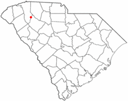
According to the U.S. Census Bureau, the city of Fountain Inn has a total area of 7.9 square miles (20.5 km2), of which 0.04 square miles (0.1 km2), or 0.43%, are water. [5]

There are several festivals in Fountain Inn, including Aunt Het Day, based on syndicated cartoon columnist Robert Quillen, that brings in several hundred visitors as Main Street is closed and filled with many unique vendors.

Demographics

Historical population
CensusPop.Note
1890 212
1900 497134.4%
1910 97997.0%
1920 1,10012.4%
1930 1,26414.9%
1940 1,3466.5%
1950 1,325−1.6%
1960 2,38580.0%
1970 3,39142.2%
1980 4,22624.6%
1990 4,3883.8%
2000 6,01737.1%
2010 7,79929.6%
2020 10,41633.6%
U.S. Decennial Census [11] [3]

2020 census

Fountain Inn racial composition [12]
RaceNum.Perc.
White (non-Hispanic)5,88361.4%
Black or African American (non-Hispanic)2,98127.92%
Native American 121.6%
Asian 680.2%
Pacific Islander 190.0%
Other/Mixed 4347.47%
Hispanic or Latino 1,0198.7%

As of the 2020 United States census, there were 10,416 people, 3,170 households, and 2,532 families residing in the city.

2020 census

As of the census [4] of 2020, there were 10,416 people. The population density was 988.9 inhabitants per square mile (381.8/km2). There were 2,465 housing units at an average density of 447.2 per square mile (172.7/km2). The racial makeup of the city was 61.49% White, 27.9% African American, 1.6% Native American, 0.2% Asian, 0.00% Pacific Islander, and 7.4% from two or more races. Hispanic or Latino of any race were 8.7 % of the population.

There were 3,538 households.

The population in the city consists of 25.7% under 18 and 9.7% who were 65 years of age or older. The median age was 33 years.

The median income for a family was $65,221. The per capita income for the city was $25,855. About 13.2% of the population were below the poverty line.

Government

Fountain Inn is governed by a mayor, a city council, a city administrator, and several boards and commissions. The current officeholders are:

City council

Crime

The city of Fountain Inn has one of the lowest crime rates in Greenville County and has the best record in closing case files of towns of similar sizes and geographic area.[ citation needed ] The Fountain Inn Police Department has annual reports and information regarding current records and statistical surveys of the area.

Education

88.9% of the residents have a high school diploma or equivalent, 28.1% with bachelor's degree, and 4.1% hold a master's, professional or doctorate.[ citation needed ]

Notable people

Fountain Inn was the adopted home of journalist and humorist Robert Quillen, one of the "leading purveyors of village nostalgia" during the early decades of the 20th century. [13]

Fountain Inn was the home town of one-legged tap dancer Clayton "Peg Leg" Bates.

Fountain Inn is the home town of Travelle Wharton, a retired NFL offensive lineman. He played for the Carolina Panthers of the NFL from 2004 through 2011. He joined the Cincinnati Bengals for the 2012 season. He played college football at the University of South Carolina.

See also

Fountain Inn High School

Related Research Articles

<span class="mw-page-title-main">Laurens County, South Carolina</span> County in South Carolina, United States

Laurens County is a county located in the U.S. state of South Carolina. As of the 2020 census, its population was 67,539. Its county seat is Laurens.

<span class="mw-page-title-main">Greenville County, South Carolina</span> County in South Carolina, United States

Greenville County is located in the U.S. state of South Carolina. As of the 2020 census, the population was 525,534, making it the most populous county in the state. Its county seat is Greenville. The county is also home to the Greenville County School District, the largest school system in South Carolina.

<span class="mw-page-title-main">Tarboro, North Carolina</span> Town in North Carolina, United States

Tarboro is a town located in Edgecombe County, North Carolina, United States. It is part of the Rocky Mount Metropolitan Statistical Area. As of the 2020 census, the town had a population of 10,721. It is the county seat of Edgecombe County. The town is on the opposite bank of the Tar River from Princeville. It is also part of the Rocky Mount-Wilson-Roanoke Rapids CSA. Tarboro is located near the western edge of North Carolina's coastal plain. It has many historical churches, some dating from as early as 1742.

<span class="mw-page-title-main">Fountain, North Carolina</span> Town in North Carolina, United States

Fountain is a town in Pitt County, North Carolina, United States. The population was 427 at the 2010 census. The town is a part of the Greenville Metropolitan Area located in North Carolina's Inner Banks region.

<span class="mw-page-title-main">Belton, South Carolina</span> City in South Carolina, United States

Belton is a city in eastern Anderson County, South Carolina. The population was 4,134 at the 2010 census.

<span class="mw-page-title-main">Blacksburg, South Carolina</span> Town in South Carolina, United States

Blacksburg is a small town in Cherokee County, South Carolina, United States. The population was 1,848 at the 2010 census. The communities of Cherokee Falls, Kings Creek, Cashion Crossroads, Buffalo, and Mount Paran are located near the town.

<span class="mw-page-title-main">Gaffney, South Carolina</span> City in South Carolina, United States

Gaffney is a city in and the seat of Cherokee County, South Carolina, United States, in the Upstate region of South Carolina. Gaffney is known as the "Peach Capital of South Carolina". The population was 12,539 at the 2010 census, with an estimated population of 12,609 in 2019. It is the principal city of the Gaffney, South Carolina, Micropolitan Statistical Area, which includes all of Cherokee County and which is further included in the greater Greenville-Spartanburg-Anderson, South Carolina Combined Statistical Area.

<span class="mw-page-title-main">City View, South Carolina</span> Census-designated place in South Carolina, United States

City View, a former incorporated city, is now a census-designated place (CDP) in Greenville County, South Carolina, United States. The population was 1,345 at the 2010 census, up from 1,254 in 2000. It is part of the Greenville–Mauldin–Easley Metropolitan Statistical Area.

<span class="mw-page-title-main">Mauldin, South Carolina</span> City in South Carolina, United States

Mauldin is a city in Greenville County, South Carolina, United States. The population was 24,724 at the 2020 census, making it the 19th-most populous city in South Carolina. It is located in the Greenville-Anderson-Greer, SC Metropolitan Statistical Area.

<span class="mw-page-title-main">Simpsonville, South Carolina</span> City in South Carolina, United States

Simpsonville is a city in Greenville County, South Carolina, United States. It is part of the Greenville, SC Metropolitan Statistical Area. The population was 23,384 at the 2020 census, up from 18,238 in the 2010 census. Simpsonville is part of the "Golden Strip", along with Mauldin and Fountain Inn, an area which is noted for having low unemployment due to a diversity of industries including H.B. Fuller, KEMET, Sealed Air and Milliken. It is the 23rd-most populous city in South Carolina.

<span class="mw-page-title-main">Travelers Rest, South Carolina</span> City in South Carolina, United States

Travelers Rest is a city in Greenville County, South Carolina. The population was 7,788 at the 2020 census. It is part of the Greenville-Mauldin-Easley Metropolitan Statistical Area. Travelers Rest, the northernmost city in Greenville County, is located 10 miles north of Greenville and around 20 miles south of the North Carolina border. Furman University, a private liberal-arts university, was annexed into the city limits of Travelers Rest in April 2018 and North Greenville University, a private Christian institution, is located in nearby Tigerville.

<span class="mw-page-title-main">Kershaw, South Carolina</span> Town in South Carolina, United States

Kershaw is a town in Lancaster County, South Carolina, United States. It was incorporated in 1888. As of the 2010 census, the population was 1,803, and as of 2019 the estimated population was 2,321. The Haile Gold Mine, where gold was discovered in 1825, is 3 miles (5 km) from town and was at one time the largest single producer of gold in the Appalachian region.

<span class="mw-page-title-main">Clinton, South Carolina</span> City in South Carolina, United States

Clinton is a city in Laurens County, South Carolina, United States. The population was 8,490 as of the 2010 census. It is part of the Greenville–Mauldin–Easley Metropolitan Statistical Area in upstate South Carolina. Clinton is the home of Presbyterian College.

<span class="mw-page-title-main">Cross Hill, South Carolina</span> Town in South Carolina, United States

Cross Hill is a town in Laurens County, South Carolina, United States. The population was 507 at the 2010 census. It is part of the Greenville–Mauldin–Easley Metropolitan Statistical Area.

<span class="mw-page-title-main">Gray Court, South Carolina</span> Town in South Carolina, United States

Gray Court is a town in Laurens County, South Carolina, United States. The population was 795 at the 2010 census. It is part of the Greenville–Mauldin–Easley Metropolitan Statistical Area.

<span class="mw-page-title-main">Laurens, South Carolina</span> City in South Carolina, United States

Laurens is a city in Laurens County, South Carolina, United States. The population was 9,139 at the 2010 census. It is the county seat of Laurens County.

<span class="mw-page-title-main">Seneca, South Carolina</span> City in South Carolina, United States

Seneca is a city in Oconee County, South Carolina, United States. The population was 8,102 at the 2010 census. It is the principal city of the Seneca Micropolitan Statistical Area, an (MSA) that includes all of Oconee County, and that is included within the greater Greenville-Spartanburg-Anderson, South Carolina Combined Statistical Area. Seneca was named for the nearby Cherokee town of Isunigu, which English colonists knew as "Seneca Town".

<span class="mw-page-title-main">Pickens, South Carolina</span> City in South Carolina, United States

Pickens, formerly called Pickens Courthouse, is a city in and the county seat of Pickens County, South Carolina, United States. The population was 3,126 at the 2010 census. Pickens changed its classification from a town to a city in 1998, but it was not reported to the Census Bureau until 2001. It was named after Andrew Pickens (1739–1817), an American revolutionary soldier and US Congressman for South Carolina.

<span class="mw-page-title-main">Ware Shoals, South Carolina</span> Town in South Carolina, United States

Ware Shoals is a town in Abbeville, Greenwood, and Laurens counties in the U.S. state of South Carolina, along the Saluda River. Ware Shoals has a population of 1,607 according to the 2020 United States Census.

<span class="mw-page-title-main">Greer, South Carolina</span> City in South Carolina, United States

Greer is a city in Greenville and Spartanburg counties in the U.S. state of South Carolina. The population was 35,308 as of the 2020 census, making it the 14th-most populous city in South Carolina. Greer is included in the Greenville-Anderson-Greer, SC Metropolitan Statistical Area, which is part of the Greenville-Spartanburg-Anderson, SC Combined Statistical Area in Upstate South Carolina.

References

  1. "ArcGIS REST Services Directory". United States Census Bureau. Retrieved October 15, 2022.
  2. 1 2 U.S. Geological Survey Geographic Names Information System: Fountain Inn, South Carolina
  3. 1 2 "Census Population API". United States Census Bureau. Retrieved October 15, 2022.
  4. 1 2 "U.S. Census website". United States Census Bureau . Retrieved January 31, 2008.
  5. 1 2 "Geographic Identifiers: 2010 Demographic Profile Data (G001): Fountain Inn city, South Carolina". American Factfinder. U.S. Census Bureau. Retrieved February 8, 2017.[ dead link ]
  6. "National Register Information System". National Register of Historic Places . National Park Service. July 9, 2010.
  7. "National Register of Historic Places Listings". Weekly List of Actions Taken on Properties: 1/30/12 through 2/03/12. National Park Service. February 10, 2012.
  8. "National Register of Historic Places Listings". Weekly List of Actions Taken on Properties: 6/27/11 through 7/01/11. National Park Service. July 8, 2011.
  9. "Welcome to Fountain Inn". Fountain Inn Chamber of Commerce. Retrieved February 8, 2017.
  10. "Communities". Laurens County Chamber of Commerce. Archived from the original on January 13, 2013. Retrieved June 14, 2014.
  11. "Census of Population and Housing". Census.gov. Retrieved June 4, 2015.
  12. "Explore Census Data". data.census.gov. Retrieved December 14, 2021.
  13. John Hammond Moore, ed., The Voice of Small-Town America: The Selected Writings of Robert Quillen, 1920-1948 (Columbia: University of South Carolina Press, 2008), xi.