Charleston County, South Carolina

Last updated

Charleston County
Charleston County Seal.png
Charleston County Logo.png
Map of South Carolina highlighting Charleston County.svg
Location within the U.S. state of South Carolina
South Carolina in United States.svg
South Carolina's location within the U.S.
Coordinates: 32°48′N79°56′W / 32.80°N 79.94°W / 32.80; -79.94
CountryFlag of the United States.svg United States
StateFlag of South Carolina.svg  South Carolina
FoundedJanuary 1, 1800
Named for King Charles II
Seat Charleston
Largest communityCharleston
Area
  Total1,357.99 sq mi (3,517.2 km2)
  Land917.98 sq mi (2,377.6 km2)
  Water440.01 sq mi (1,139.6 km2)  32.40%
Population
 (2020)
  Total408,235
  Estimate 
(2023)
424,367
  Density444.71/sq mi (171.70/km2)
Time zone UTC−5 (Eastern)
  Summer (DST) UTC−4 (EDT)
Congressional districts 1st, 6th
Website www.charlestoncounty.org

Charleston County is located in the U.S. state of South Carolina along the Atlantic coast. As of the 2020 census, the population was 408,235, [1] making it the third-most populous county in South Carolina (behind Greenville and Richland counties). Its county seat is Charleston. [2] It is also the largest county in the state by total area, although Horry County has a larger land area. The county was created in 1800 by an act of the South Carolina State Legislature. [3]

Contents

Charleston County is included in the Charleston-North Charleston, SC Metropolitan Statistical Area. It is in the Lowcountry region of South Carolina.

History

Charleston County was chartered in 1785 but was quickly dissolved after disputes by the residents about governance. The county was later redrawn in 1798 with the boundary lines taking effect on January 1, 1800. [4] The county seat and largest city in both the county and state is Charleston. Both the county and town was named after King Charles II.

Geography

Charleston County, South Carolina
Interactive map of Charleston County

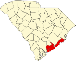
According to the U.S. Census Bureau, the county has a total area of 1,357.99 square miles (3,517.2 km2), of which 917.98 square miles (2,377.6 km2) is land and 440.01 square miles (1,139.6 km2) (32.40%) is water. [5] It is the largest county in South Carolina by total land and water area.

National protected areas

State and local protected areas/sites

Major water bodies

Adjacent counties

Major highways

Major infrastructure

Demographics

Historical population
CensusPop.Note
1790 66,985
1800 57,480−14.2%
1810 63,1799.9%
1820 80,21227.0%
1830 86,3387.6%
1840 82,661−4.3%
1850 72,805−11.9%
1860 70,100−3.7%
1870 88,86326.8%
1880 102,80015.7%
1890 59,903−41.7%
1900 88,00646.9%
1910 88,5940.7%
1920 108,45022.4%
1930 101,050−6.8%
1940 121,10519.8%
1950 164,85636.1%
1960 216,38231.3%
1970 247,65014.5%
1980 276,97411.8%
1990 295,0396.5%
2000 309,9695.1%
2010 350,20913.0%
2020 408,23516.6%
2023 (est.)424,367 [1] 4.0%
U.S. Decennial Census [7]
1790–1960 [8] 1900–1990 [9]
1990–2000 [10] 2010 [11] 2020 [1]

2020 census

Charleston County racial composition [12]
RaceNum.Perc.
White (non-Hispanic)263,56065.2%
Black or African American (non-Hispanic)91,74626.3%
Native American 8570.4%
Asian 7,4611.83%
Pacific Islander 3190.08%
Other/Mixed 15,0123.68%
Hispanic or Latino 29,2805.3%

As of the 2020 census, there were 408,235 people, 165,568 households, and 95,785 families residing in the county.

2010 census

At the 2010 census, there were 350,209 people, 144,309 households, and 85,692 families residing in the county. [13] [11] The population density was 382.3 inhabitants per square mile (147.6/km2). There were 169,984 housing units at an average density of 185.6 units per square mile (71.7 units/km2). [14] The racial makeup of the county was 64.2% white, 29.8% black or African American, 1.3% Asian, 0.3% American Indian, 0.1% Pacific islander, 2.7% from other races, and 1.6% from two or more races. Those of Hispanic or Latino origin made up 5.4% of the population. [13] In terms of claimed ancestry, 11.3% were German, 11.0% were English, 10.2% were Irish, and 9.8% were American. [15]

Of the 144,309 households, 27.8% had children under the age of 18 living with them, 40.5% were married couples living together, 14.7% had a female householder with no husband present, 40.6% were non-families, and 30.1% of all households were made up of individuals. The average household size was 2.36 and the average family size was 2.96. The median age was 35.9 years. [13]

The median income for a household in the county was $48,433 and the median income for a family was $61,525. Males had a median income of $42,569 versus $34,195 for females. The per capita income for the county was $29,401. About 11.5% of families and 16.5% of the population were below the poverty line, including 24.5% of those under age 18 and 10.8% of those age 65 or over. [16]

2000 census

At the 2000 census, [17] there were 309,969 people, 143,326 households, and 97,448 families residing in the county. The population density was 338 people per square mile (131 people/km2). There were 141,031 housing units at an average density of 154 units per square mile (59 units/km2). The racial makeup of the county was 61.9% White, 34.5% Black or African American, 0.26% Native American, 1.12% Asian, 0.06% Pacific Islander, 0.99% from other races, and 1.16% from two or more races. 2.40% of the population were Hispanic or Latino of any race. 9.6% were of American, 9.5% English, 9.1% German and 7.6% Irish ancestry.

There were 123,326 households, out of which 28.70% had children under the age of 18 living with them, 43.20% were married couples living together, 15.90% had a female householder with no husband present, and 37.20% were non-families. 28.30% of all households were made up of individuals, and 8.10% had someone living alone who was 65 years of age or older. The average household size was 2.42 and the average family size was 3.01.

In the county, the age distribution of the population shows 23.70% under the age of 18, 12.00% from 18 to 24, 30.30% from 25 to 44, 22.00% from 45 to 64, and 11.90% who were 65 years of age or older. The median age was 34 years. For every 100 females, there were 93.50 males. For every 100 females age 18 and over, there were 90.50 males.

The median income for a household in the county is $37,810, and the median income for a family was $47,139. Males had a median income of $32,681 versus $25,530 for females. The per capita income for the county was $21,393. About 12.40% of families and 16.40% of the population were below the poverty line, including 22.90% of those under age 18 and 12.70% of those age 65 or over.

In the 2000 census, the county population was classified as about 86% urban. The Charleston-North Charleston Metropolitan Statistical Area includes the populations of Charleston, Berkeley, and Dorchester counties.

Law and government

From 1895 to 1973, when the state constitution was amended to provide for home rule in the counties, the counties had limited powers, under what was called "county purpose doctrine." [18] Essentially the General Assembly governed the counties through their state legislative delegations and, with one state senator per county, the state senator was particularly powerful. In the 1940s, Charleston County adopted a council-manager form of county government to better handle its needs. [19] In 1975 the state's Home Rule Act established a larger role for the county governments.

Charleston County has a large geographic area represented by a nine-member county council. From the turn of the 20th century into the 1960s, most African Americans were excluded from voting by the state's disenfranchising constitution and discriminatory practices. This gradually changed after passage of the federal Voting Rights Act of 1965.

Since 1969, members of the county commission have been elected in a modified at-large system for nine seats from four residency districts. Elections are held every two years for staggered four-year terms. Three Council seats are reserved for residents of the City of Charleston, three for residents of North Charleston, two for residents of West Ashley, and one for residents of East Cooper. [20] [21] The council elects a chairman from its members for a limited term of two years, but chairs can be re-elected.

Charleston County was "one of only three counties in South Carolina to elect its entire county council at-large. It was "the only county with a majority white population to do so." [20] At-large positions favor candidates who can attract a majority of the votes, reducing representation from smaller portions of the population, or geographic areas.

In 1989 county residents proposed a referendum to change representation on the county council to election from single-member districts, which would have provided more opportunity for the sizable minority to elect candidates of their choice. This proposal was narrowly defeated in what both the county and the US government later defined as a racially polarized election. It was supported by 98% of the African-American minority voters; 75% of the white-majority voters rejected the referendum. [21] In practice, the at-large system results in the dilution of votes of the significant minority of African-American voters, who comprise more than one-third of the electorate. In practice, the minority voters have been unable to elect a candidate of their choice in all but a few elections in the three decades since the system was established. [21]

In January 2001, the US Department of Justice filed suit against the county government for racial discrimination based on the at-large system, which the suit contended violates Sec.2 of the Voting Rights Act of 1965 by diluting voting power. [22] The department had tried to negotiate with the county over changes in November 2000. Four voters independently filed suit as plaintiffs against the county on the same basis, and the District Court combined the cases. Justice officials noted that the at-large seats dilute the voting strength of the African-American minority in the county, who in 2000 comprised 34.5% of the population. In all but a few cases over three decades, they have been unable to elect candidates of their choice to the county commission. Whites (European Americans) comprise 61.9 percent of the population in the county. [17] Since the late 20th century, the white majority has elected Republican Party candidates.

The DOJ officials noted that the voting preference issue is not just a question of ethnicity; voters in black precincts in the county had rejected a Republican African American as a candidate for the council; they supported the Democratic at-large candidate. The suit noted that historically, black and white precincts in Charleston County have consistently supported different candidates for the council. It noted that, because of the white majority and the large geographic area, which increases costs for campaigning, "white bloc voting usually results in the defeat of candidates who are preferred by black voters." [22] DOJ noted that blacks lived in compact areas of the county, were cohesive in voting, and could comprise the majority in three districts if the county seats were apportioned as nine single-member districts. They could vote and gain representation proportional to their part of the citizenry. [22]

In United States v. Charleston County, SC (March 2003), the District Court ruled that Charleston County improperly diluted the voting strength of African-American voters "by maintaining an at-large voting system in a manner which violated Section 2." It enjoined the county from using that system, noting that the "Order is radically not a condemnation of the citizenry of Charleston County but rather a recognition that the specific bulwark of an at-large system, in twisted concert with the particular geographic and historical realities of this County, unlawfully and institutionally inhibit a community of voters in Charleston County from equal access to the electoral process." [23]

The county appealed. In July 2003, the 4th Circuit Appeals Court found that historic voting in the county was racially polarized and that minority candidates had mostly not been successful in seeking office, two conditions that are recognized under the law as showing discriminatory effects of the voting system in the county. [21] As of July of that year, the 4th Circuit Court affirmed the District Court's ruling, [24] and on April 29, 2004, issued its written decision affirming the District Court. [20] Based on historical and economic analysis, the courts found that race was a more important issue than partisanship in influencing the outcome of the elections. [20] The county appealed to the US Supreme Court, and a certiorari was denied in November 2004. [25]

The County Council system was changed in 2004 to elect individuals from nine single-member districts, with members serving four-year staggered terms. As of January 2015, elected members of the council include 4 White Republicans, 2 White Democrats and 3 African-American Democrats. [26] Republican Elliott Summey was elected by council members as chairman, replacing Democrat Teddie Pryor, who had served for six years. Summey had served as his vice-chair for five years. Pryor was first elected to the council in 2004. Summey was first elected in 2008. [27]

Charleston County is split between South Carolina's 1st congressional district, represented by Republican Nancy Mace, and South Carolina's 6th congressional district, represented by Democrat Jim Clyburn. [28]

In 2020, Joe Biden received 55.5% of the vote, the best Democratic performance since Franklin Roosevelt in 1944.

Politics

United States presidential election results for Charleston County, South Carolina [29]
Year Republican Democratic Third party
No.%No.%No.%
2020 93,29742.63%121,48555.51%4,0751.86%
2016 75,44342.78%89,29950.64%11,6036.58%
2012 77,62948.01%81,48750.39%2,5911.60%
2008 69,82245.21%82,69853.55%1,9141.24%
2004 70,29751.57%63,75846.77%2,2611.66%
2000 58,22952.23%49,52044.42%3,7273.34%
1996 48,67550.34%43,57145.06%4,4424.59%
1992 47,40348.00%40,09540.60%11,25111.39%
1988 49,14959.28%32,97739.77%7900.95%
1984 53,77963.83%29,48134.99%1,0001.19%
1980 44,11155.13%32,72740.90%3,1743.97%
1976 34,01049.18%34,32849.64%8171.18%
1972 39,86368.79%16,85529.09%1,2292.12%
1968 24,28243.45%18,34332.83%13,25523.72%
1964 32,50969.06%14,56430.94%00.00%
1960 21,22363.86%12,01036.14%00.00%
1956 7,48729.86%4,02816.07%13,55854.07%
1952 20,08766.85%9,95933.15%00.00%
1948 5624.05%2,66019.15%10,67176.81%
1944 1,18413.80%6,26072.95%1,13713.25%
1940 1,37214.42%8,14585.58%00.00%
1936 4174.95%8,01595.05%00.00%
1932 4517.73%5,35191.74%310.53%
1928 1,75928.95%4,29870.75%180.30%
1924 36111.94%2,55484.49%1083.57%
1920 37311.25%2,92988.36%130.39%
1916 1296.26%1,92993.64%20.10%
1912 341.75%1,76090.35%1547.91%
1908 34715.82%1,81482.68%331.50%
1904 19510.03%1,75089.97%00.00%
1900 27113.55%1,72986.45%00.00%
1896 1,26236.36%1,66047.82%54915.82%
1892 43021.55%1,56478.40%10.05%

Law enforcement

Sheriff Kristin Graziano was elected in 2020, becoming the first woman and first openly gay person to serve as sheriff in South Carolina. [30]

Emergency services

Volunteer Rescue Squad

The Volunteer Rescue Squad consists of over 50 members and a physician. Members are certified in a variety of emergency skills, and many members are first responders. [31]

EMS and local hospitals

Emergency medical services (EMS) for the city are provided by Charleston County Emergency Medical Services (CCEMS) & Berkeley County Emergency Medical Services (BCEMS). The city is served by the EMS and 911 services of both Charleston and Berkeley counties since the city is part of both counties. [32]

Charleston is the primary medical center for the eastern portion of the state. The city has several major hospitals located in the downtown area: Medical University of South Carolina Medical Center (MUSC), Ralph H. Johnson VA Medical Center, [33] and Roper Hospital. [34] MUSC is the state's first school of medicine, the largest medical university in the state, and the sixth-oldest continually operating school of medicine in the United States. The downtown medical district is experiencing rapid growth of biotechnology and medical research industries coupled with substantial expansions of all the major hospitals. Additionally, more expansions are planned or underway at another major hospital located in the West Ashley portion of the city: Bon Secours-St Francis Xavier Hospital. [35] The Trident Medical Center, located in North Charleston, and East Cooper Medical Center, located in Mount Pleasant, also serve the needs of residents of the city of Charleston. [36]

Economy

In 2022, the GDP of Charleston County was $41 billion (approx. $100,607 per capital). [37] In chained 2017 dollars, its real GDP was $35.1 billion (about $85,956 per capita). [38] From 2022 through 2024, its unemployment rate has fluctuated between 2-3.3%. [39]

As of April 2024, some of the largest employers within the county include Boeing, Booz Allen Hamilton, Charleston County School District, College of Charleston, CVS Pharmacy, Harris Teeter, Medical University of South Carolina, Mercedes-Benz Group, Publix, United States Department of Defense, United States Department of Veterans Affairs, and Walmart. [40]

Employment and Wage Statistics by Industry in Charleston County, South Carolina [40]
IndustryEmployment CountsEmployment Percentage (%)Average Annual Wage ($)
Accommodation and Food Services36,92613.432,240
Administrative and Support and Waste Management and Remediation Services19,9027.244,512
Agriculture, Forestry, Fishing and Hunting2400.142,796
Arts, Entertainment, and Recreation6,1032.230,992
Construction15,0785.575,452
Educational Services19,5717.156,680
Finance and Insurance8,1343.0106,288
Health Care and Social Assistance43,51115.865,884
Information4,4171.691,468
Management of Companies and Enterprises2,3050.889,700
Manufacturing17,1646.288,452
Mining, Quarrying, and Oil and Gas Extraction470.090,948
Other Services (except Public Administration)7,5632.750,752
Professional, Scientific, and Technical Services21,5767.893,756
Public Administration16,3475.974,880
Real Estate and Rental and Leasing6,6702.466,508
Retail Trade29,55610.742,484
Transportation and Warehousing11,7604.359,280
Utilities1,3150.579,612
Wholesale Trade7,3952.781,588
Total275,580100.0%62,132

Education

Charleston County School District is the school district for the entire county. [41]

Recreation

The Charleston County Park and Recreation Commission (CCPRC) operates numerous facilities within Charleston County. [42]

Beach parks
Fishing piers
Marinas and boat landings
Day parks
Water parks

Off-leash dog parks are offered at James Island, Palmetto Islands, and North Charleston Wannamaker County Park.

James Island County Park, approximately 11 minutes by car from downtown Charleston, features a 50-foot climbing wall and bouldering cave; cabin, RV, and tent camping facilities; rental facilities, fishing dock, challenge course, kayaking programs, summer camps, paved trails, and many special events such as the Lowcountry Cajun Festival (usually the first weekend in April), East Coast Canoe and Kayak Festival (3rd weekend in April), Holiday Festival of Lights (mid-November through the first of the year), and the summer outdoor reggae concerts. [43]

Communities

Cities

Towns

Census-designated places

Unincorporated communities

Former communities

Districts

Population ranking

The population ranking of the following table is based on the 2020 census of Charleston County. [50]

= county seat

RankNameTypePopulation
(2020 census)
1 Charleston City150,227
2 North Charleston City114,852
3 Mount Pleasant Town90,801
4 Summerville Town50,915
5 Ladson CDP15,550
6 James Island Town11,621
7 Hollywood Town5,339
8 Isle of Palms City4,347
9 Ravenel Town2,542
10 Folly Beach City2,078
11 Seabrook Island Town2,050
12 Kiawah Island Town2,013
13 Sullivan's Island Town1,891
14 Awendaw Town1,399
15 Meggett Town1,390
16 Lincolnville Town1,147
17 McClellanville Town605
18 Adams Run CDP421
19 Rockville Town141

Notable people

See also

Related Research Articles

<span class="mw-page-title-main">Williamsburg County, South Carolina</span> County in South Carolina, United States

Williamsburg County is a county located in the U.S. state of South Carolina. As of the 2020 census its population was 31,026. The county seat and largest community is Kingstree. After a previous incarnation of Williamsburg County, the current county was created in 1804.

<span class="mw-page-title-main">Richland County, South Carolina</span> County in South Carolina, United States

Richland County is located in the U.S. state of South Carolina. As of the 2020 census, its population was 416,147, making it the second-most populous county in South Carolina, behind only Greenville County. The county seat and largest community is Columbia, the state capital. The county was established on March 12, 1785. Richland County is part of the Columbia, SC Metropolitan Statistical Area. In 2020, the center of population of South Carolina was located in Richland County, in the city of Columbia. The county is also the location of the geographic center of South Carolina, southeast of Columbia.

<span class="mw-page-title-main">Lexington County, South Carolina</span> County in South Carolina, United States

Lexington County is a county located in the U.S. state of South Carolina. As of the 2020 census, the population was 293,991. Its county seat and largest community is Lexington. The county was chartered in 1785 and was named in commemoration of Lexington, Massachusetts, the site of the Battle of Lexington in the American Revolutionary War. Lexington County is the sixth-most populous county in South Carolina by population and is part of the Columbia, SC Metropolitan Statistical Area. It is located in the Midlands region of South Carolina.

<span class="mw-page-title-main">Horry County, South Carolina</span> County in South Carolina, United States

Horry County is the easternmost county in the U.S. state of South Carolina. As of the 2020 census, its population was 351,029. It is the fourth-most populous county in South Carolina. The county seat is Conway.

<span class="mw-page-title-main">Greenville County, South Carolina</span> County in South Carolina, United States

Greenville County is located in the U.S. state of South Carolina. As of the 2020 census, the population was 525,534, making it the most populous county in the state. Its county seat is Greenville. The county is also home to the Greenville County School District, the largest school system in South Carolina.

<span class="mw-page-title-main">Dorchester County, South Carolina</span> County in South Carolina, United States

Dorchester County is a county located in the U.S. state of South Carolina. As of the 2020 census, the population was 161,540. Its county seat is St. George.

<span class="mw-page-title-main">Colleton County, South Carolina</span> County in South Carolina, United States

Colleton County is in the Lowcountry region of the U.S. state of South Carolina. As of the 2020 census, the population was 38,604. Its county seat is Walterboro. The county is named after Sir John Colleton, 1st Baronet, one of the eight Lords Proprietor of the Province of Carolina. After two previous incarnations, the current Colleton County was created in 1800.

<span class="mw-page-title-main">Berkeley County, South Carolina</span> County in South Carolina, United States

Berkeley County is a county in the U.S. state of South Carolina. As of the 2020 census, its population was 229,861. Its county seat is Moncks Corner, and the largest community is Goose Creek. After two previous incarnations of Berkeley County, the current county was created in 1882. Berkeley County is included in the Charleston-North Charleston, SC Metropolitan Statistical Area.

<span class="mw-page-title-main">Beaufort County, South Carolina</span> County in South Carolina, United States

Beaufort County is a county in the U.S. state of South Carolina. As of the 2020 census, its population was 187,117. Its county seat is Beaufort and its largest community is Hilton Head Island.

<span class="mw-page-title-main">Bamberg County, South Carolina</span> County in South Carolina, United States

Bamberg County is a county located in the southwestern portion of U.S. state of South Carolina. As of the 2020 census, the population was 13,311, making the rural county the fourth-least populous of any in South Carolina. Its county seat is Bamberg.

<span class="mw-page-title-main">Anderson County, South Carolina</span> County in South Carolina, United States

Anderson County is a county located in the U.S. state of South Carolina. As of the 2020 census, its population was 203,718. Its county seat is Anderson. Named for Revolutionary War leader Robert Anderson, the county is located in northwestern South Carolina, along the state line of Georgia. Anderson County is included in the Greenville-Anderson-Greer, SC Metropolitan Statistical Area. Anderson County contains 55,950-acre (22,640 ha) Lake Hartwell, a U.S. Army Corps of Engineers lake with nearly 1,000 miles (1,600 km) of shoreline for residential and recreational use. The area is a growing industrial, commercial and tourist center. It is the home of Anderson University, a private, selective comprehensive university of approximately 4,000 undergraduate and graduate students.

<span class="mw-page-title-main">Awendaw, South Carolina</span> Town in South Carolina, United States

Awendaw is a small fishing town in Charleston County, South Carolina, United States. The population was 1,294 at the 2010 census. Awendaw is part of the Charleston, South Carolina metropolitan area.

<span class="mw-page-title-main">Folly Beach, South Carolina</span> City in South Carolina, United States

Folly Beach is a public city on Folly Island in Charleston County, South Carolina, United States. The population was 2,617 at the 2010 census, up from 2,116 in 2000. Folly Beach is within the Charleston-North Charleston-Summerville metropolitan area and the Charleston-North Charleston Urbanized Areas.

<span class="mw-page-title-main">Kiawah Island, South Carolina</span> Island in South Carolina, United States

Kiawah is a sea island, or barrier island, on the Atlantic coast of the United States. Located 25 miles (40 km) southwest of Charleston in Charleston County, South Carolina, it is primarily a private beach and golf resort. It is home to the Kiawah Island Golf Resort, with spacious villas, beaches, large and acclaimed golf courses, and other attractions. As of the 2010 census, Kiawah Island's population was 1,626, up from 1,163 at the 2000 census. The island is part of the Charleston-North Charleston-Summerville metropolitan area. Alternative spellings and variants of the name itself include "Kiawa", "Kittiwar", and "Kittiwah". Census Tract 21.04, located on the island, has a per capita income of $168,369, the highest in South Carolina.

<span class="mw-page-title-main">Rockville, South Carolina</span> Town in South Carolina, United States

Rockville is a town in Charleston County, South Carolina, United States, that was founded in 1784. The population was 134 at the 2010 census. Rockville is part of the Charleston-North Charleston-Summerville metropolitan area.

<span class="mw-page-title-main">Seabrook Island, South Carolina</span> Town in South Carolina, United States

Seabrook Island, formerly known as Simmons Island, is a barrier island in Charleston County, South Carolina, United States. The population was 1,714 at the 2010 census, up from 1,250 in 2000.

<span class="mw-page-title-main">Edisto Beach, South Carolina</span> Town in South Carolina, United States

Edisto Beach is a town in Colleton County, South Carolina, United States. Edisto Beach's population was 414 as of the 2010 census, down from 641 in 2000. The town limits include only the developed coastal area of Edisto Island within Colleton County, while the majority of the island consists of unincorporated land in Charleston County. Due to its status as a bedroom community, Edisto Beach is among the most affluent communities in the state.

<span class="mw-page-title-main">North Charleston, South Carolina</span> City in South Carolina, United States

North Charleston is a city in Berkeley, Charleston, and Dorchester counties in the U.S. state of South Carolina. As of the 2020 census, North Charleston had a population of 114,852, making it the third-most populous city in the state, and the 248th-most populous city in the United States. North Charleston is a principal city within the Charleston-North Charleston, SC Metropolitan Statistical Area, which had an estimated population of 849,417 in 2023.

<span class="mw-page-title-main">Charleston metropolitan area, South Carolina</span> Metropolitan statistical area in South Carolina, United States

The Charleston metropolitan area is an urban area centered around Charleston, South Carolina. The U.S. Office of Management and Budget designates the area as the Charleston-North Charleston, SC Metropolitan Statistical Area, a metropolitan statistical area used for statistical purposes only by the United States Census Bureau and other federal agencies. The OMB defines the area as comprising Berkeley, Charleston and Dorchester counties, an area with 799,636 residents in the 2020 census. Principal cities include Charleston, North Charleston, and Summerville. The area is commonly referred to as the Tri-County Area or the Lowcountry, though the latter term has historically referred to South Carolina's southern coast in general.

<span class="mw-page-title-main">Folly Island</span> Barrier island of South Carolina, United States

Folly Island is a barrier island in the Atlantic Ocean near Charleston, South Carolina. It is one of the Sea Islands and is within the boundaries of Charleston County, South Carolina. During the American Civil War, the 7-square-mile (18 km2) island served as a major staging area for troops of the Union Army that were attacking Confederate forces in the Charleston region. The largest settlement on Folly Island is Folly Beach.

References

  1. 1 2 3 "QuickFacts: Charleston County, South Carolina". United States Census Bureau. Retrieved March 22, 2024.
  2. "Find a County". National Association of Counties. Archived from the original on May 31, 2011. Retrieved June 7, 2011.
  3. "Charleston County, South Carolina". www.carolana.com. Retrieved June 13, 2022.
  4. "Charleston County, South Carolina". www.carolana.com. Retrieved September 7, 2022.
  5. "2020 County Gazetteer Files – South Carolina". United States Census Bureau. August 23, 2022. Retrieved September 10, 2023.
  6. 1 2 3 4 5 6 7 8 9 10 "SCDNR Public Lands". www2.dnr.sc.gov. Retrieved April 1, 2023.
  7. "U.S. Decennial Census". United States Census Bureau. Retrieved March 16, 2015.
  8. "Historical Census Browser". University of Virginia Library. Archived from the original on August 11, 2012. Retrieved March 16, 2015.
  9. Forstall, Richard L., ed. (March 27, 1995). "Population of Counties by Decennial Census: 1900 to 1990". United States Census Bureau. Retrieved March 16, 2015.
  10. "Census 2000 PHC-T-4. Ranking Tables for Counties: 1990 and 2000" (PDF). United States Census Bureau. April 2, 2001. Archived (PDF) from the original on October 9, 2022. Retrieved March 16, 2015.
  11. 1 2 "State & County QuickFacts". United States Census Bureau. Archived from the original on February 22, 2016. Retrieved November 22, 2013.
  12. "Explore Census Data". data.census.gov. Retrieved December 15, 2021.
  13. 1 2 3 "DP-1 Profile of General Population and Housing Characteristics: 2010 Demographic Profile Data". United States Census Bureau. Archived from the original on February 13, 2020. Retrieved March 9, 2016.
  14. "Population, Housing Units, Area, and Density: 2010 - County". United States Census Bureau. Archived from the original on February 13, 2020. Retrieved March 9, 2016.
  15. "DP02 SELECTED SOCIAL CHARACTERISTICS IN THE UNITED STATES – 2006-2010 American Community Survey 5-Year Estimates". United States Census Bureau. Archived from the original on February 13, 2020. Retrieved March 9, 2016.
  16. "DP03 SELECTED ECONOMIC CHARACTERISTICS – 2006-2010 American Community Survey 5-Year Estimates". United States Census Bureau. Archived from the original on February 13, 2020. Retrieved March 9, 2016.
  17. 1 2 "U.S. Census website". United States Census Bureau . Retrieved May 14, 2011.
  18. Charlie B. Tyler, "The South Carolina Governance Project", University of South Carolina, 1998, p. 221
  19. Tyler (1998), "The South Carolina Governance Project"], p. 222
  20. 1 2 3 4 UNITED STATES v. CHARLESTON COUNTY SOUTH CAROLINA (Decided: 29 April 2004) Archived July 10, 2018, at the Wayback Machine , US Court of Appeals, 4th Circuit, accessed January 22, 2015
  21. 1 2 3 4 United States v. Charleston County, SC, Nos. 03-2111; 03-2112, Dept. of Justice, Appeals for the 4th Circuit Court
  22. 1 2 3 DAVID FIRESTONE (January 19, 2001). "U.S. Sues Charleston County, S.C., Alleging Violation of Black Voting Rights". New York Times. Retrieved December 23, 2012.
  23. "U.S. v. CHARLESTON COUNTY | 316 F.Supp.2d 268 (2003) | pp2d2681559 | Leagle.com". Leagle. Archived from the original on April 11, 2015. Retrieved March 13, 2018.
  24. "CIVIL RIGHTS ACCOMPLISHMENTS: ACTIVELY ENFORCING THE VOTING RIGHTS ACT OF 1965" Archived January 23, 2015, at the Wayback Machine , Press Release, Department of Justice, July 23, 2003, accessed January 22, 2015
  25. Cases Raising Claims Under Section 2 of the Voting Rights Act: United States v. Charleston County (D. S.C. 2001) Archived January 24, 2015, at the Wayback Machine , Civil Rights Division, US Dept. of Justice, 2005
  26. "Charleston County Council", Charleston County, SC, accessed January 22, 2015
  27. Prentiss Findlay, "Elliott Summey becomes new Charleston County Council chairman", The Post and Courier, January 6, 2015
  28. "South Carolina Senators, Representatives, and Congressional District Maps". GovTrack.us. Retrieved September 21, 2020.
  29. Leip, David. "Dave Leip's Atlas of U.S. Presidential Elections". uselectionatlas.org. Retrieved March 13, 2018.
  30. Emily Williams (November 12, 2020). "Understand SC: Charleston's next sheriff talks reform after wave of new sheriffs elected". Post and Courier. Retrieved November 10, 2021.
  31. https://web.archive.org/web/20171201043444/http://www.charlestonrescue.com/ Charleston County Volunteer Rescue Squad Website
  32. "Emergency Medical Services (EMS)". www.charlestoncounty.org. Retrieved June 13, 2022.
  33. "Ralph H. Johnson VA Medical Center". Charleston.va.gov. Retrieved May 30, 2017.
  34. Messmer, Carly. "Charleston Hospital – Roper Hospital – Roper St. Francis – Roper St. Francis". Ropersaintfrancis.com.
  35. "Roper St. Francis Healthcare | Bon Secours St. Francis Hospital". Archived from the original on April 20, 2009. Retrieved December 14, 2009.
  36. "Healthcare". www.northcharleston.org. Retrieved April 30, 2024.
  37. U.S. Bureau of Economic Analysis (January 1, 2001). "Gross Domestic Product: All Industries in Charleston County, SC". FRED, Federal Reserve Bank of St. Louis. Retrieved April 30, 2024.
  38. U.S. Bureau of Economic Analysis (January 1, 2001). "Real Gross Domestic Product: All Industries in Charleston County, SC". FRED, Federal Reserve Bank of St. Louis. Retrieved April 30, 2024.
  39. U.S. Bureau of Labor Statistics (January 1, 1990). "Unemployment Rate in Charleston County, SC". FRED, Federal Reserve Bank of St. Louis. Retrieved April 30, 2024.
  40. 1 2 "Charleston County" (PDF). Community Profiles (04000019). Columbia, South Carolina: S.C. Department of Employment & Workforce - Business Intelligence Department. April 19, 2024.
  41. "2020 CENSUS - SCHOOL DISTRICT REFERENCE MAP: Charleston County, SC" (PDF). U.S. Census Bureau. Archived (PDF) from the original on October 9, 2022. Retrieved August 1, 2022. - Text list
  42. "Charleston County Parks and Recreation | Official Website". www.charlestoncountyparks.com. Archived from the original on September 3, 2013. Retrieved March 13, 2018.
  43. "James Island County Park | Charleston County Parks and Recreation". www.ccprc.com. Retrieved June 13, 2022.
  44. "Awendaw Fire Department". www.charlestoncounty.org. Retrieved June 13, 2022.
  45. "James Island Public Service District – Serving James Island, some residents of Charleston and Folly Beach.h." www.jipsd.org. Retrieved June 13, 2022.
  46. "Public Service Districts | Charleston County Government". www.charlestoncounty.org. Retrieved June 13, 2022.
  47. "St. John's Fire District". St. John's Fire District. Retrieved June 13, 2022.
  48. "FAQ". SAPSD. Retrieved June 13, 2022.
  49. "St Paul Fire Department | Hollywood, SC". www.stpaulsfiredept.org. Retrieved June 13, 2022.
  50. "City and Town Population Totals: 2020-2022". United States Census Bureau, Population Division. Archived from the original on July 11, 2022. Retrieved May 18, 2023.
  51. Dorie J. Gilbert and Ednita M. Wright, African American Women and HIV/AIDS, Westport, Connecticut: Greenwood Publishing Company, 2003, p. 154, accessed January 23, 2009